 Block
From the record
One of 166 National Register listings published here for Litchfield County · listed in 1979 · category: District.
Sources: the case file at the National Archives · the National Register database, National Park Service
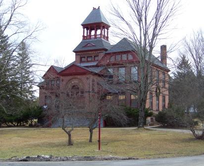
Listed on the National Register of Historic Places in 1979.
One of 166 National Register listings published here for Litchfield County · listed in 1979 · category: District.
Sources: the case file at the National Archives · the National Register database, National Park Service
The chapter on Canaan Town in History of Litchfield County, Connecticut, published 1881 names Canaan. This is what it says, exactly as the scans read.
This town is located in the northwestern part of the county, and is bounded as follows : on the north by North Canaan, on the east by Norfolk, on the south by Cornwall, and on the west by the Housatonic River, which separates it from Salisbury. The surface of this town is broken and mountainous. The town is watered by the Housatonic River and its tributaries.
Passage source: History of Litchfield County, Connecticut, published 1881.
The tract of land embraced within the present towns of Canaan and North Canaan was sold at public vendue at the court-house in New London, Jan. 3, 1737-38. The first meeting of these towns was held at Wethersfield, Feb. 22, 1737-38, with Capt. David Whitney, of Plainfield, moderator, and Humphrey Avey, of Groton, clerk. At this meeting it was
Passage source: History of Litchfield County, Connecticut, published 1881.
Machine-read from a century-old scan, so expect the errors a machine makes: misspelled names, dropped words, stray characters.
Read the whole chapter on Canaan Town - 1,825 words on its settlement, mills, schools and churches.
Regional context, not property-specific evidence. The federal wildfire occurrence database lists 103 fires within 5 miles of Falls Village District between 1992 and 2020, burning about 142 acres in total. 1 started naturally. 4 were recorded as arson. Distance is straight-line from the map coordinates, so a fire counted here may appear on a neighbouring settlement's page as well.
| Reported cause | Fires |
|---|---|
| Missing data/not specified/undetermined | 80 |
| Debris and open burning | 13 |
| Recreation and ceremony | 4 |
| Arson/incendiarism | 4 |
| Misuse of fire by a minor | 1 |
| Natural | 1 |
The most recent of them, most recent first, with the day each was reported and the service that recorded it.
| Date | Cause | Size | Reported by | Name on the report |
|---|---|---|---|---|
| 30 September 1995 | Recreation and ceremony | under an acre | Connecticut Division of Forestry | not named |
| 3 September 2020 | Missing data/not specified/undetermined | under an acre | Connecticut Division of Forestry | 380 TOWN STREET |
| 3 September 2017 | Missing data/not specified/undetermined | under an acre | Connecticut Division of Forestry | 386 SALISBURY RD (RT |
| 28 September 2019 | Missing data/not specified/undetermined | 3.5 acres | Connecticut Division of Forestry | not named |
| 25 September 2016 | Missing data/not specified/undetermined | under an acre | Connecticut Division of Forestry | 42 ETHAN ALLLEN STREET SALISBURY |
| 24 September 2007 | Missing data/not specified/undetermined | under an acre | Connecticut Division of Forestry | not named |
| 5 August 2010 | Missing data/not specified/undetermined | under an acre | Connecticut Division of Forestry | not named |
| 29 August 2008 | Missing data/not specified/undetermined | under an acre | Connecticut Division of Forestry | not named |
Regional context, not property-specific evidence. The federal mineral resources record lists 18 workings within 5 miles of Falls Village District: 14 past producers, 4 producers. 4 still produce. What was taken out: Marble, Dimension, Iron, Stone, Stone, Crushed/Broken. Distance is straight-line from the map coordinates, so a quarry counted here may appear on a neighbouring settlement's page as well.
| Where | Site | Commodity | Status | Recorded |
|---|---|---|---|---|
| Clarke Mine | Iron, Stone, Crushed/Broken | Past Producer | ||
| Connecticut Sand & Gravel Co. Pit | Sand and Gravel, Construction | Producer | ||
| Davis Limonite Mine | Iron, Manganese | Past Producer | Limonite | |
| Falls Village Quarry | Limestone, General | Past Producer | Sedimentary | |
| Gold Mine | Gold | Past Producer | ||
| Falls Village Quarry | Stone, Crushed/Broken, Marble, Dimension | Producer | ||
| Limerock Quarries | Stone, Crushed/Broken | Past Producer | ||
| Limestone Rock Quarries No. Fi-009 | Stone | Producer | Marble | |
| Limestone Rock Quarry No. Fi-008 | Stone | Producer | Marble | |
| Clarke Limonite Mine | Iron | Past Producer | Limonite |
Regional context, not property-specific evidence. The National Weather Service names Canaan, the town this property stands in, in 31 storm reports between 1997 and 2023: 18 thunderstorm wind, 6 hail, 4 flash flood, 3 flood. No death or injury is recorded in these reports. Each account below is quoted exactly as the forecast office filed it, from the NOAA Storm Events Database, and each date opens the federal record of that event.
| When | Event | Place named | Harm | What the report says |
|---|---|---|---|---|
| July 2023 | Flash Flood | South Canaan | $10,000 | A section of Route 63 in Falls Village from Cobble Road to Barnes Road was closed due to flooding. |
| July 2023 | Flood | South Canaan | $10,000 | A section of Route 63 in Falls Village from Cobble Road to Barnes Road was closed due to flooding. |
| August 2002 | Thunderstorm Wind | Canaan | $10,000 | A pocket of cold air aloft triggered isolated showers and storms across Litchfield County, late on the afternoon of August 8. One storm became briefly severe as thunderstorm winds brought down trees and wires in the town of Canaan. |
| May 2002 | Thunderstorm Wind | Canaan | $10,000 | no account filed |
| May 1998 | Thunderstorm Wind | Canaan | $3,000 | no account filed |
| August 1997 | Hail | Canaan | $2,000 | no account filed |
| July 2023 | Thunderstorm Wind | East Canaan | - | Trees and wires were down on Moses Mead Road. |
| April 2021 | Thunderstorm Wind | South Canaan | - | Tree was downed on wires on Route 7N to Page Rd. |
| May 2021 | Thunderstorm Wind | Canaan | - | Trees and limbs were reported down in Canaan. |
| July 2021 | Flash Flood | Canaan | - | A house reportedly was inundated with water up to the first floor. |
| September 2021 | Flash Flood | South Canaan | - | A road was reported closed due to flooding near the intersection of Route 126 and Route 63. |
| July 2020 | Thunderstorm Wind | South Canaan | - | Trees and wires were downed. |
| November 2020 | Thunderstorm Wind | Canaan | - | A tree and wires were downed on Devine Avenue. |
| November 2020 | Thunderstorm Wind | East Canaan | - | A tree and wires were downed on Lower Road. |
| July 2019 | Thunderstorm Wind | South Canaan | - | Trees were downed on Route 63. |
| July 2014 | Thunderstorm Wind | East Canaan | - | A tree was reported down due to thunderstorm winds in East Canaan. |
| July 2013 | Thunderstorm Wind | East Canaan | - | Powers lines were reported down and burning as a result of thunderstorm winds in East Canaan. |
| May 2013 | Thunderstorm Wind | Canaan | - | Multiple trees, limbs and power lines were reported down in North Canaan as a result of thunderstorm winds. |
| July 2013 | Thunderstorm Wind | East Canaan | - | A tree was reported down and on wires as a result of thunderstorm winds in North Canaan. |
| June 2011 | Hail | Canaan | - | Quarter size hail was reported during a thunderstorm in Canaan. |
| June 2011 | Thunderstorm Wind | Canaan | - | Trees were reported down in Canaan due to strong thunderstorm winds. |
| September 2011 | Flood | Canaan | - | Moderate flooding occurred on the Housatonic River in Licthfield County. The Falls Village river gage located near Water Street in Falls Village exceeded its 7 foot flood stage at 5 pm EST September 6th, its 10 foot moderate flood stage at 11:49 pm September 8th, it crested at 13.47 feet at 6 am September 9th, then remained above its moderate flood stage until 7:15 am September 11th, and finally fell below flood stage at 2:34 pm September 12th. The Gaylordsville river gage located near Route 7, Kent Road, less than a mile north of the Village of Gaylordsville exceeded its 8 foot flood stage at 6 pm EST September 6th, its 10 foot moderate flood stage at 5 pm September 7th, then remained above its moderate flood stage until 9 am September 11th, and finally fell below flood stage at 3 pm September 12th. The crest time and level are unknown. |
| June 2011 | Hail | Canaan | - | Golf ball size hail was reported during a thunderstorm in Canaan. |
| August 2011 | Flood | Canaan | - | Moderate flooding occurred on the Housatonic River in Litchfield County. Flooding was reported but not limited to along Route 7 in Gaylordsville.||The Falls Village river gage located near Water Street in Falls Village exceeded its 7 foot flood stage at 12:23 pm EST August 28th, its 10 foot moderate flood stage at 6:08 pm, crested at 11.74 feet at 2 am August 29th, and fell below flood stage at 5:15 pm September 1st. ||The Gaylordsville river gage located near Route 7, Kent Road, less than a mile north of the Village of Gaylordsville exceeded its flood stage at 6:08 pm EST August 28th and fell below flood stage at 7:50 pm August 29th. The crest time and level are unknown since the stilling well gage failed. A pressure transducer gage was installed while the water was still rising. |
| May 2010 | Thunderstorm Wind | Canaan | - | Several trees were reported down in Canaan due to strong thunderstorm winds. |
| June 2008 | Thunderstorm Wind | Canaan | - | Trees and wires were reported down in Canaan due to strong thunderstorm winds. |
| August 2007 | Thunderstorm Wind | Canaan | - | Trees and wires were reported down due to strong thunderstorm winds in Canaan. |
| June 2006 | Hail | Canaan | - | A trained spotter reported golf ball-sized hail at Canaan. |
| June 2000 | Flash Flood | Canaan | - | An area of low pressure developed over the DelMarVa Peninsula by early June 6. This storm tracked up the coast and became a full-blown nor'easter. It tapped into a rich supply of tropical moisture and produced a very heavy rainstorm across Litchfield County. Specific amounts included 3.53 inches at Bakersville, 3.87 inches at Bulls Bridge and 2.53 inches at Thomaston Dam. The runoff from the rain caused the Housatonic River to rise above flood stage from June 7 through June 9. The river crested at 0.8 feet above the 7 foot flood stage at Falls Village, and 0.3 feet above flood stage at Gaylordsville. No damage or injuries were reported to the National Weather Service with this flooding. |
| May 2018 | Hail | Canaan | - | no account filed |
| June 2000 | Hail | Canaan | - | no account filed |
No historic map-sheet match is published for this property yet. That does not mean no map exists. This record needs a coordinate-quality review before it can be joined to a sheet boundary. Browse the county's mapped places while that work is pending.
Other National Register properties close enough to walk or drive between, ordered by distance from this one. Both positions come from the same geocoding pass that matched these properties to their map sheets.
| Photograph | Property | Distance | Listed |
|---|---|---|---|
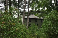 | Holabird House | 0.9 miles | 1982 |
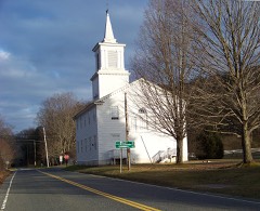 | South Canaan Congregational Church | 1.6 miles | 1983 |
 | Burrall-Belden House | 1.6 miles | 2018 |
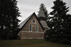 | Lime Rock Historic District | 1.8 miles | 1984 |
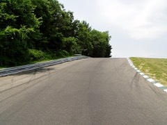 | Lime Rock Park Race Track | 2.1 miles | 2009 |
| Music Mountain | 3.3 miles | 1987 |
| National Archives record | The nomination case file for reference 79002622 in Record Group 79. |
| Litchfield County | All 166 listed properties in this county. |