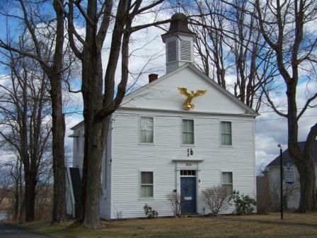
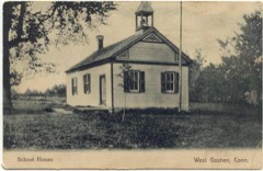
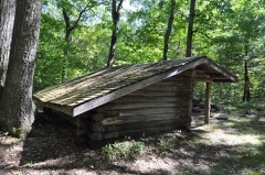
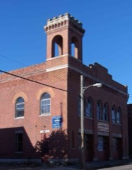
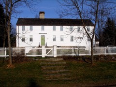
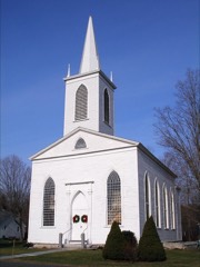
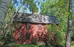
Listed on the National Register of Historic Places in 1982.
From the record
“Goshen Historic District is a historic district encompassing the town center village of Goshen, Connecticut. Centered at the Junction of Connecticut Routes 4 and 63, the village developed historically as a rural crossroads of two turnpikes, and has retained its rural character.”
Wikipedia article Goshen Historic District (Goshen, Connecticut), CC BY-SA 4.0.
One of 166 National Register listings published here for Litchfield County · listed in 1982 · category: District.
National Register reference number.82000996- the number the National Park Service assigned this property when it was listed, and the key its nomination file is catalogued under at the National Archives.
" These individuals claimed their right under the towns of Hartford and Windsor, which brought on a violent conflict between the colony and these towns. In October of 1722, while the Assembly were in session at Hartford, some of the trespassers were arrested, and imprisoned at Hartford, but a mob was raised, the jail broken open, and the delinquents were set at liberty ; and so violent was the opposition of these towns to the acts of the Assembly that the civil authority was unable to execute the laws of the land. Finally, the Assembly, feeling the disastrous consequences of a protracted warfare of this nature, did, in the autumn of 1724, appoint a committee to investigate all the claims, and report thereon, that the difficulty might be amicably settled. This committee spent nearly two years in the investigation, and then reported that a division of this territory be made, giving one-half to the towns of Hartford and Windsor, and one-half to the colony. Hartford and Windsor should have the eastern division, and the colony the western. In May, 1726, the Assembly adopted substantially the report of the committee, and subsequently secured to these towns, Hartford and Windsor, by patent, all the disputed lands east of Litchfield, Goshen, and Norfolk, and retained the western section, viz., Goshen, Norfolk, Canaan, Cornwall, Kent, and Salisbury ; and thus an affair was adjusted which had retarded the settlement of these towns and threatened the whole colony with disastrous consequences.
"At the October session of the Assembly in 1726, a grant of three hundred acres of land in this town was made to James Wadsworth, Esq., of Durham, John Hall, Esq., of Wallingford, and Hezekiah Brainard, Esq., of Haddani. What the consideration was for this grant does not appear : probably it was for services rendered the colony. This survey was made by John Hitchcock, April 28, 1731. The northwest corner of this special grant was east of the road opposite the brick house of Capt. Jonatjhan Wadhams, and south of the school-house. The west line of the grant, running south three hundred rods, intersected the north line of Litchfield thirteen rods west of the north and south road, that passes the house of Harvey Brooks, thence east on Litchfield line one hundred and sixty rods. Thence north three hundred rods, and then west one hundred and sixty rods to the northwest bound, already described, near Capt. Wadhams. This grant has always borne the appellation ' the Squires Farm' because the three gentlemen to whom the grant was made all had the title esquire attached to their names respectively. It is said that the house owned and occupied by the widow and heir of the late Isaac Wadhams stands in the central part of the Squires Farm. But at the time of this survey the town had not been laid out by government, and was denominated Western Lands, or New Bantam, the Assembly not regarding at all the laying out of the town by Hartford and Windsor in 1722. But at their session in May, 1731, they enacted that their Western lands should be laid out into five townships, and appointed their committee to perform this business. The report of this committee as it respects this town bears date Oct. 15, 1731, describing the limits of the same, making the south line four miles and one hundred and ninety-six rods, the west line nine miles and sixty rods, the north line four miles and eighty-six rods, and the east line eight miles and one hundred and forty-six rods, showing that the south line is ten rods longer than the north line, and the west line two hundred and thirty-four rods longer than the east line. Soon after these towns were laid out the trustees of Yale College applied to the Assembly for a grant of land in aid of this institution, and in 1732 they made a grant of fifteen hundred acres to the trustees, three hundred acres in each of the five towns so recently laid out, and in January, 1737, the College Farm - so called - in this town was surveyed and its boundaries established. The dwelling-houses oi Messrs. Asa, Levcrett, and Cephsis Ives stand upon this grant, and also the house at the turnpike gate leading to Cornwall. On the 13th of October, 1737, the A.ssembly enacted that the township called Goshen should be divided into fifty-three rights, exclusive of former grants, referring to the Squires Farm and college. Two of the fifty-three rights were to be appropriated to the ministry, one of them to be the property of the first settled minister, and the other to remain for the support of the ministry in all aftertime. And a third right was to be for the support of schools. Fifty rights would remain for the proprietors of said townslii[>. The Assembly then resolved that this township should be sold in so many rights, at public auction, at the court-house in New Haven, to the higiiest bidder, commencing on the first Tuesday in December next (1737), and to be continued by adjournment until all the riglit-s were sold. Tiie conditions required of each i)roi)rietor were, that he or his agent should, within two years from the date of his purchase, enter ujmn Ills premises, build and finish a house thereon, no le-ss than eighteen feet square, and seven feet between sill and plate; clear, subdue, and fence six acres of said land, and continue to dwell thereon for the s|)ace of three successive years (unless prevented by death or unavoidable Providence), commencing after the expiration of the two years in which the specified conditions were to be performed ; and, furthermore, he must perform all orders and duties, and pay all taxes granted. If these conditions were performed, then his deed was valid ; but if any part of the conditions was omitted (extraordinarics excepted), his title was void and of no effect.
Regional context, not property-specific
evidence. The
federal wildfire occurrence database
lists 128 fires within 5 miles of Goshen Historic District
between 1999 and 2020, burning about 38 acres in total. 2 started naturally. 1 was recorded as arson.
Distance is straight-line from the map coordinates, so a fire counted
here may appear on a neighbouring settlement's page as well.
Reported cause
Fires
Missing data/not specified/undetermined
93
Debris and open burning
17
Recreation and ceremony
13
Natural
2
Equipment and vehicle use
2
Arson/incendiarism
1
The most recent of
them, most recent first, with the day each was reported and the service
that recorded it.
Regional context, not property-specific
evidence. The federal mineral resources record lists
19 workings within 5 miles of Goshen Historic District: 16 past producers, 2 occurrences, 1 prospect.
None of them still produces. What was taken out: Stone, Dimension, Stone, Granite, Nickel. Distance is straight-line from the
map coordinates, so a quarry counted here may appear on a neighbouring
settlement's page as well.
Regional context, not property-specific
evidence. The National Weather Service names
Goshen, the town this property stands in, in 17 storm reports between 1995 and 2025: 8 thunderstorm wind, 6 hail, 2 lightning, 1 flash flood.
The reports record 1 injury. Each account below is quoted exactly as the forecast office
filed it, from the NOAA Storm Events Database, and each date
opens the federal record of that event.
Thunderstorms erupted ahead of cold front, on the afternoon of July 19 across Litchfield County. One of the storms became briefly severe as it moved across the town of Goshen. The winds from the storm knocked down some trees in that town.
No historic map-sheet match is published
for this property yet. That does not mean no map exists. This record needs
a coordinate-quality review before it can be joined to a sheet boundary.
Browse the county's mapped places while that work is
pending.
Listed places nearby
6 within 8 miles
Other National Register properties close
enough to walk or drive between, ordered by distance from this one. Both
positions come from the same geocoding pass that matched these properties
to their map sheets.
Listing record. National Park Service National Register of Historic Places, listed-properties dataset, current to 2026-05-22.
Map join. Address geocoded through the United States Census geocoder, then tested against the published boundary of every sheet in the USGS Historical Topographic Map Collection.
How this page is made. Listing fields come from federal records; map-sheet coverage is a labelled coordinate-to-boundary calculation, not a source-field claim.
Wildfire. Short, Karen C. 2022. Spatial wildfire occurrence data for the United States, 1992-2020 [FPA_FOD_20221014]. 6th Edition. Fort Collins, CO: Forest Service Research Data Archive. https://doi.org/10.2737/RDS-2013-0009.6 Collected with United States Government funding and usable without additional permissions or fees.
Mines and quarries. USGS Mineral Resources Data System (MRDS) https://mrdata.usgs.gov/mrds/ A work of the United States government, no copyright under 17 U.S.C. 105.
Storms. NOAA National Centers for Environmental Information, Storm Events Database https://www.ncei.noaa.gov/stormevents/ A work of the United States government, no copyright under 17 U.S.C. 105. Narratives are quoted verbatim from the National Weather Service report and are not edited or summarised.
 Block