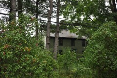
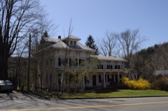
Built in 1935. Listed on the National Register of Historic Places in 1986.
From the record
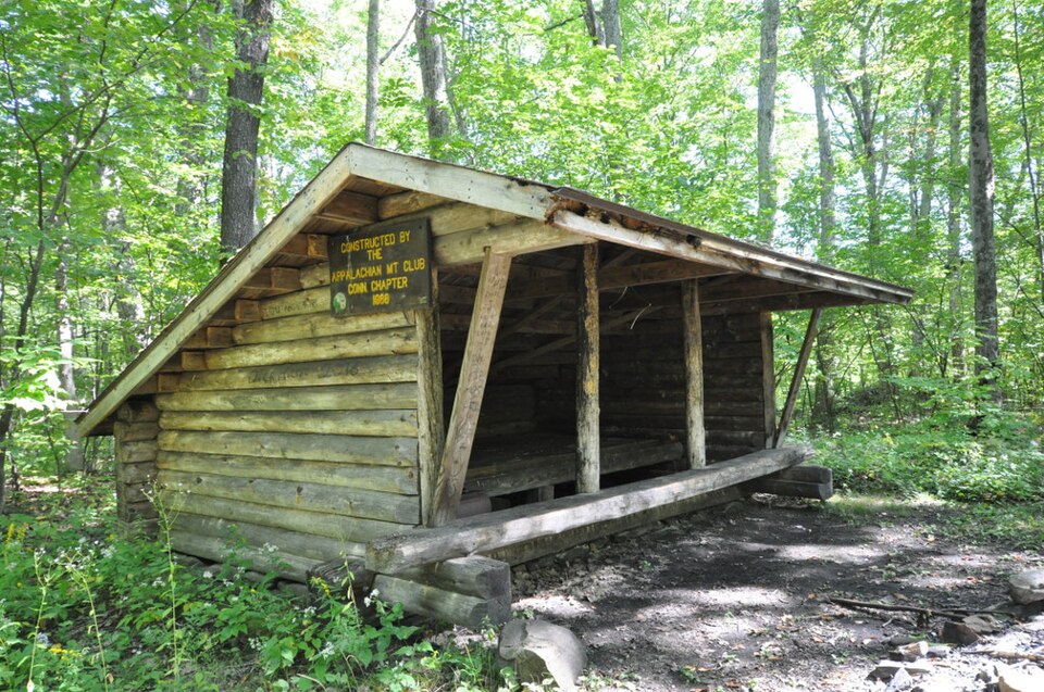
“The Cream Hill Shelter is a rustic log shelter in Housatonic State Forest in Cornwall, Connecticut. Built in 1988, it replaced what was at the time one of three surviving log shelters constructed by the Civilian Conservation Corps in Connecticut.”
Wikipedia article Cream Hill Shelter, CC BY-SA 4.0.
One of 166 National Register listings published here for Litchfield County · listed in 1986 · category: Building · built in 1935.
Also known as. Connecticut State Park and Forest Depression-Era Federal Work Relief Programs Structures TR
Town. Cornwall town
When was it built? 1935
National Register reference number.86001727- the number the National Park Service assigned this property when it was listed, and the key its nomination file is catalogued under at the National Archives.
Cornwall lies northwest of the centre of the county, and is bounded as follows : on the north by- Canaan, on the east by Goshen, on the south by Warren and Kent, and on the west by the Housatonic River, which separates it from Sharon. The surface consists mainly of deep valleys and high hills or mountains. Although one of the most mountainous sections in the State, its soil is very fertile and productive.
" The hill up which the road from Cornwall to Goshen winds is named Bunker Hill, from the residence on it of Rufus Bunker, an Indian of the Schaghticokc tribe, an old and horiot man, whose name is a.isociatcd with a more enduring monument than the ]>yramids of Egy]it. North and easterly of this hill is situated Red Mountain, so named from the color of the oak-leaves in the autumn wlien touclied by the frosts. Southerly is Clark Hill, so called from a family of that name who removed nearly one hundred years since from Hartford to that locality. Southeasterly from Clark Hill is the most elevated land in the State, lying mostly in Goshen, from the apex of which is a view of Long Island Sound. This elevation is called Mohawk Mountain. Southeast of Cornwall Plain, forming a part of the same range as Clark Hill and Mohawk Mountain, lies Great Hill. Three hundred acres of land given by the General Assembly to Yale College is located here, and goes by the name of College land. Bloody Mountain, so named from a bloody tragedy not enacted there, lies north of the Old Goshen and Sharon turnpike, northwest from the centre of the town.
Regional context, not property-specific
evidence. The
federal wildfire occurrence database
lists 59 fires within 5 miles of Cream Hill Shelter
between 1992 and 2020, burning about 151 acres in total. 2 started naturally. 4 were recorded as arson.
Distance is straight-line from the map coordinates, so a fire counted
here may appear on a neighbouring settlement's page as well.
Reported cause
Fires
Missing data/not specified/undetermined
47
Arson/incendiarism
4
Recreation and ceremony
3
Natural
2
Debris and open burning
1
Equipment and vehicle use
1
Railroad operations and maintenance
1
The most recent of
them, most recent first, with the day each was reported and the service
that recorded it.
Regional context, not property-specific
evidence. The federal mineral resources record lists
12 workings within 5 miles of Cream Hill Shelter: 11 past producers, 1 prospect.
None of them still produces. What was taken out: Feldspar, Mica, Stone, Dimension, Graphite, Granite. Distance is straight-line from the
map coordinates, so a quarry counted here may appear on a neighbouring
settlement's page as well.
Regional context, not property-specific
evidence. The National Weather Service names
Sharon, the town this property stands in, in 30 storm reports between 1998 and 2022: 24 thunderstorm wind, 3 hail, 2 flash flood, 1 lightning.
No death or injury is recorded in these reports. Each account below is quoted exactly as the forecast office
filed it, from the NOAA Storm Events Database, and each date
opens the federal record of that event.
Numerous trees and wires were downed by straight line winds from a thunderstorm. Damage was observed along Main Street in Sharon, along Fairfield Road and on West Cornwall Road near Route 7.
Heavy rainfall led to flash flooding in Sharon. The basement of the Sharon Hospital flooded. A total of six roads were closed throughout the town, as well as one bridge. A supermarket also was impacted by the flood waters.
No historic map-sheet match is published
for this property yet. That does not mean no map exists. This record needs
a coordinate-quality review before it can be joined to a sheet boundary.
Browse the county's mapped places while that work is
pending.
Listed places nearby
6 within 8 miles
Other National Register properties close
enough to walk or drive between, ordered by distance from this one. Both
positions come from the same geocoding pass that matched these properties
to their map sheets.
Listing record. National Park Service National Register of Historic Places, listed-properties dataset, current to 2026-05-22.
Map join. Address geocoded through the United States Census geocoder, then tested against the published boundary of every sheet in the USGS Historical Topographic Map Collection.
How this page is made. Listing fields come from federal records; map-sheet coverage is a labelled coordinate-to-boundary calculation, not a source-field claim.
Wildfire. Short, Karen C. 2022. Spatial wildfire occurrence data for the United States, 1992-2020 [FPA_FOD_20221014]. 6th Edition. Fort Collins, CO: Forest Service Research Data Archive. https://doi.org/10.2737/RDS-2013-0009.6 Collected with United States Government funding and usable without additional permissions or fees.
Mines and quarries. USGS Mineral Resources Data System (MRDS) https://mrdata.usgs.gov/mrds/ A work of the United States government, no copyright under 17 U.S.C. 105.
Storms. NOAA National Centers for Environmental Information, Storm Events Database https://www.ncei.noaa.gov/stormevents/ A work of the United States government, no copyright under 17 U.S.C. 105. Narratives are quoted verbatim from the National Weather Service report and are not edited or summarised.
 Block