BlockBefore
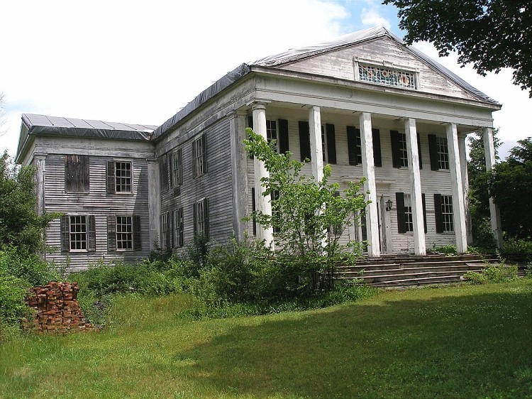
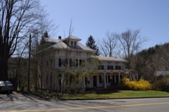
Photograph of Rumsey Hall
Photograph by Jerry Dougherty, CC BY 2.5. Via Wikimedia Commons.

Rumsey Hall

Listed on the National Register of Historic Places in 1990.

From the record

“Rumsey Hall was an historic academic building at 12 Bolton Hill Road in Cornwall, Connecticut. Built in 1848, it was a distinguished example of Greek Revival architecture that served as home to a number of academic institutions, including the first campus of the Rumsey Hall School.”

Wikipedia article Rumsey Hall (Cornwall, Connecticut), CC BY-SA 4.0.

One of 166 National Register listings published here for Litchfield County · listed in 1990 · category: Building.

Sources: the Wikipedia article · the case file at the National Archives · the National Register database, National Park Service · the Wikipedia article
The listing

  • What is counted as historic. The nomination lists 2 buildingss as contributing to the listing.
  • Address. 12 Bolton Hill Rd., Cornwall, 06753
  • When was it listed? May 1990
  • Category. building
  • Town. Cornwall town
  • Architectural style. Greek Revival architecture
  • National Register reference number. 90000762 - the number the National Park Service assigned this property when it was listed, and the key its nomination file is catalogued under at the National Archives.

The ground it stands on

11,604 words

The chapter on Cornwall Town in History of Litchfield County, Connecticut, published 1881 names Cornwall. This is what it says, exactly as the scans read.

Cornwall lies northwest of the centre of the county, and is bounded as follows : on the north by- Canaan, on the east by Goshen, on the south by Warren and Kent, and on the west by the Housatonic River, which separates it from Sharon. The surface consists mainly of deep valleys and high hills or mountains. Although one of the most mountainous sections in the State, its soil is very fertile and productive.

Passage source: History of Litchfield County, Connecticut, published 1881.

TOM WARRUPS. I " This noble old Indian warrior died in Cornwall early in the present I century, and wjis well known throughout the township. In his old age I his hair became pei-fectly white, and his visits to all parts of the town were frequent and acceptable, while bis witty pleasantries were long remembered. He was of the Scliaghticoke tribe, but he became a resident of Cornwall in bis early life. In the Revolutionary war he enlisted into a company commanded by Edward Rogers, Esq., as captain, of which Loyal Tanner was lieutenant; this company was in the battle of Long Island, and shared in all the disastrous results in that conflict, and in the perils attending the retreat of the army from New York. Tom was always spoken of by bis surviving comrjides as a brave and daring soldier, ready for every duty and danger required by the service.

Passage source: History of Litchfield County, Connecticut, published 1881.

Machine-read from a century-old scan, so expect the errors a machine makes: misspelled names, dropped words, stray characters.

Read the whole chapter on Cornwall Town - 11,604 words on its settlement, mills, schools and churches.

Fires near this property

56 since 1992

Regional context, not property-specific evidence. The federal wildfire occurrence database lists 56 fires within 5 miles of Rumsey Hall between 1992 and 2020, burning about 526 acres in total. 3 started naturally. 3 were recorded as arson. Distance is straight-line from the map coordinates, so a fire counted here may appear on a neighbouring settlement's page as well.

Reported cause Fires
Missing data/not specified/undetermined42
Recreation and ceremony4
Natural3
Arson/incendiarism3
Debris and open burning2
Equipment and vehicle use1
Railroad operations and maintenance1

The most recent of them, most recent first, with the day each was reported and the service that recorded it.

DateCause SizeReported by Name on the report
3 September 2020Missing data/not specified/undeterminedunder an acreConnecticut Division of Forestry380 TOWN STREET
28 September 2015Missing data/not specified/undetermined2.0 acresConnecticut Division of Forestrynot named
25 September 2020Missing data/not specified/undeterminedunder an acreConnecticut Division of Forestry263 W HYPERDALE DRIVE
10 September 2016Natural384 acresConnecticut Division of Forestry157 FLAT ROCKS ROAD CORNWALL (FLAT ROCK FIRE)
1 September 2006Missing data/not specified/undetermined1.0 acresConnecticut Division of Forestrynot named
5 August 2020Missing data/not specified/undeterminedunder an acreConnecticut Division of ForestryKENT ROAD (RT 7)
4 August 1999Natural1.0 acresConnecticut Division of Forestrynot named
3 August 1993Arson/incendiarism2.0 acresConnecticut Division of Forestrynot named

Every fire recorded in Litchfield County

Mines and quarries near this property

10 of 16 shown

Regional context, not property-specific evidence. The federal mineral resources record lists 16 workings within 5 miles of Rumsey Hall: 13 past producers, 3 prospects. None of them still produces. What was taken out: Granite, Nickel, Feldspar, Mica, Stone, Dimension. Distance is straight-line from the map coordinates, so a quarry counted here may appear on a neighbouring settlement's page as well.

Where SiteCommodity StatusRecorded
Buck Hill Magnetite MineIronProspectMagnetite
Gold MineGoldPast Producer
Graphite MinesGraphitePast Producer
Kaolin MineKaolinPast Producer
Limestone QuarriesLimestone, DimensionPast Producer
Silver MineSilverPast Producer
Benedict Granite Gneiss Rock QuarryStone, DimensionPast ProducerUnknown
Benedict QuarryGranitePast Producer
Gneiss Rock Quarry No. Ei-004StonePast ProducerGneiss
Gneiss Rock Quarry No. Fi-012StonePast ProducerUnknown

Every working recorded in Litchfield County

Storms near this property

16 since 1995

Regional context, not property-specific evidence. The National Weather Service names Cornwall, the town this property stands in, in 16 storm reports between 1995 and 2024: 9 thunderstorm wind, 6 hail, 1 flash flood. No death or injury is recorded in these reports. Each account below is quoted exactly as the forecast office filed it, from the NOAA Storm Events Database, and each date opens the federal record of that event.

WhenEvent Place namedHarm What the report says
August 2017Flash FloodCornwall$5,000Four to six inches of water on Route 125 led to a road closure. Part of the road was also washed out.
July 2003Thunderstorm WindWest Cornwall$1,000A large upper air trough dug across the western Great Lakes on Monday, July 21. At the surface, a deep low pressure area moved across the eastern Great Lakes, driving a warm front across southern New England by the evening. The air became very unstable in the warm air mass behind the front. The remnants of a line of destructive storms in eastern New York worked into Litchfield county during the evening hours. One storm became severe as it blew trees and wires down in the town of West Cornwall.
June 2024Thunderstorm WindCornwall-Trees were downed onto wires in Cornwall resulting in widespread power outages.
May 2015Thunderstorm WindWest Cornwall-Wires were reported down one mile north of West Cornwall due to thunderstorm winds.
July 2014Thunderstorm WindWest Cornwall-Wires were reported down on Dibble Hill Road in Cornwall due to thunderstorm winds.
July 2014Thunderstorm WindCornwall-Trees and wires were reported down in Cornwall Center due to thunderstorm winds.
July 2012HailCornwall-Quarter sized hail was reported during a thunderstorm at Mohawk Mountain Ski Area.
July 2012HailCornwall-Quarter sized hail was reported during a thunderstorm in Cornwall.
May 2009HailCornwall-Nickel size hail was reported near Cornwall during a thunderstorm.
August 2006Thunderstorm WindWest Cornwall-Fire and Rescue personnel reported that trees were blown down onto Route 7 closing the road in West Cornwall.
April 1995Thunderstorm WindCornwall-Power lines were knocked down.
July 2005Thunderstorm WindCornwall-no account filed
May 2002HailCornwall-no account filed
July 1999HailCornwall-no account filed

Every storm recorded in Litchfield County

Map coverage status

No historic map-sheet match is published for this property yet. That does not mean no map exists. This record needs a coordinate-quality review before it can be joined to a sheet boundary. Browse the county's mapped places while that work is pending.

Listed places nearby

6 within 8 miles

Other National Register properties close enough to walk or drive between, ordered by distance from this one. Both positions come from the same geocoding pass that matched these properties to their map sheets.

Photograph PropertyDistance Listed
Steward's House, Foreign Mission Schoolunder 500 feet2016
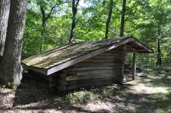
Red Mountain Shelter2.2 miles1986
Stephen and Helen Foster House2.4 miles2017
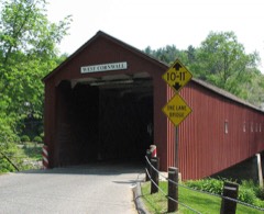
West Cornwall Bridge2.5 miles1975
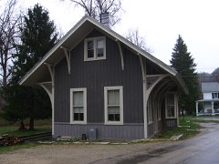
Cornwall Bridge Railroad Station2.7 miles1972
Bridge No. 5602.7 miles2004

Sources for this property

National Archives recordThe nomination case file for reference 90000762 in Record Group 79.
Wikipedia articleCommunity-written account of this property, licensed CC BY-SA.
Litchfield CountyAll 166 listed properties in this county.

Provenance

  • Listing record. National Park Service National Register of Historic Places, listed-properties dataset, current to 2026-05-22.
  • Map join. Address geocoded through the United States Census geocoder, then tested against the published boundary of every sheet in the USGS Historical Topographic Map Collection.
  • How this page is made. Listing fields come from federal records; map-sheet coverage is a labelled coordinate-to-boundary calculation, not a source-field claim.
  • Wildfire. Short, Karen C. 2022. Spatial wildfire occurrence data for the United States, 1992-2020 [FPA_FOD_20221014]. 6th Edition. Fort Collins, CO: Forest Service Research Data Archive. https://doi.org/10.2737/RDS-2013-0009.6 Collected with United States Government funding and usable without additional permissions or fees.
  • Mines and quarries. USGS Mineral Resources Data System (MRDS) https://mrdata.usgs.gov/mrds/ A work of the United States government, no copyright under 17 U.S.C. 105.
  • Storms. NOAA National Centers for Environmental Information, Storm Events Database https://www.ncei.noaa.gov/stormevents/ A work of the United States government, no copyright under 17 U.S.C. 105. Narratives are quoted verbatim from the National Weather Service report and are not edited or summarised.