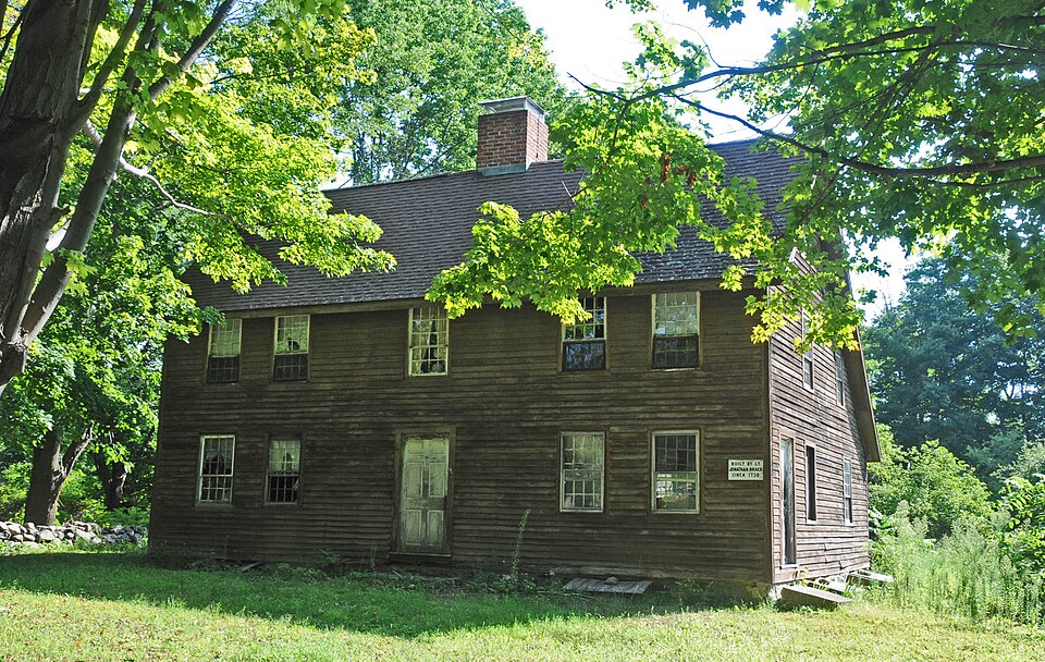
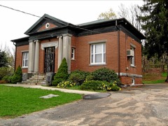
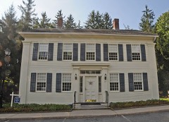
Listed on the National Register of Historic Places in 1996.
From the record
“The Burlington-Harmony Hill Roads Historic District encompasses a historic rural agricultural crossroads village in eastern Harwinton, Connecticut. Stretching mainly along Harmony Hill Road North of its Junction with Burlington Road, it includes residential buildings dating from the mid-18th to late 19th centuries.”
Wikipedia article Burlington-Harmony Hill Roads Historic District, CC BY-SA 4.0.
One of 166 National Register listings published here for Litchfield County · listed in 1996 · category: District.
National Register reference number.96001364- the number the National Park Service assigned this property when it was listed, and the key its nomination file is catalogued under at the National Archives.
The town of Harwinton lies on the east border of the county, and is bounded as follows: on the north by Torrington and New Hartford, on the east by Hartford County, on the south by Plymouth and Thomaston, and on the west by Litchfield. The surface of the town is elevated and hilly, and better adapted to grazing than the raising of grain.
THE PIONEERS. To Daniel Messenger is inscribed the honor of having been the first white settler within the bounds of the present town of Harwinton. He located here in 1730. "Whether we think of him," says R. M. Chipman, in the " History of Harwinton," "as now keeping more closely to his tarrying-place, whicii must at tlie first have been so lonely, though near the road between Litchfield and Farmington, or as now crossing the line between the Hartford and Windsor proprieties, he for both East Harwinton and West Harwinton respectively, and so for us all, wjis ' the pathfinder.' Viewed in relation with merely such effects, consequent on his coming to Harwinton, as here, while he lived he saw accomplished ; much more, viewed in relation with those results thence originating, which here since his death have been unfolded, he appears, even aside from any of his own purposes in the matter, to have executed a mission from God for the good of all otiier persons who should dwell here ; so that, without intent to utter it punningly, far less profanely, one might say that to each of such persons Providence, in effect, affirmed of him (what wa-s said of ' one greater than he') : ' This is he of whom it is written. Behold 1 send my messenger before thy face, which shall prepare thy way before thee.' As to our ' pathfinder,' literally, ' before' him, respecting time and otherwise, was that ' way' prepared which has incidentally been twice mentioned. In the latter mention of it were quoted the words of a record which, one other excepted, is the oldest that Harwinton possesses.* This road which our annals present thus early was, previously to Capt. Messenger's taking his residence in the township, part of the route traversed and incipiently ' made' by such persons as, at Farmington, Hartford, and other places, had been interested in facilitating access and accessions to the plantation by them set forward at Bantam (now Litchfield). Chiefly by this did the people of Hartford and the other easterly towns gain entrance into a territory which, forming at present a large part of the largest county in Connecticut, and supplied now with agricultural products, manufactures, villages, and well-instructed inhabitants, was at that period a wilderness, known as ' the Western lands.' The said road, by Capt. Messenger and other ' East Harwinton Proprietors' put into fit condition, December, 1732, continued to be a main thoroughfare until long after the establishment of stage-coach accommodations ; so that, by means of the travelers who used it, Harwinton had at that day, and for years afterward, a more extensive publicity than it has now. It was over this road that - with his suite, including Maj.-Geu. the Marquis de La Fayette, Gen. Knox, and several other American officers of distinction - passed our nation's ' pathfinder,' Gen. Wa.shington. After his party had taken here refreshments, in presenting ^liich the choicest of our young maidens honored themselves as well a.s their fathers' and their town's welcome guests,t the cavalcade went onward ; and when, in its progress, it moved gracefully up the western ascent from the valley of Lead-mine Brook, and thus was in full view of persons assembled at the church standing then, it presented a pageant which, sixty years afterwards, aged citizens vividly remerabere<l.
Regional context, not property-specific
evidence. The
federal wildfire occurrence database
lists 441 fires within 5 miles of Burlington-Harmony Hill Roads Historic District
between 1992 and 2020, burning about 1,774 acres in total. None started naturally. 19 were recorded as arson.
Distance is straight-line from the map coordinates, so a fire counted
here may appear on a neighbouring settlement's page as well.
Reported cause
Fires
Missing data/not specified/undetermined
363
Recreation and ceremony
25
Debris and open burning
21
Arson/incendiarism
19
Misuse of fire by a minor
7
Smoking
5
Equipment and vehicle use
1
The most recent of
them, most recent first, with the day each was reported and the service
that recorded it.
Regional context, not property-specific
evidence. The federal mineral resources record lists
17 workings within 5 miles of Burlington-Harmony Hill Roads Historic District: 14 past producers, 2 producers, 1 plant.
3 still produce. What was taken out: Sand and Gravel, Construction, Stone, Dimension, Granite, Talc-Soapstone. Distance is straight-line from the
map coordinates, so a quarry counted here may appear on a neighbouring
settlement's page as well.
Regional context, not property-specific
evidence. The National Weather Service names
Harwinton, the town this property stands in, in 23 storm reports between 1994 and 2024: 14 thunderstorm wind, 6 hail, 2 flood, 1 tornado.
No death or injury is recorded in these reports. Each account below is quoted exactly as the forecast office
filed it, from the NOAA Storm Events Database, and each date
opens the federal record of that event.
A tornado touched down along Spring Hill Road in Harwinton, CT on June 21, 2024 just before 5 PM. The tornado moved in a general southeast direction, but the path was curved and the tornado moved almost southward for a period before turning eastward. The tornado ended along Route 4 near the Harwinton Ambulance station. Most of the damage consisted of broken tree limbs with some uprooted trees. Damage was sporadic along the path. Video of the tornado was posted to social media by the general public.
Power lines were downed near Fairview Farm Golf Course on Hill Road. Trees and wires were also downed on Wild Cat Hill Road with debris in the roadway.
Trees and powerlines were reported down in Harwinton due to strong thunderstorm winds. In addition, penny size hail also occurred during this thunderstorm.
Penny size hail was reported in Harwinton during a thunderstorm. In addition, trees and power lines were also reported down due to strong thunderstorm winds.
Nearly half of the roads in Harwinton were closed due to downed trees from strong thunderstorm winds. Trees were down on Route 72 and Route 222. Downed trees blocked the entrance to the town garage, Harwinton Street Department, on Locust Road. Motorists were reported stranded and rescued by state police on Burlington Road and Hill Road. A tree was reported down on a house on Swimming Hole Road.
No historic map-sheet match is published
for this property yet. That does not mean no map exists. This record needs
a coordinate-quality review before it can be joined to a sheet boundary.
Browse the county's mapped places while that work is
pending.
Listed places nearby
6 within 8 miles
Other National Register properties close
enough to walk or drive between, ordered by distance from this one. Both
positions come from the same geocoding pass that matched these properties
to their map sheets.
Listing record. National Park Service National Register of Historic Places, listed-properties dataset, current to 2026-05-22.
Map join. Address geocoded through the United States Census geocoder, then tested against the published boundary of every sheet in the USGS Historical Topographic Map Collection.
How this page is made. Listing fields come from federal records; map-sheet coverage is a labelled coordinate-to-boundary calculation, not a source-field claim.
Wildfire. Short, Karen C. 2022. Spatial wildfire occurrence data for the United States, 1992-2020 [FPA_FOD_20221014]. 6th Edition. Fort Collins, CO: Forest Service Research Data Archive. https://doi.org/10.2737/RDS-2013-0009.6 Collected with United States Government funding and usable without additional permissions or fees.
Mines and quarries. USGS Mineral Resources Data System (MRDS) https://mrdata.usgs.gov/mrds/ A work of the United States government, no copyright under 17 U.S.C. 105.
Storms. NOAA National Centers for Environmental Information, Storm Events Database https://www.ncei.noaa.gov/stormevents/ A work of the United States government, no copyright under 17 U.S.C. 105. Narratives are quoted verbatim from the National Weather Service report and are not edited or summarised.
 Block