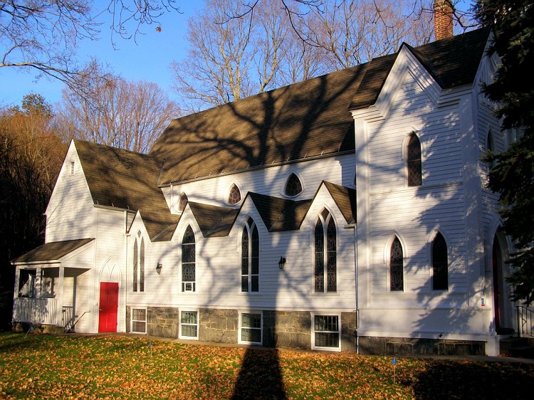
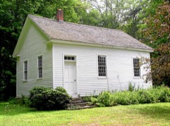
Listed on the National Register of Historic Places in 1996.
From the record
“The Pine Meadow Historic District encompasses most of the historic 19th-century village of Pine Meadow in New Hartford, Connecticut, United States. Located at a bend in the West Branch of the Farmington River southeast of New Hartford center, it is a well-preserved example of a rural industrial village.”
Wikipedia article Pine Meadow Historic District, CC BY-SA 4.0.
One of 166 National Register listings published here for Litchfield County · listed in 1996 · category: District.
National Register reference number.96001463- the number the National Park Service assigned this property when it was listed, and the key its nomination file is catalogued under at the National Archives.
The writer acknowledges courtesies and assistance received from Messrs. Charles J. Hoadley, State librarian, and Addison Van Name, assistant librarian of Yale College, from Rev. William H. Moore, of Memorial Hall, from Hon. John Boyd, of Winsted, and from the custodians of tlie Connecticut Historial Library. Much that is valuable concerning his native town has been gleamed from the MSS. of Rev. Frederick Marsh, late pastor of the Congregational Church at Winchester, kindly loaned by Messrs. Edward Marsh, of New Hartford, and George M. Carrington, of Winsted.
Grateful acknowledgments are due to those who have furnished church records, to Deacon J. C. Keach, the courteous town clerk of New Hartford, to Mr. Ashbel Marsh, whose recollections have been invaluable, to Messrs. Wait Garrett, Darius B. Smith, Edmund Watson, and to all others whose personal recollections or family records have in any way contributed to this history.
Regional context, not property-specific
evidence. The
federal wildfire occurrence database
lists 169 fires within 5 miles of Pine Meadow Historic District
between 1997 and 2020, burning about 144 acres in total. None started naturally. 6 were recorded as arson.
Distance is straight-line from the map coordinates, so a fire counted
here may appear on a neighbouring settlement's page as well.
Reported cause
Fires
Missing data/not specified/undetermined
134
Debris and open burning
13
Recreation and ceremony
11
Arson/incendiarism
6
Smoking
2
Other causes
1
Railroad operations and maintenance
1
Misuse of fire by a minor
1
The most recent of
them, most recent first, with the day each was reported and the service
that recorded it.
Regional context, not property-specific
evidence. The federal mineral resources record lists
14 workings within 5 miles of Pine Meadow Historic District: 11 past producers, 2 producers, 1 prospect.
2 still produce. What was taken out: Stone, Dimension, Sand and Gravel, Construction, Mica, Feldspar. Distance is straight-line from the
map coordinates, so a quarry counted here may appear on a neighbouring
settlement's page as well.
Regional context, not property-specific
evidence. The National Weather Service names
New Hartford, the town this property stands in, in 15 storm reports between 1999 and 2025: 8 thunderstorm wind, 5 hail, 1 flash flood, 1 flood.
No death or injury is recorded in these reports. Each account below is quoted exactly as the forecast office
filed it, from the NOAA Storm Events Database, and each date
opens the federal record of that event.
Heavy rain led to widespread flooding across Litchfield County from Sunday evening on the 15th, and persisted through Wednesday morning on the 18th. Several streams and creeks exceeded bankful as a result of this heavy rain, including the Still River in Winsted, and the Nepaug Brook and River in New Hartford. This led to numerous road closures across the county, as well as some evacuations.|Some of the roads that were closed included Carpenter Road in new Hartford, where a foot of water was reported covering the bridge just north of Route 202, South Main Street and Highland Lake Road in Torrington, where some debris also covered portions of Highland Lake Road, Route 47 and Weekeepeemee Road in Woodbury, Torrington Road between Torrington and Winsted, Cross Road and Youngsfield Road in New Milford, as well as several roads in Washington and Winsted that were washed out.|In addition, several evacuations also occurred, including residents on Standard Avenue in Winsted, as well as at a 40 unit apartment complex in Winsted.|A mudslide also was reported at Grove Street in New Milford by an Emergency Manager. This resulted in the evacuation of 5 homes.|The runoff from this heavy rainfall also led to moderate flooding on the Housatonic River. At Falls Village, the Housatonic River crested at 11.14 feet at 0115 EST on the 18th, while at Gaylordsville, the river crested at 12.97 feet at 2300 EST on the 16th, Further south, the Housatonic River at Stevenson Dam crested at 19.96 feet at 1400 EST on the 16th.
A line of thunderstorms developed ahead of a cold front on the evening of August 28, across Litchfield County. One of the storms became severe as it approached the eastern extreme end of the county. Winds from the storm blew down a few trees and power lines in the town of New Hartford.
No historic map-sheet match is published
for this property yet. That does not mean no map exists. This record needs
a coordinate-quality review before it can be joined to a sheet boundary.
Browse the county's mapped places while that work is
pending.
Listed places nearby
6 within 8 miles
Other National Register properties close
enough to walk or drive between, ordered by distance from this one. Both
positions come from the same geocoding pass that matched these properties
to their map sheets.
Listing record. National Park Service National Register of Historic Places, listed-properties dataset, current to 2026-05-22.
Map join. Address geocoded through the United States Census geocoder, then tested against the published boundary of every sheet in the USGS Historical Topographic Map Collection.
How this page is made. Listing fields come from federal records; map-sheet coverage is a labelled coordinate-to-boundary calculation, not a source-field claim.
Wildfire. Short, Karen C. 2022. Spatial wildfire occurrence data for the United States, 1992-2020 [FPA_FOD_20221014]. 6th Edition. Fort Collins, CO: Forest Service Research Data Archive. https://doi.org/10.2737/RDS-2013-0009.6 Collected with United States Government funding and usable without additional permissions or fees.
Mines and quarries. USGS Mineral Resources Data System (MRDS) https://mrdata.usgs.gov/mrds/ A work of the United States government, no copyright under 17 U.S.C. 105.
Storms. NOAA National Centers for Environmental Information, Storm Events Database https://www.ncei.noaa.gov/stormevents/ A work of the United States government, no copyright under 17 U.S.C. 105. Narratives are quoted verbatim from the National Weather Service report and are not edited or summarised.
 Block