 Block
BlockBartow, Florida
17 topographic sheets cover this place, the earliest surveyed in 1949 and the latest in 1988. It stands in the Bartow census division. It lies in ZIP code area 33830. It stands on Bear Branch. The Survey maps it on the Bartow quadrangle. 19,309 people lived here at the 2020 count. It stands 121 feet above sea level.
Then and now
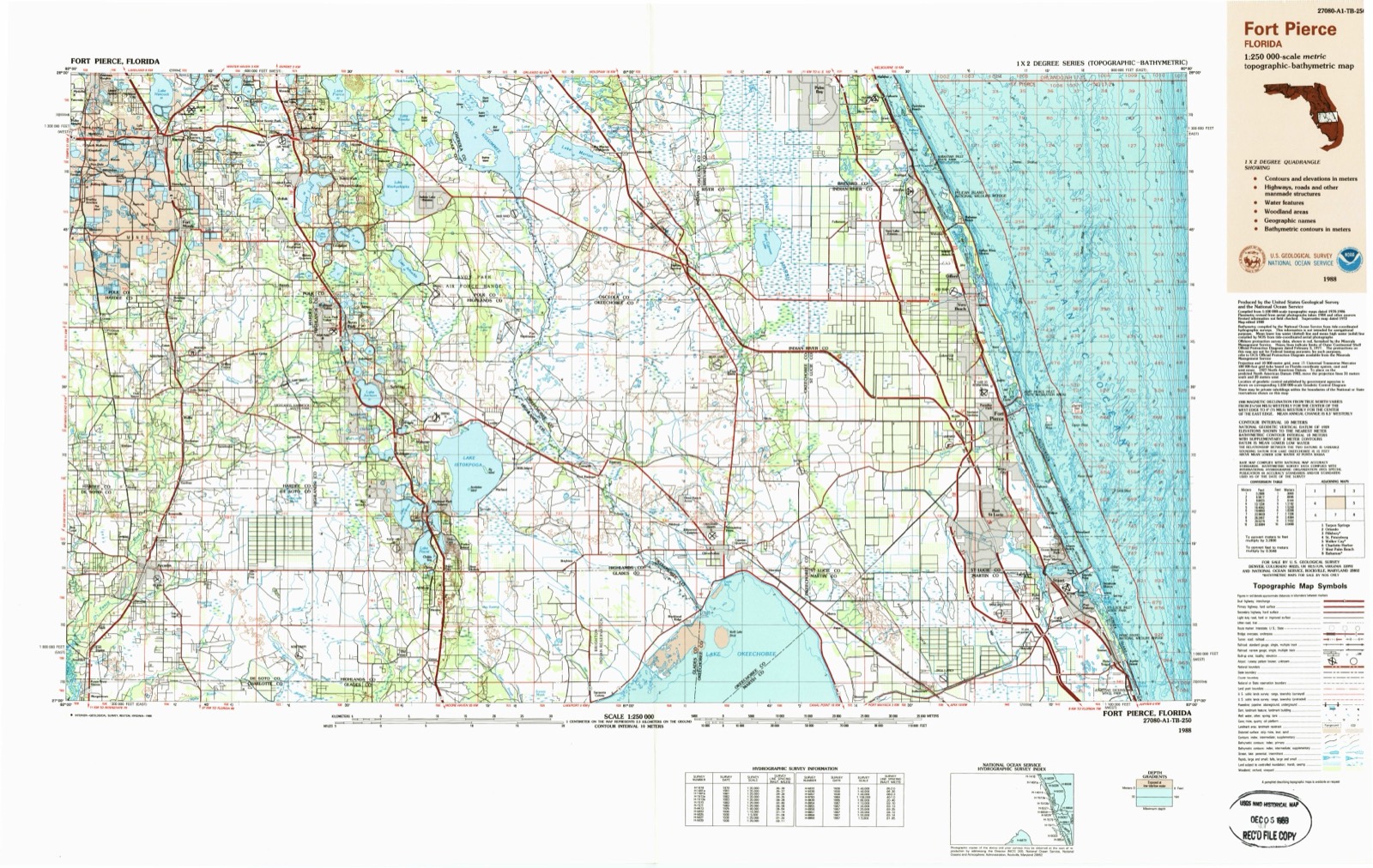
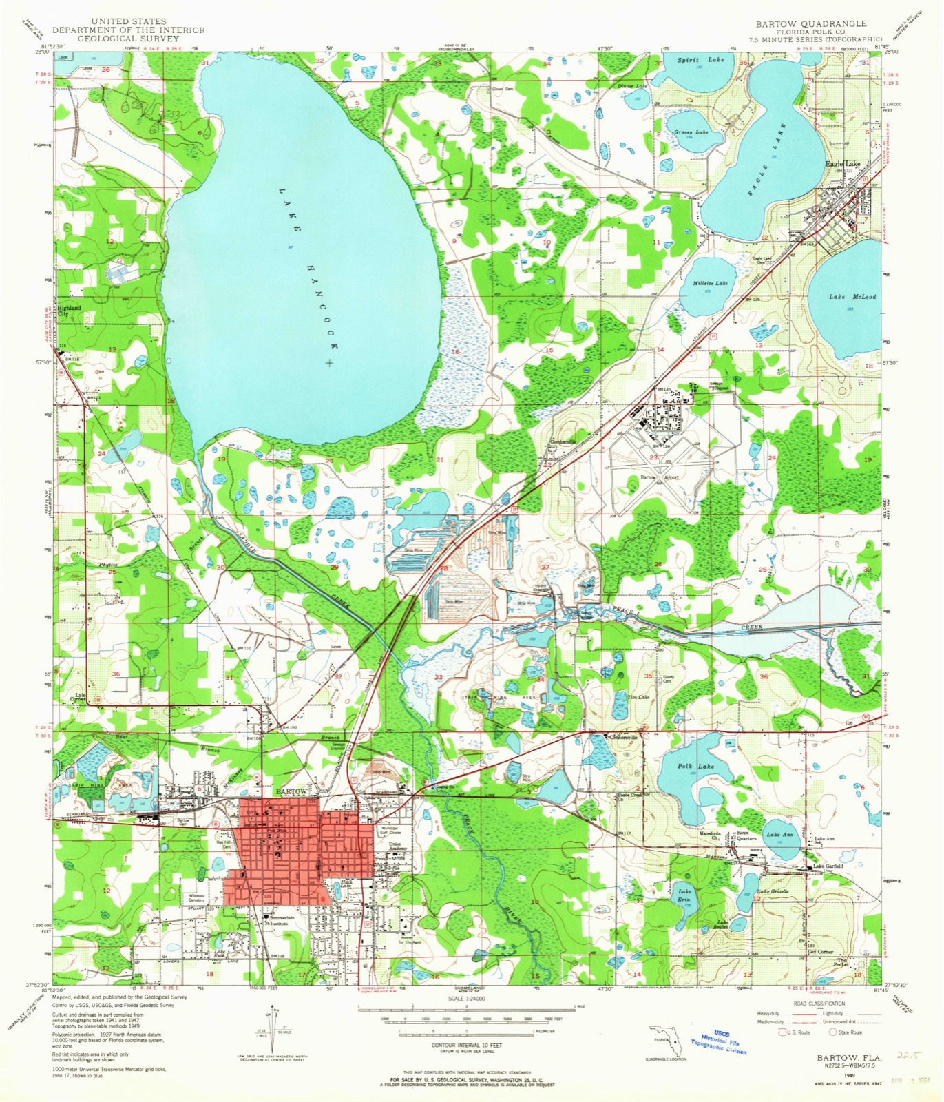
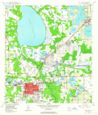
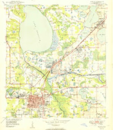
1949 to 1988The same ground, surveyed 39 years apart. Drag the handle to wipe between them. Both sheets are United States Geological Survey originals; neither has been altered.
On record in Bartow
Buildings and businesses the archive holds for this place. Each opens its own page, with the source record it came from.
On the National Register 12 records
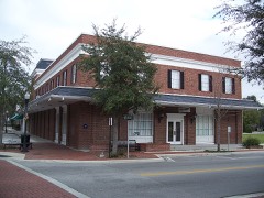 Bartow Downtown Commercial Districtlisted 1993
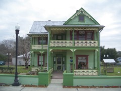 Lawrence Brown Houselisted 2001
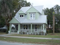 Benjamin Franklin Holland Houselisted 1975
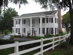 Mann Manorlisted 2011
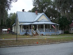 Northeast Bartow Residential Districtlisted 1993
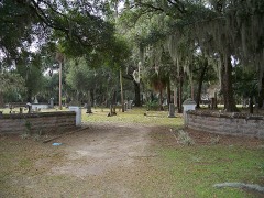 Oak Hill Cemeterylisted 2003
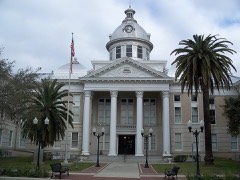 Polk County Courthouse, Oldlisted 1989
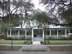 South Bartow Residential Districtlisted 1993
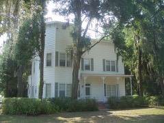 South Florida Military Collegelisted 1972
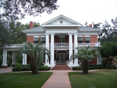 John J. Swearingen Houselisted 1982
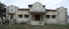 Thompson and Company Cigar Factorylisted 2002
- Surveyor's Lake Schoolhouselisted 2024
Population over time
2 figuresBartow grew from 17,298 to 19,309 between 2010 and 2020. These are the recorded population figures Wikidata holds for this place, reached through the Geographic Names Information System number this page is keyed on rather than by name, so they belong to this place and not to another of the same name. Most are census counts, but not all are: an early figure may be a founding or settlement estimate, and an estimate published within five years of a census is left out. The change column is computed, and is left blank where more than 20 years separate a figure from the one before it, because a gap that long is not a change between two counts.
| Year | People | Change |
|---|---|---|
| 2010 | 17,298 | |
| 2020 | 19,309 | +2,011 (+12%) |
Topographic sheets covering this place
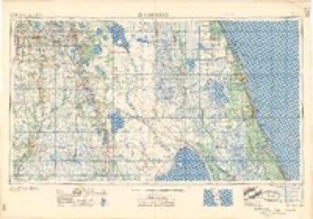
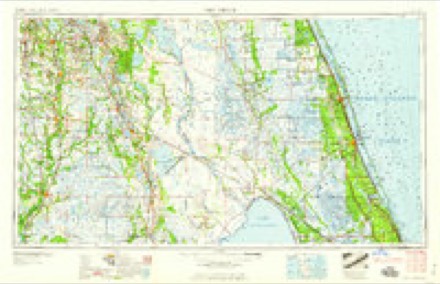
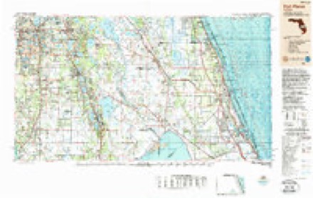
7 surveys from 17 printed sheetsMatched by testing this settlement's coordinate against the published boundary of every sheet in the United States Geological Survey's historical collection. Each opens the scanned sheet at the Survey.
- 1949 USGS Bartow quadrangle1:24000, 5 printings
- 1950 USGS Bartow quadrangle1:24000
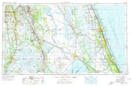
- 1956 USGS Fort Pierce quadrangle1:250000, 4 printings
- 1958 USGS Fort Pierce quadrangle1:250000
- 1959 USGS Fort Pierce quadrangle1:250000, 3 printings
- 1978 USGS Bartow quadrangle1:100000, 2 printings
- 1988 USGS Fort Pierce quadrangle1:250000
Fires near this place
184 since 1992Regional context, not property-specific evidence. The federal wildfire occurrence database lists 184 fires within 5 miles of Bartow between 1992 and 2020, burning about 6,322 acres in total. 16 started naturally. 13 were recorded as arson. Distance is straight-line from the map coordinates, so a fire counted here may appear on a neighbouring settlement's page as well.
| Reported cause | Fires |
|---|---|
| Equipment and vehicle use | 41 |
| Railroad operations and maintenance | 30 |
| Missing data/not specified/undetermined | 27 |
| Recreation and ceremony | 25 |
| Debris and open burning | 19 |
| Natural | 16 |
| Arson/incendiarism | 13 |
| Misuse of fire by a minor | 7 |
| Power generation/transmission/distribution | 6 |
The most recent of them, most recent first, with the day each was reported and the service that recorded it.
| Date | Cause | Size | Reported by | Name on the report |
|---|---|---|---|---|
| 3 September 1996 | Equipment and vehicle use | 3.0 acres | Florida Forest Service | not named |
| 3 September 1996 | Equipment and vehicle use | under an acre | Florida Forest Service | not named |
| 3 September 1996 | Equipment and vehicle use | under an acre | Florida Forest Service | not named |
| 3 September 1996 | Equipment and vehicle use | under an acre | Florida Forest Service | not named |
| 3 September 1996 | Equipment and vehicle use | under an acre | Florida Forest Service | not named |
| 3 September 1996 | Equipment and vehicle use | under an acre | Florida Forest Service | not named |
| 3 September 1996 | Equipment and vehicle use | under an acre | Florida Forest Service | not named |
| 10 September 1999 | Natural | 5.0 acres | Florida Forest Service | not named |
Settlements close enough to share some of these fires:
Mines and quarries near this place
10 of 18 shownRegional context, not property-specific evidence. The federal mineral resources record lists 18 workings within 5 miles of Bartow: 7 plants, 4 producers, 3 past producers, 2 unknowns. 11 still produce. What was taken out: Phosphorus-Phosphates, Fluorine-Fluorite, Uranium, Iron, Aluminum, Magnesite, Iron, Magnesite, Uranium, Aluminum, Fluorine-Fluorite, Aluminum, Fluorine-Fluorite, Iron, Magnesite, Uranium. Distance is straight-line from the map coordinates, so a quarry counted here may appear on a neighbouring settlement's page as well.
| Where | Site | Commodity | Status | Recorded |
|---|---|---|---|---|
| Bonny Lake Mine | Phosphorus-Phosphates, Magnesite, Uranium, Iron, Aluminum, Water, Free, Fluorine-Fluorite | Plant | 1958 | |
| Clear Springs | Phosphorus-Phosphates, Iron, Magnesite, Uranium, Aluminum, Fluorine-Fluorite | Past Producer | 1950 | |
| Clear Springs Mine | Phosphorus-Phosphates, Fluorine-Fluorite, Uranium, Iron, Aluminum, Magnesite | Producer | 1966 | |
| Ged Mining - Tice Pit | Clay | Producer | Clay | |
| Noralyn/Phosphoria | Phosphorus-Phosphates, Aluminum, Fluorine-Fluorite, Iron, Magnesite, Uranium | Past Producer | 1920, 1948 | |
| Stuart-Griffin Tracts | Phosphorus-Phosphates, Fluorine-Fluorite, Iron, Magnesite, Uranium, Aluminum | Occurrence | ||
| Unnamed Diatomite Prospect | Diatomite | Occurrence | ||
| Bartow #1 Phosphoric Acid Plant | Phosphorus-Phosphates | Unknown | 1965 | |
| Bartow #2 Phosphoric Acid Plant | Phosphorus-Phosphates | Unknown | 1977 | |
| Bartow Cargill 2 | Phosphorus-Phosphates | Plant |
Storms near this place
53 since 1993Regional context, not property-specific evidence. The National Weather Service names Bartow in 53 storm reports between 1993 and 2014: 17 thunderstorm wind, 16 hail, 9 flood, 5 lightning. The reports record 2 injuries. Each account below is quoted exactly as the forecast office filed it, from the NOAA Storm Events Database, and each date opens the federal record of that event.
| When | Event | Place named | Harm | What the report says |
|---|---|---|---|---|
| March 1996 | Hail | Bartow | 1 hurt, $400,000 | no account filed |
| September 2000 | Lightning | Bartow | 1 hurt | The charge from a nearby lightning strike injured a 36 year old man who was holding onto the aluminum frame of the sliding door of his home on the 100 block of Madera Drive northeast of Bartow. |
| May 2005 | Lightning | Bartow | $1,000,000 | Lightning sparked a fire that destroyed the Polk County Traffic Engineering and Operations Building. The complex and vehicles within the complex near Spirit Lake Road were a complete loss. The main building was very old and was not equipped with a sprinkler system. |
| July 1995 | Thunderstorm Wind | Bartow | $500,000 | A thunderstorm downburst wind gust measured at 86 mph struck the Bartow Municipal Airport. Two aircraft, and three large metal buildings, were destroyed. Four other aircraft were heavily damaged. Three additional aircraft incurred minor damage. A few of the aircraft were lifted and tossed nearly 500 yards. Two additonal structures incurred minor damage. Several medium sized trees, and some power lines, were downed. |
| March 1996 | Thunderstorm Wind | Bartow | $300,000 | no account filed |
| June 2001 | Thunderstorm Wind | Bartow | $279,000 | Polk county emergency management reported, through the Tampa Tribune newspaper, that thunderstorm winds destroyed three structures, caused major damage to six structures, minor damage to 21 additional structures, and downed numerous trees, branches and power lines in Bartow. |
| May 1997 | Thunderstorm Wind | Bartow | $250,000 | Thunderstorm winds overturned a few mobile homes and damaged the roofs of twelve others in Bartow. Four of the mobile homes were destroyed. Scattered trees and power lines were also downed in the vicinity of Bartow. |
| December 1997 | Tornado (F0) | Bartow | $200,000 | A tornado touched down in the Oakwood Estates mobile home park along Spirit Lake Road south of County Road 540. Approximately twelve mobile homes sustained minor to moderate roof, lanai and siding damage. |
| May 2009 | Lightning | Bartow | $190,000 | A house along Old Homeland Road was struck by lightning. It caused a fire that consumed the structure. |
| August 2002 | Thunderstorm Wind | Bartow | $50,000 | Spotter reported strong winds at the Bartow airport which damaged two airplanes, downed trees, and took the roof off a storage shed. |
| March 1996 | Hail | Bartow | $30,000 | no account filed |
| June 2014 | Thunderstorm Wind | Bartow | $25,000 | The Polk County Department of Emergency Management reported numerous trees and powerlines down from a storm that passed through around 7 pm EDT. There were two homes that sustained damage when trees fell onto the roofs penetrating the homes. |
| September 1999 | Flood | Bartow | $25,000 | Four to six inches of rain caused localized flooding of roadways and low-lying areas from Bartow to Frostproof in Polk county. A few vehicles and homes in low-lying areas incurred water damage from the floodwaters in Bartow. |
| May 1997 | Tornado (F0) | Bartow | $25,000 | A weak tornado touched down briefly along a path less than a mile long near State Road 60. Damage was confined to sheet metal on a few mobile homes and downed trees. |
| September 2000 | Flash Flood | Bartow | $25,000 | no account filed |
| May 1995 | Thunderstorm Wind | Bartow | $12,000 | Thunderstorm winds blew a large two- to three-feet wide and 25- to 30-feet long branch onto a vehicle causing $5,000 damage. Another two-foot wide branch was downed on a home which destroyed the screen porch and severely damaged the roof causing losses of $7,000. |
| January 1999 | Thunderstorm Wind | Bartow | $10,000 | Thunderstorm winds damaged roofs and porches of a few homes from Bartow to Haines City. |
| May 1999 | Thunderstorm Wind | Bartow | $10,000 | The Bartow Police Department reported that thunderstorm winds downed a large tree which damaged the roof of a home in Bartow. Thunderstorm winds also downed power lines across Bartow. |
| June 2009 | Thunderstorm Wind | Bartow | $6,000 | Several large water oak trees were fallen across East Hooker Street and South Floral Avenue blocking the roads. |
| July 2004 | Thunderstorm Wind | Bartow | $5,000 | Thunderstorm wind gusts caused numerous power outages, fallen trees, downed limbs, and isolated flooding in Bartow. A newly installed pool cage was destroyed on the 600 block of Alice Place. |
| June 1998 | Thunderstorm Wind | Bartow | $5,000 | Thunderstorm winds downed several large oak trees in Bartow. |
| February 1998 | Flood | Bartow | $5,000 | The Peace River along State Road 60 in Bartow crested at 9.0 feet, one foot above the flood stage of eight feet, on the 23rd. |
| March 1993 | Thunderstorm Wind | Bartow | $5,000 | Strong thunderstorm winds knocked down trees and fences. |
| August 1998 | Lightning | Bartow | $1,000 | Lightning struck a television antenna which sparked a fire that caused $500 dollars worth of damage to a home on the 1600 block of Lagoon Circle in Bartow. A second home on the 1400 block of Davis Avenue in Bartow was struck by lightning which caused $500 dollars worth of damage to the electrical system. |
| February 2007 | Thunderstorm Wind | Bartow | - | Windows were broken and small trees were downed in Bartow. A measured gust of 56 MPH was reported several minutes earlier 9 miles west of Bartow from a trained SKYWARN spotter. |
| June 2006 | Tornado (F0) | Bartow | - | A tornado was reported two miles east of the Polk County Emergency Operations Center at the Bartow Municipal Airport. |
| August 2005 | Thunderstorm Wind | Bartow | - | Several trees and power lines were downed along State Road 640. |
| September 2004 | Tornado (F0) | Bartow | - | A feeder band behind Hurricane Frances produced a brief tornado. Radar estimated the storm's movement to be northeast at 45 mph. |
| October 2003 | Thunderstorm Wind | Bartow | - | A local utility company reported numerous trees and power lines downed by strong thunderstorm winds. |
| June 2001 | Hail | Bartow | - | Dime sized hail was reported by the public, through WTVT-TV (FOX) of Tampa, near the intersection of County Road 655A (Alturas Rd) and State Road 60, eight miles east of Bartow. |
| June 2001 | Hail | Bartow | - | Nickel sized hail was reported by a Skywarn Spotter in Bartow. |
| May 2000 | Hail | Bartow | - | Skywarn Spotters reported dime to nickel sized hail over Bartow in northwest Polk county for a duration of twenty minutes. |
| May 1999 | Hail | Bartow | - | Nickel sized hail was reported by FAA control tower personnel at the Bartow Municipal Airport. |
| April 1999 | Wildfire | Bartow | - | A wildfire scorched nearly 200 acres of scrub trees and brush at the Cargill Fertilizer Corporation near State Road 60 west of Bartow. |
| April 1999 | Hail | Bartow | - | Golfball sized hail was reported by tower personnel at the Bartow Municipal Airport. |
| September 1998 | Flood | Bartow | - | The Peace River along State Road 60 in Bartow crested at 8.6 feet, over a half foot above the flood stage of eight feet, on the 29th. |
| April 1998 | Flood | Bartow | - | The Peace River along State Road 60 in Bartow crested at 8.2 feet on the 1st, less than a half foot above the flood stage of eight feet. |
| June 1998 | Hail | Bartow | - | Dime sized hail was reported by the Bartow police department. |
| June 1998 | Hail | Bartow | - | Dime sized hail was reported in Highland City by a Skywarn Spotter. |
| March 1998 | Flood | Bartow | - | The Peace River along State Road 60 in Bartow crested at 8.85 feet, nearly one foot above the flood stage of eight feet, on the 24th. |
| March 1998 | Flood | Bartow | - | The Peace River along State Road 60 in Bartow crested at 8.91 feet, nearly one foot above the flood stage of eight feet, on the 1st. |
| October 1998 | Flood | Bartow | - | The Peace River along State Road 60 in Bartow crested at 8.5 feet, a half foot above the flood stage of eight feet, on the 1st. |
| June 1998 | Lightning | Bartow | - | Lightning ignited and burned two and a half acres of brush on Old Homeland Road two miles south of Bartow. |
| May 1997 | Hail | Bartow | - | Nickel sized hail that lasted for ten minutes was reported at and around the Bartow Municipal Airport. |
| December 1997 | Flood | Bartow | - | The Peace River along State Road 60 in Bartow crested at 8.5, one half foot above the flood stage of eight feet, on the 31st. |
| May 1995 | Hail | Bartow | - | Dime-size hail was reported in the Lake Arbuckle campground. |
| June 1994 | Thunderstorm Wind | Bartow | - | Several trees and power lines were downed in Bartow, and a tree blocked a road near Lakeland. |
| March 1993 | Hail | Bartow | - | Quarter-size hail fell between Bartow and Wahneta and near Lake Alfred. |
| May 2003 | Hail | Bartow | - | no account filed |
| April 2002 | Hail | Bartow | - | no account filed |
| May 2002 | Hail | Bartow | - | no account filed |
| February 1996 | Flood | Bartow | - | no account filed |
| March 1996 | Hail | Bartow | - | no account filed |
Nearest settlements
The eight closest, with where each one stands in the county. Distances are straight-line, computed from the Geographic Names Information System coordinates.
| Map | Place | Distance | Sheets |
|---|---|---|---|
| Lyle Corner | 1.8 miles | 17 | |
| Connersville | 3.1 miles | 17 | |
| Ridgewood | 3.8 miles | 17 | |
| Roux Quarters | 3.8 miles | 17 | |
| Gordonville | 4.1 miles | 17 | |
| Ewell | 4.3 miles | 17 | |
| Lake Garfield | 4.4 miles | 17 | |
| Cox Corner | 4.5 miles | 17 |
Elsewhere
Matched on this settlement's Geographic Names Information System number rather than its name, so it cannot be a different place of the same name in another state.
| Wikipedia article on Bartow | An encyclopaedic summary. Its text is share-alike, so it is linked here rather than copied. |
| Wikidata item Q809580 | The structured record the population and elevation above come from. Public domain (CC0). |
Provenance
This settlement is recorded in the Geographic Names Information System as feature 278138. The sheet list is computed by point-in-boundary test against the United States Geological Survey's historical topographic inventory. Both are works of the United States government and carry no copyright under 17 U.S.C. 105.
Wildfire. Short, Karen C. 2022. Spatial wildfire occurrence data for the United States, 1992-2020 [FPA_FOD_20221014]. 6th Edition. Fort Collins, CO: Forest Service Research Data Archive. https://doi.org/10.2737/RDS-2013-0009.6 Collected with United States Government funding and usable without additional permissions or fees.
Mines and quarries. USGS Mineral Resources Data System (MRDS) https://mrdata.usgs.gov/mrds/ A work of the United States government, no copyright under 17 U.S.C. 105.
Storms. NOAA National Centers for Environmental Information, Storm Events Database https://www.ncei.noaa.gov/stormevents/ A work of the United States government, no copyright under 17 U.S.C. 105. Narratives are quoted verbatim from the National Weather Service report and are not edited or summarised.