 Block
BlockBiscayne Park, Florida
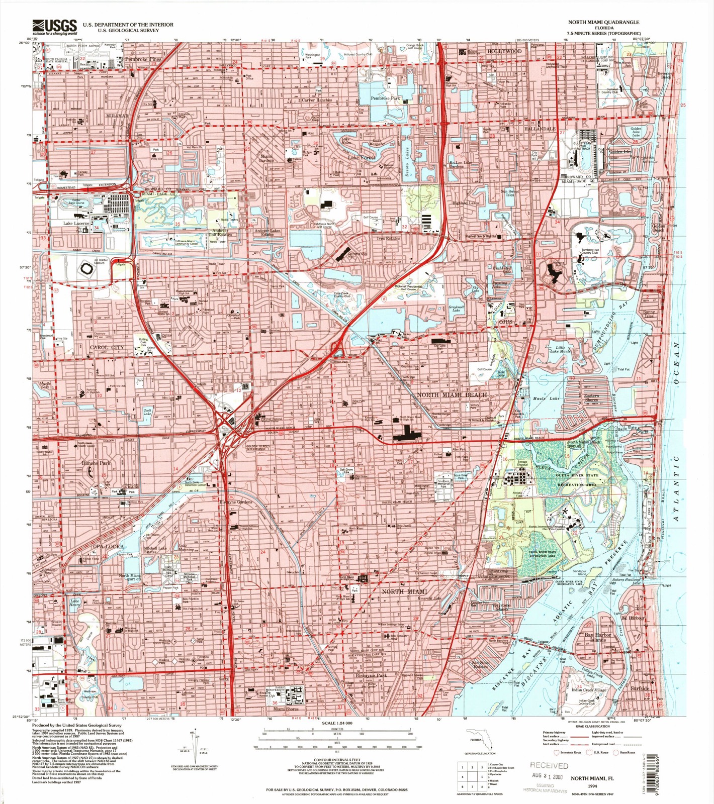
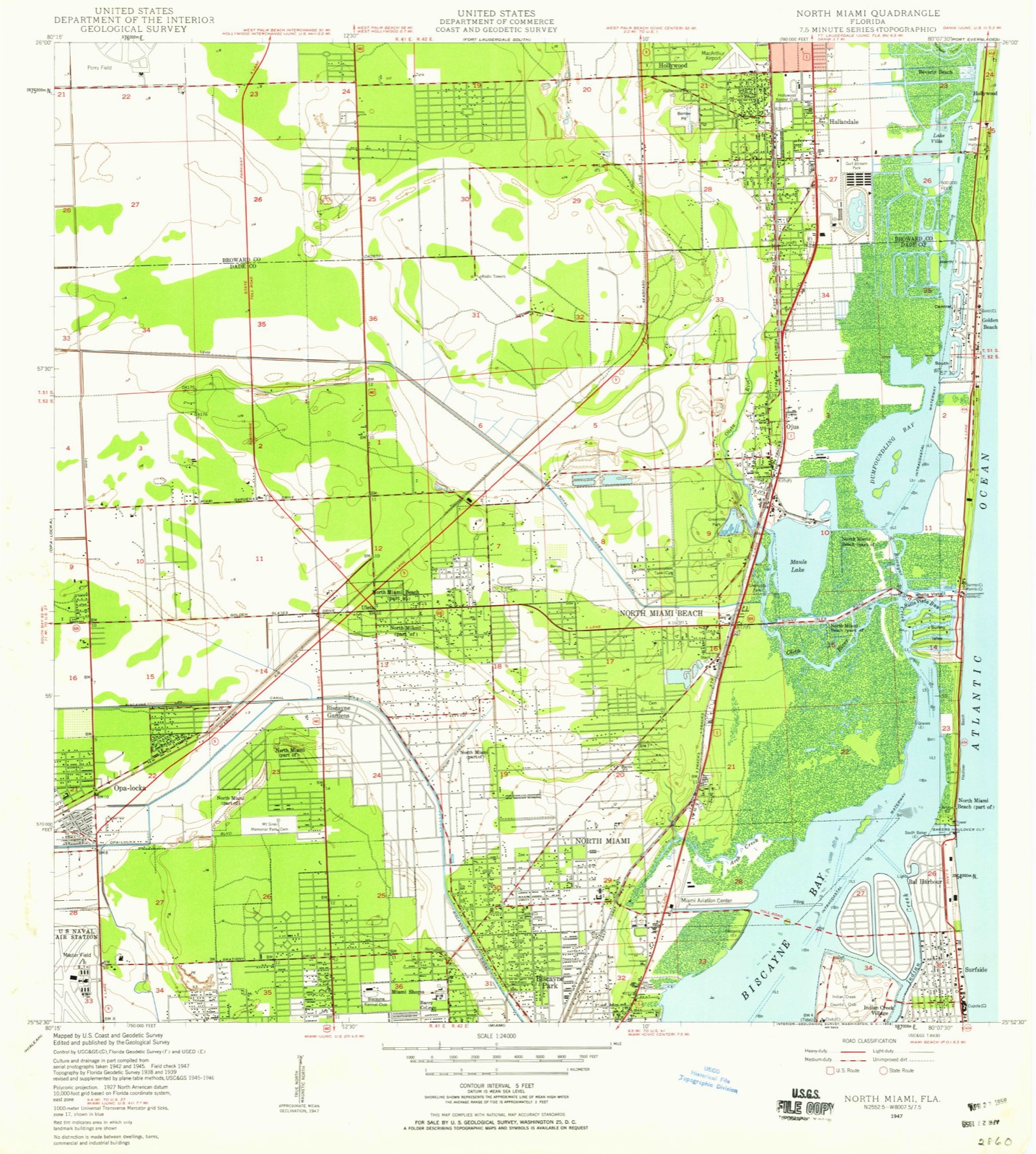
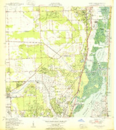
15 topographic sheets cover this place, the earliest surveyed in 1947 and the latest in 1994. It stands in the Miami census division. It lies in ZIP code area 33161. The Survey maps it on the North Miami quadrangle. 3,117 people lived here at the 2020 count. It stands 3 feet above sea level.
Then and now
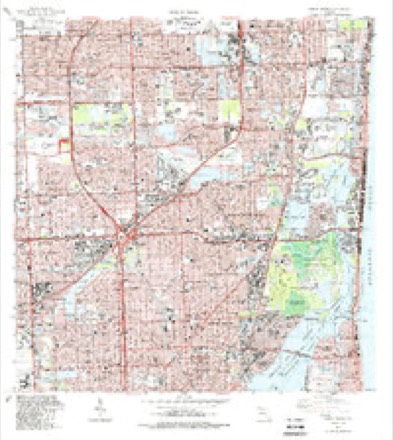
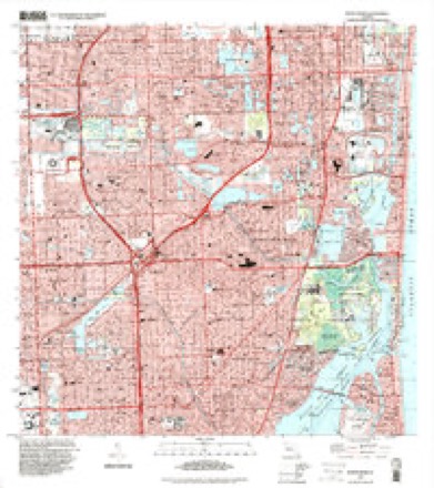
1947 to 1994The same ground, surveyed 47 years apart. Drag the handle to wipe between them. Both sheets are United States Geological Survey originals; neither has been altered.
Compare 1947 against another survey:
On record in Biscayne Park
Buildings and businesses the archive holds for this place. Each opens its own page, with the source record it came from.
On the National Register within a mile 1 record
The National Register names another town for these. They stand within one mile of this settlement's coordinate.
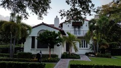 Building at 1291 Northeast 102nd Streetlisted 1988 · 0.9 miles away
Population over time
2 figuresBiscayne Park grew from 3,055 to 3,117 between 2010 and 2020. These are the recorded population figures Wikidata holds for this place, reached through the Geographic Names Information System number this page is keyed on rather than by name, so they belong to this place and not to another of the same name. Most are census counts, but not all are: an early figure may be a founding or settlement estimate, and an estimate published within five years of a census is left out. The change column is computed, and is left blank where more than 20 years separate a figure from the one before it, because a gap that long is not a change between two counts.
| Year | People | Change |
|---|---|---|
| 2010 | 3,055 | |
| 2020 | 3,117 | +62 (+2%) |
Topographic sheets covering this place
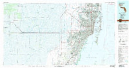
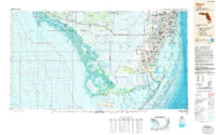
9 surveys from 15 printed sheetsMatched by testing this settlement's coordinate against the published boundary of every sheet in the United States Geological Survey's historical collection. Each opens the scanned sheet at the Survey.
- 1947 USGS North Miami quadrangle1:24000
- 1950 USGS North Miami quadrangle1:24000
- 1956 USGS Miami quadrangle1:250000, 5 printings
- 1958 USGS Miami quadrangle1:250000
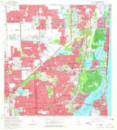
- 1962 USGS North Miami quadrangle1:24000, 3 printings
- 1981 USGS Miami quadrangle1:100000
- 1988 USGS Miami quadrangle1:250000
- 1988 USGS North Miami quadrangle1:24000
- 1994 USGS North Miami quadrangle1:24000
Fires near this place
11 since 1992Regional context, not property-specific evidence. The federal wildfire occurrence database lists 11 fires within 5 miles of Biscayne Park between 1992 and 2018, burning about 13 acres in total. None started naturally. 2 were recorded as arson. Distance is straight-line from the map coordinates, so a fire counted here may appear on a neighbouring settlement's page as well.
| Reported cause | Fires |
|---|---|
| Railroad operations and maintenance | 5 |
| Arson/incendiarism | 2 |
| Recreation and ceremony | 2 |
| Missing data/not specified/undetermined | 2 |
The most recent of them, most recent first, with the day each was reported and the service that recorded it.
| Date | Cause | Size | Reported by | Name on the report |
|---|---|---|---|---|
| 17 September 1992 | Railroad operations and maintenance | 5.0 acres | Florida Forest Service | not named |
| 30 May 1992 | Railroad operations and maintenance | under an acre | Florida Forest Service | not named |
| 30 May 1992 | Railroad operations and maintenance | under an acre | Florida Forest Service | not named |
| 28 April 2018 | Missing data/not specified/undetermined | 3.0 acres | Florida Forest Service | OLETA (13) |
| 16 April 2017 | Arson/incendiarism | under an acre | Florida Forest Service | GOLF COURSE ( 06 ) |
| 11 April 2005 | Missing data/not specified/undetermined | 2.5 acres | Florida Forest Service | OLETA |
| 26 March 1995 | Railroad operations and maintenance | under an acre | Florida Forest Service | not named |
| 14 March 1992 | Railroad operations and maintenance | under an acre | Florida Forest Service | not named |
Settlements close enough to share some of these fires:
Storms near this place
24 since 1997Regional context, not property-specific evidence. The National Weather Service names Biscayne Park in 24 storm reports between 1997 and 2024: 7 flood, 4 waterspout, 4 hail, 3 thunderstorm wind. The reports record 1 death and 1 injury. Each account below is quoted exactly as the forecast office filed it, from the NOAA Storm Events Database, and each date opens the federal record of that event.
| When | Event | Place named | Harm | What the report says |
|---|---|---|---|---|
| March 2015 | Thunderstorm Wind | Biscayne Park | 1 killed | A building maintenance worker was killed after he was struck by a glass tabletop that flew off a 9th floor balcony of Flamingo Apartments in Miami Beach. The tabletop flew off during high winds from thunderstorms which affected the area. Nearest measured wind gust was 46 mph at the City of Miami Beach Police Headquarters at 656 PM EDT. It is likely winds were higher at the 9th floor of the building. Report was supplemented with information from City of Miami Beach Department of Emergency Management. |
| August 1998 | Lightning | Biscayne Park | 1 hurt | A man was hit by a lightning bolt while he was pruning an Oak tree 20 feet above the ground. the 38 year old man climbed down the tree and then collapsed in front of a house in the 11900 block of Northeast 11 CT. It was not raining at the time. |
| June 2009 | Flash Flood | Biscayne Park | $50,000 | Severe flooding affected the Mid and South Beach sections of Miami Beach as well as downtown Miami from a nearly stationary thunderstorm. A total of 9.30 inches fell at the cooperative station on South Beach, most of this falling in less than 3 hours. This caused as much as 3 feet of standing water on streets and garages on South Beach, resulting in many vehicles stalled on streets and road closures across the area. Cars were seen floating down Michigan Avenue at 11th Street. Several businesses had water intrusion along Alton Road and 17th Street. A number of condominium buildings along West Avenue had up to 5 feet of water in the parking garages, resulting in dozens of cars being towed. Significant flooded was also reported in downtown Miami in the Omni area.||At the Fountainbleau Hotel on Miami Beach, heavy rains caused an eight-foot hole to open up in the lobby's ceiling, causing ankle deep water to spread from the lobby into a nightclub. |
| May 2019 | Flood | Biscayne Park | $5,000 | Heavy rainfall on Miami Beach lead to flooding of roadways. The Macarthur Causeway was closed and cars were stuck in flood waters. |
| May 2020 | Flash Flood | Biscayne Park | $1,000 | An off-duty NWS employee reported flooding impacting vehicle travel and entering structures near Alton Road and 13th Street in Miami Beach. |
| June 2024 | Flood | Biscayne Park | - | The City of Miami Beach Emergency Manager reported flooding across several roadways in Miami Beach due to heavy rainfall in the area. The South Florida Water Management District estimated 1.5 to 3 inches of rain in this general area from 7:30 PM to 9 PM. Photo evidence showed water rising from the streets onto the sidewalks. Clogged drains may have played a significant role in standing water on the roadways. |
| September 2024 | Flood | Biscayne Park | - | Minor street flooding of about 6 inches in depth occurred over parts of Miami Beach, mainly from 13th Street to 58th Street, during the early evening of September 13th. |
| October 2024 | Flood | Biscayne Park | - | The City of Miami Beach Emergency Manager reported flooding across several roadways in Miami Beach due to heavy rainfall in the area. The South Florida Water Management District estimated 3 to 5 inches of rain in this general area from late October 6th through 7th. Photo evidence showed several inches of rain ponding on the roadways into inclined driveways. Clogged drains may have played a significant role in standing water during this period. |
| October 2023 | Flood | Biscayne Park | - | Periods of moderate to heavy rain affected Miami Beach during the morning hours, and along with the high astronomical tides led to standing water of up to 6-12 inches deep at several locations in Miami Beach. Tide levels at nearby Virginia Key peaked at 1.72 feet MHHW or 3.96 feet MLLW. Rainfall amounts were estimated to be as much as 0.75 inches. |
| October 2023 | Flood | Biscayne Park | - | Reports of standing water 6-12 inches deep were reported in parts of Miami Beach as a result of afternoon thunderstorms producing brief, heavy rainfall. Rainfall amounts of up to 0.75 inches were estimated over a period of 1 hour. |
| August 2023 | Flood | Biscayne Park | - | Standing water was reported along several streets in Miami Beach from heavy rainfall during the late afternoon and early evening. As much as 3 inches of rain was estimated to have fallen in a short period of time. |
| January 2022 | Thunderstorm Wind | Biscayne Park | - | A thunderstorm wind gust of 78 mph was measured at the WeatherSTEM station at the University of Miami RSMAS campus in Virginia Key. The anemometer height is elevated on top of a building, therefore winds closer to the surface were likely lower. |
| April 2013 | Heavy Rain | Biscayne Park | - | Nearly six inches of rain fell on Miami Beach during a short duration and caused significant street flooding. One resident near the intersection of 13th Street and West Ave. reported water flooded his music room and the front yard of his house. Neighbors also spent the afternoon drying up the entrances to their apartments. There was no other serious reports of damage. |
| May 2012 | Hail | Biscayne Park | - | Multiple reports of hail ranging in size form an inch to an inch and a half were received from employees at the Hurricane Research Division on Virginia Key. |
| July 2010 | Thunderstorm Wind | Biscayne Park | - | KVIK mesonet on Virginia Key recorded a gust of 57 Knots with a passing thunderstorm. |
| June 2009 | Hail | Biscayne Park | - | A few reports were received of golf ball size hail on South Miami Beach. |
| June 2009 | Hail | Biscayne Park | - | Reported at Michigan Avenue and 11th Street on Miami Beach. Small palm trees also reported downed. |
| May 2005 | Hail | Biscayne Park | - | Nickel-size hail was reported. |
| September 1998 | Waterspout | Biscayne Park | - | Two waterspouts were observed by Miami Beach Patrol. |
| August 1997 | Waterspout | Biscayne Park | - | reported by several observers just east of elliot key. |
| June 1997 | Waterspout | Biscayne Park | - | reported by public |
| August 1997 | Funnel Cloud | Biscayne Park | - | funnel cloud reported by ship entering cutler channel. |
| August 1997 | Waterspout | Biscayne Park | - | reported by park ranger near eastern southerbed cut. |
| August 1997 | Funnel Cloud | Biscayne Park | - | sighted near elliot key. |
Nearest settlements
The eight closest, with where each one stands in the county. Distances are straight-line, computed from the Geographic Names Information System coordinates.
| Map | Place | Distance | Sheets |
|---|---|---|---|
| North Miami | 0.6 miles | 15 | |
| Courtly Manor | 0.7 miles | 15 | |
| San Souci Estates | 1.2 miles | 15 | |
| Miami Shores | 1.5 miles | 16 | |
| Keystone Islands | 1.6 miles | 15 | |
| El Portal | 2.0 miles | 16 | |
| Pinewood Park | 2.1 miles | 16 | |
| Pinewood | 2.1 miles | 16 |
Elsewhere
Matched on this settlement's Geographic Names Information System number rather than its name, so it cannot be a different place of the same name in another state.
| Wikipedia article on Biscayne Park | An encyclopaedic summary. Its text is share-alike, so it is linked here rather than copied. |
| Wikidata item Q866067 | The structured record the population and elevation above come from. Public domain (CC0). |
Provenance
This settlement is recorded in the Geographic Names Information System as feature 278854. The sheet list is computed by point-in-boundary test against the United States Geological Survey's historical topographic inventory. Both are works of the United States government and carry no copyright under 17 U.S.C. 105.
Wildfire. Short, Karen C. 2022. Spatial wildfire occurrence data for the United States, 1992-2020 [FPA_FOD_20221014]. 6th Edition. Fort Collins, CO: Forest Service Research Data Archive. https://doi.org/10.2737/RDS-2013-0009.6 Collected with United States Government funding and usable without additional permissions or fees.
Storms. NOAA National Centers for Environmental Information, Storm Events Database https://www.ncei.noaa.gov/stormevents/ A work of the United States government, no copyright under 17 U.S.C. 105. Narratives are quoted verbatim from the National Weather Service report and are not edited or summarised.