 Block
BlockBradenton, Florida
14 topographic sheets cover this place, the earliest surveyed in 1947 and the latest in 1994. It stands in the Bradenton census division. It lies in ZIP code area 34205. It stands on Wares Creek. The Survey maps it on the Bradenton quadrangle. 55,698 people lived here at the 2020 count. It stands 6 feet above sea level.
Research this city
Then and now
1947 to 1994The same ground, surveyed 47 years apart. Drag the handle to wipe between them. Both sheets are United States Geological Survey originals; neither has been altered.
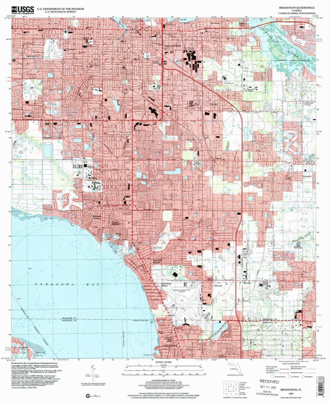
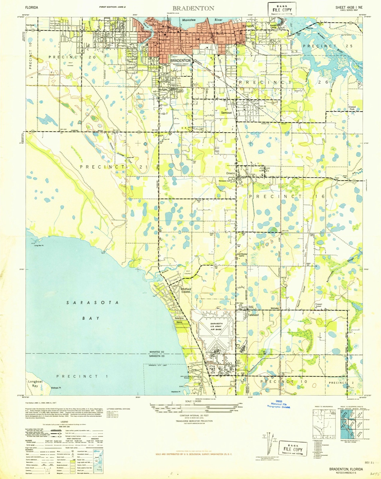
Compare 1947 against another survey:
On record in Bradenton
Buildings and businesses the archive holds for this place. Each opens its own page, with the source record it came from.
On the National Register 9 records
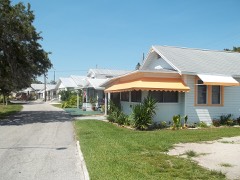 Braden Castle Park Historic Districtlisted 1983
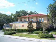 Bradenton Carnegie Librarylisted 1987
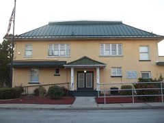 Bradenton Woman's Clublisted 2019
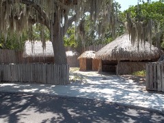 DeSoto National Memoriallisted 1966
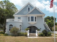 Johnson Helm Houselisted 2009
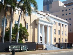 Manatee County Courthouselisted 1998
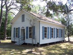 Manatee County Courthouse (Original)listed 1976
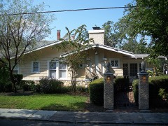 Richardson Houselisted 2003
- Curry Houses Historic Districtlisted 2015
Population over time
2 figuresBradenton grew from 49,546 to 55,698 between 2010 and 2020. These are the recorded population figures Wikidata holds for this place, reached through the Geographic Names Information System number this page is keyed on rather than by name, so they belong to this place and not to another of the same name. Most are census counts, but not all are: an early figure may be a founding or settlement estimate, and an estimate published within five years of a census is left out. The change column is computed, and is left blank where more than 20 years separate a figure from the one before it, because a gap that long is not a change between two counts.
| Year | People | Change |
|---|---|---|
| 2010 | 49,546 | |
| 2020 | 55,698 | +6,152 (+12%) |
Topographic sheets covering this place
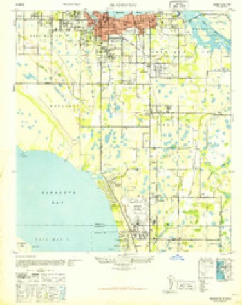
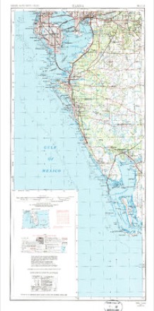
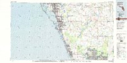
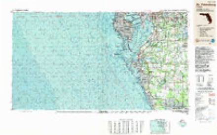
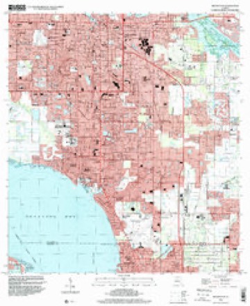
9 surveys from 14 printed sheetsMatched by testing this settlement's coordinate against the published boundary of every sheet in the United States Geological Survey's historical collection. Each opens the scanned sheet at the Survey.
- 1947 USGS Bradenton quadrangle1:24000
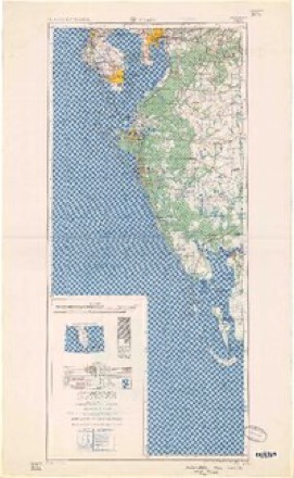
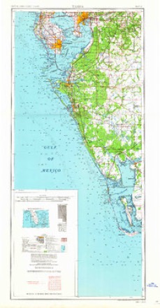
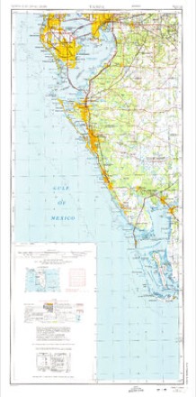
- 1956 USGS Tampa quadrangle1:250000, 2 printings
- 1959 USGS Tampa quadrangle1:250000
- 1960 USGS Tampa quadrangle1:250000, 2 printings
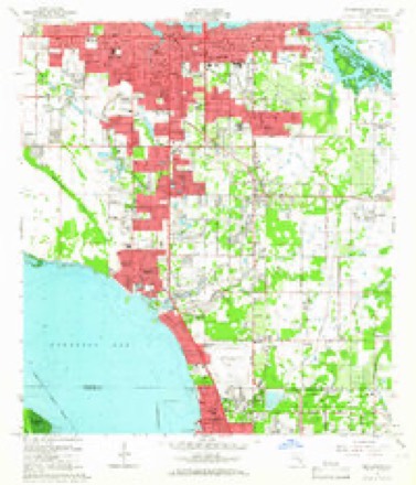
- 1964 USGS Bradenton quadrangle1:24000, 4 printings
- 1972 USGS Tampa quadrangle1:250000
- 1979 USGS Sarasota quadrangle1:100000
- 1988 USGS St Petersburg quadrangle1:250000
- 1994 USGS Bradenton quadrangle1:24000
Fires near this place
29 since 1992Regional context, not property-specific evidence. The federal wildfire occurrence database lists 29 fires within 5 miles of Bradenton between 1992 and 2020, burning about 148 acres in total. 5 started naturally. 1 was recorded as arson. Distance is straight-line from the map coordinates, so a fire counted here may appear on a neighbouring settlement's page as well.
| Reported cause | Fires |
|---|---|
| Railroad operations and maintenance | 6 |
| Misuse of fire by a minor | 5 |
| Natural | 5 |
| Missing data/not specified/undetermined | 4 |
| Debris and open burning | 3 |
| Equipment and vehicle use | 3 |
| Arson/incendiarism | 1 |
| Recreation and ceremony | 1 |
| Power generation/transmission/distribution | 1 |
The most recent of them, most recent first, with the day each was reported and the service that recorded it.
| Date | Cause | Size | Reported by | Name on the report |
|---|---|---|---|---|
| 28 September 1993 | Natural | 5.0 acres | Florida Forest Service | not named |
| 8 August 1993 | Equipment and vehicle use | 2.0 acres | Florida Forest Service | not named |
| 8 July 2016 | Natural | 50 acres | Florida Forest Service | PINE ISLAND (41) |
| 8 June 1992 | Natural | under an acre | Florida Forest Service | not named |
| 26 June 1993 | Natural | 2.0 acres | Florida Forest Service | not named |
| 16 June 1992 | Natural | 5.0 acres | Florida Forest Service | not named |
| 13 June 1994 | Arson/incendiarism | 3.0 acres | Florida Forest Service | not named |
| 4 May 1994 | Equipment and vehicle use | under an acre | Florida Forest Service | not named |
Settlements close enough to share some of these fires:
Mines and quarries near this place
6 within 5 milesRegional context, not property-specific evidence. The federal mineral resources record lists 6 workings within 5 miles of Bradenton: 5 past producers, 1 producer. 1 still produces. What was taken out: Dolomite, Stone, Crushed/Broken, Calcium, Stone, Crushed/Broken, Dolomite. Distance is straight-line from the map coordinates, so a quarry counted here may appear on a neighbouring settlement's page as well.
| Where | Site | Commodity | Status | Recorded |
|---|---|---|---|---|
| Clarks Dolomite Quarry | Stone, Crushed/Broken, Dolomite | Past Producer | ||
| P and R Shell Pit | Stone, Crushed/Broken | Past Producer | ||
| P and R Shell Pit No. 2 | Calcium | Producer | ||
| Bradenton Dolomite Quarry | Dolomite | Past Producer | ||
| Minton Dolomite Quarry | Dolomite | Past Producer | ||
| Palmetto Dolomite Quarry | Dolomite | Past Producer |
Storms near this place
60 of 132 shownRegional context, not property-specific evidence. The National Weather Service names Bradenton in 132 storm reports between 1993 and 2020: 36 thunderstorm wind, 26 hail, 20 flood, 20 lightning. The reports record 2 deaths and 6 injuries. Each account below is quoted exactly as the forecast office filed it, from the NOAA Storm Events Database, and each date opens the federal record of that event.
| When | Event | Place named | Harm | What the report says |
|---|---|---|---|---|
| August 2003 | Flash Flood | Bradenton | 1 killed, $1,300,000 | A small area of brief heavy rains of 4 to 6 inches in one hour caused a flash flood in Bradenton between 27th Street and 75th Street. An unidentified man, possibly homeless, misjudged the flooded 18th Avenue Drive West and rode his bicycle into the turbulent waters. He was swept away into the Gulf of Mexico and his body was not found. The water caused damage to 88 homes and flooded numerous cars in the parking lot of the DeSoto Square Mall. Twenty six single family homes and 20 multi-family homes received major damage. |
| July 2000 | Lightning | Bradenton | 1 killed | A 21 year old male was struck and killed by lightning from an approaching thunderstorm while on a boat on the Braden River. |
| July 2013 | Tornado (EF0) | West Bradenton | 1 hurt, $20,000 | Emergency management relayed a report of a brief tornado causing damage in a mobile home park in Palmetto near 10th Street SW and 28th Avenue W. In total, 7 mobile homes sustained damage, 3 of which suffering moderate to heavy damage. Additionally, one person was treated for minor injuries caused by flying debris. Multiple sources relayed pictures of a funnel cloud from the same storm. |
| June 1997 | Lightning | Bradenton | 1 hurt, $2,000 | Lightning initially struck a large tree with a sideflash that entered the home through the roof of a Bradenton resident. The resident was shocked by lightning inside his home. |
| April 1996 | Thunderstorm Wind | Bradenton | 1 hurt, $1,000 | no account filed |
| July 2007 | Lightning | Bradenton | 1 hurt | Lightning struck the ground near a 13-year-old boy and he was injured. |
| July 1997 | Lightning | Bradenton | 1 hurt | A seven year old male was slightly injured by the side-flash of lightning that struck the tree he was climbing in Bradenton. |
| October 1997 | Lightning | Bradenton | 1 hurt | An adult female was struck and slightly injured by lightning while standing in a parking lot at the Noahs Ark Preschool on 26th Street W. and Bayshore Gardens. |
| October 1997 | Flood | Bradenton | $2,000,000 | no account filed |
| July 2007 | Lightning | Bradenton | $1,500,000 | A fire at the 1300 block of Commerce Blvd. at a tropical furniture factory was started by lightning. The 11,000-square-foot building valued at $1 million was a complete loss. Damage to the contents in the building was about $500,000. No injuries were reported. |
| August 2006 | Lightning | Bradenton | $1,200,000 | Lightning sparked a fire that destroyed a 12 unit apartment complex on Manatee Avenue West. |
| January 1998 | Flash Flood | Bradenton | $1,200,000 | Heavy rainfall of three to five inches in less than 24 hours caused flooding of up to 300 homes from Bradenton to Myakka Head in Manatee county. Several roads and bridges were damaged by the flooding across Manatee county.Five homes incurred major water damage and another 131 had minor damage from the floodwaters as high as two feet deep. Total damage from the floodwaters was estimated at $1.2 million dollars. |
| September 2001 | Flash Flood | Bradenton | $750,000 | no account filed |
| August 2002 | Lightning | Bradenton | $500,000 | Lightning struck a home at the University Park Country Club. The resulting fire resulted in the home being a total loss. A nearby house was scorched in the blaze. A few miles away in Lakewood Ranch a second home was struck causing a hole in the roof and blowing out several windows. |
| March 1993 | Thunderstorm Wind | Bradenton | $500,000 | Strong winds ripped the roof off two wings of a hospital building. |
| November 1997 | Flash Flood | Bradenton | $400,000 | no account filed |
| July 2006 | Lightning | Bradenton | $300,000 | Lightning sparked a house fire on Night Heron Way in the Panther Ridge subdivision. Firefighters had to battle the roof blaze from the ground because lightning in the area would have made it too dangerous to use extension ladders. |
| November 1997 | Flood | Bradenton | $300,000 | no account filed |
| September 1997 | Flash Flood | Bradenton | $300,000 | no account filed |
| July 2006 | Lightning | Bradenton | $250,000 | Lightning caused a fire in the attic of a home on the 1900 block of 85th Court NW. Firefighters took 25 minutes to bring the blaze under control. |
| July 2005 | Tornado (F1) | Bradenton | $210,000 | A tornado related to Hurricane Dennis in the Hidden Oaks and Greyhawk Landing communities collapsed a large concrete block barn with a metal roof as one of the walls was pushed inward, shredded several pool cages, and uprooted many trees. The maximum wind was estimated at 90 MPH. |
| February 1998 | Thunderstorm Wind | Bradenton | $117,000 | Thunderstorm wind shattered the windows of 21 vehicles, blew off the roofs of several home and downed numerous large trees in Holmes Beach and Anna Maria. |
| March 1998 | Flood | Bradenton | $100,000 | The Manatee River at Myakka Head along State Road 64 crested at 18.08 feet on the 20th which tied its record crest. The 18.08 foot crest was over eleven feet above the flood stage of seven. Significant road and bed damage occurred to State Road 64 from the floodwaters. |
| April 1997 | Thunderstorm Wind | Bradenton | $100,000 | Thunderstorm winds blew out the windows of several homes and downed numerous trees and power lines throughout the city of Bradenton mainly west of the U.S. Highway 301 corridor. Several vehicles were also damaged from fallen trees, branches and wind blown debris in Bradenton. Nearly 40,000 Bradenton residents were without electrical power for up to eight hours after the storm passed. |
| September 2000 | Flash Flood | Bradenton | $100,000 | no account filed |
| August 2000 | Lightning | Bradenton | $95,000 | Lightning struck and caused $95,000 worth of damage to the roof and attic of a home on the 5200 block of 52nd Avenue W. in Bradenton. |
| April 1997 | Tornado (F0) | Bradenton | $60,000 | A short-lived tornado caused severe damage to the roofs of two homes, caused moderate damage to the roof of a motel and damaged two vehicles in Bradenton Beach. Numerous trees and power lines were also downed by the brief tornado. |
| October 1997 | Tornado (F0) | Bradenton | $60,000 | A tornado touched down and severely damaged a pool cage, barn roof and downed several oak trees near State Road 64 and Upper Manatee River Road. |
| July 2004 | Lightning | Bradenton | $50,000 | Lightning struck a house on Westminster Court in University Park starting a fire near the chimney. |
| June 2001 | Thunderstorm Wind | Bradenton | $50,000 | Thunderstorm winds downed several large trees, branches and power lines, from near the intersection of U.S. Highway 301 and Whitfield Avenue, to 51st Avenue East in Bradenton. |
| July 2001 | Thunderstorm Wind | Bradenton | $50,000 | Thunderstorm winds downed trees, power poles and power lines along State Roads 70 and 64, near the Interstate 75 corridor, in west central Manatee county. |
| January 1998 | Flood | Bradenton | $50,000 | The Manatee River at Myakka Head along State Road 64 crested at 15.5 feet on the 24th, eight and a half feet above the flood stage of seven feet. Significant crop damage occurred, mainly to tomatoes, from the floodwaters. |
| February 1998 | Tornado (F0) | Bradenton | $50,000 | A weak short-lived tornado caused minor damage to a mobile home park along Moccasin Wallow Road and Imperial Circle near Interstate 75. |
| June 1997 | Thunderstorm Wind | Bradenton | $50,000 | Thunderstorm winds cause minor to moderate damage to the roofs of a few homes and downed numerous large tree limbs on the 500 block of 8th Avenue W. in Palmetto. Two homes in the Leisure Lake mobile home park also suffered roof damage near the 3000 block of U.S. Highway 41 North. |
| April 1997 | Thunderstorm Wind | Bradenton | $50,000 | Several trees and power lines were downed throughout the city of Bradenton which left nearly 3,300 residents without electrical power for a couple of hours. |
| December 1997 | Flood | Bradenton | $50,000 | The Manatee River at Myakka Head along State Road 64 crested at 15.6 feet on the 14th, over eight and a half feet above the flood stage of seven feet. A few homes in the flood plain and along the banks of the Manatee River received flood damage. |
| March 1993 | Thunderstorm Wind | Bradenton | $50,000 | Thunderstorm gusts blew a large tree into a mobile home. |
| June 1996 | Flood | Bradenton | $50,000 | no account filed |
| August 1996 | Tornado (F0) | Bradenton | $50,000 | no account filed |
| August 1996 | Flood | Bradenton | $50,000 | no account filed |
| June 1996 | Flood | Bradenton | $40,000 | no account filed |
| August 2017 | Thunderstorm Wind | Bradenton | $30,000 | Downburst winds along the southern bank of the Manatee River in Bradenton knocked down several trees and caused minor damage to shingles and aluminum roofing. Several pictures were received of the damage, showing that some of the downed trees damaged an iron fence. The damage mostly occurred between 10th Street West and 15th Street West north of 3rd Avenue West. |
| March 1998 | Thunderstorm Wind | Bradenton | $30,000 | Thunderstorm winds damaged the roof of a mobile home in the Colonial Mobile Home Park and downed several trees and power lines in Palmetto. Thunderstorm winds also damaged the roof of a home on 50th Avenue West along the Manatee River and damaged a few carports at the Shadow Brook Mobile Home Park in Ellenton. |
| April 1997 | Thunderstorm Wind | Bradenton | $30,000 | Thunderstorm winds caused major roof damage to three homes, downed several power lines and trees in Bradenton. |
| December 2002 | Flash Flood | Bradenton | $30,000 | no account filed |
| August 2000 | Lightning | Bradenton | $25,000 | Lightning struck and severly damaged a home on the 500 block of Reclinata Drive on Longboat Key. The lightning's electrical surge traveled down a water pipe which then jumped to the home's gas line under the kitchen floor crawl space. The surge ignited the gas line which caused approximately $25,000 to home's kitchen. |
| August 1998 | Thunderstorm Wind | Bradenton | $25,000 | Thunderstorm winds downed a large tree which fell atop and damaged a parked vehicle in Bradenton. Thunderstorm winds also downed several large trees at the Coach House mobile home park in Palmetto. |
| February 1998 | Flood | Bradenton | $25,000 | The Manatee River at Myakka Head along State Road 64 crested at 13.7 feet on the 17th, over six and a half feet above the flood stage of seven feet. Crop damaged occurred, mainly tomatoes, from the floodwaters. |
| August 1996 | Tornado (F0) | Bradenton | $25,000 | no account filed |
| June 2000 | Lightning | Bradenton | $20,000 | The Manatee County Sheriffs Department reported that lightning struck a tree which fell and severely damaged a home and vehicle in Bradenton. |
| August 1998 | Lightning | Bradenton | $20,000 | Lightning struck and damaged the roof of a home on 50th Street East in the Braden River Lakes subdivision along State Road 64. Lightning burned two large holes in the roof of the home and pierced the ceiling in three locations. |
| June 2004 | Tornado (F0) | Bradenton | $15,000 | A tornado briefly touched down along 27th Avenue near 14th Street. Sheet metal was peeled off the roof of a large metal shed. Also, several two-by-fours damaged a tow truck. |
| October 1997 | Lightning | Bradenton | $15,000 | Lightning struck and damaged the roof of a home on 29th Street East in Bradenton. |
| October 1997 | Thunderstorm Wind | Bradenton | $15,000 | Thunderstorm winds downed several trees and power lines near Cortez Road. |
| June 2004 | Thunderstorm Wind | Bradenton | $12,000 | A lanai was destroyed and shingles were blown off a roof. Two trees were down and large hail was also reported, though size was not determined. |
| June 1999 | Thunderstorm Wind | Bradenton | $10,000 | The Bradenton Herald newspaper reported that thunderstorm winds downed a large tree which damaged the roof of a home on 55th Avenue Drive East near U.S. Highway 301 in Bradenton. |
| September 1998 | Thunderstorm Wind | Bradenton | $10,000 | Thunderstorm winds, associated with an outer band of Hurricane Georges, toppled the large metal canopy of a gasoline service station along the 10200 block of State Road 684 (Cortez Road) in Bradenton. |
| June 1998 | Thunderstorm Wind | Bradenton | $10,000 | Thunderstorm winds damaged the roofs of a couple of homes and downed several large trees and branches in Ellenton. |
| June 1997 | Lightning | Bradenton | $10,000 | Lightning struck and knocked out the main radio system of the communications center of the Florida Highway Patrol along State Road 70. |
| December 1997 | Thunderstorm Wind | Bradenton | $10,000 | Thunderstorm winds caused minor siding and lanai damage to a few mobile homes in Bradenton. |
Nearest settlements
The eight closest, with where each one stands in the county. Distances are straight-line, computed from the Geographic Names Information System coordinates.
| Map | Place | Distance | Sheets |
|---|---|---|---|
| Palmetto | 1.6 miles | 17 | |
| Manatee | 1.9 miles | 14 | |
| West Bradenton | 2.1 miles | 17 | |
| West Samoset | 2.2 miles | 14 | |
| Cedar Hammock | 2.2 miles | 14 | |
| Braden Castle | 2.4 miles | 14 | |
| Manavista | 2.4 miles | 17 | |
| South Bradenton | 2.5 miles | 14 |
Elsewhere
Matched on this settlement's Geographic Names Information System number rather than its name, so it cannot be a different place of the same name in another state.
| Wikipedia article on Bradenton | An encyclopaedic summary. Its text is share-alike, so it is linked here rather than copied. |
| Wikidata item Q582121 | The structured record the population and elevation above come from. Public domain (CC0). |
Provenance
This settlement is recorded in the Geographic Names Information System as feature 279311. The sheet list is computed by point-in-boundary test against the United States Geological Survey's historical topographic inventory. Both are works of the United States government and carry no copyright under 17 U.S.C. 105.
Wildfire. Short, Karen C. 2022. Spatial wildfire occurrence data for the United States, 1992-2020 [FPA_FOD_20221014]. 6th Edition. Fort Collins, CO: Forest Service Research Data Archive. https://doi.org/10.2737/RDS-2013-0009.6 Collected with United States Government funding and usable without additional permissions or fees.
Mines and quarries. USGS Mineral Resources Data System (MRDS) https://mrdata.usgs.gov/mrds/ A work of the United States government, no copyright under 17 U.S.C. 105.
Storms. NOAA National Centers for Environmental Information, Storm Events Database https://www.ncei.noaa.gov/stormevents/ A work of the United States government, no copyright under 17 U.S.C. 105. Narratives are quoted verbatim from the National Weather Service report and are not edited or summarised.