 Block
BlockBrandon, Florida
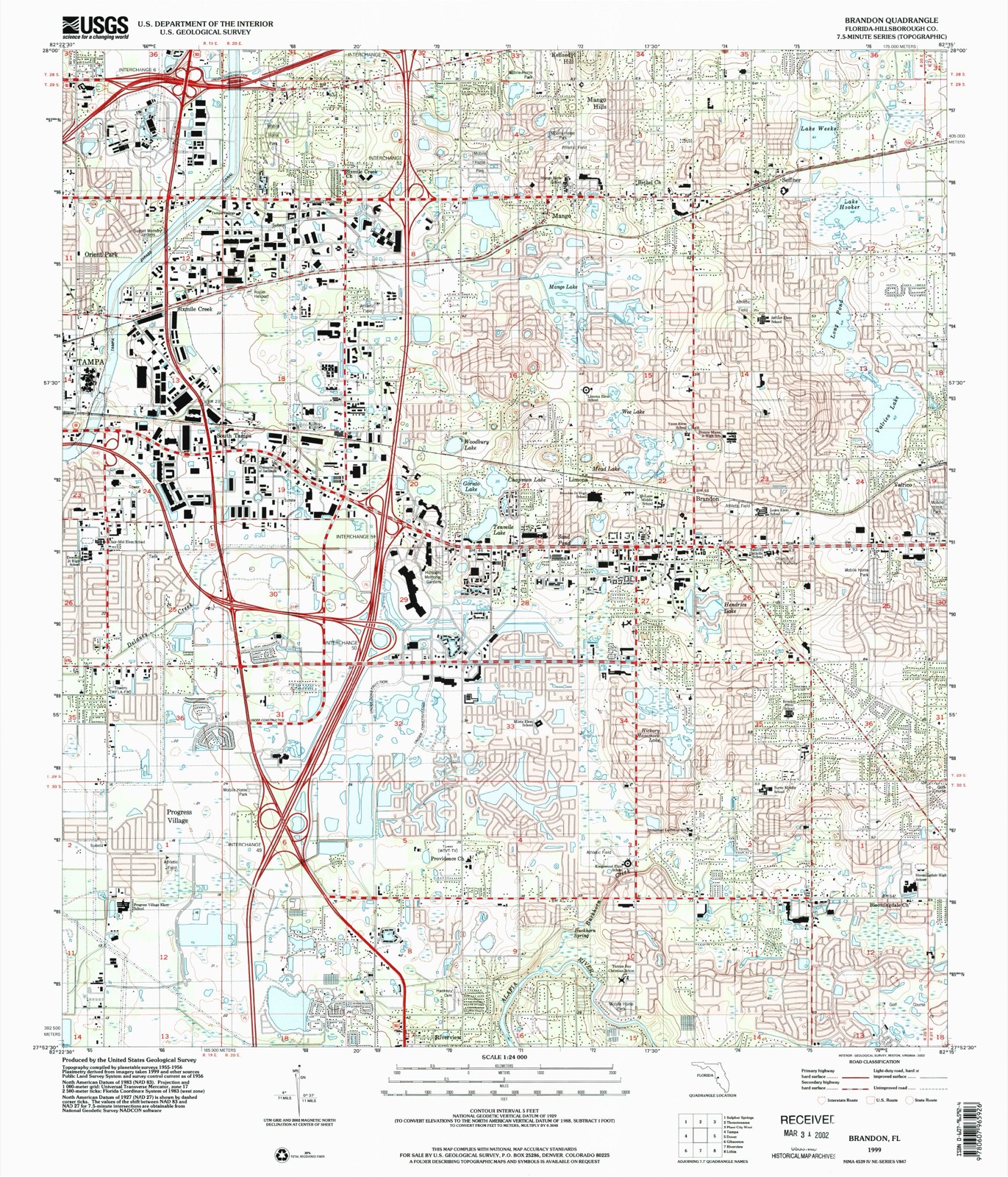
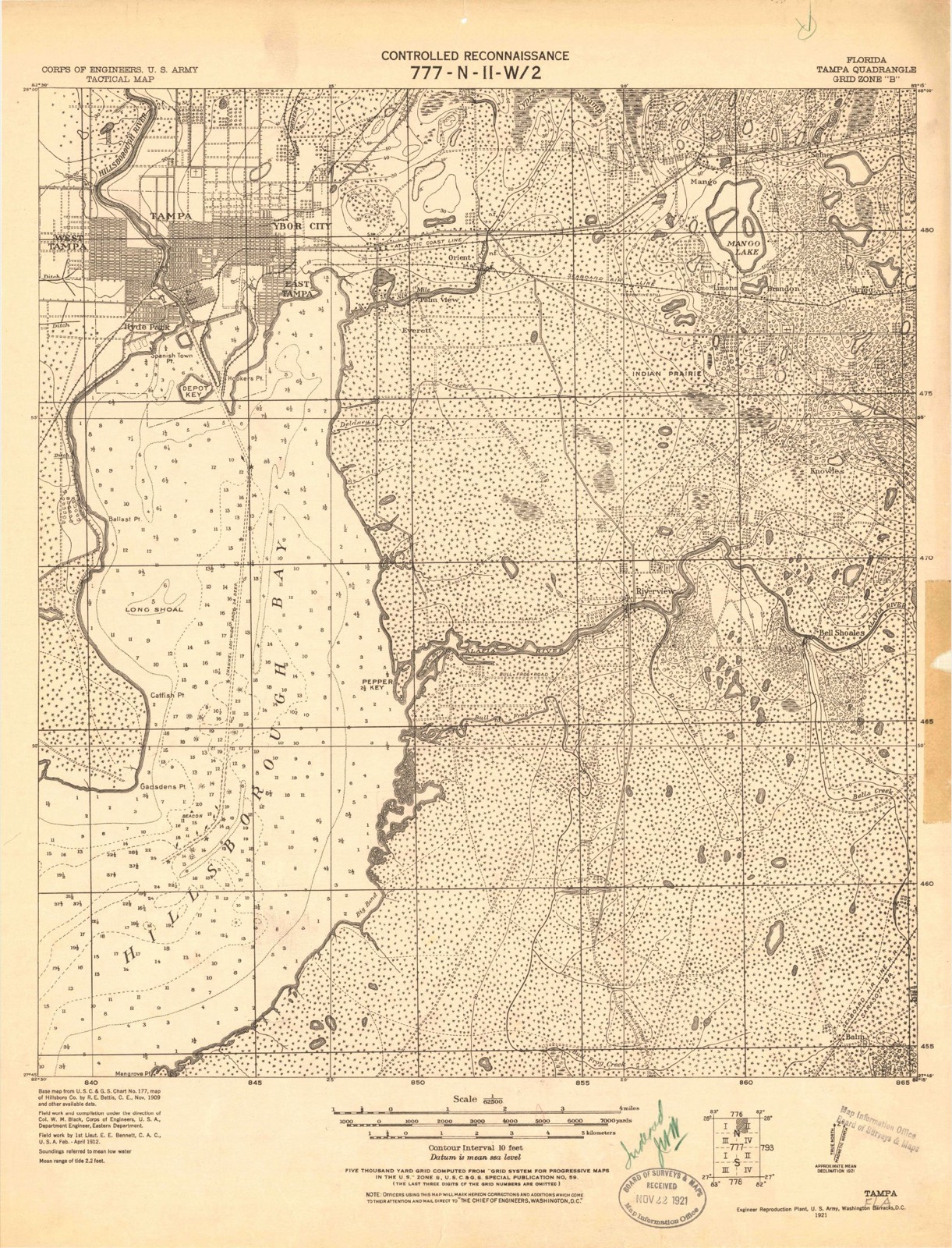
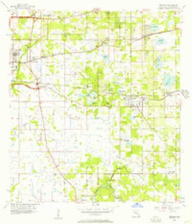
16 topographic sheets cover this place, the earliest surveyed in 1921 and the latest in 1999. It stands in the Brandon census division. It lies in ZIP code area 33510. The Survey maps it on the Brandon quadrangle. 114,626 people lived here at the 2020 count. It stands 46 feet above sea level.
Then and now
1921 to 1999The same ground, surveyed 78 years apart. Drag the handle to wipe between them. Both sheets are United States Geological Survey originals; neither has been altered.
Compare 1921 against another survey:
Population over time
2 figuresBrandon grew from 103,483 to 114,626 between 2010 and 2020. These are the recorded population figures Wikidata holds for this place, reached through the Geographic Names Information System number this page is keyed on rather than by name, so they belong to this place and not to another of the same name. Most are census counts, but not all are: an early figure may be a founding or settlement estimate, and an estimate published within five years of a census is left out. The change column is computed, and is left blank where more than 20 years separate a figure from the one before it, because a gap that long is not a change between two counts.
| Year | People | Change |
|---|---|---|
| 2010 | 103,483 | |
| 2020 | 114,626 | +11,143 (+11%) |
Topographic sheets covering this place
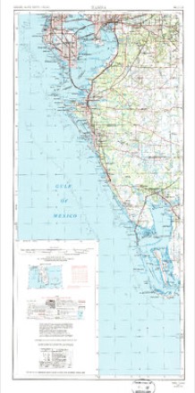
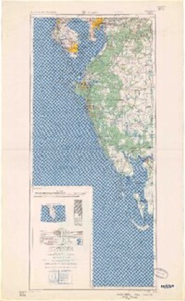
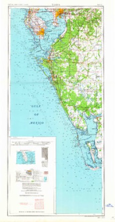
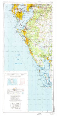
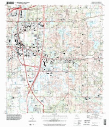
10 surveys from 16 printed sheetsMatched by testing this settlement's coordinate against the published boundary of every sheet in the United States Geological Survey's historical collection. Each opens the scanned sheet at the Survey.
- 1921 USGS Tampa quadrangle1:62500
- 1944 USGS Mango quadrangle1:31680
- 1956 USGS Brandon quadrangle1:24000, 5 printings
- 1956 USGS Tampa quadrangle1:250000, 2 printings
- 1959 USGS Tampa quadrangle1:250000
- 1960 USGS Tampa quadrangle1:250000, 2 printings
- 1972 USGS Tampa quadrangle1:250000
- 1981 USGS St Petersburg quadrangle1:100000
- 1988 USGS St Petersburg quadrangle1:250000
- 1999 USGS Brandon quadrangle1:24000
Fires near this place
64 since 1992Regional context, not property-specific evidence. The federal wildfire occurrence database lists 64 fires within 5 miles of Brandon between 1992 and 2019, burning about 584 acres in total. 3 started naturally. 7 were recorded as arson. Distance is straight-line from the map coordinates, so a fire counted here may appear on a neighbouring settlement's page as well.
| Reported cause | Fires |
|---|---|
| Railroad operations and maintenance | 16 |
| Misuse of fire by a minor | 12 |
| Equipment and vehicle use | 9 |
| Missing data/not specified/undetermined | 9 |
| Arson/incendiarism | 7 |
| Debris and open burning | 6 |
| Natural | 3 |
| Power generation/transmission/distribution | 1 |
| Fireworks | 1 |
The most recent of them, most recent first, with the day each was reported and the service that recorded it.
| Date | Cause | Size | Reported by | Name on the report |
|---|---|---|---|---|
| 29 September 2005 | Missing data/not specified/undetermined | under an acre | Florida Forest Service | 29 TATE |
| 5 August 1999 | Natural | 1.0 acres | Florida Forest Service | not named |
| 7 July 1992 | Natural | 10 acres | Florida Forest Service | not named |
| 5 July 1995 | Missing data/not specified/undetermined | 3.0 acres | Florida Forest Service | not named |
| 4 July 1996 | Missing data/not specified/undetermined | under an acre | Florida Forest Service | not named |
| 29 July 1993 | Railroad operations and maintenance | 6.0 acres | Florida Forest Service | not named |
| 3 June 1993 | Railroad operations and maintenance | 1.0 acres | Florida Forest Service | not named |
| 3 June 1993 | Railroad operations and maintenance | 7.0 acres | Florida Forest Service | not named |
Settlements close enough to share some of these fires:
Storms near this place
55 since 1993Regional context, not property-specific evidence. The National Weather Service names Brandon in 55 storm reports between 1993 and 2026: 21 thunderstorm wind, 19 hail, 10 lightning, 2 tornado. The reports record 1 death and 8 injuries. Each account below is quoted exactly as the forecast office filed it, from the NOAA Storm Events Database, and each date opens the federal record of that event.
| When | Event | Place named | Harm | What the report says |
|---|---|---|---|---|
| June 1998 | Lightning | Brandon | 1 killed | A 26 year-old male was struck and killed by lightning while working on a third story roof along Princess Palm Avenue in Sabel Park. |
| September 1997 | Lightning | Brandon | 3 hurt, $10,000 | One adult and two children were injured by lightning that struck a flagpole at Burns Middle School. The lightning charge travelled down the flagpole to it's brick base which exploded and injured the two children.The lightning charge travelled underground where it breached and damaged the schools electrical and telephone system. A teacher near the lightning strike received a shock and was knocked down while handling a doorknob in the school. |
| July 2007 | Lightning | Brandon | 1 hurt | Lightning struck a pickup as a 51-year-old male was trying to enter the truck. The electricity went through the man's key into his left thumb before exiting his left shoe. The man was knocked unconscious briefly and his left side was numb. |
| October 2007 | Lightning | Brandon | 1 hurt | On a construction site near Brandon, a 52-year-old man sitting in the cab of a crane was injured when lightning struck the crane's boom. The man suffered burns to his face and was unable to see out of his right eye. |
| August 2004 | Lightning | Brandon | 1 hurt | A 39 year old female was injured by a nearby lightning strike at the Florida State Fairgrounds. |
| December 2002 | Lightning | Brandon | 1 hurt | Firefighter was struck by lightning while responding to an overturned vehicle near Bloomingdale Avenue and Interstate 75. The 30 year old male briefly lost consciousness, suffered a ruptured eardrum in his left ear, and could not feel anything in his left forearm or hand. He was standing in waist deep water and was leaning against a guard rail when lightning struck a light pole nearby. |
| August 2001 | Lightning | Brandon | 1 hurt | A 24 year old male was struck, injured and knocked to the ground unconscious, by the sideflash of lightning that struck a large tree, less than ten feet from the entrance of his home, on the 1200 block of Taylor Road in Brandon. |
| July 2019 | Lightning | Brandon | $500,000 | A fire at McLane Middle School is suspected to have been sparked by a lightning strike. The fire did significant damage before rescue crews were able to put it out. |
| May 1999 | Hail | Brandon | $500,000 | Numerous reports from Skywarn Spotters and the general public indicated that golfball to dime size hail covered the ground white from Brandon south to Riverview. Several vehicles from Brandon south to Riverview were damaged by the golfball sized hail. |
| March 1996 | Hail | Brandon | $90,000 | no account filed |
| May 1999 | Thunderstorm Wind | Brandon | $50,000 | Several large trees and numerous branches were downed and a few small sheds were damaged by thunderstorm winds in Brandon. |
| October 1994 | Thunderstorm Wind | Brandon | $50,000 | Severe thunderstorm winds blew down a wall under construction and also blew down several trees. |
| March 1993 | Thunderstorm Wind | Brandon | $50,000 | Strong downburst winds damaged the roof of a house and knocked down fences. |
| July 2005 | Tornado (F0) | Brandon | $40,000 | A tornado in a feeder band of Hurricane Dennis pushed over trees and damage carports and lanais in Brandon. In all 18 homes were damaged along Charles Place, Julie Lane, Bryan Road, and Berkshire Drive. The tornado was on the leading edge of the thunderstorm gust front that caused large tree limbs to break off along Lithia Pinecrest from Bloomingdale Avenue to Brandon Boulevard. |
| July 2000 | Thunderstorm Wind | Brandon | $30,000 | A local utility company reported that thunderstorm winds downed a few large trees and several large branches in Brandon. One home incurred roof and structural damage from a downed tree near Parsons Road north of State Road 60 in Brandon. |
| February 1998 | Thunderstorm Wind | Brandon | $30,000 | Thunderstorm winds downed several trees atop power lines and caused power outages in Brandon. Nearly 5,000 electrical customers in Brandon were without power for several hours. |
| June 2001 | Thunderstorm Wind | Brandon | $25,000 | An off-duty NWS meteorologist estimated 60 mph winds along Interstate 75 and State Highway 574A (Martin Luther King Blvd). Also, the public reported that thunderstorm winds downed a few large trees and several large branches north of State Road 60 in Brandon. |
| August 2000 | Thunderstorm Wind | Brandon | $20,000 | The Hillsborough County Emergency Management reported that thunderstorm winds downed a few large trees and several large branches from Brandon southeast to Bloomingdale in eastern Hillsborough county. |
| May 2019 | Thunderstorm Wind | Brandon | $15,000 | Hillsborough County Sheriff's Office reported a tree down on a house on Clayton Street in Brandon. |
| February 2004 | Thunderstorm Wind | Brandon | $15,000 | A thunderstorm gust front damaged a plant nursery on 58th Street near Rose Lane. The flat topped roof of the nursery lost some tar paper and heavy rains caused significant water damage inside. No trees were downed but tarps acting as a green house were ripped and thrown about. |
| July 1998 | Thunderstorm Wind | Brandon | $15,000 | Thunderstorm winds downed several large trees and power lines on Lithia Pinecrest Road in Brandon. |
| July 2013 | Thunderstorm Wind | Brandon | $10,000 | Hillsborough County Emergency Management reported several trees down around Brandon. Some of the trees fell on homes. |
| August 2013 | Lightning | Brandon | $10,000 | Broadcast media reported an attic fire started by lightning on Lido Drive in Brandon. Fire crews were able to put the fire out. |
| June 1998 | Thunderstorm Wind | Brandon | $10,000 | Thunderstorm winds downed several large trees and limbs from Brandon north to Seffner. |
| July 1998 | Thunderstorm Wind | Brandon | $10,000 | Thunderstorm winds estimated at up to 50 mph removed the tin roof of a automotive body shop, downed a tree atop a vehicle and blew an empty 18-wheel moving truck on its side near the intersection of Adamo Drive and 50th Street. |
| April 1997 | Thunderstorm Wind | Brandon | $5,000 | Thunderstorm winds downed a few trees, power lines and several large branches throughout the city of Brandon. |
| February 1993 | Thunderstorm Wind | Brandon | $5,000 | Strong thunderstorm winds blew down traffic lights. |
| January 2026 | Thunderstorm Wind | Brandon | $2,500 | County fire rescue reported a tree down across power lines near Brandon. |
| June 2000 | Lightning | Brandon | $2,000 | Lightning struck a nursing home in Brandon and severely damaged the buildings fire alarm and security system. |
| September 1998 | Thunderstorm Wind | Brandon | $2,000 | A local cable television all news station reported thunderstorm winds downed a large oak tree and several power lines on Little Road between Bloomingdale Avenue and Durant Road. |
| April 2002 | Thunderstorm Wind | Brandon | $2,000 | no account filed |
| June 1994 | Thunderstorm Wind | Brandon | $500 | Tile was blown from the roof of a house in Brandon. |
| February 1995 | Thunderstorm Wind | Brandon | $100 | Shingles were damaged at an apartment complex and a few tree limbs were downed. |
| September 2007 | Hail | Brandon | - | Penny size hail was reported in the Providence Lakes subdivision. |
| September 2007 | Hail | Brandon | - | Pea and a few half dollar size hail was reported along Bloomingdale Avenue east of Highway 301. |
| July 2003 | Thunderstorm Wind | Brandon | - | Law enforcement reported several large branches were downed by thunderstorm winds and were blocking Bloomingdale Avenue. |
| September 2002 | Funnel Cloud | Brandon | - | Trained spotter reported a funnel cloud just east of Interstate 75 about 2 miles south of Highway 60. |
| July 2000 | Tornado (F0) | Brandon | - | An off-duty National Weather Service meteorologist observed a tornado briefly touch down over a wooded area near the intersection of Lumsden and Lithia-Pinecrest roads in Brandon. |
| July 2000 | Hail | Brandon | - | An off-duty NWS meteorologist reported nickel sized hail near the intersection of Bloomingdale and Bell Shoals roads in southeast Brandon. |
| June 1999 | Hail | Brandon | - | Dime sized hail was reported by the public on Causeway Boulevard in Brandon through Bay News Nine Cable of Pinellas Park. |
| May 1999 | Hail | Brandon | - | Nickel sized hail was reported at the Brandon Town Center Mall along Interstate 75 and State Road 60 by mall security. |
| July 1999 | Hail | Brandon | - | Dime sized hail was reported in Brandon by the Hillsborough County Emergency Management. |
| May 1999 | Hail | Brandon | - | Dime sized hail was reported by the public through the broadcast media near the intersection of Clay and Kingsway in Brandon. |
| May 1999 | Hail | Brandon | - | Dime sized hail was reported by an off-duty NWS meteorologist in Brandon. |
| May 1999 | Hail | Brandon | - | Nickel to dime sized hail was reported by an off duty NWS meteorologist and several Skywarn Spotters from Brandon east to Valrico. |
| June 1999 | Hail | Brandon | - | The public reported nickel sized hail in Brandon through WFLA-TV in Tampa. |
| September 1998 | Hail | Brandon | - | Nickel sized hail was reported by the public in Brandon. |
| May 1998 | Hail | Brandon | - | Nickel to dime sized hail was reported by off-duty NWS meteorologists in Brandon. |
| May 1998 | Hail | Brandon | - | Golfball sized hail was reported near the intersection of Interstate 75 and State Road 60. |
| June 1998 | Hail | Brandon | - | Dime sized hail was reported near the intersection of Interstate 75 and State Road 574 (Martin Luther King Boulevard) by a Skywarn Spotter. |
| April 2002 | Hail | Brandon | - | no account filed |
| May 2002 | Flood | Brandon | - | no account filed |
| April 2002 | Heavy Rain | Brandon | - | no account filed |
| May 2002 | Hail | Brandon | - | no account filed |
| May 1996 | Hail | Brandon | - | no account filed |
Nearest settlements
The eight closest, with where each one stands in the county. Distances are straight-line, computed from the Geographic Names Information System coordinates.
| Map | Place | Distance | Sheets |
|---|---|---|---|
| Limona | 1.1 miles | 16 | |
| Valrico | 2.6 miles | 13 | |
| Mango | 3.1 miles | 16 | |
| Seffner | 3.2 miles | 16 | |
| South Tampa | 3.7 miles | 16 | |
| Mango Hills | 3.8 miles | 16 | |
| Bloomingdale | 3.9 miles | 13 | |
| Clair-Mel City | 4.4 miles | 16 |
Elsewhere
Matched on this settlement's Geographic Names Information System number rather than its name, so it cannot be a different place of the same name in another state.
| Wikipedia article on Brandon | An encyclopaedic summary. Its text is share-alike, so it is linked here rather than copied. |
| Wikidata item Q898109 | The structured record the population and elevation above come from. Public domain (CC0). |
Provenance
This settlement is recorded in the Geographic Names Information System as feature 279329. The sheet list is computed by point-in-boundary test against the United States Geological Survey's historical topographic inventory. Both are works of the United States government and carry no copyright under 17 U.S.C. 105.
Wildfire. Short, Karen C. 2022. Spatial wildfire occurrence data for the United States, 1992-2020 [FPA_FOD_20221014]. 6th Edition. Fort Collins, CO: Forest Service Research Data Archive. https://doi.org/10.2737/RDS-2013-0009.6 Collected with United States Government funding and usable without additional permissions or fees.
Storms. NOAA National Centers for Environmental Information, Storm Events Database https://www.ncei.noaa.gov/stormevents/ A work of the United States government, no copyright under 17 U.S.C. 105. Narratives are quoted verbatim from the National Weather Service report and are not edited or summarised.