 Block
BlockCambon, Florida
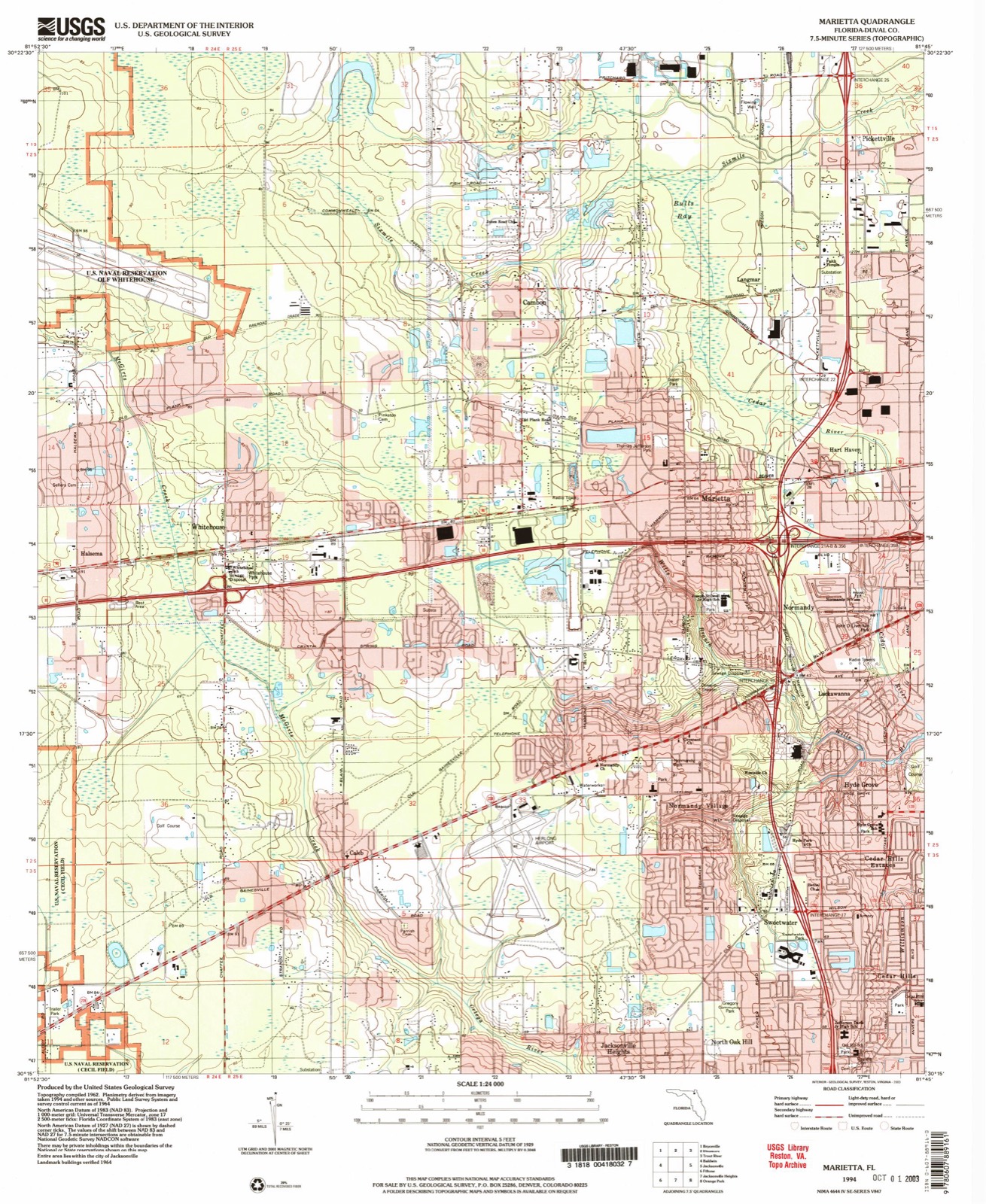
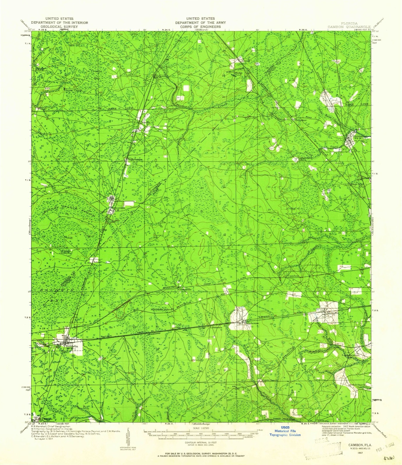
21 topographic sheets cover this place, the earliest surveyed in 1917 and the latest in 1994. It stands in the Jacksonville West census division. It lies in ZIP code area 32220. The Survey maps it on the Marietta quadrangle.
Then and now
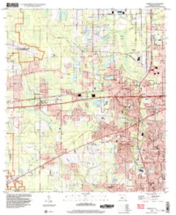
1917 to 1994The same ground, surveyed 77 years apart. Drag the handle to wipe between them. Both sheets are United States Geological Survey originals; neither has been altered.
Compare 1917 against another survey:
Topographic sheets covering this place
11 surveys from 21 printed sheetsMatched by testing this settlement's coordinate against the published boundary of every sheet in the United States Geological Survey's historical collection. Each opens the scanned sheet at the Survey.
- 1917 USGS Cambon quadrangle1:62500, 2 printings
- 1918 USGS Cambon quadrangle1:62500, 3 printings
- 1948 USGS Jacksonville quadrangle1:250000
- 1957 USGS Jacksonville quadrangle1:250000, 3 printings
- 1959 USGS Jacksonville quadrangle1:250000
- 1960 USGS Jacksonville quadrangle1:250000
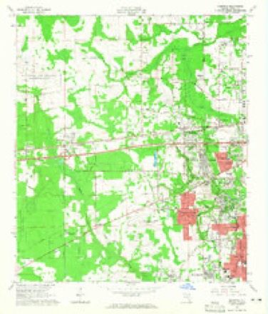
- 1964 USGS Marietta quadrangle1:24000, 6 printings
- 1977 USGS Jacksonville quadrangle1:100000
- 1980 USGS Jacksonville quadrangle1:100000
- 1988 USGS Jacksonville quadrangle1:250000
- 1994 USGS Marietta quadrangle1:24000
Fires near this place
179 since 1992Regional context, not property-specific evidence. The federal wildfire occurrence database lists 179 fires within 5 miles of Cambon between 1992 and 2020, burning about 1,742 acres in total. 22 started naturally. 19 were recorded as arson. Distance is straight-line from the map coordinates, so a fire counted here may appear on a neighbouring settlement's page as well.
| Reported cause | Fires |
|---|---|
| Equipment and vehicle use | 45 |
| Railroad operations and maintenance | 26 |
| Misuse of fire by a minor | 23 |
| Natural | 22 |
| Arson/incendiarism | 19 |
| Debris and open burning | 18 |
| Missing data/not specified/undetermined | 13 |
| Recreation and ceremony | 9 |
| Smoking | 2 |
| Power generation/transmission/distribution | 2 |
The most recent of them, most recent first, with the day each was reported and the service that recorded it.
| Date | Cause | Size | Reported by | Name on the report |
|---|---|---|---|---|
| 14 September 2000 | Missing data/not specified/undetermined | under an acre | Florida Forest Service | not named |
| 8 August 2000 | Natural | 1.0 acres | Florida Forest Service | not named |
| 7 August 2016 | Natural | 2.0 acres | Florida Forest Service | LANE SWAMP (16) |
| 7 August 2006 | Debris and open burning | 1.0 acres | Florida Forest Service | CISCO FIRE 2006-07-0275 |
| 3 August 1994 | Equipment and vehicle use | under an acre | Florida Forest Service | not named |
| 3 August 1993 | Natural | under an acre | Florida Forest Service | not named |
| 29 August 2016 | Arson/incendiarism | 1.0 acres | Florida Forest Service | NORMANDY LANE (16) |
| 22 August 2016 | Railroad operations and maintenance | 6.0 acres | Florida Forest Service | IMESON RD (16) |
Settlements close enough to share some of these fires:
Mines and quarries near this place
1 within 5 milesRegional context, not property-specific evidence. The federal mineral resources record lists 1 working within 5 miles of Cambon: 1 prospect. None of them still produces. What was taken out: Titanium. Distance is straight-line from the map coordinates, so a quarry counted here may appear on a neighbouring settlement's page as well.
| Where | Site | Commodity | Status | Recorded |
|---|---|---|---|---|
| Unnamed Titanium Deposit | Titanium | Prospect |
Storms near this place
17 since 2009Regional context, not property-specific evidence. The National Weather Service names Cambon in 17 storm reports between 2009 and 2024: 6 thunderstorm wind, 5 heavy rain, 3 flood, 1 lightning. No death or injury is recorded in these reports. Each account below is quoted exactly as the forecast office filed it, from the NOAA Storm Events Database, and each date opens the federal record of that event.
| When | Event | Place named | Harm | What the report says |
|---|---|---|---|---|
| December 2023 | Flood | Cambon | $75,000 | Harrison Street washed-out and collapsed. According to the Public Works Dept., a cross drain under the road became clogged with debris from stormwater runoff. The debris got stuck in the drain and stormwater levels started rising over Harrison St. The water eroded part of the road and it washed away. People living in a neighborhood along Alexa Lane were trapped since Harrison St is the only road in and out. |
| June 2012 | Flood | Cambon | $50,000 | Widespread flooding occurred across Jacksonville. On 6/25 at 3:17 am, an NWS employee reported minor street flooding along Shindler Drive between 103rd Street and Collins Road in Jacksonville. At 7:11 am, the public reported 8 inches of water in a home at 6314 105th Street in the Normandy area of Jacksonville. At 8:04 am, an NWS employee reported 7.4 inches of rainfall in Arlington, about 6 miles west of Jacksonville Beach. At 10 am, Duval county emergency management reported flooding at a home in the Boone Park area of Riverside. There were about 40 road closures at the time across Duval county due to flooding. At 9:09 pm, a spotter reported flooding in the Country Roads Mobile Home Park about 4 miles NW of Orange Park. On 6/26 at 8:11 am, a spotter reported 4.25 inches of rainfall in the past 12 hours. There was about 9 inches of storm total rainfall with minor street flooding. At 3:53 pm, a NWS employee reported the intersection of 103rd Street and Shindler Drive was closed due to high flood water. At 5:45 pm, the public reported a creek was overflowing into home on Old Plank Road. The water depth was about 18 inches. At 6 pm, the public reported road and yard flooding along Blackthorn Road. At 7:02 pm, 12 to 18 inches of water was over the road about 3 mile WSW of Ortega due to a nearby creek out of its banks. At 8:30 pm on the 26th, a retention pond overflowed and water was approaching a home on Collins Ridge Blvd. On 9/27 at 6:34 am, Duval County Emergency Management reported the intersection of Garden Street and Imeson Road was flooded with at least one foot of standing water. The cost of damage was estimated, and it is likely greatly under-estimated. |
| May 2015 | Thunderstorm Wind | Cambon | $5,000 | A tree was blown down on a home on Lake Marietta Drive. The cost of damage was unknown but estimated for this event to be included in Storm Data. |
| June 2018 | Thunderstorm Wind | Cambon | $2,000 | A tree was blown down onto a home trapping one person inside. The cost of damage was unknown, but it was estimated for the inclusion of the event in Storm Data. |
| June 2018 | Lightning | Cambon | $1,000 | A transformer was hit by lightning and damage. The cost of damage was unknown and it was estimated for the inclusion of the event in Storm Data. |
| July 2024 | Flash Flood | Cambon | - | Flash flooding from heavy rainfall of 2 inches in 1 hour and up to 3 inches in 1.5 hrs occurred across the downtown and immediate metro area of Jacksonville between 5 pm and 7 pm EDT. At 5:09 pm, an NWS Employee reported that the field at Everbank Stadium was temporarily flooded. ||At 5:36 pm, broadcast media reported flood water of 4-6 inches deep was across the roads in the Springfield area of downtown Jacksonville.||At 6 pm, the public reported that vehicles were stuck due to flood water along | Landon Avenue in San Marco. The time of the | flooding was based on radar. ||At 6 pm, the public reported that vehicles were stuck due to flood water at | Beaver Street and Baker Avenue and at 1932 | Beaver Street. The time of flooding was | based on radar. At the same time, emergency management reported that vehicles were trapped due to flood water at | the intersection of Union Street East and | Market Street North. At 6 pm, broadcast media reported that a portion of Lasalle St was closed due | to flooding. Floodwaters reached business | doorways along Lasalle St. Vehicles were | stuck due to flood water along Landon Avenue | in San Marco. The time of the flooding was | based on radar. ||At 6:30 pm, emergency management reported that vehicles were stuck due to flood water along | Osceola Street. The time of damage was based | on radar. At 6:30 pm, emergency management reported that vehicles were struck and/or trapped due to | flood waters at 700 Edgewood Avenue North. | There were multiple other trapped and/or | stuck vehicles reported due to flood waters | along Edgewood Ave including along | Commonwealth Ave near Edgewood and Beaver | Street and Edgewood Avenue. The time of the | flooding reports was approximated. Vehicles were also stuck due to flood water at | Riverside and Stockton Streets. The time of | flood water based on radar. Vehicles were also trapped due to flood water at | Commonwealth Ave and Elllis Road. The time | of damage was approximated. || At 6:45 pm, broadcast media reported flood water of up to 1-2 foot deep was across | Post Street near McDuff Avenue in downtown | Jacksonville. A video showed vehicles | driving through with water almost covering | the front bumper of low-profile vehicles. | The time of the video was estimated. At 6:45 pm, the public shared an image of approximately | 6 inches to 1 foot of flood water blanketing | the intersection of E 15th Street and North | Liberty Street in the Phoenix area of | downtown Jacksonville. The time of the photo | was approximated. |
| June 2020 | Heavy Rain | Cambon | - | Mesonet station AV553 measured 6.51 inches of rain since midnight. |
| July 2020 | Thunderstorm Wind | Cambon | - | Power lines were blown down near Cisco and Jones Roads due to tree branches blown int the lines. |
| August 2020 | Hail | Cambon | - | Golf ball size hail was observed at Westside Chandler Oaks. |
| August 2020 | Heavy Rain | Cambon | - | A private weather station along Crystal Springs East measured 4.66 inches of rainfall in about 90 minutes. |
| August 2020 | Heavy Rain | Cambon | - | Daily rainfall total of 4.79 inches was measured at a rain gauge. Most occurred with evening thunderstorms. |
| August 2020 | Heavy Rain | Cambon | - | A public rain gauge measured a daily total of 4.12 inches of rain. Most occurred in the evening with thunderstorms. |
| November 2019 | Heavy Rain | Cambon | - | Storm total rainfall from a mesonet site on the JAX Westside. |
| June 2016 | Thunderstorm Wind | Cambon | - | As the Westside-Crystal Springs Tornado was dissipating the thunderstorm rear-flank downdraft moved across a neighborhood northeast of the dissipating funnel. The downdraft contacted the ground near West Beaver Street and moved northeast through the Watershed Drive, Maple Ave., and Orme Road areas. The path length was about 1 to 1.5 miles in length and about .1 mile wide. The prominent damage was to trees and some roof damage on Maple Street. |
| June 2016 | Thunderstorm Wind | Cambon | - | As the Westside-Crystal Springs Tornado was dissipating the thunderstorm rear-flank downdraft moved across a neighborhood northeast of the dissipating funnel. The downdraft contacted the ground near West Beaver Street and moved northeast through the Watershed Drive, Maple Ave., and Orme Road areas. The path length was about 1 to 1.5 miles in length and about .1 mile wide. The prominent damage was to trees and some roof damage on Maple Street. |
| June 2015 | Thunderstorm Wind | Cambon | - | Power lines were blown down on the Jacksonville west side. |
| May 2009 | Flood | Cambon | - | Flooding was been reported in homes on the Westside of Jacksonville on 105th Street. 2 inches of standing water was reported in some homes near the Ramona Road Flea Market. Later that afternoon McCoys Creek flooded with McCoys Creek Road and portions of Kings Street shut down. Also several homes in the 9000 block of Hecksher Drive were flooded during the evening. |
Nearest settlements
The eight closest, with where each one stands in the county. Distances are straight-line, computed from the Geographic Names Information System coordinates.
| Map | Place | Distance | Sheets |
|---|---|---|---|
| Langmar | 1.8 miles | 21 | |
| Marietta | 2.2 miles | 21 | |
| Hart Haven | 2.6 miles | 21 | |
| Whitehouse | 2.9 miles | 21 | |
| Brightsville | 3.0 miles | 21 | |
| Pickettville | 3.7 miles | 21 | |
| Normandy | 3.7 miles | 21 | |
| Edgewood | 3.8 miles | 21 |
Provenance
This settlement is recorded in the Geographic Names Information System as feature 279867. The sheet list is computed by point-in-boundary test against the United States Geological Survey's historical topographic inventory. Both are works of the United States government and carry no copyright under 17 U.S.C. 105.
Wildfire. Short, Karen C. 2022. Spatial wildfire occurrence data for the United States, 1992-2020 [FPA_FOD_20221014]. 6th Edition. Fort Collins, CO: Forest Service Research Data Archive. https://doi.org/10.2737/RDS-2013-0009.6 Collected with United States Government funding and usable without additional permissions or fees.
Mines and quarries. USGS Mineral Resources Data System (MRDS) https://mrdata.usgs.gov/mrds/ A work of the United States government, no copyright under 17 U.S.C. 105.
Storms. NOAA National Centers for Environmental Information, Storm Events Database https://www.ncei.noaa.gov/stormevents/ A work of the United States government, no copyright under 17 U.S.C. 105. Narratives are quoted verbatim from the National Weather Service report and are not edited or summarised.