 Block
BlockDavie, Florida
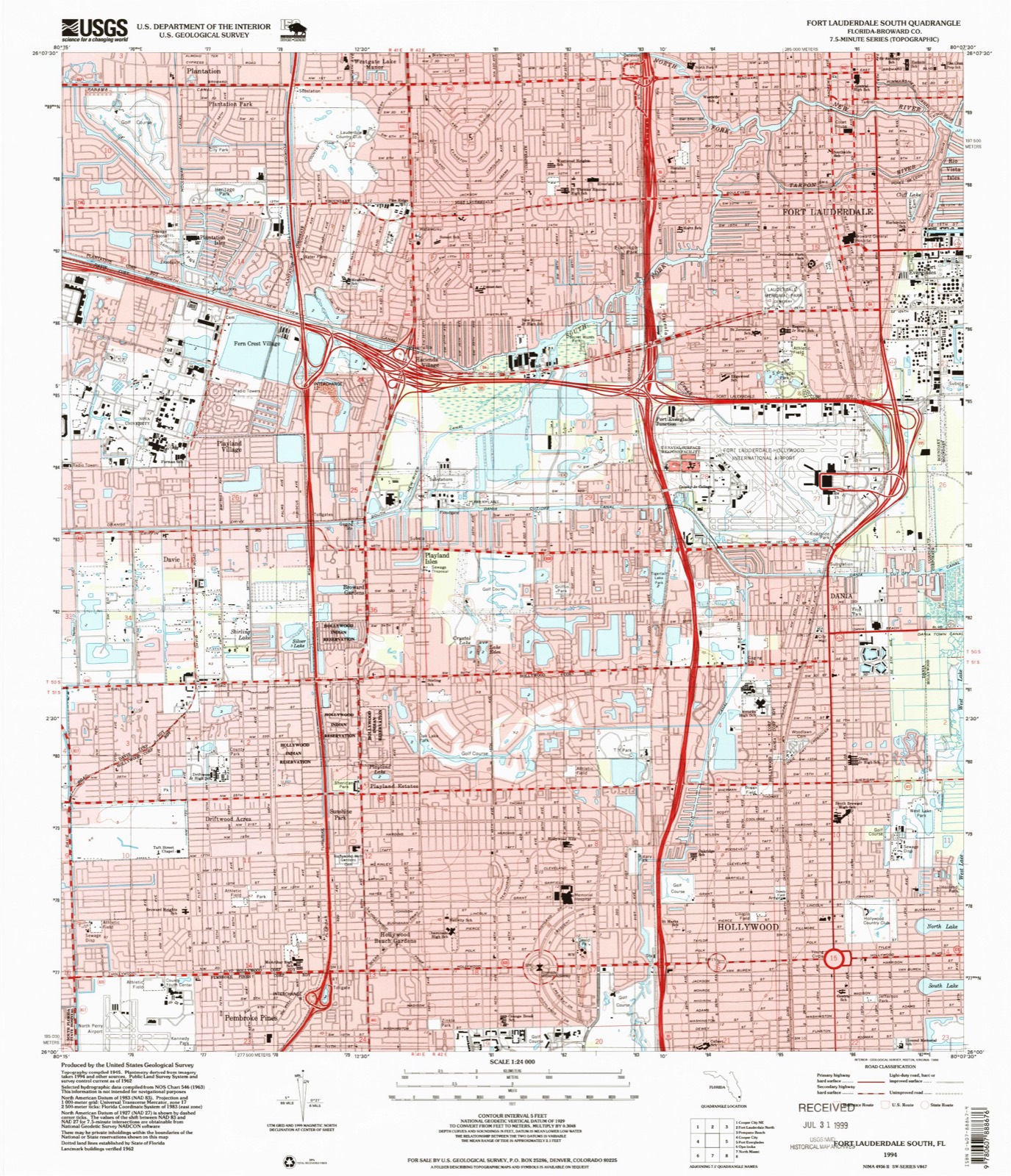
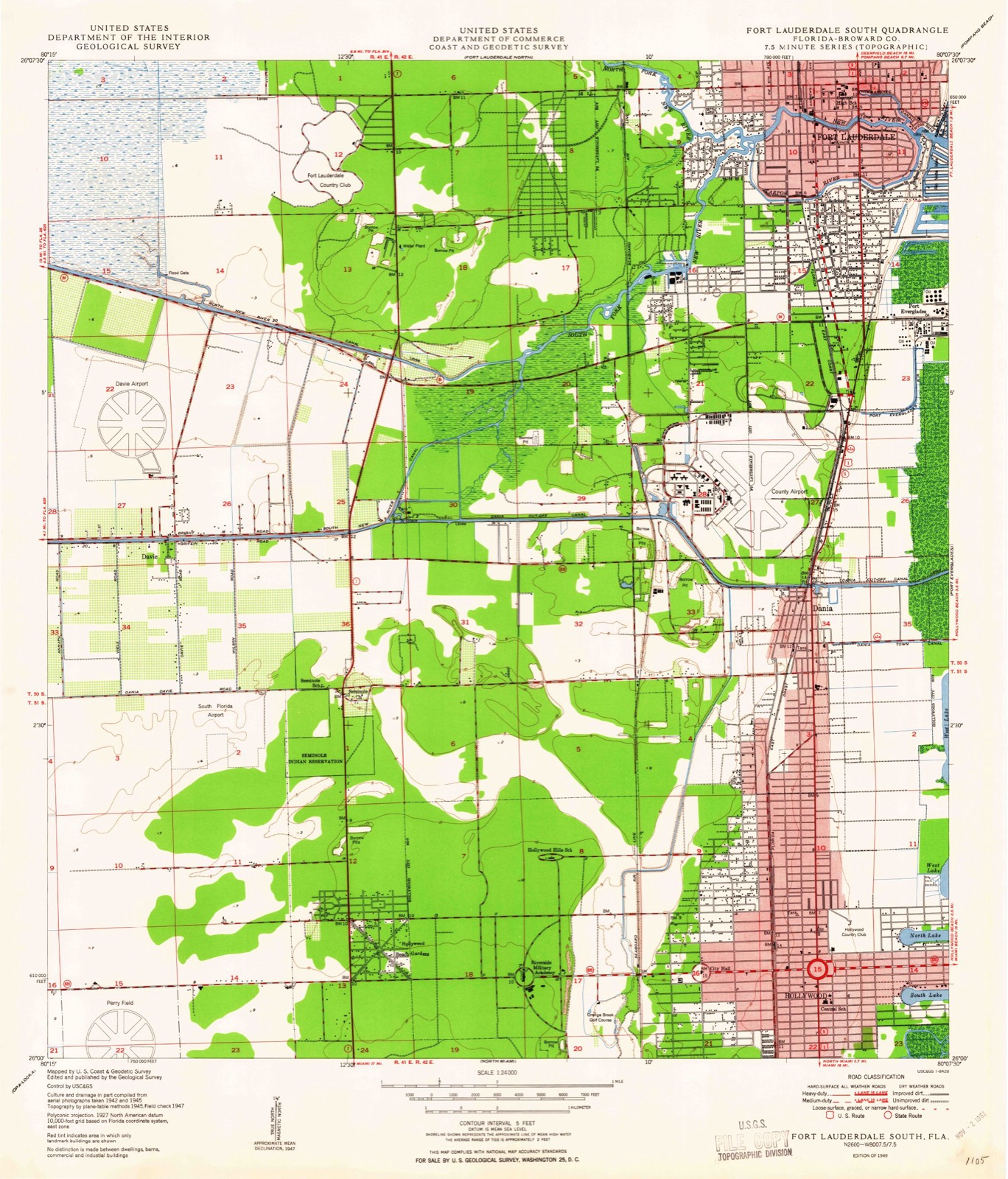
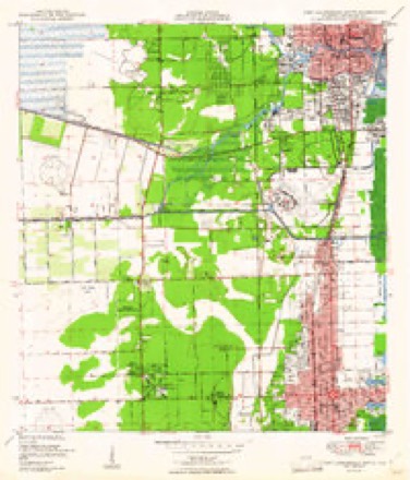
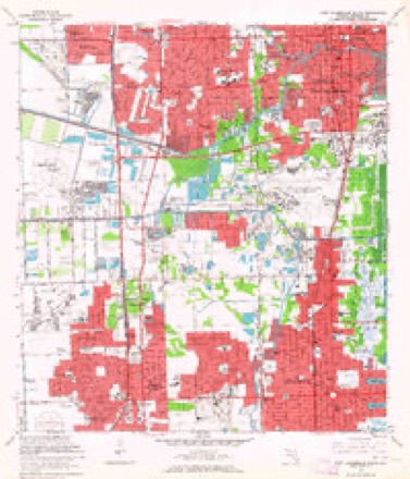
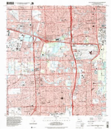
16 topographic sheets cover this place, the earliest surveyed in 1949 and the latest in 1994. It stands in the Davie census division. It lies in ZIP code area 33314. The Survey maps it on the Fort Lauderdale South quadrangle. 105,691 people lived here at the 2020 count. It stands 3 feet above sea level.
Research this city
Then and now
1949 to 1994The same ground, surveyed 45 years apart. Drag the handle to wipe between them. Both sheets are United States Geological Survey originals; neither has been altered.
Compare 1949 against another survey:
On record in Davie
Buildings and businesses the archive holds for this place. Each opens its own page, with the source record it came from.
On the National Register 2 records
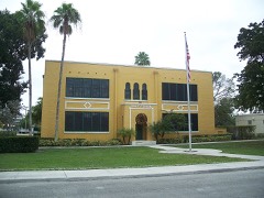 Davie Schoollisted 1988
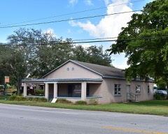 Davie Woman's Clublisted 2016
Population over time
2 figuresDavie grew from 91,992 to 105,691 between 2010 and 2020. These are the recorded population figures Wikidata holds for this place, reached through the Geographic Names Information System number this page is keyed on rather than by name, so they belong to this place and not to another of the same name. Most are census counts, but not all are: an early figure may be a founding or settlement estimate, and an estimate published within five years of a census is left out. The change column is computed, and is left blank where more than 20 years separate a figure from the one before it, because a gap that long is not a change between two counts.
| Year | People | Change |
|---|---|---|
| 2010 | 91,992 | |
| 2020 | 105,691 | +13,699 (+15%) |
Topographic sheets covering this place
9 surveys from 16 printed sheetsMatched by testing this settlement's coordinate against the published boundary of every sheet in the United States Geological Survey's historical collection. Each opens the scanned sheet at the Survey.
- 1949 USGS Fort Lauderdale South quadrangle1:24000, 2 printings
- 1956 USGS West Palm Beach quadrangle1:250000, 2 printings
- 1957 USGS West Palm Beach quadrangle1:250000
- 1958 USGS West Palm Beach quadrangle1:250000, 2 printings
- 1962 USGS Fort Lauderdale South quadrangle1:24000, 3 printings
- 1981 USGS Fort Lauderdale quadrangle1:100000
- 1985 USGS Fort Lauderdale quadrangle1:100000, 2 printings
- 1987 USGS West Palm Beach quadrangle1:250000, 2 printings
- 1994 USGS Fort Lauderdale South quadrangle1:24000




Fires near this place
11 since 1993Regional context, not property-specific evidence. The federal wildfire occurrence database lists 11 fires within 5 miles of Davie between 1993 and 2011, burning about 38 acres in total. None started naturally. 1 was recorded as arson. Distance is straight-line from the map coordinates, so a fire counted here may appear on a neighbouring settlement's page as well.
| Reported cause | Fires |
|---|---|
| Railroad operations and maintenance | 4 |
| Debris and open burning | 2 |
| Missing data/not specified/undetermined | 2 |
| Arson/incendiarism | 1 |
| Equipment and vehicle use | 1 |
| Misuse of fire by a minor | 1 |
The most recent of them, most recent first, with the day each was reported and the service that recorded it.
| Date | Cause | Size | Reported by | Name on the report |
|---|---|---|---|---|
| 13 June 2010 | Debris and open burning | under an acre | Florida Forest Service | 2 PILE FIRE |
| 18 May 1994 | Railroad operations and maintenance | 2.0 acres | Florida Forest Service | not named |
| 11 May 1993 | Railroad operations and maintenance | under an acre | Florida Forest Service | not named |
| 27 April 2002 | Railroad operations and maintenance | 1.0 acres | Florida Forest Service | not named |
| 26 April 1998 | Misuse of fire by a minor | 2.0 acres | Florida Forest Service | not named |
| 18 April 2006 | Equipment and vehicle use | 15 acres | Florida Forest Service | MCCALL FIRE |
| 15 March 2010 | Arson/incendiarism | 5.0 acres | Florida Forest Service | TARGET FIRE |
| 12 February 1996 | Railroad operations and maintenance | under an acre | Florida Forest Service | not named |
Settlements close enough to share some of these fires:
Mines and quarries near this place
10 within 5 milesRegional context, not property-specific evidence. The federal mineral resources record lists 10 workings within 5 miles of Davie: 6 past producers, 3 producers, 1 unknown. 3 still produce. What was taken out: Stone, Crushed/Broken, Stone, Dimension, Peat, Sand and Gravel, Construction, Sand and Gravel, Construction. Distance is straight-line from the map coordinates, so a quarry counted here may appear on a neighbouring settlement's page as well.
| Where | Site | Commodity | Status | Recorded |
|---|---|---|---|---|
| Dania Pit | Peat, Sand and Gravel, Construction | Past Producer | ||
| Powerline Pit | Silica | Past Producer | ||
| State Road Quarry | Stone, Dimension | Unknown | ||
| Sterling Road Pit | Sand and Gravel, Construction | Past Producer | ||
| Arvida Lakes | Stone, Crushed/Broken | Producer | ||
| Bates Project | Stone, Crushed/Broken | Past Producer | ||
| Deem Pit | Stone, Crushed/Broken | Past Producer | ||
| Ferncrest Quarry | Stone, Crushed/Broken | Past Producer | ||
| Rhodes Pit | Stone, Crushed/Broken | Producer | ||
| State Road Quarry | Stone, Crushed/Broken | Producer |
Storms near this place
60 of 98 shownRegional context, not property-specific evidence. The National Weather Service names Davie in 98 storm reports between 1997 and 2024: 36 thunderstorm wind, 30 hail, 12 lightning, 10 funnel cloud. The reports record 8 injuries. Each account below is quoted exactly as the forecast office filed it, from the NOAA Storm Events Database, and each date opens the federal record of that event.
| When | Event | Place named | Harm | What the report says |
|---|---|---|---|---|
| September 2014 | Lightning | Davie | 1 hurt | A landscape worker was jolted by a bolt of lightning while riding a lawn mower in Cooper City. The 27-year-old male was knocked unconscious, but regained consciousness by the time he reached the hospital a short time later. No evidence of entry or exit burns were noted. |
| July 2014 | Lightning | Davie | 1 hurt | A man was struck by lightning when a bolt hit a nearby tree and traveled through the ground, impacting him. He was hospitalized but released by the next day. Time is estimated based on archived lightning data from Earth Systems. |
| June 2009 | Thunderstorm Wind | Davie | 1 hurt | Tree fell on 70-year-old gentleman riding a golf cart in the 900 block of NW 116 Terrace in Plantation. Man was taken to the hospital in serious condition. |
| August 2005 | Lightning | Davie | 1 hurt | A videographer for the Miami Dolphins was working on a tower at the practice facility when lightning struck and shocked him. He was transported to the hospital but released. The practice facility was equipped with a lightning detection network, but apparently no alarm was sounded. |
| June 2001 | Lightning | Davie | 1 hurt | A man exiting his work truck was injured by lightning which struck a nearby tree. He reported numbness but recovered at a hosiptal. |
| August 1998 | Lightning | Davie | 1 hurt | 55 year old male was struck by lightning as he went out in the front yard to check a leaking roof. The location was in the city of Weston |
| July 1997 | Lightning | Davie | 1 hurt | in weston...a 39 year old male was in serious condition when working on or nearby a crane a lightning bolt struck it. |
| August 1999 | Lightning | Davie | 1 hurt | no account filed |
| October 2011 | Tornado (EF2) | Davie | $4,000,000 | A strong tornado rated as an EF-2 with maximum estimated winds of 125 mph moved across western portions of Plantation and Sunrise on the evening of October 18th. A total of 136 structures suffered damage, with about 20-25 of these sustaining significant to severe damage. A few mobile homes in the Plantation section of the tornado were destroyed with roof and wall collapse. The tornado intensified as it moved into Sunrise, damaging homes in the New Orleans Homes subdivision. Two concrete block homes sustained significant to total roof loss, and several other homes had significant roof, garage and window damage. Cars were damaged by winds and debris as well as uprooted and sheared trees. ||Most of the damage was in the EF-1 range, except for a two-block area of EF-2 damage in Sunrise at the New Orleans Homes subdivision where the highest winds were noted.||Despite the magnitude and extent of the damage, no major injuries were reported with only a few scrapes and cuts. Federal assistance was approved for residents in the affected area due to the severity and magnitude of the damage. |
| September 2023 | Lightning | Davie | $100,000 | Lightning struck a mobile home in Davie during a heavy thunderstorm, igniting a fire, which resulted in a complete loss of the structure. Three people were displaced due to the damage. Time is based on National Lightning Detection Network data which showed several lightning strikes in the immediate area. Damage totals are estimated. |
| July 2020 | Thunderstorm Wind | Davie | $50,000 | Multiple broadcast media outlets and law enforcement reports damage to two homes on 83rd Terrace near Nova Drive. One of these homes suffered severe roof damage, with part of the roof detached and blown off. Estimated winds based on the damage observed as well as data from TFLL radar is around 75 mph. This damage is a result of downburst winds and not tornadic. Damage amount is also estimated. |
| May 2020 | Heavy Rain | Davie | $25,000 | Broadcast media reported heavy rainfall associated with showers and storms in Davie, FL. Home surveillance cameras captured the moment a patio roof collapsed after a deluge of rain. Pieces of furniture were moving all over the patio. Fortunately, no one was injured. |
| March 2017 | Tornado (EF0) | Davie | $25,000 | A NWS survey team confirmed a tornado across parts of Plantation. Damage consisted of trees uprooted and branches split/broken, as well as fences blown over. Fallen trees also damaged several vehicles. The damage path began near Hiatus Road and NW 6 ST, ending near Clearly Blvd and Central Park Place North. Most concentrated area of damage was along NW 6 ST from NW 106 Ave block to Nob Hill Rd, then along Cleary Blvd from Nob Hill to NW 98 Ave. ||Tornado was initially rated an EF-1, but subsequent review of the damage suggests that tree damage resembling typical EF-1 level damage was instead influenced by a high canopy and shallow root system which can lead to large trees toppling at relatively low wind speeds. Therefore, final rating is EF-0 (peak wind 85 mph), near the threshold of EF-1.||Damage total provided is a general estimate and based mostly on the number of trees damaged. |
| May 1999 | Thunderstorm Wind | Davie | $25,000 | no account filed |
| August 2003 | Thunderstorm Wind | Davie | $20,000 | A large tree was blown down and a fence was damaged. |
| February 2024 | Tornado (EF0) | Davie | $15,000 | A tornado was observed in portions of Cooper City, Davie, and Plantation as showers passed in the mid-afternoon. Damage was mainly to vegetation, including hardwood trees, which impacted some structures. There were public reports of tree damage and metal siding debris at the Bamford Sports Complex in Davie. The tornado was rated as an EF-0 with estimated an maximum winds near 80 mph. The tornado had a non-continuous damage path length of 3.4 miles with a maximum 350 yards. Damage amount is estimated. |
| June 1997 | Thunderstorm Wind | Davie | $15,000 | 130 ave/sterling rd...signs and power poles down |
| September 2022 | Tornado (EF0) | Davie | $10,000 | A tornado affected two blocks of the Sunshine Village manufactured home community in Davie near SW 136 Avenue and I-595. Damage was relatively minor, mainly to siding, gutters, awnings, and trees. Damage totals are estimated. |
| June 2021 | Thunderstorm Wind | Davie | $10,000 | NWS storm survey reported several portable classrooms with flat roofs damaged along with good amount of tree and sign damage at Indian Ridge Middle School along with 3 medium limbs snapped on an older tree and small yard material moved around at the Intersection of SW 16th PL and SW 102 TER in Davie. ||Local broadcast media reported roof and awning damage to manufactured homes in the Park City West community in Davie. ||The public also reported wind damage nearby via social media along S Nob Hill Road near I-595 with pictures of downed tree branches. ||A thunderstorm wind gust of 73 mph (63 knots) was measured by the Earth Networks station DVNHR at Indian Ridge Middle School which is representative of the damage which occurred in this area. |
| May 2018 | Flood | Davie | $10,000 | Multiple media reports of flooding of a neighborhood in Davie. Heavy rainfall caused a canal to overflow into adjacent streets near SW 133rd Avenue and SW 5th Court in Davie. |
| August 2005 | Thunderstorm Wind | Davie | $10,000 | A severe thunderstorm wind gust blew down a power pole which electrocuted seven goats and a llama who were standing in a pasture. |
| March 2017 | Thunderstorm Wind | Davie | $5,000 | Survey of damage from eventual tornadic storm in Plantation revealed a tipped trailer and wood paneling removed from a barn near SW 148 Avenue and SW 14 Street in Davie. Damage total given is an estimate. |
| February 2016 | Lightning | Davie | $5,000 | Lightning struck a tree on a residential property. A four-foot-long chunk from the tree broke a sliding glass door on the home, destroying the doorframe. Additional portions of the tree landed on a backyard concrete wall, and the canopy of the tree fell onto the roof of several homes and blocked an adjacent street. |
| November 2003 | Lightning | Davie | $5,000 | Lightning struck a 20,000 gallon oil tank causing a small fire. |
| March 2001 | Thunderstorm Wind | Davie | $5,000 | Trees and power lines were blown down. |
| August 2000 | Thunderstorm Wind | Davie | $5,000 | no account filed |
| June 2021 | Thunderstorm Wind | Davie | $3,000 | Reports from the public of canopy blown over and metal roof shingles on the ground just southeast of Pine Island Park in Plantation. Wind gust of 59 mph measured from an Earth Network station located at the Broward County EOC in Plantation is representative of winds in the area of damage. |
| March 2024 | Thunderstorm Wind | Davie | $2,000 | FPL power crews reported several large branches and a few trees down near Griffin Road after a thunderstorm moved through the area, resulting in downed power lines and power outages. |
| May 2024 | Thunderstorm Wind | Davie | $2,000 | Officials from Cooper City reported trees down near Stonebridge Parkway and Court View Drive after a severe thunderstorm moved through the area. |
| May 2009 | Thunderstorm Wind | Davie | $2,000 | The Davie Police Department reported trees down near SW 131 Ave and 9th Place. County wide, 3,168 homes and businesses lost power from these afternoon thunderstorms according to Florida Power and Light. |
| May 2010 | Thunderstorm Wind | Davie | $1,000 | Strong winds from a thunderstorm knocked down a big pine tree onto SW 61st Ave in Davie. Palm trees were also knocked down along University and Nova Drives. Pea size hail was also reported. |
| June 2010 | Thunderstorm Wind | Davie | $500 | A NWS employee reported a full grown Mahogany tree of more than 30 ft tall down at SW 59th Street in Cooper City. |
| March 2024 | Hail | Davie | - | The public reported up to quarter-sized hail in Davie as a severe thunderstorm moved through the area. |
| March 2024 | Hail | Davie | - | The public reported quarter-sized hail in East Davie as a severe thunderstorm moved through the area. |
| March 2024 | Hail | Davie | - | Numerous pictures and videos on social media of hail up to ping pong ball size as a severe thunderstorm moved through the area. |
| March 2024 | Thunderstorm Wind | Davie | - | Earth Networks mesonet stations CLWCH at Seminole Tribe Headquarters measured a wind gust to 64 mph / 56 knots as a severe thunderstorm moved through the area. The height of the anemometer is above the standard 33 ft height. |
| May 2023 | Hail | Davie | - | A member of the reported up to nickel size (0.88 inches) hail in Cooper City near Griffin Road and Hiatus Road as a strong thunderstorm moved through the area. |
| November 2023 | Flood | Davie | - | Several reports of 6-12 inches of standing water on roads, baseball fields, and backyards near Davie due to heavy rainfall as continuous rounds of showers moved through the area. Several stalled vehicles were also reported in the area. There were no reports of structures being impacted. 10 to 12 inches of rainfall was estimated to have fallen over a 12-hour period. |
| August 2023 | Thunderstorm Wind | Davie | - | EarthNetworks mesonet at the Seminole Tribe Headquarters reported a wind gust of 59 mph as a strong thunderstorm moved through Hollywood. |
| July 2020 | Hail | Davie | - | A member of the public reported quarter size hail on Interstate 595 in Davie. |
| July 2020 | Thunderstorm Wind | Davie | - | Broadcast media relayed large tree damage in the area of 81st Avenue and 20th Court. Estimated downburst winds of 75 mph based mainly on radar data from TFLL and nearby damage. |
| August 2019 | Flash Flood | Davie | - | Flooding was reported along University Drive in Davie near Nova Southeastern University. Low lying drainage areas have been over topped leading to water across the roadway. In addition, water completely covered the baseball field at Nova Southeastern University. Estimated total rainfall in the area from this storm was around 5 inches in less than 3 hours. |
| September 2018 | Funnel Cloud | Davie | - | Multiple members of the broadcast media reported a funnel cloud near Markham Park area around 3PM EDT associated with an area of showers and thunderstorms. |
| April 2018 | Hail | Davie | - | A trained spotter reported dime sized hail in Davie. |
| April 2018 | Hail | Davie | - | A trained spotter reported dime sized hail at the intersection of University Drive and Peters Road in Plantation. |
| April 2018 | Hail | Davie | - | A trained spotter reported quarter sized hail along Interstate 595 near SW 66th Terrace. Several additional reports of pea to dime sized hail were received in Cooper City, Davie, and Plantation between 430pm and 445pm EDT. Wind gusts of 50 to 55 mph were recorded in the vicinity around the same time. |
| January 2017 | Thunderstorm Wind | Davie | - | Several large tree branches down and scattered debris located at the Jacaranda Golf Club. Wind gusts off 50-60 mph were measured with the line of thunderstorms as it moved across Broward County. |
| February 2016 | Thunderstorm Wind | Davie | - | Seminole Tribe Headquarters WeatherBug site recorded a gust to 61 mph/53kts. |
| May 2016 | Funnel Cloud | Davie | - | Several members of the public called to report several funnel clouds in western Broward county in Southwest Ranches. |
| June 2015 | Thunderstorm Wind | Davie | - | The Becon Weatherbug site in Davie measured a 64 mph wind gust. |
| September 2015 | Tornado (EF0) | Davie | - | An EF-0 tornado initially touched down in Imagination Farms community north of Griffin Road and west of Flamingo Road in Davie. The tornado traveled W-SW over Imaginary Farms and uprooted several medium to large trees as well as breaking off large branches. One home had about a dozen roof tiles removed/shifted in a few places in Imaginary Farms, with most of the damage oriented in a NE-SW direction. Damage became less noticeable at Griffin Road, with only minor damage to branches.||The tornado appeared to have lifted briefly just south of Griffin Road as it entered Southwest Rances, with very little damage. Therefore, this tornado likely had a discontinuous path.||Damage increased again west of SW 148th Avenue in the Ivanhoe Estates neighborhood of Davie between Griffin and Sterling Roads as it continued to move SW. A second area of peak intensity and evidence of rotation along Castlegate Avenue north of Waterford Drive. A large black olive tree about 3 feet in diameter at the base uprooted in a southwest direction with nearby large tree branches and debris oriented in an eastward direction. One home had about a dozen tiles removed or shifted. The tornado apparently lifted just east of I-75 in Ivanhoe Estates.||In total, at least two dozen trees were uprooted or had medium to large sized branches snapped. At least two homes sustained minor roof damage. Most damage rated on low end of EF0 scale near 65 mph, with only two or three spots of peak intensity of 70 to 80 mph. |
| July 2015 | Funnel Cloud | Davie | - | Two funnel clouds were observed 2 miles east-southeast of downtown Davie. Duration was unknown. |
| November 2015 | Funnel Cloud | Davie | - | Spotter reported a funnel cloud SW of the intersection of 30th Ave and South University Drive. Additional pictures from social media in the vicinity showed also showed a wall cloud on the leading edge of gust front. |
| March 2014 | Thunderstorm Wind | Davie | - | A trained spotter reported a downed tree along South University Drive near the Grand Oaks Golf Course. |
| July 2014 | Thunderstorm Wind | Davie | - | Several large trees were downed east of Interstate 75 and south of Interstate 595. Report was received via social media. |
| June 2014 | Hail | Davie | - | Up to quarter sized hail was reported in Davie via social media. |
| June 2014 | Hail | Davie | - | A member of the public reported penny size hail 2 miles south of the Sawgrass Mills Mall. |
| June 2014 | Hail | Davie | - | A member of the public reported penny size hail 1 mile south of Markham Park. |
| June 2014 | Hail | Davie | - | A member of the public reported penny size hail 2 miles north northwest of Davie. |
| June 2014 | Hail | Davie | - | Broadcast media reported quarter size hail in Davie. |
Nearest settlements
The eight closest, with where each one stands in the county. Distances are straight-line, computed from the Geographic Names Information System coordinates.
| Map | Place | Distance | Sheets |
|---|---|---|---|
| Playland Village | 0.9 miles | 16 | |
| Broward Gardens | 1.4 miles | 16 | |
| Playland Isles | 1.5 miles | 16 | |
| Fern Crest Village | 2.0 miles | 16 | |
| Cooper City | 2.1 miles | 15 | |
| Driftwood Estates | 2.1 miles | 16 | |
| Hacienda Village | 2.3 miles | 16 | |
| Driftwood Acres | 2.4 miles | 16 |
Elsewhere
Matched on this settlement's Geographic Names Information System number rather than its name, so it cannot be a different place of the same name in another state.
| Wikipedia article on Davie | An encyclopaedic summary. Its text is share-alike, so it is linked here rather than copied. |
| Wikidata item Q985438 | The structured record the population and elevation above come from. Public domain (CC0). |
Provenance
This settlement is recorded in the Geographic Names Information System as feature 281316. The sheet list is computed by point-in-boundary test against the United States Geological Survey's historical topographic inventory. Both are works of the United States government and carry no copyright under 17 U.S.C. 105.
Wildfire. Short, Karen C. 2022. Spatial wildfire occurrence data for the United States, 1992-2020 [FPA_FOD_20221014]. 6th Edition. Fort Collins, CO: Forest Service Research Data Archive. https://doi.org/10.2737/RDS-2013-0009.6 Collected with United States Government funding and usable without additional permissions or fees.
Mines and quarries. USGS Mineral Resources Data System (MRDS) https://mrdata.usgs.gov/mrds/ A work of the United States government, no copyright under 17 U.S.C. 105.
Storms. NOAA National Centers for Environmental Information, Storm Events Database https://www.ncei.noaa.gov/stormevents/ A work of the United States government, no copyright under 17 U.S.C. 105. Narratives are quoted verbatim from the National Weather Service report and are not edited or summarised.