 Block
BlockFrontenac, Florida
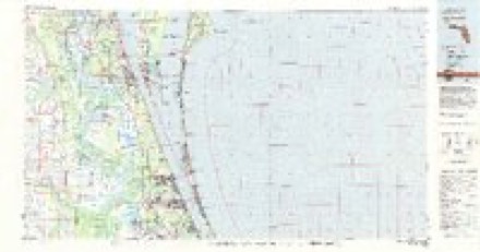
14 topographic sheets cover this place, the earliest surveyed in 1949 and the latest in 1981. It stands in the Cocoa-Rockledge census division. It lies in ZIP code area 32927. The Survey maps it on the Sharpes quadrangle.
Then and now
1949 to 1981The same ground, surveyed 32 years apart. Drag the handle to wipe between them. Both sheets are United States Geological Survey originals; neither has been altered.
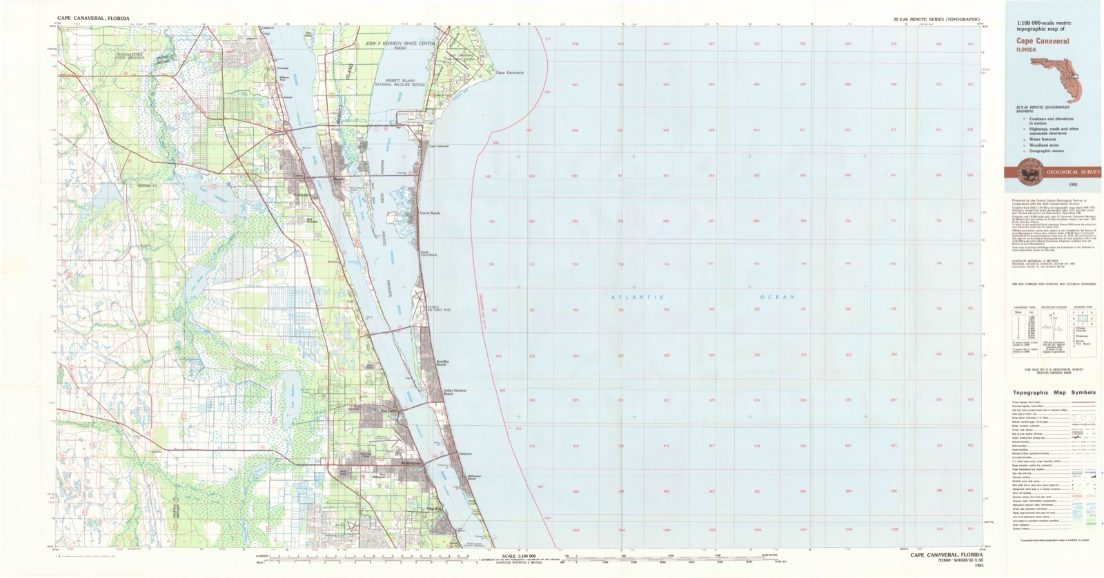
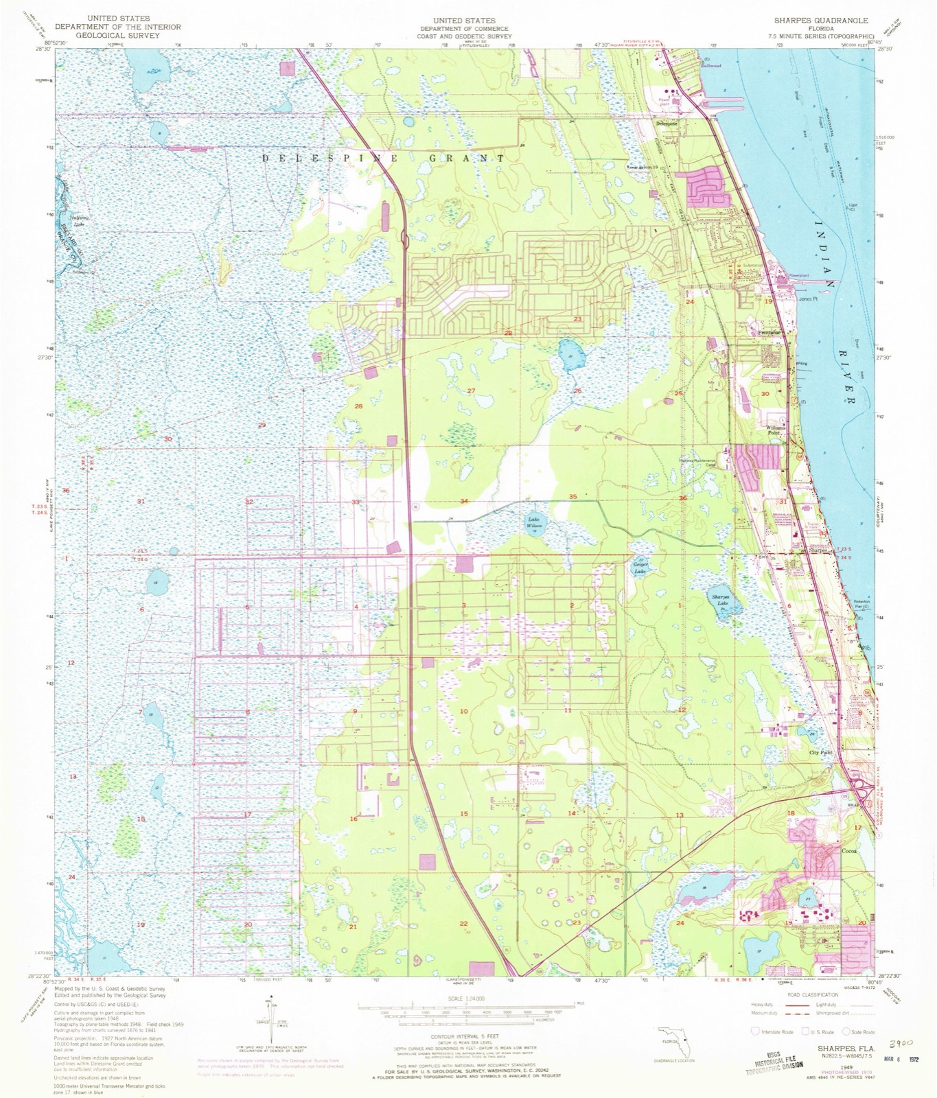
Topographic sheets covering this place
7 surveys from 14 printed sheetsMatched by testing this settlement's coordinate against the published boundary of every sheet in the United States Geological Survey's historical collection. Each opens the scanned sheet at the Survey.
- 1949 USGS Sharpes quadrangle1:24000, 6 printings
- 1951 USGS Sharpes quadrangle1:24000
- 1955 USGS Orlando quadrangle1:250000, 3 printings
- 1957 USGS Orlando quadrangle1:250000
- 1958 USGS Orlando quadrangle1:250000
- 1962 USGS Orlando quadrangle1:250000
- 1981 USGS Cape Canaveral quadrangle1:100000
Fires near this place
316 since 1992Regional context, not property-specific evidence. The federal wildfire occurrence database lists 316 fires within 5 miles of Frontenac between 1992 and 2020, burning about 12,708 acres in total. 109 started naturally. 55 were recorded as arson. Distance is straight-line from the map coordinates, so a fire counted here may appear on a neighbouring settlement's page as well.
| Reported cause | Fires |
|---|---|
| Natural | 109 |
| Arson/incendiarism | 55 |
| Missing data/not specified/undetermined | 44 |
| Equipment and vehicle use | 27 |
| Misuse of fire by a minor | 24 |
| Railroad operations and maintenance | 20 |
| Recreation and ceremony | 16 |
| Debris and open burning | 11 |
| Power generation/transmission/distribution | 4 |
| Fireworks | 4 |
| Other causes | 2 |
The most recent of them, most recent first, with the day each was reported and the service that recorded it.
| Date | Cause | Size | Reported by | Name on the report |
|---|---|---|---|---|
| 5 September 2000 | Natural | under an acre | Florida Forest Service | not named |
| 2 September 2002 | Natural | 1.0 acres | Florida Forest Service | not named |
| 2 September 2000 | Natural | 1.0 acres | Florida Forest Service | not named |
| 19 September 2005 | Recreation and ceremony | under an acre | Florida Forest Service | CAROLE AVE (O5) |
| 16 September 1997 | Missing data/not specified/undetermined | 1.5 acres | Florida Forest Service | not named |
| 13 September 1997 | Natural | 5.0 acres | Florida Forest Service | not named |
| 1 September 2000 | Natural | 500 acres | Florida Forest Service | not named |
| 1 September 2000 | Natural | under an acre | Florida Forest Service | not named |
Settlements close enough to share some of these fires:
Mines and quarries near this place
3 within 5 milesRegional context, not property-specific evidence. The federal mineral resources record lists 3 workings within 5 miles of Frontenac: 2 producers, 1 past producer. 2 still produce. What was taken out: Stone, Crushed/Broken, Sand, Limestone, General. Distance is straight-line from the map coordinates, so a quarry counted here may appear on a neighbouring settlement's page as well.
| Where | Site | Commodity | Status | Recorded |
|---|---|---|---|---|
| F&W Mines - Hwy 520 Mine | Limestone, General | Producer | Limestone | |
| Kings Park Pit | Stone, Crushed/Broken | Past Producer | ||
| Kirschenbaum Co. - Ti-Co Pit | Sand | Producer |
Storms near this place
17 since 2009Regional context, not property-specific evidence. The National Weather Service names Frontenac in 17 storm reports between 2009 and 2025: 8 thunderstorm wind, 3 hail, 2 funnel cloud, 2 tornado. The reports record 1 injury. Each account below is quoted exactly as the forecast office filed it, from the NOAA Storm Events Database, and each date opens the federal record of that event.
| When | Event | Place named | Harm | What the report says |
|---|---|---|---|---|
| August 2012 | Lightning | Frontenac | 1 hurt | A local media outlet relayed a report of a woman being struck by lightning on Arborwood Avenue in Port St. John. She was taken to a nearby hospital and reported to be in stable condition. |
| October 2025 | Flash Flood | Frontenac | $3,060,000 | A stalled thunderstorm produced between 6 to 12 inches of rainfall over portions of north Merritt Island. Flash flooding lead to numerous roads being flooded, including Nina Court. According to local emergency managers, over 150 homes and businesses were affected by flooding, including one house with major damage and over 90 with minor damage, due to floodwaters entering structures. This was part of a rare, high-impact flood event that also impacted Tiusville, Mims, Sharpes, and Cocoa, with a 12-hour annual exceedance probability (AEP or the percent chance of an event occurring in any calendar year) between 0.5% and 0.2%, alternatively known as a 200 to 500-year flood. |
| June 2021 | Tornado (EF0) | Frontenac | $5,000 | A resident of the Preserve Pointe subdivision on Merritt Island, just south of the NASA Causeway and west of State Road 3, observed trees being uprooted, fences destroyed and solar panels ripping off of neighbors' roofs as a severe thunderstorms passed by. The eyewitness report along with videos and photos confirmed that a brief, weak (EF-0) tornado likely developed within the thunderstorm and produced additional scattered, (mainly tree) damage northeastward to Pine Island Road. The circulation likely initially reached the ground within the Pine Island Conservation Area to the southwest of Preserve Pointe. |
| July 2011 | Thunderstorm Wind | Frontenac | $200 | A Brevard County media outlet reported that several trees and a few sections of a concrete retaining wall were knocked over from Sharpes to Port St. John as a severe thunderstorm moved through. |
| April 2023 | Hail | Frontenac | - | Trained spotter reported hail up to one inch north of Merritt Island. |
| April 2023 | Thunderstorm Wind | Frontenac | - | Trained spotter reported a 57 knot wind gust north of Merritt Island. |
| September 2023 | Funnel Cloud | Frontenac | - | Public photo via social media of a funnel cloud near Cape Canaveral Space Force Station. |
| June 2019 | Thunderstorm Wind | Frontenac | - | A trained weather spotter measured a peak wind gust of 62 mph from the southwest, on a private weather station. |
| June 2019 | Thunderstorm Wind | Frontenac | - | US Air Force wind tower 0803 measured a peak wind gust of 59 mph from the west. |
| March 2018 | Thunderstorm Wind | Frontenac | - | A trained spotter measured a peak wind gust of 65 mph from a weather station in North Merritt Island. |
| March 2013 | Thunderstorm Wind | Frontenac | - | The tops of several 60-80 foot tall pine trees were snapped on Sugartown Street in Port St. John. |
| June 2013 | Thunderstorm Wind | Frontenac | - | U.S. Air Force wind tower 1204 measured a 53 knot wind gust. |
| May 2012 | Hail | Frontenac | - | Public reported estimated pea to quarter-sized hail around Port St. John. |
| April 2011 | Hail | Frontenac | - | A weather spotter observed nickel sized hail in Port St. John. |
| June 2009 | Funnel Cloud | Frontenac | - | Funnel cloud spotter near Port Saint John was sighted by the public. |
| April 2009 | Tornado (EF0) | Frontenac | - | National Weather Service Storm Survey revealed short line of damage through several buildings comprising the middle of the Frontenac Flea Market. The top wooden cross member of a single telephone phone was broken adjacent to the flea market, on the eastern side of US1 on Canebreakers Drive. Estimated winds were 65-75 mph. Two eyewitnesses driving north on US1 just SSE of the flea market observed a white, rotating vortex hit the flea market and cross US1 in front of them. |
| April 2009 | Thunderstorm Wind | Frontenac | - | A small area of straight-line thunderstorm winds damaged several residences within the Colony Park Mobile Home Village just north of North Courtney Parkway and North Tropical Trail. Damage was consistent with 55-65 mph straight-line winds. |
Nearest settlements
The eight closest, with where each one stands in the county. Distances are straight-line, computed from the Geographic Names Information System coordinates.
| Map | Place | Distance | Sheets |
|---|---|---|---|
| Williams Point | 0.9 miles | 14 | |
| Port Saint John | 1.7 miles | 14 | |
| Sharpes | 2.0 miles | 14 | |
| Delespine | 2.2 miles | 14 | |
| Courtenay | 2.9 miles | 13 | |
| Bellwood | 3.2 miles | 14 | |
| North Merritt Island | 3.5 miles | 13 | |
| City Point | 3.9 miles | 14 |
Provenance
This settlement is recorded in the Geographic Names Information System as feature 282840. The sheet list is computed by point-in-boundary test against the United States Geological Survey's historical topographic inventory. Both are works of the United States government and carry no copyright under 17 U.S.C. 105.
Wildfire. Short, Karen C. 2022. Spatial wildfire occurrence data for the United States, 1992-2020 [FPA_FOD_20221014]. 6th Edition. Fort Collins, CO: Forest Service Research Data Archive. https://doi.org/10.2737/RDS-2013-0009.6 Collected with United States Government funding and usable without additional permissions or fees.
Mines and quarries. USGS Mineral Resources Data System (MRDS) https://mrdata.usgs.gov/mrds/ A work of the United States government, no copyright under 17 U.S.C. 105.
Storms. NOAA National Centers for Environmental Information, Storm Events Database https://www.ncei.noaa.gov/stormevents/ A work of the United States government, no copyright under 17 U.S.C. 105. Narratives are quoted verbatim from the National Weather Service report and are not edited or summarised.