 Block
BlockHialeah Gardens, Florida
14 topographic sheets cover this place, the earliest surveyed in 1950 and the latest in 1994. It stands in the Hialeah census division. It lies in ZIP code area 33016. The Survey maps it on the Hialeah quadrangle. 23,068 people lived here at the 2020 count. It stands 7 feet above sea level.
Then and now
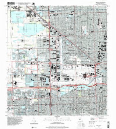
1950 to 1994The same ground, surveyed 44 years apart. Drag the handle to wipe between them. Both sheets are United States Geological Survey originals; neither has been altered.
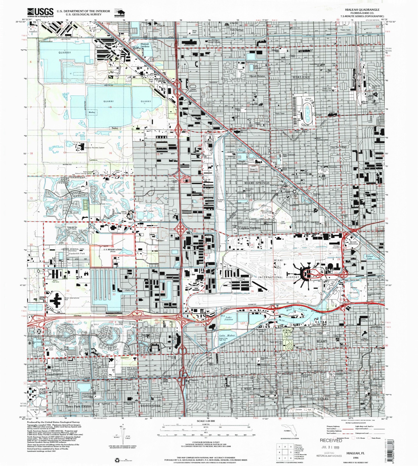
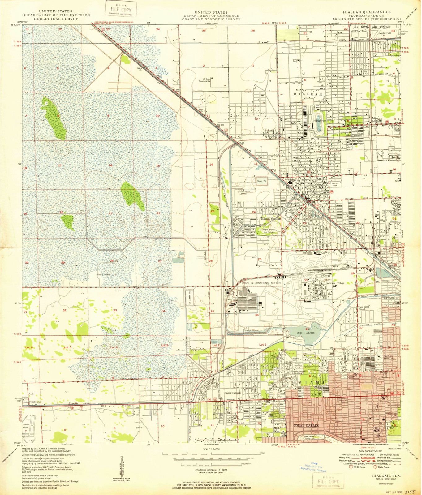
Compare 1950 against another survey:
Population over time
2 figuresHialeah Gardens grew from 21,744 to 23,068 between 2010 and 2020. These are the recorded population figures Wikidata holds for this place, reached through the Geographic Names Information System number this page is keyed on rather than by name, so they belong to this place and not to another of the same name. Most are census counts, but not all are: an early figure may be a founding or settlement estimate, and an estimate published within five years of a census is left out. The change column is computed, and is left blank where more than 20 years separate a figure from the one before it, because a gap that long is not a change between two counts.
| Year | People | Change |
|---|---|---|
| 2010 | 21,744 | |
| 2020 | 23,068 | +1,324 (+6%) |
Topographic sheets covering this place
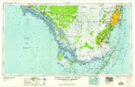
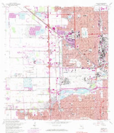
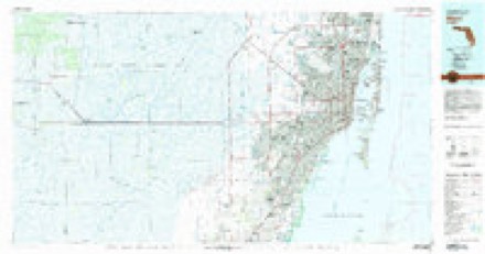
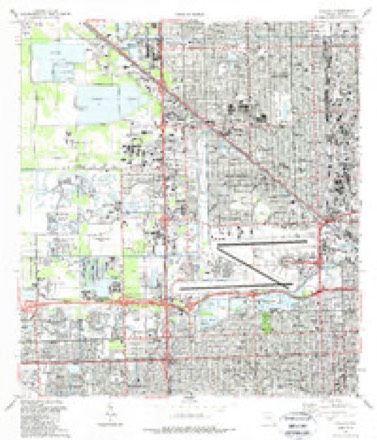
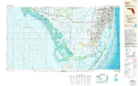
8 surveys from 14 printed sheetsMatched by testing this settlement's coordinate against the published boundary of every sheet in the United States Geological Survey's historical collection. Each opens the scanned sheet at the Survey.
- 1950 USGS Hialeah quadrangle1:24000
- 1956 USGS Miami quadrangle1:250000, 5 printings
- 1958 USGS Miami quadrangle1:250000
- 1962 USGS Hialeah quadrangle1:24000, 3 printings
- 1981 USGS Miami quadrangle1:100000
- 1988 USGS Hialeah quadrangle1:24000
- 1988 USGS Miami quadrangle1:250000
- 1994 USGS Hialeah quadrangle1:24000
Fires near this place
73 since 1992Regional context, not property-specific evidence. The federal wildfire occurrence database lists 73 fires within 5 miles of Hialeah Gardens between 1992 and 2020, burning about 683 acres in total. 4 started naturally. 7 were recorded as arson. Distance is straight-line from the map coordinates, so a fire counted here may appear on a neighbouring settlement's page as well.
| Reported cause | Fires |
|---|---|
| Railroad operations and maintenance | 22 |
| Equipment and vehicle use | 16 |
| Misuse of fire by a minor | 10 |
| Arson/incendiarism | 7 |
| Missing data/not specified/undetermined | 6 |
| Natural | 4 |
| Debris and open burning | 4 |
| Recreation and ceremony | 3 |
| Fireworks | 1 |
The most recent of them, most recent first, with the day each was reported and the service that recorded it.
| Date | Cause | Size | Reported by | Name on the report |
|---|---|---|---|---|
| 16 September 1995 | Railroad operations and maintenance | under an acre | Florida Forest Service | not named |
| 31 August 2001 | Equipment and vehicle use | 12 acres | Florida Forest Service | not named |
| 3 August 1999 | Natural | 10 acres | Florida Forest Service | not named |
| 29 August 1998 | Equipment and vehicle use | 4.0 acres | Florida Forest Service | not named |
| 17 August 1997 | Equipment and vehicle use | 10 acres | Florida Forest Service | not named |
| 14 August 1996 | Natural | 2.0 acres | Florida Forest Service | not named |
| 18 June 1994 | Railroad operations and maintenance | 3.0 acres | Florida Forest Service | not named |
| 17 June 2000 | Misuse of fire by a minor | under an acre | Florida Forest Service | not named |
Settlements close enough to share some of these fires:
Mines and quarries near this place
10 of 22 shownRegional context, not property-specific evidence. The federal mineral resources record lists 22 workings within 5 miles of Hialeah Gardens: 16 producers, 4 past producers, 2 plants. 18 still produce. What was taken out: Stone, Crushed/Broken, Limestone, General, Sand and Gravel, Construction. Distance is straight-line from the map coordinates, so a quarry counted here may appear on a neighbouring settlement's page as well.
| Where | Site | Commodity | Status | Recorded |
|---|---|---|---|---|
| Fec Quarry | Sand and Gravel, Construction | Past Producer | ||
| 21st Century Rock and Fill - Number 11 | Limestone, General | Producer | Limestone | |
| Lowell S. Dunn - 58th Street Quarry | Limestone, General | Producer | Limestone | |
| Vulcan Materials - Medley Quarry | Limestone, General | Producer | Limestone | |
| Black Velvet Top Soil | Stone, Crushed/Broken | Past Producer | ||
| Dade Pit | Stone, Crushed/Broken | Producer | ||
| Dade Pit No. 1 | Stone, Crushed/Broken | Producer | ||
| Dade Pit No. 7 | Stone, Crushed/Broken | Producer | ||
| F.E.C. Quarry | Stone, Crushed/Broken | Producer | ||
| General Fill Pit No. 1 | Stone, Crushed/Broken | Producer |
Storms near this place
19 since 2007Regional context, not property-specific evidence. The National Weather Service names Hialeah Gardens in 19 storm reports between 2007 and 2022: 6 hail, 5 thunderstorm wind, 3 flood, 2 flash flood. The reports record 1 injury. Each account below is quoted exactly as the forecast office filed it, from the NOAA Storm Events Database, and each date opens the federal record of that event.
| When | Event | Place named | Harm | What the report says |
|---|---|---|---|---|
| July 2019 | Lightning | Hialeah Gardens | 1 hurt | A man was struck by lightning while standing underneath a tree due to a thunderstorm. The man was working as a part of a group working on a roadway. The man was transported to a nearby hospital. |
| May 2016 | Lightning | Hialeah Gardens | $80,000 | Lightning struck an apartment building on the 5400 block of West 21 Court in Hialeah. 4 apartments suffered significant damage when lightning caused fire to spread across a common attic. A total of 20 people were displaced by the fire. |
| May 2012 | Flash Flood | Hialeah Gardens | $75,000 | A second band of numerous showers and a few thunderstorms accompanied with intense rainfall moved through the same area of Miami-Dade County that received very heavy rainfall earlier in the day. The first significant report of flooding with this event was received at 810 PM EDT in Doral by the media stating that the canal running along NW 25th Street near NW 107th Avenue had overflowed its banks and flooded a nearby police department parking lot. Later reports received at 830 PM EDT indicated that rising flood waters had inundated some apartments at the Fountainbleau Gardens Apartments on 81st Avenue and NW 7th Street. A HAM radio operator reported at 938 PM EDT road closure of 87th Avenue near NW 12th Street due to flooding and at 950 PM EDT the same person reported that the Dolphin Expressway...State Road 836...was nearly impassable near the Palmetto Expressway...State Road 826...overpass due to standing water on the roadway. Many roads in Doral were under several feet of water, resulting in stalled cars and water entering businesses in warehouse districts. ||Damage totals indicated for this event also include the previous flooding earlier in the afternoon.||The ASOS at Miami International Airport received an additional three plus inches of rainfall making the total for the calendar day to 9.7 inches which was a record daily amount. This also made it the second wettest day recorded in Miami for the month of May with continuous records back to 1895. Storm total rainfall amounts in the Sweetwater and Doral areas ranged from 8 to 10 inches, with an area of 4 to 7 inches extending from the FIU area to near the Dolphin Mall. |
| May 2012 | Thunderstorm Wind | Hialeah Gardens | $3,000 | Trees were down and window screens blown out in Balmoral Estates and Doral Isles in Doral. Winds were estimated 60 to 70 mph. |
| May 2012 | Thunderstorm Wind | Hialeah Gardens | $1,000 | An off duty meteorologist reported trees downed near the intersection of NW 64th Street and NW 114th Avenue in Doral. |
| October 2022 | Flood | Hialeah Gardens | - | A video post on social media showed notable street flooding in Doral. The roadway near the intersection of NW 87th Ave and NW 74th Street had an estimated six inches of water across the road. Rainfall measurements in the general area were in the 3-4 inch range. |
| July 2021 | Flood | Hialeah Gardens | - | A member of the public reported via social media street flooding, with water covering all lanes except the center turn late on W 12 Avenue between 60th and 68th Streets in Hialeah. |
| July 2020 | Flood | Hialeah Gardens | - | Pictures of street flooding relayed by members of the public via social media in Hialeah in the area between W 47th Street and W 57th Street near the Palmetto Expressway. |
| July 2019 | Hail | Hialeah Gardens | - | A member of the public reported nickel sized hail near W 16th Ave and W 32nd St in Hialeah. |
| December 2015 | Heavy Rain | Hialeah Gardens | - | Heavy rain resulted in minor street and parking lot flooding in Doral. |
| June 2014 | Hail | Hialeah Gardens | - | Broadcast media reported nickel size hail 2 miles southeast of Hialeah Gardens. |
| May 2013 | Hail | Hialeah Gardens | - | An off duty NWS employee reported penny-sized hail near the intersection of Palmetto Expressway and Okeechobee Road. |
| May 2012 | Thunderstorm Wind | Hialeah Gardens | - | The public estimated wind gusts to 60 mph in Doral. |
| May 2012 | Thunderstorm Wind | Hialeah Gardens | - | An off duty meteorologist reported at least two trees snapped near the Eugenia B. Thomas School in Doral. |
| May 2012 | Flash Flood | Hialeah Gardens | - | A band of showers and a few thunderstorms along with torrential rainfall developed over the far western portions of the Miami-Dade County metropolitan area and moved east through the area from Kendall to Doral and Miami Springs. The ASOS at Miami International Airport recorded 4.40 inches of rainfall between 1245 and 2 PM EDT. During this time, a trained spotter reported 1 foot of water covering NW 82nd Avenue south of NW 25th Street in Doral. Shortly after 2 PM, an off-duty meteorologist reported cars floating in the street near the intersection of NW 36th Street and NW 82nd Avenue in Doral. Several cars in the area stalled out in high waters that had inundated the streets. On NW 82nd Avenue along the 2800 block, a large pickup stalled out in the flood waters and a tow truck pulled it to safety with two occupants still inside. On 87th Avenue, a woman driving a minivan stalled out and had to wait for a tow truck to pull her to safety. Other rainfall reports received in this event were 3.64 inches at the National Weather Service Forecast Office on the FIU South Campus and 4.03 inches at Ruben Dario Middle School in Sweetwater.||Damage totals for this event are included in the event which occurred later in the evening over the same area. |
| May 2012 | Hail | Hialeah Gardens | - | Penny sized hail was reported at Eugenia B. Thomas School in Doral. |
| May 2012 | Thunderstorm Wind | Hialeah Gardens | - | A member of the public estimated wind gusts up to 70 mph near the intersection of NW 58th Street and NW 107th Avenue in Doral. |
| July 2012 | Hail | Hialeah Gardens | - | Public reported nickel sized hail in Hialeah near West 16th Avenue and 37th Street. |
| May 2007 | Hail | Hialeah Gardens | - | Funnel clouds also reported. |
Nearest settlements
The eight closest, with where each one stands in the county. Distances are straight-line, computed from the Geographic Names Information System coordinates.
| Map | Place | Distance | Sheets |
|---|---|---|---|
| Holiday Acres | 1.4 miles | 14 | |
| Palm Springs | 1.4 miles | 14 | |
| Palm Springs Estates | 1.6 miles | 15 | |
| Medley | 1.7 miles | 14 | |
| Hialeah Estates | 1.8 miles | 14 | |
| Hialeah | 2.5 miles | 14 | |
| Miami Lakes | 3.1 miles | 15 | |
| Miami Springs | 3.5 miles | 14 |
Elsewhere
Matched on this settlement's Geographic Names Information System number rather than its name, so it cannot be a different place of the same name in another state.
| Wikipedia article on Hialeah Gardens | An encyclopaedic summary. Its text is share-alike, so it is linked here rather than copied. |
| Wikidata item Q595281 | The structured record the population and elevation above come from. Public domain (CC0). |
Provenance
This settlement is recorded in the Geographic Names Information System as feature 305060. The sheet list is computed by point-in-boundary test against the United States Geological Survey's historical topographic inventory. Both are works of the United States government and carry no copyright under 17 U.S.C. 105.
Wildfire. Short, Karen C. 2022. Spatial wildfire occurrence data for the United States, 1992-2020 [FPA_FOD_20221014]. 6th Edition. Fort Collins, CO: Forest Service Research Data Archive. https://doi.org/10.2737/RDS-2013-0009.6 Collected with United States Government funding and usable without additional permissions or fees.
Mines and quarries. USGS Mineral Resources Data System (MRDS) https://mrdata.usgs.gov/mrds/ A work of the United States government, no copyright under 17 U.S.C. 105.
Storms. NOAA National Centers for Environmental Information, Storm Events Database https://www.ncei.noaa.gov/stormevents/ A work of the United States government, no copyright under 17 U.S.C. 105. Narratives are quoted verbatim from the National Weather Service report and are not edited or summarised.