 Block
BlockMargate, Florida
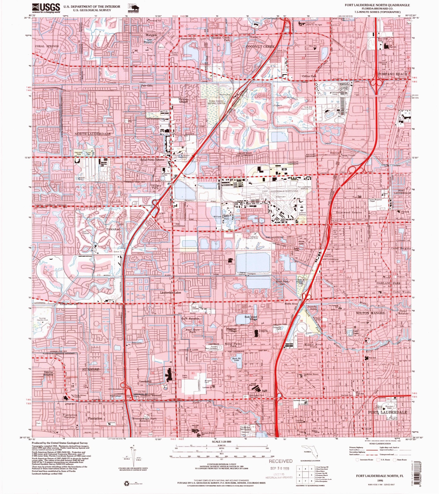
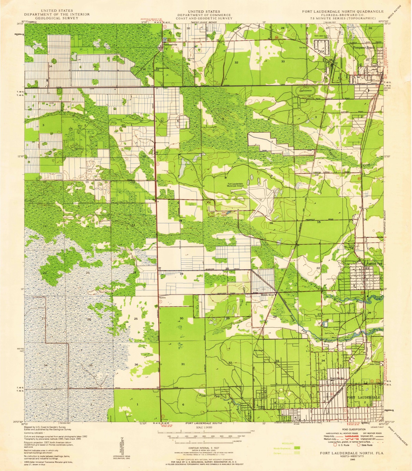
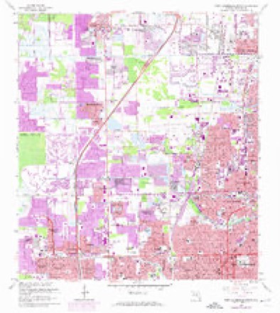
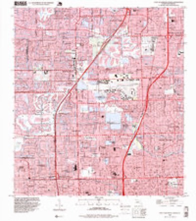
18 topographic sheets cover this place, the earliest surveyed in 1945 and the latest in 1995. It stands in the Coral Springs-Margate census division. It lies in ZIP code area 33063. The Survey maps it on the Fort Lauderdale North quadrangle. 58,712 people lived here at the 2020 count. It stands 10 feet above sea level.
Then and now
1945 to 1995The same ground, surveyed 50 years apart. Drag the handle to wipe between them. Both sheets are United States Geological Survey originals; neither has been altered.
Compare 1945 against another survey:
Population over time
2 figuresMargate grew from 53,284 to 58,712 between 2010 and 2020. These are the recorded population figures Wikidata holds for this place, reached through the Geographic Names Information System number this page is keyed on rather than by name, so they belong to this place and not to another of the same name. Most are census counts, but not all are: an early figure may be a founding or settlement estimate, and an estimate published within five years of a census is left out. The change column is computed, and is left blank where more than 20 years separate a figure from the one before it, because a gap that long is not a change between two counts.
| Year | People | Change |
|---|---|---|
| 2010 | 53,284 | |
| 2020 | 58,712 | +5,428 (+10%) |
Topographic sheets covering this place
10 surveys from 18 printed sheetsMatched by testing this settlement's coordinate against the published boundary of every sheet in the United States Geological Survey's historical collection. Each opens the scanned sheet at the Survey.
- 1945 USGS Fort Lauderdale North quadrangle1:24000
- 1949 USGS Fort Lauderdale North quadrangle1:24000, 2 printings
- 1956 USGS West Palm Beach quadrangle1:250000, 2 printings
- 1957 USGS West Palm Beach quadrangle1:250000
- 1958 USGS West Palm Beach quadrangle1:250000, 2 printings
- 1962 USGS Fort Lauderdale North quadrangle1:24000, 4 printings
- 1981 USGS Fort Lauderdale quadrangle1:100000
- 1985 USGS Fort Lauderdale quadrangle1:100000, 2 printings
- 1987 USGS West Palm Beach quadrangle1:250000, 2 printings
- 1995 USGS Fort Lauderdale North quadrangle1:24000




Fires near this place
9 since 2003Regional context, not property-specific evidence. The federal wildfire occurrence database lists 9 fires within 5 miles of Margate between 2003 and 2019, burning about 3,720 acres in total. 1 started naturally. 5 were recorded as arson. Distance is straight-line from the map coordinates, so a fire counted here may appear on a neighbouring settlement's page as well.
| Reported cause | Fires |
|---|---|
| Arson/incendiarism | 5 |
| Missing data/not specified/undetermined | 1 |
| Misuse of fire by a minor | 1 |
| Recreation and ceremony | 1 |
| Natural | 1 |
The most recent of them, most recent first, with the day each was reported and the service that recorded it.
| Date | Cause | Size | Reported by | Name on the report |
|---|---|---|---|---|
| 13 June 2003 | Missing data/not specified/undetermined | 3,700 acres | Florida Forest Service | THE REFUGE FIRE |
| 12 May 2015 | Recreation and ceremony | 1.0 acres | Florida Forest Service | TENT POLE (6) |
| 12 May 2008 | Natural | 5.0 acres | Florida Forest Service | ALMOST FIRE |
| 9 April 2012 | Arson/incendiarism | under an acre | Florida Forest Service | GREEN ROAD (06) |
| 5 April 2018 | Arson/incendiarism | 2.0 acres | Florida Forest Service | SANDY RIDGE ( 06 ) |
| 23 April 2019 | Arson/incendiarism | 8.0 acres | Florida Forest Service | TRAINING (6) |
| 7 January 2019 | Arson/incendiarism | under an acre | Florida Forest Service | SANDY RIDGE 2 |
| 3 January 2019 | Misuse of fire by a minor | under an acre | Florida Forest Service | SANDY RIDGE ONE (06) |
Settlements close enough to share some of these fires:
Mines and quarries near this place
10 of 11 shownRegional context, not property-specific evidence. The federal mineral resources record lists 11 workings within 5 miles of Margate: 10 producers, 1 past producer. 10 still produce. What was taken out: Sand and Gravel, Construction, Stone, Crushed/Broken, Sand, Silica. Distance is straight-line from the map coordinates, so a quarry counted here may appear on a neighbouring settlement's page as well.
| Where | Site | Commodity | Status | Recorded |
|---|---|---|---|---|
| 101 Sand Pit | Silica | Producer | ||
| Desrocher Sand and Rock - Desrocher Pit | Sand | Producer | ||
| Sawgrass Mining - Sawgrass Pit | Sand | Producer | ||
| H L Westberry Rock and Fill | Stone, Crushed/Broken | Producer | ||
| Pit No. 4 | Stone, Crushed/Broken | Producer | ||
| Prospect Limestone Quarry | Stone, Crushed/Broken | Past Producer | ||
| Margate Pit | Sand and Gravel, Construction | Producer | ||
| Pit No. 1 | Sand and Gravel, Construction | Producer | ||
| Pompano Pit | Sand and Gravel, Construction | Producer | ||
| Prospect Pit | Sand and Gravel, Construction | Producer |
Storms near this place
17 since 2003Regional context, not property-specific evidence. The National Weather Service names Margate in 17 storm reports between 2003 and 2023: 6 hail, 6 thunderstorm wind, 3 lightning, 1 funnel cloud. The reports record 3 injuries. Each account below is quoted exactly as the forecast office filed it, from the NOAA Storm Events Database, and each date opens the federal record of that event.
| When | Event | Place named | Harm | What the report says |
|---|---|---|---|---|
| March 2015 | Thunderstorm Wind | Margate | 1 hurt | A 40' by 80' vendor tent at the Margate City Fair collapsed as strong winds from a thunderstorm outflow moved through the area. One person suffered minor injuries from a cut to his right foot. Measured winds in the general area at the time were 52 mph at Liberty Elementary School slightly over 1 mile from the fair location. |
| February 2015 | Lightning | Margate | 1 hurt | A Broward County Sheriff's deputy who was directing traffic in Tamarac was injured after lightning struck a nearby utility box. The lightning struck an Florida Power & Light signal box at the corner of the intersection of University Drive and Southgate Boulevard and that transferred some residual electricity to the deputy.||The deputy felt a tingling and was transported to a nearby hospital for examination. Time is estimated. |
| August 2005 | Lightning | Margate | 1 hurt | A 46-year-old female postal worker was critically injured while delivering mail. Lightning struck an oak tree next to the mail box and knocked the woman unconscious. She was admitted to a local hospital. |
| March 2016 | Thunderstorm Wind | Margate | $10,000 | One large tree and several smaller trees were downed just north of the intersection of Lyons Road and Hammock Boulevard. Additional trees and limbs fell on another home in Coconut Creek, piercing through the ceiling and leading to significant water damage. Additional downed trees were reported in Margate. Nearby mesonet observations recorded wind gusts of 45 to 55 mph. Information received from NWS employee and from local media outlets. Time estimated from radar. |
| July 2007 | Lightning | Margate | $8,000 | Lightning struck a two-story house in the 3000 block of Green Turtle Place. A 3-foot hole was left in the roof, and a second floor bedroom caught fire. There were no injuries as no one was home. |
| April 2022 | Thunderstorm Wind | Margate | $5,000 | A thunderstorm wind gust produced tree damage and damaged screen patios in a Margate neighborhood northwest of HCA Florida Northwest Hospital. Time is estimated via radar. |
| July 2020 | Thunderstorm Wind | Margate | $5,000 | Broadcast media reported a large outdoor contraption, consisting of mesh netting well-attached to a solid wooden enclosure, was fully lofted and tilted vertically, colliding with backyard facing side of a house. Mesh was damaged. Backyard lawn recreational items also toppled. This thunderstorm wind damage was in association with a microburst. Estimated wind gusts near 60 mph based primarily on magnitude of damage as well as strength of storm observed on radar. |
| June 2021 | Thunderstorm Wind | Margate | $1,000 | Broadcast media reported several large trees snapped in the Woodlake Isles Community in Margate. Time and wind speed estimated from radar. |
| February 2023 | Flood | Margate | - | Report received via social media of flooded streets in Deerfield Beach on Green Road between the Florida Turnpike and Military Trail. Rainfall of 3-4 inches was noted in the area. |
| July 2020 | Hail | Margate | - | Report from MPING: Penny size hail from thunderstorms. |
| March 2016 | Funnel Cloud | Margate | - | Public reported brief funnel cloud at the intersection of the Florida Turnpike and Sample Road. |
| June 2014 | Hail | Margate | - | A trained spotter reported penny size hail 1 mile east southeast of Margate. |
| April 2013 | Hail | Margate | - | A spotter reported nickel sized hail at the intersection of Hillsboro Blvd. and U.S. 441. |
| April 2013 | Hail | Margate | - | A spotter reported quarter to half dollar sized hail near the Florida Turnpike and the Sawgrass Expressway. |
| August 2012 | Thunderstorm Wind | Margate | - | A skywarn spotter estimated wind gusts of around 60 mph near the intersection of Atlantic Boulevard and Banks Road in Margate. Some tree limbs downed with at least one hitting a car. |
| February 2007 | Hail | Margate | - | Observed near Rock Island Road in Margate. |
| April 2003 | Hail | Margate | - | A SKYWARN spotter saw one inch hail in Margate and police reported 3/4 inch hail in Coconut Creek. |
Nearest settlements
The eight closest, with where each one stands in the county. Distances are straight-line, computed from the Geographic Names Information System coordinates.
| Map | Place | Distance | Sheets |
|---|---|---|---|
| Hammondville | 0.3 miles | 18 | |
| Fair Gate | 1.1 miles | 18 | |
| Coconut Creek Park | 1.3 miles | 18 | |
| Margate Estates | 1.5 miles | 18 | |
| Coconut Creek | 1.5 miles | 16 | |
| North Lauderdale | 2.1 miles | 18 | |
| Collier Park | 2.6 miles | 18 | |
| Sabal Palms Estates | 2.7 miles | 18 |
Elsewhere
Matched on this settlement's Geographic Names Information System number rather than its name, so it cannot be a different place of the same name in another state.
| Wikipedia article on Margate | An encyclopaedic summary. Its text is share-alike, so it is linked here rather than copied. |
| Wikidata item Q989468 | The structured record the population and elevation above come from. Public domain (CC0). |
Provenance
This settlement is recorded in the Geographic Names Information System as feature 286413. The sheet list is computed by point-in-boundary test against the United States Geological Survey's historical topographic inventory. Both are works of the United States government and carry no copyright under 17 U.S.C. 105.
Wildfire. Short, Karen C. 2022. Spatial wildfire occurrence data for the United States, 1992-2020 [FPA_FOD_20221014]. 6th Edition. Fort Collins, CO: Forest Service Research Data Archive. https://doi.org/10.2737/RDS-2013-0009.6 Collected with United States Government funding and usable without additional permissions or fees.
Mines and quarries. USGS Mineral Resources Data System (MRDS) https://mrdata.usgs.gov/mrds/ A work of the United States government, no copyright under 17 U.S.C. 105.
Storms. NOAA National Centers for Environmental Information, Storm Events Database https://www.ncei.noaa.gov/stormevents/ A work of the United States government, no copyright under 17 U.S.C. 105. Narratives are quoted verbatim from the National Weather Service report and are not edited or summarised.