 Block
BlockWest Hollywood, Florida
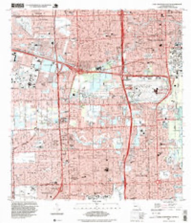
16 topographic sheets cover this place, the earliest surveyed in 1949 and the latest in 1994. It stands in the Hollywood census division. It lies in ZIP code area 33021. The Survey maps it on the Fort Lauderdale South quadrangle.
Then and now
1949 to 1994The same ground, surveyed 45 years apart. Drag the handle to wipe between them. Both sheets are United States Geological Survey originals; neither has been altered.
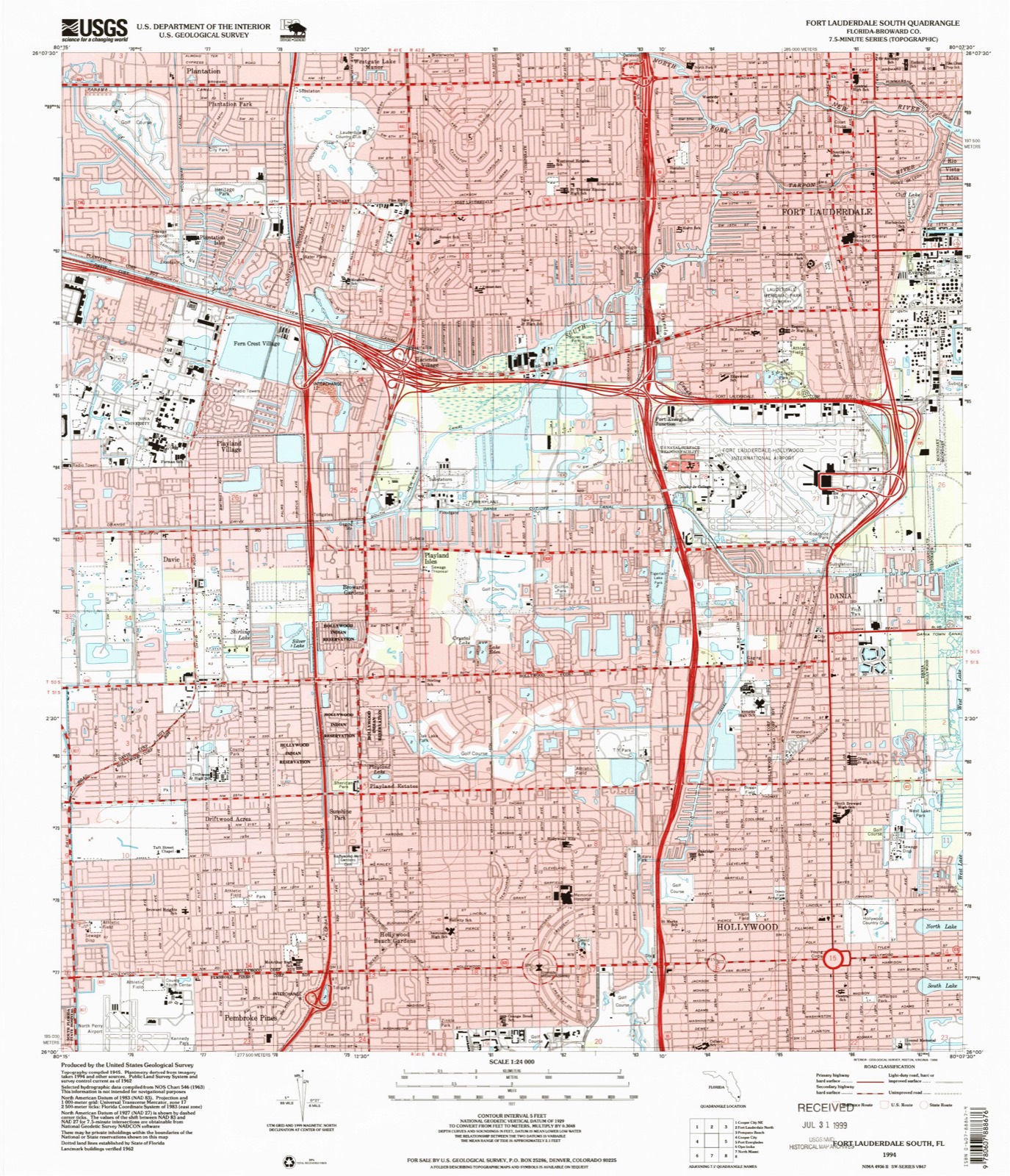
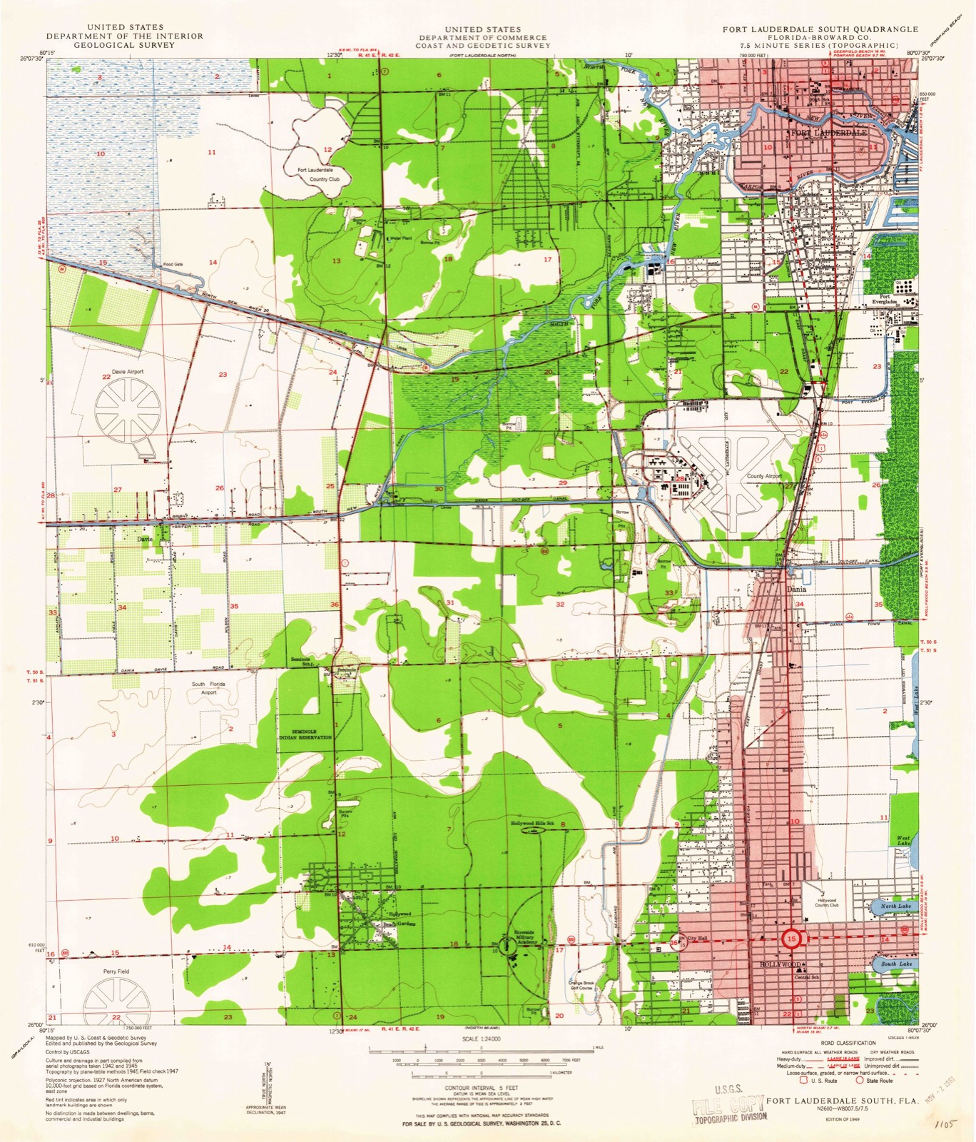
Compare 1949 against another survey:
Topographic sheets covering this place
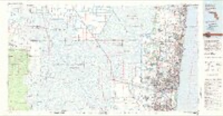
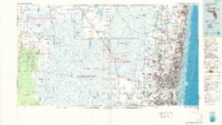
9 surveys from 16 printed sheetsMatched by testing this settlement's coordinate against the published boundary of every sheet in the United States Geological Survey's historical collection. Each opens the scanned sheet at the Survey.
- 1949 USGS Fort Lauderdale South quadrangle1:24000, 2 printings
- 1956 USGS West Palm Beach quadrangle1:250000, 2 printings
- 1957 USGS West Palm Beach quadrangle1:250000
- 1958 USGS West Palm Beach quadrangle1:250000, 2 printings
- 1962 USGS Fort Lauderdale South quadrangle1:24000, 3 printings
- 1981 USGS Fort Lauderdale quadrangle1:100000
- 1985 USGS Fort Lauderdale quadrangle1:100000, 2 printings
- 1987 USGS West Palm Beach quadrangle1:250000, 2 printings
- 1994 USGS Fort Lauderdale South quadrangle1:24000




Fires near this place
18 since 1993Regional context, not property-specific evidence. The federal wildfire occurrence database lists 18 fires within 5 miles of West Hollywood between 1993 and 2018, burning about 108 acres in total. 1 started naturally. 4 were recorded as arson. Distance is straight-line from the map coordinates, so a fire counted here may appear on a neighbouring settlement's page as well.
| Reported cause | Fires |
|---|---|
| Railroad operations and maintenance | 6 |
| Arson/incendiarism | 4 |
| Debris and open burning | 2 |
| Missing data/not specified/undetermined | 2 |
| Misuse of fire by a minor | 1 |
| Recreation and ceremony | 1 |
| Natural | 1 |
| Equipment and vehicle use | 1 |
The most recent of them, most recent first, with the day each was reported and the service that recorded it.
| Date | Cause | Size | Reported by | Name on the report |
|---|---|---|---|---|
| 13 June 2010 | Debris and open burning | under an acre | Florida Forest Service | 2 PILE FIRE |
| 25 May 2015 | Natural | 3.0 acres | Florida Forest Service | MEMORIAL (6) |
| 18 May 1994 | Railroad operations and maintenance | 2.0 acres | Florida Forest Service | not named |
| 27 April 2002 | Railroad operations and maintenance | 1.0 acres | Florida Forest Service | not named |
| 24 April 1993 | Railroad operations and maintenance | 1.5 acres | Florida Forest Service | not named |
| 20 April 1993 | Railroad operations and maintenance | under an acre | Florida Forest Service | not named |
| 18 April 2006 | Equipment and vehicle use | 15 acres | Florida Forest Service | MCCALL FIRE |
| 26 March 2006 | Arson/incendiarism | 50 acres | Florida Forest Service | THE MIRAMAR FIRE 2 |
Settlements close enough to share some of these fires:
Mines and quarries near this place
10 of 12 shownRegional context, not property-specific evidence. The federal mineral resources record lists 12 workings within 5 miles of West Hollywood: 5 producers, 5 past producers, 2 unknowns. 5 still produce. What was taken out: Stone, Crushed/Broken, Sand and Gravel, Construction, Stone, Dimension, Peat, Sand and Gravel, Construction. Distance is straight-line from the map coordinates, so a quarry counted here may appear on a neighbouring settlement's page as well.
| Where | Site | Commodity | Status | Recorded |
|---|---|---|---|---|
| Dania Pit | Peat, Sand and Gravel, Construction | Past Producer | ||
| State Road Quarry | Stone, Dimension | Unknown | ||
| Hollywood Pit No. 1 | Sand and Gravel, Construction | Producer | ||
| Pegram Mine | Sand and Gravel, Construction | Past Producer | ||
| Sterling Road Pit | Sand and Gravel, Construction | Past Producer | ||
| Arvida Lakes | Stone, Crushed/Broken | Producer | ||
| Big Cypress Pit | Stone, Crushed/Broken | Past Producer | ||
| Main Quarry | Stone, Crushed/Broken | Past Producer | ||
| Monarch Quarry | Stone, Crushed/Broken | Unknown | ||
| Rhodes Pit | Stone, Crushed/Broken | Producer |
Storms near this place
14 since 1998Regional context, not property-specific evidence. The National Weather Service names West Hollywood in 14 storm reports between 1998 and 2024: 5 thunderstorm wind, 3 hail, 2 flood, 2 tornado. The reports record 2 injuries. Each account below is quoted exactly as the forecast office filed it, from the NOAA Storm Events Database, and each date opens the federal record of that event.
| When | Event | Place named | Harm | What the report says |
|---|---|---|---|---|
| February 2016 | Thunderstorm Wind | West Hollywood | 1 hurt | Strong winds lead to damage throughout the Hollywood area. Trees fell onto a home on 31st Court near Johnson Street, and severely damaged a mobile home on Arthur Street near N 58 Ave, injuring a female occupant. Radar estimated winds were around 80 mph across the area at the time of the event. |
| July 1998 | Lightning | West Hollywood | 1 hurt | 55 year old male was injured while inspecting roof for leaks in Weston. |
| April 2023 | Flash Flood | West Hollywood | $28,000,000 | During the afternoon and evening of April 12th, prolific rainfall occurred across southern and central metro Broward County, including the cities of Fort Lauderdale, Hollywood, Dania Beach, and Wilton Manors. Showers and thunderstorms repeatedly training over this urban corridor brought multiple hours with rainfall rates of 3-6 inches/hour, with total rainfall of 15-25 inches between Noon and Midnight. The highest measured rainfall amount was 25.91 at a WeatherSTEM gauge at Fort Lauderdale/Hollywood International Airport, with 20 inches falling between 4 and 10 PM. This rainfall rate has less than a 0.1% chance of being exceeded in any given year, and the rainfall over most of the Fort Lauderdale and Hollywood areas has an annual exceedance probability of no more than 0.5%. ||This extremely rare rainfall led to devastating impacts and crippled neighborhoods for several days. Fort Lauderdale/Hollywood International Airport was closed for nearly 40 hours due to high standing water. Over 1,100 buildings in Fort Lauderdale suffered damage, with 766 having major damage. Fort Lauderdale City Hall sustained major water damage and was considered a complete loss. At least 38,000 cubic yards of debris was collected in Fort Lauderdale. The city of Hollywood Waste Water plant sustained damage. Damage surveys revealed high water marks of over 3 feet inside homes in the Edgewood and Melrose Park neighborhoods of Fort Lauderdale, with 1-2 feet of standing water and high water marks in sections of Dania Beach and Hollywood. About 600 residents were displaced by the flood, with many being rescued from their homes by first responders. 22,000 residents were without power during the peak of the event, with the hardest hit areas remaining without it for days. Port Everglades, which supplies 100% of the fuel for the area (13 million gallons per day), suffered a 50% reduction in distribution due to submerged fuel pumps, with interruptions lasting over 10 days. This led to a fuel shortage across the area, with most South Florida gas stations having to close for days at a time. Nearly one thousand calls were made to local towing companies for abandoned/stranded vehicles in flooded water, with the number of vehicle insurance claims across the area in the thousands.||Damage totals were provided by Fort Lauderdale and Hollywood emergency management officials. |
| March 2024 | Thunderstorm Wind | West Hollywood | $5,000 | An emergency manager reported numerous trees down near Sheridan Steet and the Florida Turnpike after a severe thunderstorm moved through the area. |
| June 2024 | Thunderstorm Wind | West Hollywood | $5,000 | A large tree was downed and a carport was damaged during a strong thunderstorm in the area of N 59 Avenue and Buchanan Street in Hollywood. |
| September 2022 | Tornado (EF0) | West Hollywood | $5,000 | A tornado touched down in the 4800 block of Jefferson Street in Hollywood, breaking off large tree branches. A well defined tornado debris signature (TDS) was observed on doppler radar as the tornado moved NW across portions of Hollywood, crossing the Florida Turnpike near Stirling Road. Trees were uprooted west of the Turnpike near and south of the Broward College central campus in Davie, before lifting near the intersection of University Drive and I-595 in Davie. |
| July 2024 | Thunderstorm Wind | West Hollywood | $2,000 | A member of the public reported downed large tree branches and fence damage in Hollywood after a strong thunderstorm moved through the area. |
| August 2019 | Flood | West Hollywood | $100 | Trained spotters reported heavy rainfall of 2 to 3.5 inches which caused street flooding near the Intersection of 56th Ave and Sheridan street around Sheridan plaza, between 1 pm and 4 pm. |
| April 2023 | Tornado (EF0) | West Hollywood | - | A weak tornadic debris signature (TDS) was noted on radar in a slow-moving thunderstorm in Broward County. There was minimal damage found in the area of the noted TDS in western Hollywood. A short-lived, small tornado likely only impacted the tree-top level. It was determined to be a low end EF-0 with estimated peak wind speed around 65 mph. |
| June 2023 | Hail | West Hollywood | - | City of Hollywood emergency management reported quarter-sized hail and trees down in the Hollywood Hills area. Time estimated from radar. |
| October 2020 | Flood | West Hollywood | - | Pictures on social media showed flooding at the intersection of Park Road and Sheridan Street in Hollywood. The sidewalk and the parking lot of a shopping plaza were under water. |
| February 2016 | Thunderstorm Wind | West Hollywood | - | Driftwood Middle School WeatherBug site recorded a gust to 62 mph/54kts. A tree fell on an occupied car on 72nd Avenue north of Sheridan Street, very close to the location of the wind gust, with no injury to the occupants. Additional tree and minor structure damage was reported in the vicinity. |
| April 2015 | Hail | West Hollywood | - | A trained weather spotter reported penny sized hail at S 56th Ave. and Hollywood Blvd. |
| April 2015 | Hail | West Hollywood | - | A trained weather spotter reported penny sized hail at the intersection of Johnson Road and Park Road. |
Nearest settlements
The eight closest, with where each one stands in the county. Distances are straight-line, computed from the Geographic Names Information System coordinates.
| Map | Place | Distance | Sheets |
|---|---|---|---|
| Hollywood Beach Gardens | 1.1 miles | 16 | |
| Playland Estates | 1.3 miles | 16 | |
| Sunshine Park | 1.6 miles | 16 | |
| Oak Point | 1.9 miles | 16 | |
| Hollywood | 1.9 miles | 16 | |
| Fleetwood Manor | 2.0 miles | 16 | |
| Carver Ranches | 2.3 miles | 15 | |
| Driftwood Acres | 2.3 miles | 16 |
Provenance
This settlement is recorded in the Geographic Names Information System as feature 294460. The sheet list is computed by point-in-boundary test against the United States Geological Survey's historical topographic inventory. Both are works of the United States government and carry no copyright under 17 U.S.C. 105.
Wildfire. Short, Karen C. 2022. Spatial wildfire occurrence data for the United States, 1992-2020 [FPA_FOD_20221014]. 6th Edition. Fort Collins, CO: Forest Service Research Data Archive. https://doi.org/10.2737/RDS-2013-0009.6 Collected with United States Government funding and usable without additional permissions or fees.
Mines and quarries. USGS Mineral Resources Data System (MRDS) https://mrdata.usgs.gov/mrds/ A work of the United States government, no copyright under 17 U.S.C. 105.
Storms. NOAA National Centers for Environmental Information, Storm Events Database https://www.ncei.noaa.gov/stormevents/ A work of the United States government, no copyright under 17 U.S.C. 105. Narratives are quoted verbatim from the National Weather Service report and are not edited or summarised.