Block
BlockFrom the record
One of 72 National Register listings published here for Pinellas County · listed in 2017 · category: Site.
Sources: the National Register database, National Park Service
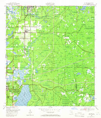
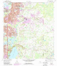
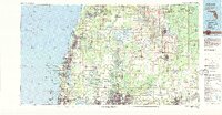
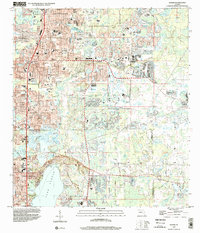
Listed on the National Register of Historic Places in 2017. 11 historic topographic surveys show this location, the earliest from 1943.
One of 72 National Register listings published here for Pinellas County · listed in 2017 · category: Site.
Sources: the National Register database, National Park Service
Regional context, not property-specific evidence. The federal wildfire occurrence database lists 117 fires within 5 miles of Rose Hill Cemetery between 1992 and 2020, burning about 1,471 acres in total. 22 started naturally. 29 were recorded as arson. Distance is straight-line from the map coordinates, so a fire counted here may appear on a neighbouring settlement's page as well.
| Reported cause | Fires |
|---|---|
| Arson/incendiarism | 29 |
| Natural | 22 |
| Misuse of fire by a minor | 18 |
| Missing data/not specified/undetermined | 17 |
| Equipment and vehicle use | 12 |
| Railroad operations and maintenance | 8 |
| Recreation and ceremony | 7 |
| Power generation/transmission/distribution | 3 |
| Smoking | 1 |
The most recent of them, most recent first, with the day each was reported and the service that recorded it.
| Date | Cause | Size | Reported by | Name on the report |
|---|---|---|---|---|
| 23 September 2010 | Recreation and ceremony | 1.0 acres | Florida Forest Service | 51/ANCLOTE FIRE-0987 |
| 16 September 1997 | Natural | 410 acres | Florida Forest Service | not named |
| 1 September 1999 | Natural | 20 acres | Florida Forest Service | not named |
| 23 August 1997 | Natural | 28 acres | Florida Forest Service | not named |
| 2 August 1999 | Natural | 31 acres | Florida Forest Service | not named |
| 10 August 2020 | Natural | 102 acres | Florida Forest Service | KEYSTONE BIKE TRAIL (52)** |
| 7 July 2016 | Missing data/not specified/undetermined | 2.0 acres | Florida Forest Service | RUSHMORE (51) |
| 5 July 2007 | Natural | 7.0 acres | Florida Forest Service | 52 LORA LANE |
Regional context, not property-specific evidence. The National Weather Service names Tarpon Springs, the town this property stands in, in 15 storm reports between 1993 and 2018: 5 thunderstorm wind, 4 lightning, 3 hail, 2 flood. The reports record 1 injury. Each account below is quoted exactly as the forecast office filed it, from the NOAA Storm Events Database, and each date opens the federal record of that event.
| When | Event | Place named | Harm | What the report says |
|---|---|---|---|---|
| August 2013 | Lightning | Tarpon Springs | 1 hurt | A 40 year old female was injured by a lightning strike. |
| August 2018 | Lightning | Tarpon Springs | $75,000 | Local broadcast media aired a story of a house fire thought to have been caused by lightning. |
| March 1993 | Thunderstorm Wind | Tarpon Springs | $50,000 | Strong winds damaged a house and the combination of wind and storm surge led to the evacuation of 15 people. |
| August 2018 | Lightning | Tarpon Springs | $25,000 | A fire at a home was suspected to have been caused by a lightning strike. The time of the lightning strike was estimated from radar. |
| July 2009 | Heavy Rain | Tarpon Springs | $20,000 | Heavy rains flooded roads in Tarpon Springs. One home on the 600 block of South Grosse Avenue was damaged as debris piled up in a nearby storm drain and caused flooding of three inches of water into the home. |
| March 2012 | Thunderstorm Wind | Tarpon Springs | $5,000 | Screens on a pool cage were ripped and a stop sign bent by estimated thunderstorm winds of 45 knots near the corner of Westwinds Drive and Cardinal Trail in Dunedin. |
| August 1996 | Flood | Tarpon Springs | $5,000 | no account filed |
| August 1996 | Lightning | Tarpon Springs | $2,500 | no account filed |
| May 2016 | Thunderstorm Wind | Tarpon Springs | $500 | Picture on social media showed a medium-sized tree down on a road near Tarpon Springs. |
| January 2011 | Hail | Tarpon Springs | $250 | There were numerous reports from the broadcast media and trained spotters from Palm Harbor to Tarpon Springs of dime to quarter sized hail. A window was broken in Tarpon Springs from the hail. |
| April 2010 | Hail | Tarpon Springs | - | The public reported up to quarter sized hail falling for five minutes east of Tarpon Springs. |
| April 2009 | Thunderstorm Wind | Tarpon Springs | - | Trees and power lines were downed in North Tarpon Springs. |
| July 2008 | Hail | Tarpon Springs | - | The public reported nickel size hail near the intersection of East Lake Road and Lansbrook Parkway in Palm Harbor. |
| April 1993 | Thunderstorm Wind | Tarpon Springs | - | A wind gust of 69 mph was reported by a spotter in Fred Howard Park in Tarpon Springs. |
| April 1996 | Flood | Tarpon Springs | - | no account filed |
United States Geological Survey topographic sheets whose coverage includes this point. Matched by taking the coordinate the National Park Service records for this property, then testing that coordinate against the published boundary of every sheet.
Other National Register properties close enough to walk or drive between, ordered by distance from this one. Both positions come from the same geocoding pass that matched these properties to their map sheets.
| Photograph | Property | Distance | Listed |
|---|---|---|---|
| Cycadia Cemetery | 0.1 miles | 2019 | |
 | Tarpon Springs High School, Old | 1.0 miles | 1990 |
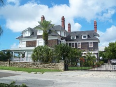 | Tarpon Springs, Depot | 1.2 miles | 1990 |
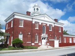 | Tarpon Springs City Hall, Old | 1.3 miles | 1990 |
 | Arcade Hotel | 1.3 miles | 1984 |
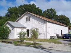 | N. G. Arfaras Sponge Packing House | 1.3 miles | 1991 |
| National Archives record | The nomination case file for reference 100000711 in Record Group 79. |
| Pinellas County | All 72 listed properties in this county. |