Block
BlockFrom the record
One of 3 National Register listings published here for Levy County · listed in 2018 · category: Building.
Sources: the National Register database, National Park Service
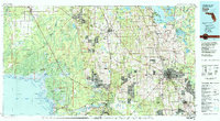
Listed on the National Register of Historic Places in 2018. 5 historic topographic surveys show this location, the earliest from 1954.
One of 3 National Register listings published here for Levy County · listed in 2018 · category: Building.
Sources: the National Register database, National Park Service
Regional context, not property-specific evidence. The federal wildfire occurrence database lists 276 fires within 5 miles of Eugene Knotts House between 1992 and 2020, burning about 1,595 acres in total. 172 started naturally. 23 were recorded as arson. Distance is straight-line from the map coordinates, so a fire counted here may appear on a neighbouring settlement's page as well.
| Reported cause | Fires |
|---|---|
| Natural | 172 |
| Arson/incendiarism | 23 |
| Railroad operations and maintenance | 19 |
| Equipment and vehicle use | 19 |
| Missing data/not specified/undetermined | 18 |
| Debris and open burning | 9 |
| Misuse of fire by a minor | 7 |
| Power generation/transmission/distribution | 5 |
| Smoking | 2 |
| Recreation and ceremony | 2 |
The most recent of them, most recent first, with the day each was reported and the service that recorded it.
| Date | Cause | Size | Reported by | Name on the report |
|---|---|---|---|---|
| 8 September 1999 | Natural | 25 acres | Florida Forest Service | not named |
| 3 September 2004 | Natural | 12 acres | Florida Forest Service | PINK FIRE-0739 |
| 28 September 2000 | Railroad operations and maintenance | 2.0 acres | Florida Forest Service | not named |
| 18 September 2006 | Smoking | under an acre | Florida Forest Service | LEVY - JIFFY LUBE FIRE |
| 17 September 1997 | Natural | 4.0 acres | Florida Forest Service | not named |
| 17 September 1997 | Natural | 5.0 acres | Florida Forest Service | not named |
| 13 September 2016 | Natural | 1.0 acres | Florida Forest Service | PALM TREE (09) |
| 13 September 1998 | Railroad operations and maintenance | 3.0 acres | Florida Forest Service | not named |
Regional context, not property-specific evidence. The federal mineral resources record lists 5 workings within 5 miles of Eugene Knotts House: 3 producers, 1 past producer, 1 unknown. 3 still produce. What was taken out: Limestone, General, Stone, Crushed/Broken. Distance is straight-line from the map coordinates, so a quarry counted here may appear on a neighbouring settlement's page as well.
| Where | Site | Commodity | Status | Recorded |
|---|---|---|---|---|
| Crystal River Quarry | Stone, Crushed/Broken | Producer | ||
| Gulf Coast Quarry | Stone, Crushed/Broken | Past Producer | ||
| Gulf Rock, Inc. - Gulf Rock No. 1 Mine | Limestone, General | Unknown | Limestone | |
| Holnam - Crystal River Quarry | Limestone, General | Producer | Limestone | |
| Independent Aggregates - Ind. Agg. Quarry | Limestone, General | Producer | Limestone |
Regional context, not property-specific evidence. The National Weather Service names Yankeetown, the town this property stands in, in 4 storm reports between 2008 and 2019: 3 thunderstorm wind, 1 tornado. No death or injury is recorded in these reports. Each account below is quoted exactly as the forecast office filed it, from the NOAA Storm Events Database, and each date opens the federal record of that event.
| When | Event | Place named | Harm | What the report says |
|---|---|---|---|---|
| June 2019 | Thunderstorm Wind | Yankeetown | $20,000 | Levy County Emergency Management reported numerous trees down in Yankeetown, a couple of which fell partially on to houses. |
| March 2011 | Thunderstorm Wind | Yankeetown | $15,000 | Trees were uprooted in Yankeetown and fell on at least one home and brought down power lines. |
| November 2008 | Thunderstorm Wind | Yankeetown | $10,000 | Trees and powerlines were downed by wind north of Crackertown. |
| May 2012 | Tornado (EF0) | Yankeetown | - | A large waterspout moved onshore at Hodges Island, then began to dissipate. Damage was limited to trees as the tornado was just north of roads and buildings in this rural area. |
United States Geological Survey topographic sheets whose coverage includes this point. Matched by taking the coordinate the National Park Service records for this property, then testing that coordinate against the published boundary of every sheet.
| National Archives record | The nomination case file for reference 100002066 in Record Group 79. |
| Levy County | All 3 listed properties in this county. |