Block
BlockFrom the record
One of 2 National Register listings published here for Holmes County · listed in 2020 · category: District.
Sources: the National Register database, National Park Service
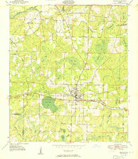
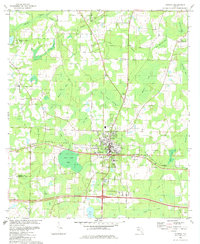
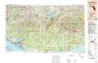
Listed on the National Register of Historic Places in 2020. 7 historic topographic surveys show this location, the earliest from 1951.
One of 2 National Register listings published here for Holmes County · listed in 2020 · category: District.
Sources: the National Register database, National Park Service
Regional context, not property-specific evidence. The federal wildfire occurrence database lists 156 fires within 5 miles of Downtown Bonifay Historic District between 1992 and 2020, burning about 490 acres in total. 9 started naturally. 6 were recorded as arson. Distance is straight-line from the map coordinates, so a fire counted here may appear on a neighbouring settlement's page as well.
| Reported cause | Fires |
|---|---|
| Railroad operations and maintenance | 41 |
| Debris and open burning | 38 |
| Missing data/not specified/undetermined | 22 |
| Equipment and vehicle use | 17 |
| Misuse of fire by a minor | 9 |
| Natural | 9 |
| Arson/incendiarism | 6 |
| Power generation/transmission/distribution | 6 |
| Smoking | 5 |
| Recreation and ceremony | 1 |
| Other causes | 1 |
| Fireworks | 1 |
The most recent of them, most recent first, with the day each was reported and the service that recorded it.
| Date | Cause | Size | Reported by | Name on the report |
|---|---|---|---|---|
| 30 September 2008 | Power generation/transmission/distribution | under an acre | Florida Forest Service | 30/COUNTY LINE FIRE-0624 |
| 24 September 2012 | Equipment and vehicle use | under an acre | Florida Forest Service | BONIFAY CHIPLEY RD (30) |
| 15 September 1999 | Recreation and ceremony | under an acre | Florida Forest Service | not named |
| 15 September 1999 | Smoking | under an acre | Florida Forest Service | not named |
| 15 September 1992 | Arson/incendiarism | under an acre | Florida Forest Service | not named |
| 13 September 2010 | Missing data/not specified/undetermined | 3.0 acres | Florida Forest Service | 30/HENRY GRAY RD-0527 |
| 11 September 1997 | Missing data/not specified/undetermined | under an acre | Florida Forest Service | not named |
| 1 September 1997 | Railroad operations and maintenance | 4.0 acres | Florida Forest Service | not named |
Regional context, not property-specific evidence. The federal mineral resources record lists 2 workings within 5 miles of Downtown Bonifay Historic District: 1 prospect, 1 unknown. None of them still produces. What was taken out: Clay. Distance is straight-line from the map coordinates, so a quarry counted here may appear on a neighbouring settlement's page as well.
| Where | Site | Commodity | Status | Recorded |
|---|---|---|---|---|
| Unnamed Clay Deposit | Clay | Prospect | ||
| Washington Co Comm. - Cook Mine | Clay | Unknown |
Regional context, not property-specific evidence. The National Weather Service names Bonifay, the town this property stands in, in 77 storm reports between 1996 and 2026: 49 thunderstorm wind, 14 flash flood, 8 hail, 4 tornado. The reports record 2 injuries. Each account below is quoted exactly as the forecast office filed it, from the NOAA Storm Events Database, and each date opens the federal record of that event.
| When | Event | Place named | Harm | What the report says |
|---|---|---|---|---|
| April 1996 | Thunderstorm Wind | Bonifay | 2 hurt, $5,000 | no account filed |
| December 2000 | Tornado (F2) | Bonifay | $750,000 | An F2 tornado touched down once just south of Bonifay, lifted, then touched down again before dissipating just east of the city. According to the Holmes County EMA, 39 homes and eight businesses were damaged, and four mobile homes were destroyed. Most of the damage occurred in the vicinity of Son-In-Law Road, just north of Interstate 10. Trees were uprooted and roofs were ripped off homes and businesses in the affected area. Numerous power lines were toppled, knocking out power to several thousand customers. A local state of emergency was declared in Holmes County. |
| April 2005 | Tornado (F1) | Bonifay | $350,000 | A tornado touched down near Boswell Road and destroyed a barn and downed several trees. After crossing County Road 177A, it damaged a home on Gator Lane and snapped many trees. Another three homes were partially destroyed on Long Round Bay Road before the tornado dissipated. Reported by WJHG-TV Panama City. |
| September 2004 | Tornado (F1) | Bonifay | $250,000 | A tornado destroyed one home and damaged several others. Scattered trees and power lines were down. Reported by the Holmes County EMA. |
| January 2016 | Thunderstorm Wind | Bonifay | $50,000 | Roof damage occurred to two buildings in Bonifay. Damage was estimated. |
| March 2000 | Thunderstorm Wind | Bonifay | $25,000 | Holmes County EMA reported five large trees down. One was blown into a residence causing minor damage. |
| October 2022 | Tornado (EF0) | Bonifay | $20,000 | A tornado touched down in a densely wooded area west of Henry Grey road in southeastern Holmes county around 1114 pm CDT. The starting point was based on a tornadic debris signature (TDS) from the Eglin Air Force Base radar, as access to this area is extremely limited. The tornado continued east just north of Sand Path Road, but was likely quite weak by the time it reached Henry Grey road. No damage was noted to homes near this intersection. The only damage noted along the path was along Barefield Lane. At this location, a small metal outbuilding was lifted and tossed into a nearby power pole. In addition, numerous fence panels were blown out. Finally, a large tree limb fell onto a vehicle. However, no structural damage to any of the surrounding manufactured homes was noted. Maximum winds were estimated at this location to be around 75 mph. The tornado likely dissipated at this point at approximately 1119 pm CDT. No additional damage was seen to the east of this location, and the TDS dissipated on radar. The tornado was rated an EF0 with max winds around 75 mph. Thanks to Holmes County Emergency management for aiding in this assessment. |
| March 1999 | Thunderstorm Wind | Bonifay | $14,000 | Portion of tin roof blown off the Holmes County Agricultural Center and lay scattered across adjacent farm fields. |
| December 2018 | Flash Flood | Bonifay | $10,000 | Many local roads were flooded near Bonifay, including the intersection of Highway 90 and Highway 79. That intersection was impassable with cars stalling. Some flooding of homes was also reported in the area. |
| July 2013 | Thunderstorm Wind | Bonifay | $10,000 | Numerous trees were blown down, including one tree that fell and damaged a porch in Bonifay. |
| April 2006 | Thunderstorm Wind | Bonifay | $10,000 | A roof was blown off a home located on Stellers Road off Highway 179. Reported by the Holmes County EMA. |
| February 2004 | Thunderstorm Wind | Bonifay | $10,000 | A roof was ripped off a barn with several downed trees near the intersection of County Road 173 and Antique Road. Reported by the Holmes County Sheriff. |
| August 2024 | Thunderstorm Wind | Bonifay | $5,000 | A tree was blown down on a carport and power line in the Bonifay area. |
| June 2023 | Thunderstorm Wind | Bonifay | $5,000 | Numerous trees and power lines were blown down. |
| June 2018 | Thunderstorm Wind | Bonifay | $5,000 | Numerous trees and power lines were blown down. |
| February 2012 | Thunderstorm Wind | Bonifay | $5,000 | Several trees were blown down with power outages north of Bonifay. Monetary damage was estimated. |
| July 2007 | Thunderstorm Wind | Bonifay | $5,000 | Numerous trees and power lines were down throughout the city. |
| January 2024 | Thunderstorm Wind | Bonifay | $3,000 | Power lines were blown down on Hubbard Street. |
| June 2019 | Thunderstorm Wind | Bonifay | $3,000 | Multiple trees and power lines were blown down. |
| February 2016 | Thunderstorm Wind | Bonifay | $3,000 | State Highway 79 was closed due to down power lines on the road. |
| January 2024 | Thunderstorm Wind | Bonifay | $2,000 | A tree was blown down in front of 403 North Tracy along with power lines blocking the road. |
| January 2024 | Thunderstorm Wind | Bonifay | $2,000 | Wind damage occurred to a barn, gazebo, carport, and a large wooden playground. In addition, a tree blew down. |
| June 2021 | Thunderstorm Wind | Bonifay | $2,000 | A power pole was blown down on Lee Valley Road. |
| May 2015 | Thunderstorm Wind | Bonifay | $2,000 | Two tree and a power line were blown down about a quarter mile north of Bonifay. |
| September 2013 | Thunderstorm Wind | Bonifay | $2,000 | Trees were blown down on Bonifay-Gritney Road. |
| January 2013 | Thunderstorm Wind | Bonifay | $2,000 | A piece of metal roofing and/or awning was blown off a gas station near Bonifay. A picture was submitted via Twitter. Monetary damage was estimated. |
| March 2007 | Thunderstorm Wind | Bonifay | $2,000 | The Holmes County Sheriff reported trees and power lines down north of Bonifay, with power outages in Bonifay. |
| June 2004 | Thunderstorm Wind | Bonifay | $2,000 | Downed trees and power lines on Highway 177A reported by the Holmes County EMA. |
| June 2004 | Thunderstorm Wind | Bonifay | $2,000 | Downed trees and power lines reported by a HAM radio operator. |
| July 2000 | Thunderstorm Wind | Bonifay | $2,000 | Some trees down on power lines. Reported by the Holmes County Sheriff. |
| December 2018 | Thunderstorm Wind | Bonifay | $1,000 | A tree was blown down along Highway 90 along with a power line. |
| August 2014 | Thunderstorm Wind | Bonifay | $1,000 | A tree and a power line were blown down in the Bonifay area. |
| June 2013 | Thunderstorm Wind | Bonifay | $1,000 | A tree was blown down across Highway 177A. |
| July 2013 | Thunderstorm Wind | Bonifay | $1,000 | A tree was blown down and blocking Thomas Dr. |
| June 2000 | Thunderstorm Wind | Bonifay | $1,000 | Numerous trees down at 177 Ten Mile Creek, Shady Grove Church and Winterville Church. Reported by the Holmes County EMA. |
| August 2000 | Thunderstorm Wind | Bonifay | $1,000 | A few trees and power lines down. Reported by the Holmes County EMA. |
| November 2006 | Thunderstorm Wind | Bonifay | $500 | Several downed trees in Bonifay reported by a county 911 dispatcher. |
| August 2006 | Thunderstorm Wind | Bonifay | $250 | A few downed trees along State Highway 79 reported by the Holmes County Sheriff. |
| January 2026 | Thunderstorm Wind | Bonifay | - | Trees were blown down in Holmes county in the Bonifay area. |
| January 2024 | Thunderstorm Wind | Bonifay | - | Trees were blown down on Bethel Road. |
| January 2024 | Thunderstorm Wind | Bonifay | - | Trees were blown down on Sandpath Road just past the back entrance to the schools. |
| January 2024 | Thunderstorm Wind | Bonifay | - | A tree was blown down onto Byrd Ave near Weeks Street. |
| May 2024 | Thunderstorm Wind | Bonifay | - | Trees were blown down on Highway 177. |
| May 2024 | Thunderstorm Wind | Bonifay | - | A tree was blown down onto power lines along Highway 173 northeast of Bonifay. |
| April 2024 | Flash Flood | Bonifay | - | Water was over roadways in the Bonifay area. |
| July 2023 | Thunderstorm Wind | Bonifay | - | Scattered trees and power lines were blown down. |
| June 2023 | Hail | Bonifay | - | There were several reports of hail in Bonifay up to quarter size. |
| June 2022 | Thunderstorm Wind | Bonifay | - | Trees were blown down south of Bonifay. |
| April 2021 | Flash Flood | Bonifay | - | The intersection of Highway 79 and 177 was covered in water. |
| August 2021 | Flash Flood | Bonifay | - | Water was beginning to cover Highway 79 in both directions as well as adjacent business parking lots in Bonifay. |
| August 2021 | Flash Flood | Bonifay | - | Several streets were closed due to flash flooding in Bonifay. |
| January 2020 | Thunderstorm Wind | Bonifay | - | A tree was blown down near Bonifay. |
| August 2020 | Flash Flood | Bonifay | - | Flooding of dirt roads was reported in Holmes county via the Holmes District School Board Facebook page. |
| September 2020 | Flash Flood | Bonifay | - | Highway 79 was closed from Highway 90 to Bird Road due to flooding. |
| September 2020 | Flash Flood | Bonifay | - | Highway 79 north of Northdale Ave was closed due to flooding. |
| April 2020 | Thunderstorm Wind | Bonifay | - | Widespread trees were blown down. |
| April 2020 | Thunderstorm Wind | Bonifay | - | Several trees were blown down. |
| March 2019 | Thunderstorm Wind | Bonifay | - | A tree was blown down in the Bonifay area. |
| April 2019 | Thunderstorm Wind | Bonifay | - | Trees were blown down near Bonifay. |
| May 2019 | Thunderstorm Wind | Bonifay | - | Multiple trees were blown down near Highway 79 north of Bonifay. |
United States Geological Survey topographic sheets whose coverage includes this point. Matched by taking the middle of the area the National Park Service maps for this listing, then testing that coordinate against the published boundary of every sheet.
| National Archives record | The nomination case file for reference 100005242 in Record Group 79. |
| Holmes County | All 2 listed properties in this county. |