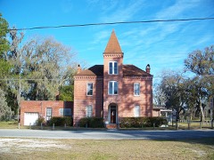
| February 1998 | Thunderstorm Wind | Jasper | $250,000 | Roof blown off of a large building. |
| March 2001 | Tornado (F2) | Jasper | $80,000 | One mobile home and one church were destroyed. Two vehicles damaged. Tornado ranged from F0-F2 and skipped along the path. Numerous trees and power lines were blown down. |
| June 2020 | Flash Flood | Jasper | $35,000 | FDEM reported that the Hamilton EOC was flooded. Computers, furniture and records on the main floor were damaged. The road department reported that there was $30-$35K of repairs to roadways needed. The cost of damage for the EOC was unknown. |
| February 1998 | Tornado (F0) | Jasper | $35,000 | One home destroyed |
| February 1998 | Flash Flood | Jasper | $30,000 | Numerous road were closed due to excessive flooding. |
| March 2026 | Thunderstorm Wind | Jasper | $17,000 | Roof damage to a couple of homes and an uprooted tree were reported along SW Pennington Farm Rd near Jasper. |
| May 2016 | Thunderstorm Wind | Jasper | $10,000 | A tree fell on a home and destroyed it. Another tree fell onto a mobile home and destroyed it. Power lines were blown down. Pea size hail was also reported. The cost of damage was unknown, but it was estimated for the event to be included in StormData. |
| January 2007 | Thunderstorm Wind | Jasper | $10,000 | Several damaged chicken and quail coops blown on to County Road 6 along with power lines down on road. Power outages reported in the county. County Emergency Management surveyed at the damage. |
| December 2002 | Thunderstorm Wind | Jasper | $5,000 | Numerous large trees and power lines down across road |
| June 2000 | Thunderstorm Wind | Jasper | $3,000 | Large trees and power lines were blown down. |
| November 1999 | Tornado (F0) | Jasper | $3,000 | Tornado was weak, with most of the damage at tree top level. Tornado moved into Echols County, Georgia. |
| March 2000 | Flash Flood | Jasper | $3,000 | no account filed |
| July 2001 | Thunderstorm Wind | Jasper | $2,500 | Large trees and power lines were blown down. |
| March 2000 | Thunderstorm Wind | Jasper | $2,500 | Large trees and power lines were blown down. |
| August 2000 | Thunderstorm Wind | Jasper | $2,500 | Large trees and power lines were blown down. |
| January 2000 | Thunderstorm Wind | Jasper | $2,500 | Large trees and power lines were blown down. |
| September 1998 | Thunderstorm Wind | Jasper | $2,500 | Large trees and power lines were blown down. |
| October 1997 | Tornado (F0) | Jasper | $2,500 | no account filed |
| June 2002 | Thunderstorm Wind | Jasper | $2,000 | Large trees down. |
| November 2002 | Thunderstorm Wind | Jasper | $2,000 | Large trees down on NW 44th Street in Jasper. |
| November 2002 | Thunderstorm Wind | Jasper | $2,000 | Large trees down over road and on power lines at SW 99th Street in Jasper. |
| November 1999 | Thunderstorm Wind | Jasper | $2,000 | Large trees were blown down. |
| March 1998 | Thunderstorm Wind | Jasper | $2,000 | Large trees and power lines were blown down. |
| February 1998 | Thunderstorm Wind | Jasper | $1,500 | Large trees were blown down. |
| November 2003 | Thunderstorm Wind | Jasper | $1,000 | Three pine trees down near school. Some power outages. |
| May 2002 | Thunderstorm Wind | Jasper | $1,000 | Large trees down across power lines, one tree leaning on a house. |
| June 2017 | Thunderstorm Wind | Jasper | $200 | A tree was blown down on 5th Avenue SW in Jasper. The cost of damage was estimated. |
| April 2021 | Thunderstorm Wind | Jasper | - | Homes were damaged in the Waters Mobile Home Park. Numerous trees were blown down. The time of damage was based on radar. |
| April 2021 | Thunderstorm Wind | Jasper | - | A tree was blown down onto a home at 211 3rd Street in SW Jasper. |
| April 2019 | Thunderstorm Wind | Jasper | - | Florida State Warning Point relayed report of a tree blown down onto the porch of a home. The time of damage was based on radar. |
| April 2018 | Thunderstorm Wind | Jasper | - | Two tree limbs were blown down and blocked a road and a flag pole was blown down. The time of damage was based on radar. |
| January 2017 | Thunderstorm Wind | Jasper | - | The Hamilton High School mesonet station measured a thunderstorm wind gust to 58 mph. |
| April 2017 | Thunderstorm Wind | Jasper | - | A tree was blown down just east of Jasper. The time of damage was based on radar. |
| December 2015 | Thunderstorm Wind | Jasper | - | Wind damage occurred at the Hamilton County Elementary School. Multiple power lines were blown down and one was blown onto a roof. The roof was blown off of one of the school building. No injuries were reported. The school was evacuated. The cost of damage was unknown. |
| August 2015 | Thunderstorm Wind | Jasper | - | Trees were blown down along 2nd Avenue NW in Jasper and County Road 6 East and 120th Avenue. |
| May 2015 | Thunderstorm Wind | Jasper | - | Significant damage occurred to a mobile home roof. Numerous large tree limbs were blown down. |
| July 2015 | Thunderstorm Wind | Jasper | - | A tree was blown down onto a power line along 99th Avenue. |
| July 2014 | Thunderstorm Wind | Jasper | - | Numerous trees were blown down across the county. Two homes had fallen trees. The time of damage was based on radar. The cost of damage was unknown. |
| January 2014 | Thunderstorm Wind | Jasper | - | Numerous trees were blown down. |
| June 2011 | Thunderstorm Wind | Jasper | - | Several trees were blown down in the western portion of the county near Jasper. The time was based on radar imagery. |
| July 2011 | Thunderstorm Wind | Jasper | - | Trees and power lines were blown down near the Jasper city limits. The time of damage was based on radar imagery. |
| August 2009 | Thunderstorm Wind | Jasper | - | A tree was blown down across Highway 129 near Interstate 75. The time of the event was based on radar. |
| February 2008 | Lightning | Jasper | - | Emergency management reported one female county employee indirectly struck by lightning while on the phone. EMS treated and released her. |
| August 2008 | Thunderstorm Wind | Jasper | - | A spotter reported trees blown down between Jasper and Jennings. Most of the damage was near Highway 41 North and State Road 6. The time of the event was based on radar. |
| March 2007 | Thunderstorm Wind | Jasper | - | Reports of ten (10) trees down in various parts of the county. |
| May 2007 | Hail | Jasper | - | Quarter inch hail fell in Jasper. |
| May 2007 | Thunderstorm Wind | Jasper | - | Thunderstorm wind gusts blew down trees along Highway 129, about 2 miles north of Jasper. |
| May 2007 | Thunderstorm Wind | Jasper | - | Thunderstorm winds blew down a large tree that split a power pole in half in the city of Jasper. |
| May 2003 | Thunderstorm Wind | Jasper | - | Large trees and power lines down near Highways 41 and 129. |
| May 2003 | Thunderstorm Wind | Jasper | - | Numerous reports of trees and power lines down. Most extensive damage just south of Jasper near US Highway 41 and Highway 129. Pea sized hail also reported. |
| December 2002 | Thunderstorm Wind | Jasper | - | Tree down in city of Jasper. |
| July 1998 | Wildfire | Jasper | - | 125 acres, 5 homes destroyed and two vehicles destroyed or damaged. |
| May 1995 | Hail | Jasper | - | Dime-size hail fell near Jasper. |
| June 1994 | Thunderstorm Wind | Jasper | - | Sheriff's' office reported trees down and damage to a mobile home in Jasper. |
| February 2006 | Hail | Jasper | - | no account filed |
| February 2006 | Hail | Jasper | - | no account filed |
| February 2006 | Hail | Jasper | - | no account filed |
| July 2006 | Thunderstorm Wind | Jasper | - | no account filed |
| July 2006 | Thunderstorm Wind | Jasper | - | no account filed |
| March 2005 | Hail | Jasper | - | no account filed |
 Block
Block