BlockBefore
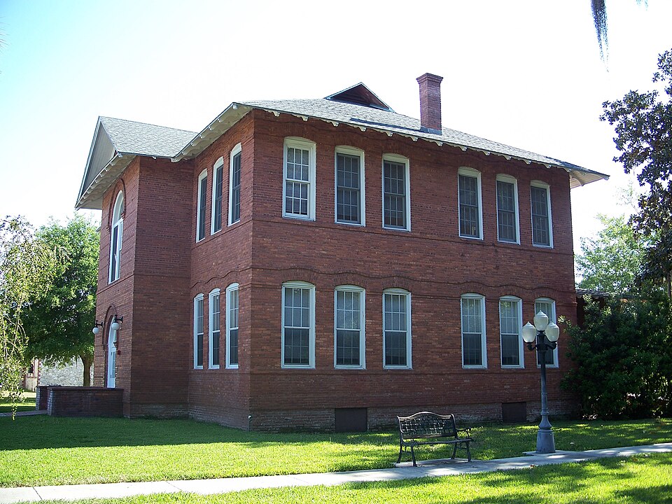
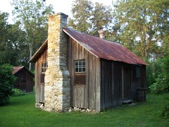
Photograph of Newberry Historic District (Newberry, Florida)
Photograph by Ebyabe, CC BY 2.5. Via Wikimedia Commons.

Newberry Historic District

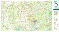
Listed on the National Register of Historic Places in 1987. 5 historic topographic surveys show this location, the earliest from 1954.

From the record

“The Newberry Historic District is a U.S. historic district located in Newberry, Florida. It encompasses approximately 400 acres (1.6 km2), bounded by Northwest 2nd Avenue, Northwest 2nd Street, Lucile Street, and Northwest 9th Street.”

Wikipedia article Newberry Historic District (Newberry, Florida), CC BY-SA 4.0.

One of 64 National Register listings published here for Alachua County · listed in 1987 · category: District.

Sources: the Wikipedia article · the case file at the National Archives · the National Register database, National Park Service · the Wikipedia article

The listing

Fires near this property

132 since 1992

Regional context, not property-specific evidence. The federal wildfire occurrence database lists 132 fires within 5 miles of Newberry Historic District between 1992 and 2020, burning about 822 acres in total. 7 started naturally. 4 were recorded as arson. Distance is straight-line from the map coordinates, so a fire counted here may appear on a neighbouring settlement's page as well.

Reported cause Fires
Railroad operations and maintenance38
Debris and open burning33
Missing data/not specified/undetermined22
Equipment and vehicle use10
Natural7
Misuse of fire by a minor5
Recreation and ceremony5
Power generation/transmission/distribution4
Arson/incendiarism4
Other causes2
Smoking2

The most recent of them, most recent first, with the day each was reported and the service that recorded it.

DateCause SizeReported by Name on the report
15 September 2005Debris and open burningunder an acreFlorida Forest ServiceBUMBLE FIRE/ GILCHRIST
14 September 2005Equipment and vehicle use1.0 acresFlorida Forest ServiceDAN'S BALER FIRE/ ALACHUA
30 August 2008Missing data/not specified/undeterminedunder an acreFlorida Forest ServiceALACHUA/2008-08-0629
11 August 1992Natural2.0 acresFlorida Forest Servicenot named
9 July 1992Debris and open burning10 acresFlorida Forest Servicenot named
31 July 2002Railroad operations and maintenanceunder an acreFlorida Forest Servicenot named
15 July 1995Natural3.5 acresFlorida Forest Servicenot named
12 July 1992Railroad operations and maintenance3.5 acresFlorida Forest Servicenot named

Every fire recorded in Alachua County

Specimens collected near this property

12 of 678 shown

Regional context, not property-specific evidence. Museums hold 678 specimens collected within 10 miles of Newberry Historic District between 1860 and 1975: 447 Animalia, 122 Plantae, 64 Fungi, 44 Protozoa, 1 Unrecorded. 12 distinct Species records are shown. Collected by A Chable & W McLane, A. Koebele, A. L. Quaintance and others. Each is a physical object with a catalogue number, and each entry opens the museum's record. This is what was collected and kept, not a survey of what lives here - nothing can be concluded from a species being absent.

Image SpeciesYear Collected by Where, as recorded
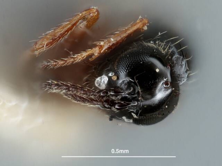
Specimen of Piezobria Forster, 1869Piezobria Forster, 18691882[Not Stated]Archer
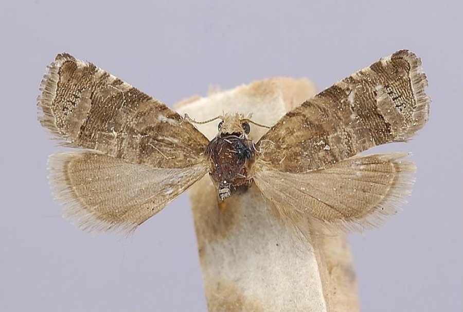
Specimen of Satronia tantilla Heinrich, 1926Satronia tantilla Heinrich, 19261882[Not Stated]Archer
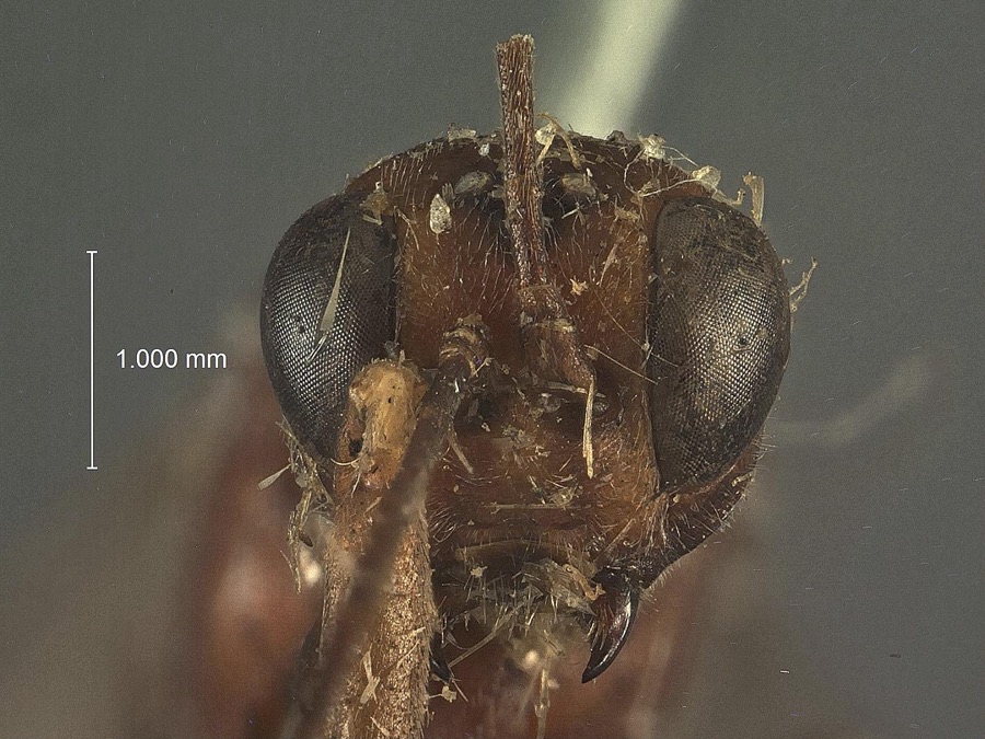
Specimen of Xylonomus Gravenhorst, 1829Xylonomus Gravenhorst, 18291882[Not Stated]Archer
A photograph of the species Myotis austroriparius, not of this specimenMyotis austroriparius (Rhoads, 1897)1860unknownGainesville, 10 mi. W
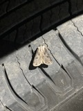
A photograph of the species Agrotis malefida, not of this specimenAgrotis malefida Guenée, 18521882Lugger, O.Archer
A photograph of the species Aulonothroscus schwarzi, not of this specimenAulonothroscus schwarzi Blanchard, 19171882M. Hubbard & SchwarzArcher
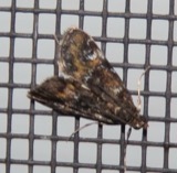
A photograph of the species Elophila Hübner, not of this specimenElophila Hübner, 18221882A. KoebeleArcher
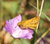
A photograph of the species Hylephila phyleus, not of this specimenHylephila phyleus (Drury, 1773)1882not recordedArcher
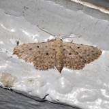
A photograph of the species Sigela penumbrata, not of this specimenSigela penumbrata Hulst, 18961882KoebeleArcher
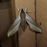
A photograph of the species Xylophanes tersa, not of this specimenXylophanes tersa Linnaeus, 17711882not recordedArcher
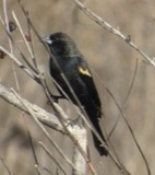
A photograph of the species Agelaius phoeniceus, not of this specimenAgelaius phoeniceus (Linnaeus, 1766)1885M. MartinFLORIDA: Alachua County; Archer
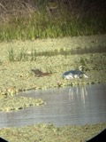
A photograph of the species Butorides virescens, not of this specimenButorides virescens (Linnaeus, 1758)1885M. MartinFLORIDA: Alachua County; Archer

All 678 specimens within 10 miles, at the Global Biodiversity Information Facility.

Mines and quarries near this property

10 of 17 shown

Regional context, not property-specific evidence. The federal mineral resources record lists 17 workings within 5 miles of Newberry Historic District: 8 past producers, 8 producers, 1 unknown. 8 still produce. What was taken out: Stone, Crushed/Broken, Limestone, General, Sand. Distance is straight-line from the map coordinates, so a quarry counted here may appear on a neighbouring settlement's page as well.

Where SiteCommodity StatusRecorded
Dickerson Fla.SandPast Producer
Watson Construction, Inc. - Newberry MineSandUnknown
Limerock Industries - Newberry MineLimestone, GeneralProducerLimestone
Limestone Prod.Limestone, GeneralProducerLimestone
Limestone Prod. (Haile)Limestone, GeneralProducerLimestone
Limestone Products - NewberryLimestone, GeneralProducerLimestone
White Constr.Limestone, GeneralProducerLimestone
Haile PitStone, Crushed/BrokenProducer
Unnamed Limestone QuarryStone, Crushed/BrokenPast Producer

Every working recorded in Alachua County

Storms near this property

29 since 1996

Regional context, not property-specific evidence. The National Weather Service names Newberry, the town this property stands in, in 29 storm reports between 1996 and 2023: 18 thunderstorm wind, 7 hail, 2 heavy rain, 1 lightning. The reports record 1 injury. Each account below is quoted exactly as the forecast office filed it, from the NOAA Storm Events Database, and each date opens the federal record of that event.

WhenEvent Place namedHarm What the report says
June 2014Thunderstorm WindNewberry1 hurtA possible tornado touchdown was reported near Newberry. Trees and power lines were blown down by storng wind gusts. One person was injured in an apartment complex.
March 2022Thunderstorm WindNewberry$1,000,000Thunderstorm wind knocked down powerlines onto CR-235 at the intersection of CR-235 and 5th Ave in Newberry. This led to the closure of CR-235 at this intersection.
June 2000Thunderstorm WindNewberry$8,000Large trees and power lines were blown down. Car damaged.
July 1996Thunderstorm WindNewberry$5,500no account filed
May 1999Thunderstorm WindNewberry$2,500Large trees were blown down and a shed was damaged.
May 2017Thunderstorm WindNewberry$2,000Trees and power lines were blown down in Newberry. The cost of damage was unknown, but it was estimated for the event to be included in Storm Data.
July 2019Thunderstorm WindNewberry$1,000Large tree limbs and fence material were blown around by strong winds. The time of damage was based on radar. The cost of damage was unknown, but it was estimated for the inclusion of the event in Storm Data.
June 2023Thunderstorm WindNewberry-Wind gusts of 70 to 75 mph were measured about 2 miles southwest of Newberry.
June 2023Funnel CloudNewberry-A spotter reported a funnel cloud descending from a rotating wall cloud with a supercell.
May 2019Heavy RainNewberry-A Weather Underground site reported 2.94 inches of rainfall in 2 hrs and 40 minutes.
March 2018Thunderstorm WindNewberry-Numerous trees were blown down.
July 2016Thunderstorm WindNewberry-A tree was blown down and blocked the road along CR 235.
July 2016Thunderstorm WindNewberry-A tree was blown down an blocked the roadwayt at 21603 SW 46th Avenue.
June 2014Thunderstorm WindNewberry-A building suffered moderate damage at 10 NW 250th Street and a gas station canopy was toppled over.
June 2014LightningNewberry-One person was injured by a lightning strike at 2706 NW 245th Drive in Newberry.
June 2013Thunderstorm WindNewberry-A large tree was blown down on County Road 235 and NW 22nd Avenue.
October 2012Thunderstorm WindNewberry-A tree was blown down.
July 2011HailNewberry-A deputy reported golf ball size hail at 23300 W Newberry Road.
February 2011HailNewberry-A spotter reported heavy penny size hail for 2 minutes on State Road 26 at the Alachua and Gilchrist county line.
April 2010Thunderstorm WindNewberry-Numerous trees were blown down along Highway 26 and Highway 90.
July 2009Thunderstorm WindNewberry-A Gainesville television station reported 10 large trees were blown down across a field. The time of the event was based on radar.
October 2008HailNewberry-A Kangaroo Express employee was traveling east of Newberry and experienced hail penny to pea size along County Road 235. The time of the event was based on radar.
April 2008Thunderstorm WindNewberry-Trees and power lines were blown down in the vicinity of Newberry.
August 2008Thunderstorm WindNewberry-Numerous power lines were blown down in Newberry.
June 2015HailNewberry-no account filed
August 2004Heavy RainNewberry-no account filed
June 2003HailNewberry-no account filed
June 1999HailNewberry-no account filed
August 1998HailNewberry-no account filed

Every storm recorded in Alachua County

Maps showing this location

5 surveys

United States Geological Survey topographic sheets whose coverage includes this point. Matched by taking the middle of the area the National Park Service maps for this listing, then testing that coordinate against the published boundary of every sheet.

Listed places nearby

1 within 8 miles

Other National Register properties close enough to walk or drive between, ordered by distance from this one. Both positions come from the same geocoding pass that matched these properties to their map sheets.

Photograph PropertyDistance Listed
Dudley Farm4.4 miles2002

Sources for this property

National Archives recordThe nomination case file for reference 87002150 in Record Group 79.
Wikipedia articleCommunity-written account of this property, licensed CC BY-SA.
Alachua CountyAll 64 listed properties in this county.

Provenance

  • Listing record. National Park Service National Register of Historic Places, listed-properties dataset, current to 2026-05-22.
  • Map join. Address geocoded through the United States Census geocoder, then tested against the published boundary of every sheet in the USGS Historical Topographic Map Collection.
  • How this page is made. Listing fields come from federal records; map-sheet coverage is a labelled coordinate-to-boundary calculation, not a source-field claim.
  • Wildfire. Short, Karen C. 2022. Spatial wildfire occurrence data for the United States, 1992-2020 [FPA_FOD_20221014]. 6th Edition. Fort Collins, CO: Forest Service Research Data Archive. https://doi.org/10.2737/RDS-2013-0009.6 Collected with United States Government funding and usable without additional permissions or fees.
  • Specimens. Global Biodiversity Information Facility (GBIF), https://www.gbif.org/. Only records licensed CC0 or CC BY are used. Records licensed CC BY-NC are excluded because this site carries advertising. Images are checked individually and any whose licence is non-commercial, no-derivatives or unreadable is refused.
  • Mines and quarries. USGS Mineral Resources Data System (MRDS) https://mrdata.usgs.gov/mrds/ A work of the United States government, no copyright under 17 U.S.C. 105.
  • Storms. NOAA National Centers for Environmental Information, Storm Events Database https://www.ncei.noaa.gov/stormevents/ A work of the United States government, no copyright under 17 U.S.C. 105. Narratives are quoted verbatim from the National Weather Service report and are not edited or summarised.