BlockBefore
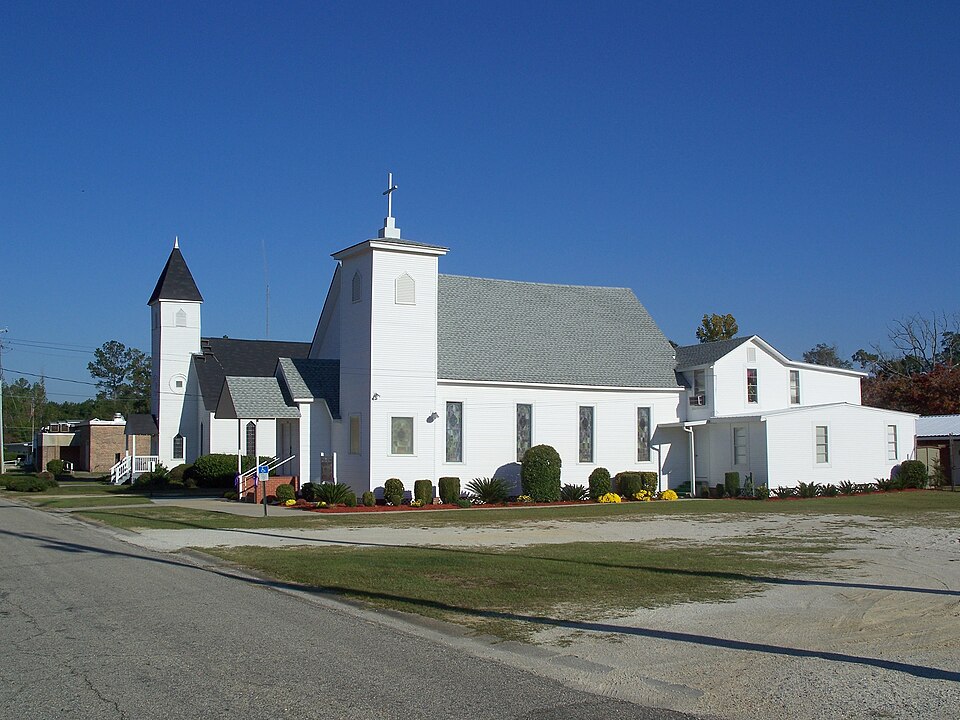
Photograph of Alger-Sullivan Lumber Company Residential Historic District
Photograph by Ebyabe, CC BY-SA 3.0. Via Wikimedia Commons.

Alger-Sullivan Lumber Company Residential Historic District

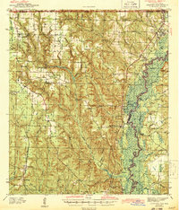
Listed on the National Register of Historic Places in 1989. 7 historic topographic surveys show this location, the earliest from 1941.

From the record

“The Alger-Sullivan Lumber Company Residential Historic District is a historic district in Century, Florida. The district is bounded by Pinewood Avenue, Front Street, Jefferson Avenue, Church Street, and Mayo Street, encompasses approximately 23 acres (93,000 m2), and contains 45 historic buildings.”

Wikipedia article Alger-Sullivan Lumber Company Residential Historic District, CC BY-SA 4.0.

One of 38 National Register listings published here for Escambia County · listed in 1989 · category: District.

Sources: the Wikipedia article · the case file at the National Archives · the National Register database, National Park Service

The listing

Fires near this property

237 since 1992

Regional context, not property-specific evidence. The federal wildfire occurrence database lists 237 fires within 5 miles of Alger-Sullivan Lumber Company Residential Historic District between 1992 and 2020, burning about 781 acres in total. 3 started naturally. 37 were recorded as arson. Distance is straight-line from the map coordinates, so a fire counted here may appear on a neighbouring settlement's page as well.

Reported cause Fires
Debris and open burning64
Railroad operations and maintenance46
Missing data/not specified/undetermined41
Arson/incendiarism37
Equipment and vehicle use22
Recreation and ceremony11
Misuse of fire by a minor5
Smoking4
Natural3
Fireworks3
Other causes1

The most recent of them, most recent first, with the day each was reported and the service that recorded it.

DateCause SizeReported by Name on the report
9 September 2010Equipment and vehicle useunder an acreAlabama Forestry Commissionnot named
6 September 1995Debris and open burning1.5 acresFlorida Forest Servicenot named
30 September 2000Missing data/not specified/undetermined1.0 acresAlabama Forestry Commissionnot named
30 September 1995Recreation and ceremonyunder an acreAlabama Forestry Commissionnot named
29 September 1997Railroad operations and maintenanceunder an acreAlabama Forestry Commissionnot named
28 September 2008Debris and open burningunder an acreAlabama Forestry Commission71 VIVAL PATHE LANE, AL
27 September 2019Debris and open burningunder an acreFlorida Forest ServiceJETER LANE (17)
26 September 2008Arson/incendiarism53 acresAlabama Forestry Commissionnot named

Every fire recorded in Escambia County

Mines and quarries near this property

10 of 17 shown

Regional context, not property-specific evidence. The federal mineral resources record lists 17 workings within 5 miles of Alger-Sullivan Lumber Company Residential Historic District: 7 producers, 5 unknowns, 3 past producers, 1 occurrence. 7 still produce. What was taken out: Sand and Gravel, Construction, Sand, Clay, Stone, Crushed/Broken. Distance is straight-line from the map coordinates, so a quarry counted here may appear on a neighbouring settlement's page as well.

Where SiteCommodity StatusRecorded
JayPetroleum (Oil), SulfurUnknown
Mixon Gravel PitStone, Crushed/BrokenProducer
Esc 3 Clay ProspectClayProspect
Wiggins W H ProspectClayOccurrence
Campbell Sand and Gravel - Century MineSandUnknown
Pace Sand and Gravel - Bluff Springs MineSandUnknown
Pace Sand and Gravel - Century Pit #1SandUnknown
Pace Sand and Gravel - Century Pit #2SandUnknown
Bluff Springs MineSand and Gravel, ConstructionPast Producer
Century MineSand and Gravel, ConstructionProducer

Every working recorded in Escambia County

Storms near this property

14 since 1995

Regional context, not property-specific evidence. The National Weather Service names Century, the town this property stands in, in 14 storm reports between 1995 and 2023: 8 thunderstorm wind, 4 hail, 1 funnel cloud, 1 tornado. No death or injury is recorded in these reports. Each account below is quoted exactly as the forecast office filed it, from the NOAA Storm Events Database, and each date opens the federal record of that event.

WhenEvent Place namedHarm What the report says
October 2004Thunderstorm WindCentury$40,000High winds from a thunderstorm caused minor damage to eight homes west of Century. Most of the damage was to roofs and out buildings.
February 2008Thunderstorm WindCentury$40,000no account filed
June 2008Thunderstorm WindCentury$12,000High winds from a thunderstorm blew down several trees and power lines in Century.
May 2006Thunderstorm WindCentury$12,000High winds from a thunderstorm blew down several trees and power lines near Century. Wind speeds were estimated at around 70 MPH.
April 2007Thunderstorm WindCentury$10,000Tree and roof damage along with outbuilding damage on Hwy 4 just west of Century.
March 1999Thunderstorm WindCentury$10,000Trees and power lines were blown down near Century.
January 2016Thunderstorm WindCentury$5,000Winds estimated at 70 mph destroyed a metal barn on Highway 4A.
August 2005Tornado (F0)Century$5,000The weak tornado that developed in Santa Rosa county, west of Munson, moved into Escambia county from the southeast. The weak tornado dissipated near Century. The tornado blew down several trees and power lines just southeast of Century.
May 1995Thunderstorm WindCentury$500Several trees and power lines were blown down just north of Century.
October 2004Funnel CloudCentury-Local Emergency Management personnel, while looking at wind damage that had occurred earlier in the day, observed a funnel cloud for several minutes. The funnel cloud never touched down and went back into the cloud.
May 2023HailCentury-no account filed
March 2003HailCentury-no account filed
May 2003HailCentury-no account filed
August 1996HailCentury-no account filed

Every storm recorded in Escambia County

Maps showing this location

7 surveys

United States Geological Survey topographic sheets whose coverage includes this point. Matched by taking the middle of the area the National Park Service maps for this listing, then testing that coordinate against the published boundary of every sheet.

Sources for this property

National Archives recordThe nomination case file for reference 89001586 in Record Group 79.
Wikipedia articleCommunity-written account of this property, licensed CC BY-SA.
Escambia CountyAll 38 listed properties in this county.

Provenance

  • Listing record. National Park Service National Register of Historic Places, listed-properties dataset, current to 2026-05-22.
  • Map join. Address geocoded through the United States Census geocoder, then tested against the published boundary of every sheet in the USGS Historical Topographic Map Collection.
  • How this page is made. Listing fields come from federal records; map-sheet coverage is a labelled coordinate-to-boundary calculation, not a source-field claim.
  • Wildfire. Short, Karen C. 2022. Spatial wildfire occurrence data for the United States, 1992-2020 [FPA_FOD_20221014]. 6th Edition. Fort Collins, CO: Forest Service Research Data Archive. https://doi.org/10.2737/RDS-2013-0009.6 Collected with United States Government funding and usable without additional permissions or fees.
  • Mines and quarries. USGS Mineral Resources Data System (MRDS) https://mrdata.usgs.gov/mrds/ A work of the United States government, no copyright under 17 U.S.C. 105.
  • Storms. NOAA National Centers for Environmental Information, Storm Events Database https://www.ncei.noaa.gov/stormevents/ A work of the United States government, no copyright under 17 U.S.C. 105. Narratives are quoted verbatim from the National Weather Service report and are not edited or summarised.