BlockBefore
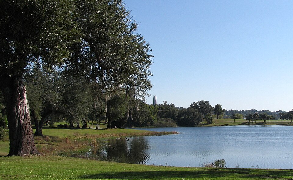
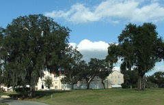
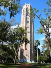
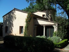
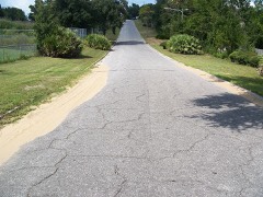
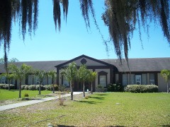
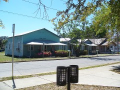
Photograph of Mountain Lake Estates Historic District
Photograph by Nerdomatic, CC BY-SA 3.0. Via Wikimedia Commons.

Mountain Lake Estates Historic District

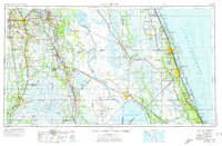
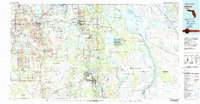
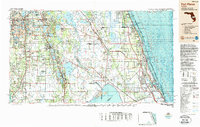
Listed on the National Register of Historic Places in 1993. 6 historic topographic surveys show this location, the earliest from 1952.

From the record

“Mountain Lake is a private community and U.S. historic district north of the City of Lake Wales, Florida, United States, off the FL 17 Scenic Highway. Mountain Lake was founded in 1915, with major development of the property commencing in the 1920s.”

Wikipedia article Mountain Lake, Florida, CC BY-SA 4.0.

One of 78 National Register listings published here for Polk County · listed in 1993 · category: District.

Sources: the Wikipedia article · the case file at the National Archives · the National Register database, National Park Service · the Wikipedia article

The listing

  • Address. US 27A N of Lake Wales, Lake Wales, 33898
  • When was it listed? August 1993
  • Category. district
  • Census division. Lake Wales
  • National Register reference number. 93000871 - the number the National Park Service assigned this property when it was listed, and the key its nomination file is catalogued under at the National Archives.

Then and now

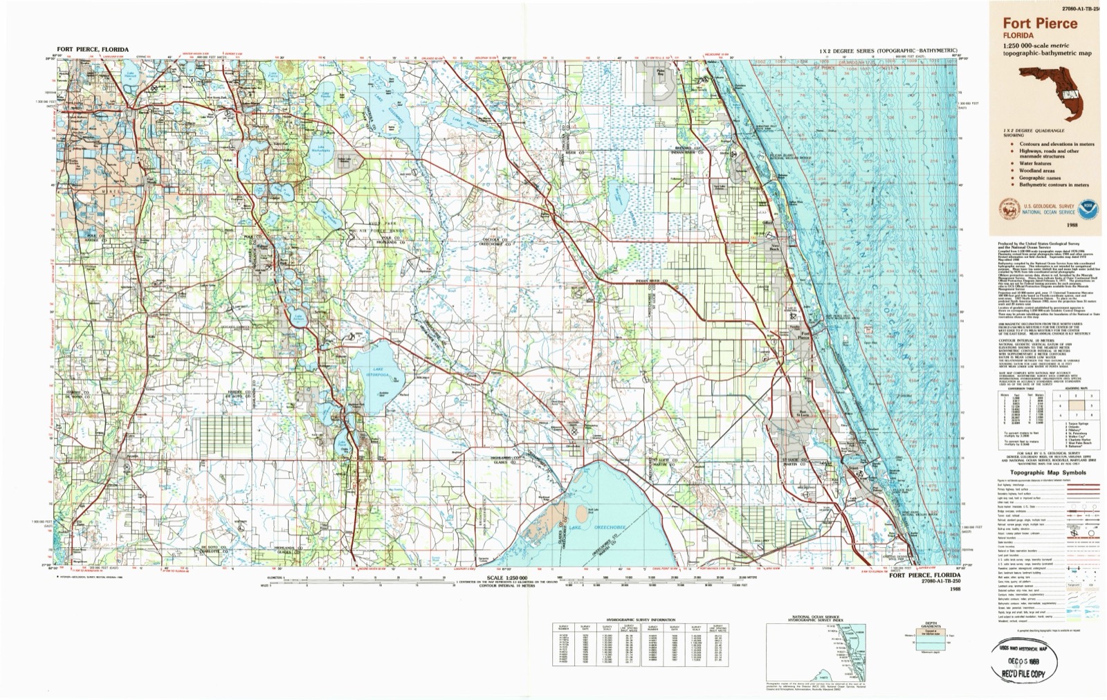
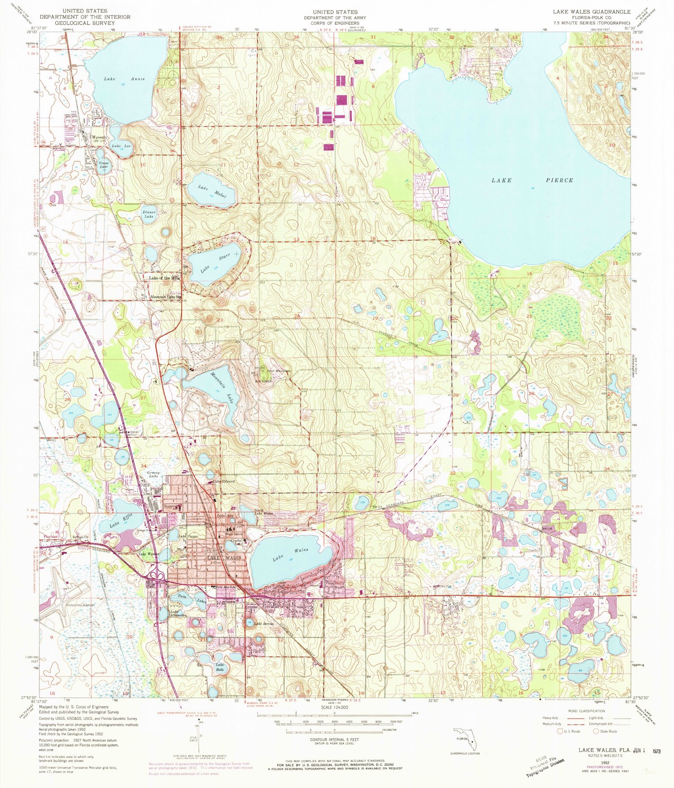
1952 to 1988

The ground this property stands on, surveyed 36 years apart. Drag the handle to wipe between them. Both sheets are United States Geological Survey originals; neither has been altered.

Topographic sheet covering Mountain Lake Estates Historic District, surveyed 1988
Topographic sheet covering Mountain Lake Estates Historic District, surveyed 1952

Fires near this property

149 since 1992

Regional context, not property-specific evidence. The federal wildfire occurrence database lists 149 fires within 5 miles of Mountain Lake Estates Historic District between 1992 and 2020, burning about 851 acres in total. 13 started naturally. 13 were recorded as arson. Distance is straight-line from the map coordinates, so a fire counted here may appear on a neighbouring settlement's page as well.

Reported cause Fires
Debris and open burning34
Railroad operations and maintenance33
Missing data/not specified/undetermined22
Equipment and vehicle use17
Arson/incendiarism13
Natural13
Misuse of fire by a minor9
Recreation and ceremony5
Power generation/transmission/distribution3

The most recent of them, most recent first, with the day each was reported and the service that recorded it.

DateCause SizeReported by Name on the report
13 September 2004Debris and open burningunder an acreFlorida Forest ServiceTIMBERLANE COMMAND
11 September 1997Railroad operations and maintenanceunder an acreFlorida Forest Servicenot named
31 August 2004Debris and open burning1.0 acresFlorida Forest ServiceCHICKEN COOP
14 August 1998Naturalunder an acreFlorida Forest Servicenot named
31 July 2006Missing data/not specified/undetermined7.0 acresFlorida Forest Service53 CARRIAGE
27 July 1994Naturalunder an acreFlorida Forest Servicenot named
26 July 1993Misuse of fire by a minor50 acresFlorida Forest Servicenot named
25 July 1997Natural2.0 acresFlorida Forest Servicenot named

Every fire recorded in Polk County

Mines and quarries near this property

10 of 11 shown

Regional context, not property-specific evidence. The federal mineral resources record lists 11 workings within 5 miles of Mountain Lake Estates Historic District: 5 producers, 3 unknowns, 1 occurrence, 1 prospect. 5 still produce. What was taken out: Sand, Diatomite, Sand and Gravel, Construction, Clay. Distance is straight-line from the map coordinates, so a quarry counted here may appear on a neighbouring settlement's page as well.

Where SiteCommodity StatusRecorded
Piper Land Clearing, Inc. - Piper MineClayUnknown
Independent MineSand and Gravel, ConstructionPast Producer
Sandland PitSand and Gravel, ConstructionProducer
Unnamed Diatomite DepositDiatomiteOccurrence
Unnamed Diatomite DepositDiatomiteProspect
Csr Rinker - Lake WalesSandProducer
E.R. Jahna Industries - Independent DiamondSandProducer
Florida Rock Industries - Sandland MineSandProducer
Florida Rock Industries, Inc. - Sandland MineSandUnknown
Florida Rock Industries, Inc. - Tower Sand MineSandUnknown

Every working recorded in Polk County

Storms near this property

42 since 1995

Regional context, not property-specific evidence. The National Weather Service names Lake Wales, the town this property stands in, in 42 storm reports between 1995 and 2024: 17 hail, 15 thunderstorm wind, 6 tornado, 1 lightning. The reports record 4 injuries. Each account below is quoted exactly as the forecast office filed it, from the NOAA Storm Events Database, and each date opens the federal record of that event.

WhenEvent Place namedHarm What the report says
March 1998Tornado (F2)Lake Wales4 hurt, $2,000,000no account filed
March 1996HailLake Wales$24,000,000no account filed
November 1995Thunderstorm WindLake Wales$250,000Thunderstorm winds damaged ten manufactured homes and eight six-unit apartment buildings near Fedhaven. Estimated damage of $250 thousand.
March 1996Thunderstorm WindLake Wales$180,000no account filed
February 1998Tornado (F1)Lake Wales$175,000A tornado touched down at Fourth and Johnson Streets in Lake Wales and caused significant roof damage to 25 homes, damaged a few vehicles, downed numerous large tree limbs and power lines along an intermittent path. Five homes in the North Point subdivision incurred moderate roof and lanai damage. One large vehicle was rolled and severely damaged by the tornado before it lifted and dissipated in the Crown Pointe subdivision along Burns Avenue in Lake Wales.
February 1998Tornado (F0)Lake Wales$150,000A tornado touched down along U.S. Highway 27A and North Crooked Lake Drive and lifted near Gulf View Cutoff Road in Babson Park. Five homes in a Babson Park division incurred roof damage by the tornado while several trees and power lines were downed before the tornado lifted and dissipated.
March 1996HailLake Wales$150,000no account filed
June 2001Thunderstorm WindLake Wales$100,000The Polk county sheriffs department reported that thunderstorm winds caused moderate to minor damage to twelve mobile homes and caused minor hanger damage at the Lake Wales Municipal Airport.
March 1999WildfireLake Wales$60,000A wildfire consumed nearly five acres of brush and destroyed three mobile homes and a swamp buggy near Lake Wales.
March 1996HailLake Wales$50,000no account filed
January 1999Thunderstorm WindLake Wales$20,000Thunderstorm winds caused minor roof and structural damage to a few homes along Alternate U.S. Highway 27 in Lake Wales. Also, a few trees and power lines were downed by thunderstorm winds approximately one mile north of Lake Wales.
June 1998LightningLake Wales$15,000Lightning struck, ignited and burned 500 acres of brush west of U.S. Highway 27 between Caloosa Lake and East Lake Buffum Road in Lake Wales.
July 2000Thunderstorm WindLake Wales$10,000Florida Power Electric Company officials reported that thunderstorms winds downed several large trees and power lines in Lake Wales of eastern Polk county.
April 1997Thunderstorm WindLake Wales$10,000Thunderstorm winds blew down the wall of an automobile dealership under construction.
July 2024Tornado (EF0)West Lake Wales$5,000Broadcast media shared video from a social media account depicting a very brief land spout tornado impacting a trailer and small carport-style structure, causing minor damage. No additional damage was reported.
June 1998Thunderstorm WindLake Wales$5,000Thunderstorm winds tore off the screened porch of a mobile home and destroyed the carport of another.
May 1997Tornado (F0)Lake Wales$5,000A short-lived tornado touched down and shredded a 14-by-42 foot aluminum and screen enclosure of a home along U.S. Highway 27. The enclosure was tossed over the home and the remains scattered over an area 150 yards downstream from the damage site.
May 1999Thunderstorm WindLake Wales$3,000The Peace River Electric Company reported several power lines were downed by thunderstorm winds along Old U.S. Highway 27 (Old Scenic Highway) in Lake Wales.
June 2008Thunderstorm WindLake Wales$1,000Law enforcement reported numerous powerines down.
May 1997Thunderstorm WindLake Wales$1,000A Skywarn Spotter measured a wind gust of 64 mph and reported trees and power lines downed near Cypress Gardens.
August 1995Thunderstorm WindLake Wales$500Thunderstorm winds gusts of 40 to 50 mph blew down a few large trees.
August 2014HailLake Wales-A picture of dime to quarter size hail was sent in by the public near Lake Wales.
June 2011HailWest Lake Wales-The public reported nickel to quarter sized hail near West Lake Wales Road South.
June 2010HailLake Wales-Nickel-sized hail was reported near Lake Pierce.
June 2009HailLake Wales-Penny sized hail was reported south of Lake Wales.
April 2008Thunderstorm WindLake Wales-A trained spotter located on U.S. Highway 27 reported quarter size hail and estimated wind gusts of 60 to 70 MPH.
April 2008HailLake Wales-A trained spotter located on U.S. Highway 27 reported quarter size hail and estimated wind gusts of 60 to 70 MPH.
April 2008Thunderstorm WindLake Wales-The public reported an estimated wind gust of 60 MPH and a five minute duration of pea to dime size hail.
July 2008Heavy RainLake Wales-The public reported 7.31 inches of rain fell in 24 hours near Blue Lake south of Lake Wales.
June 2008Thunderstorm WindLake Wales-There were several public reports of 60 to 70 mph wind gusts around Lake Wales.
May 2007HailLake Wales-Nickel size hail was reported by the public along Highway 60 northwest of Inidan Lakes Estates and again 10 miles east of Lake Wales.
July 2007HailLake Wales-Quarter size hail damaged vehicles at a soft ball tournament.
February 2006HailLake Wales-Hail dinged a metal porch roof but did not damage vehicles in the yard.
August 2004Tornado (F0)Lake Wales-The public reported a brief tornado in Lake Wales.
August 1999HailLake Wales-Quarter sized hail was reported in Lake Wales by Skywarn Spotters.
May 1998HailLake Wales-Quarter sized hail was reported near the intersection of U.S. Highway 27 and State Road 60 by Skywarn Spotters.
February 1998WaterspoutLake Wales-A large waterspout touched down on Crooked Lake east of U.S. Highway 27 and south of County Road 640. The waterspout moved onshore near North Crooked Lake Drive.
July 1997HailLake Wales-Nickel sized hail was reported by the Lake Wales Police Department along U.S. Highway 27.
May 1997HailLake Wales-Dime sized hail was reported by a Skywarn Spotter along U.S. Highway 27.
May 2005HailLake Wales-no account filed
July 2002Thunderstorm WindLake Wales-no account filed
March 1996HailLake Wales-no account filed

Every storm recorded in Polk County

Maps showing this location

6 surveys

United States Geological Survey topographic sheets whose coverage includes this point. Matched by taking the middle of the area the National Park Service maps for this listing, then testing that coordinate against the published boundary of every sheet.

Listed places nearby

6 within 8 miles

Other National Register properties close enough to walk or drive between, ordered by distance from this one. Both positions come from the same geocoding pass that matched these properties to their map sheets.

Photograph PropertyDistance Listed
Mountain Lake Colony House0.3 miles1991
Singing Tower, Bok Mountain Lake Sanctuary0.8 miles1972
El Retiro1.3 miles1985
Spook Hill1.4 miles2019
Roosevelt School1.5 miles2001
North Avenue Historic District1.6 miles2001

Sources for this property

National Archives recordThe nomination case file for reference 93000871 in Record Group 79.
Wikipedia articleCommunity-written account of this property, licensed CC BY-SA.
Polk CountyAll 78 listed properties in this county.

Provenance

  • Listing record. National Park Service National Register of Historic Places, listed-properties dataset, current to 2026-05-22.
  • Map join. Address geocoded through the United States Census geocoder, then tested against the published boundary of every sheet in the USGS Historical Topographic Map Collection.
  • How this page is made. Listing fields come from federal records; map-sheet coverage is a labelled coordinate-to-boundary calculation, not a source-field claim.
  • Wildfire. Short, Karen C. 2022. Spatial wildfire occurrence data for the United States, 1992-2020 [FPA_FOD_20221014]. 6th Edition. Fort Collins, CO: Forest Service Research Data Archive. https://doi.org/10.2737/RDS-2013-0009.6 Collected with United States Government funding and usable without additional permissions or fees.
  • Mines and quarries. USGS Mineral Resources Data System (MRDS) https://mrdata.usgs.gov/mrds/ A work of the United States government, no copyright under 17 U.S.C. 105.
  • Storms. NOAA National Centers for Environmental Information, Storm Events Database https://www.ncei.noaa.gov/stormevents/ A work of the United States government, no copyright under 17 U.S.C. 105. Narratives are quoted verbatim from the National Weather Service report and are not edited or summarised.