| June 2004 | Lightning | Pensacola | 1 hurt | A male was indirectly struck by lightning in west Pensacola. He was a thirty year old male and was transported to the hospital where he was treated and released. |
| July 2002 | Lightning | Pensacola | 1 hurt | A male was indirectly struck by lightning near Pensacola. Little information was available about how he was struck. He was taken to a local hospital and was kept for a few days before being released. |
| July 2011 | Lightning | Pensacola | 1 hurt | no account filed |
| October 2001 | Tornado (F0) | Pensacola | $250,000 | An F0 tornado touched down in the Coral Creek Subdivision, along Coral Reef Road. Twenty five homes suffered some degree of roof damage, with three of the homes sustaining major roof damage. Many homes had some window damage, mainly resulting from flying debris. A few homes also had fence damage. |
| October 2001 | Thunderstorm Wind | Pensacola | $75,000 | Strong thunderstorm winds produced damage in the Car City area of Pensacola, south of Interstate 10. A garage was damaged in the area as was at least one automobile. In addition, a tree was also blown down, damaging a fence. |
| April 2015 | Thunderstorm Wind | Pensacola | $50,000 | Pensacola Regional Airport recorded a 61 mph wind gust at 405 pm.||The severe thunderstorm winds resulted in numerous trees being downed through the city of Pensacola. The downed trees also resulted in damage to some residential fences and a few homes. |
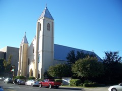
| July 2002 | Lightning | Pensacola | $50,000 | Lightning struck the roof of a church and started a fire. The fire burned for six hours before being put out. There was considerable damage to a roof over a sanctuary and smoke damaged most of the church. No one was in the building near where the strike occurred. |
| August 2001 | Lightning | Pensacola | $50,000 | A home was struck by lightning and caught on fire. The home was almost completely destroyed before the fire department could put the fire out. |
| July 2013 | Thunderstorm Wind | Pensacola | $35,000 | Trees and power lines blown down on Lloyd Street and Scenic Highway. |
| April 2014 | Thunderstorm Wind | Pensacola | $25,000 | Winds estimated at 60 mph downed a tree on a house and car. |
| February 2008 | Thunderstorm Wind | Pensacola | $25,000 | no account filed |
| March 2002 | Thunderstorm Wind | Pensacola | $20,000 | Trees and power lines were blown down and a couple of buildings suffered minor roof damage in Pensacola. |
| July 2000 | Wildfire | West Pensacola | $20,000 | Lightning started a woods fire in the west part of Pensacola. The fire started in a heavily wooded area and spread toward a sub-division. The fire threatened 150 homes but was brought under control before reaching the homes. No injuries were reported. |
| January 1999 | Thunderstorm Wind | Pensacola | $15,000 | An apartment complex sustained roof damage while a vehicle sitting in the parking lot of the same complex sustained damage. |
| July 2010 | Thunderstorm Wind | Pensacola | $10,000 | Winds estimated at 65 mph blew a tree down on to a house. |
| October 2008 | Lightning | Pensacola | $10,000 | A home was hit by lightning and a fire started. The home only suffered minor damage from the fire. |
| October 2001 | Thunderstorm Wind | Pensacola | $10,000 | Trees downed on the east side of Pensacola as thunderstorms moved through the area. |
| August 2012 | Thunderstorm Wind | Pensacola | $8,000 | Winds estimated at 60 mph downed a tree on house and downed powerlines. |
| June 2007 | Thunderstorm Wind | Pensacola | $7,000 | Thunderstorms produced wind gusts estimated to be 60 to 70 mph near the downtown area. Some powerlines were reported down. |
| December 2015 | Thunderstorm Wind | Pensacola | $5,000 | Thunderstorm wind gusts around 60 mph downed several large trees. |
| June 2012 | Flash Flood | Pensacola | $5,000 | Heavy rains caused water to entering 1st floor of baptist hospital. Also numerous area roads were flooded. |
| August 2012 | Thunderstorm Wind | Pensacola | $5,000 | Winds estimated at 60 mph blew windows out of a bus at 9th and College Blvd. |
| August 2012 | Thunderstorm Wind | Pensacola | $5,000 | Winds estimated at 60 mph downed trees and powerlines. |
| August 2012 | Thunderstorm Wind | Pensacola | $5,000 | High winds damaged a Hobby Lobby store on N Davis Highway in Pensacola. |
| July 2000 | Thunderstorm Wind | Pensacola | $5,000 | Power lines were blown down in the community as a thunderstorm moved through. |
| August 2000 | Thunderstorm Wind | Pensacola | $5,000 | Trees were blown down near I-10 and Pine Forest Road as a thunderstorm move through the area. |
| July 2000 | Thunderstorm Wind | Pensacola | $5,000 | High winds blew trees down in Pensacola. |
| August 1999 | Thunderstorm Wind | Pensacola | $5,000 | Several trees and power lines were blown down. |
| October 1997 | Thunderstorm Wind | Pensacola | $5,000 | Several trees and power lines were blown down near downtown Pensacola. Two vehicles were damaged by falling trees. No injuries were reported. |
| June 1994 | Thunderstorm Wind | Pensacola | $5,000 | Thunderstorm winds blew down a few large trees which did minor damage to a house roof and a porch. |
| July 1996 | Thunderstorm Wind | Pensacola | $3,500 | no account filed |
| June 2016 | Thunderstorm Wind | Pensacola | $3,000 | Winds estimated at 60 mph downed a large tree on the 3700 Block of Cervantes. |
| October 2008 | Lightning | Pensacola | $3,000 | Lightning struck a tree and knocked it down. A male, in his middle 70s, was standing near the tree and the strike knocked him down. He was taken to a local hospital, treated and released. |
| March 2005 | Hail | Pensacola | $3,000 | Golfball size hail fell from a storm near Pensacola. Several vehicles were damaged by the large hail. The hail lasted for about ten minutes. |
| January 1998 | Thunderstorm Wind | Pensacola | $3,000 | A few trees were blown down near downtown Pensacola. |
| June 2013 | Thunderstorm Wind | Pensacola | $2,000 | Winds estimated at 60 mph produced damage at the Blue Wahoos Stadium. 200 ft of outfiled wall knocked down...15 porta-johns knocked over and two tents damaged. |
| September 2011 | Thunderstorm Wind | Pensacola | $2,000 | Winds estimated at 60 mph downed several large tree limbs across the county. |
| August 2011 | Thunderstorm Wind | Pensacola | $2,000 | Winds estimated at 60 mph snapped flag poles and broke trees limbs. Some garbage cans were also tossed around. |
| December 1995 | Thunderstorm Wind | Pensacola | $2,000 | Several trees and power lines were blown down in the southeast sections of Pensacola. |
| June 1996 | Lightning | Pensacola | $2,000 | no account filed |
| January 2017 | Thunderstorm Wind | Pensacola | $1,000 | An awning was blown off of a Pensacola restaurant. |
| March 2014 | Thunderstorm Wind | Pensacola | $1,000 | Winds estimated at 60 mph downed tree branches along Gregory street. |
| May 2012 | Tornado (EF0) | Pensacola | $1,000 | A waterspout moved onshore and caused minor damage to a fence...shed and house. |
| April 1997 | Thunderstorm Wind | Pensacola | $1,000 | Several large limbs were blown down in the coastal sections of downtown Pensacola. |
| July 1995 | Thunderstorm Wind | West Pensacola | $1,000 | Wind gust to 58 mph and dime-size hail was reported two miles east of Lillian, Alabama, on the west side of Pensacola just past the Lillian Bridge. |
| July 1995 | Thunderstorm Wind | Pensacola | $500 | Winds blew two to three small boats out of the water near the Bob Sikes Bridge. It could have been a possible waterspout but no one observed or thought they saw one. |
| April 1995 | Thunderstorm Wind | Pensacola | $500 | Several trees were blown down in the north sections of Pensacola. |
| May 2024 | Flash Flood | Pensacola | - | Law enforcement reported flooding at the intersection of L and Garden streets with vehicles stalled in the water. |
| June 2023 | Flash Flood | Pensacola | - | Heavy rain caused flooding of numerous structures and ongoing highwater rescues ongoing. |
| June 2023 | Tornado (EF2) | West Pensacola | - | Damage survey found a very broad area roughly a mile and a half|wide of strong sporadic straight line winds beginning around|Fairfield drive and 52nd Ave in West Pensacola. No visual|convergence was noted until the area near N Old Corry Field Rd|and W Gregory St. Several large limbs were noted and few uproots|at this location in a loosely convergent pattern. This more|concentrated damage continued south-southeast across US 98 to|Barrancas Ave with a several mile wider swath of damaging winds.|The path at this point seems discontinuous with several weak areas|of convergence resulting in likely high end EF-0 damage embedded|within a broader damaging wind swath. A more concentrated area of|convergence appears around Fairway Drive on the north side of the|Pensacola County Club. Several hardwoods had large 2 foot in|diameter branches snapped and several softwood pines were snapped|as a more continuous path extended across the country club and|Bayshore Dr before moving out over Pensacola Bay. ||The tornado then likely continued as a waterspout traversing Pensacola Bay|dodging the western tip of Gulf Breeze before wrapping back|southeast towards Pensacola Beach. The tornado quickly|strengthened as it crossed Fort Pickens Rd near Galvez CT.|Significant damage to homes built to withstand significant|hurricanes was noted and thus damage estimates from this location leaned on|the higher side for given damage indicators. Several of the homes|across a quarter mile swath had damage to siding including|several sides beings completely removed. A few homes lost 20 to|60 percent of metal roofing material even with proper hurricane|code anchors. Several bottom floor garages were completely gutted|as garage doors were blown in and destroyed. Bottom exterior walls|blew out leading to complete exposure of the bottom floors.|Several palm trees across the area were snapped a few feet off the|ground. The most notable damage was right along Fort Pickens Rd|where a house under construction had the entire top floor and|roof removed. This damage was put on the lower end of estimates|as the house was under construction and an opening on the north|side may have helped the failure of the upper walls and floors.|However, a large dumpster likely weighing several hundred pounds|was thrown roughly 50-70 yards due east and was deposited between|two palm trees about 2 feet off the ground. The damage to the|home, dumpster combined with a garage door that failed being|wrapped around a concrete piling resulted in the peak wind|estimate of 120 mph. ||The tornado likely crossed over Fort Pickens Rd and into the |Gulf of Mexico where it likely dissipated. One other interesting |damage note was that at least two boats were tossed on the Pensacola |Bay side. One boat was found about 20-30 yards from the boat lift |upside down in the water. The other boat was thrown off the lift |and was reportedly found near Deer Point about a mile north across |the bay. This boat likely floated over there but still impressive. |There is no damage indicator for boats; however, the sheer |impressiveness helped support the higher rating given the surrounding |damage indicators. |
| April 2022 | Thunderstorm Wind | Pensacola | - | Measured by a personal weather station near Brent Lane and I-10. |
| July 2022 | Flash Flood | Pensacola | - | A CoCoRaHS observer reported street flooding. |
| June 2022 | Flash Flood | Pensacola | - | Heavy rain flooded several roads and yards. |
| June 2021 | Flash Flood | Pensacola | - | Heavy rain caused flooding of several roadways in and around Pensacola. |
| June 2017 | Flash Flood | West Pensacola | - | Reports of knee deep water the the Forest Creek Apartments. |
| August 2017 | Flash Flood | Pensacola | - | Heavy rains caused flooding in the Pensacola area. |
| March 2014 | Flood | Pensacola | - | Heavy rain caused numerous reports of street flooding along Creighton Rd, Mobile highway, E and l St intersection, and Garden St. |
| June 2012 | Flash Flood | Pensacola | - | Heavy rain caused several roads to flood with water starting to get into houses. |
| July 2012 | Flash Flood | Pensacola | - | Heavy rain caused flooding which closed south-bound I-110 and Brent lane. |
| November 2010 | Flash Flood | Pensacola | - | Heavy rains flooded the road at North Spring Street. |
 Block
Block