 Block
From the record
5 National Register listings published here.
Sources: the National Register database, National Park Service
30 topographic sheets and 2 fire insurance atlases across 1 place.
5 National Register listings published here.
Sources: the National Register database, National Park Service
Every property in this county listed on the National Register of Historic Places, with the year it was listed and the federal nomination document.
| Photograph | Property | Type | Listed | Reference |
|---|---|---|---|---|
 | Candler County Courthouse | building | 1980 | 80000984 |
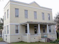 | Candler County Jail | building | 2002 | 02001291 |
 | Metter Downtown Historic District | district | 2011 | 11000578 |
 | Metter High School | building | 2002 | 02000840 |
 | South Metter Residential Historic District | district | 1988 | 87001429 |
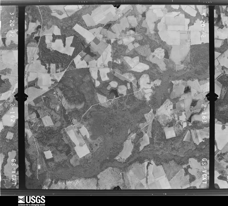
Flown by the U.S. Geological Survey between 1937 and 1989, the Aerial Photo Single Frames collection is the definitive mid-century view of the land: fields, roads and rivers as the camera saw them. The Survey holds 513 frames inside the rectangle that bounds this county; the 28 frames below were taken over the county itself, chosen across the decades of flights (at most four a year from that rectangle), so one flight cannot crowd out the rest. The full set is free to browse and download at EarthExplorer under the dataset Aerial Photo Single Frames.



























The thermometers that kept this county's weather, as the federal records hold them. The extremes below are measured values from those records, not estimates.
Who lived here in 1950, one enumeration district at a time, as the Census Bureau described each district. Each row opens its official National Archives result, with Population Schedules and ED Maps available there.
Every wildfire the federal occurrence database records inside this county: 1,248 of them, burning about 4,535 acres. 42 started naturally and 210 were recorded as arson. Each settlement page carries the fires within five miles of it.
| Reported cause | Fires |
|---|---|
| Debris and open burning | 753 |
| Arson/incendiarism | 210 |
| Equipment and vehicle use | 97 |
| Misuse of fire by a minor | 54 |
| Missing data/not specified/undetermined | 50 |
| Natural | 42 |
| Recreation and ceremony | 28 |
| Smoking | 13 |
| Railroad operations and maintenance | 1 |
The five largest, by the area the report gives. One of them was set deliberately.
| Date | Cause | Size | Reported by | Name on the report |
|---|---|---|---|---|
| 15 September 2011 | Debris and open burning | 339 acres | Georgia Forestry Commission | FY2012-CANDLER-007 |
| 18 January 2014 | Debris and open burning | 214 acres | Georgia Forestry Commission | FY2014-CANDLER-007 |
| 28 February 1992 | Debris and open burning | 127 acres | Georgia Forestry Commission | not named |
| 30 June 1998 | Arson/incendiarism | 124 acres | Georgia Forestry Commission | not named |
| 5 March 1999 | Debris and open burning | 108 acres | Georgia Forestry Commission | not named |
| 9 March 2006 | Debris and open burning | 103 acres | Georgia Forestry Commission | not named |
| 20 July 2000 | Debris and open burning | 97 acres | Georgia Forestry Commission | FY2001-CANDLER-006 |
| 7 April 2000 | Debris and open burning | 92 acres | Georgia Forestry Commission | FY2000-EMANUEL-082 |
Every settlement page carries the fires within five miles of it - see the settlement index below.
The NOAA Storm Events Database holds 160 reports for this county, causing no deaths, 4 injuries and about $974,030 in recorded property damage. Each settlement page carries the reports that name it.
| Kind of event | Reports |
|---|---|
| Thunderstorm Wind | 111 |
| Hail | 31 |
| Flash Flood | 7 |
| Tornado | 6 |
| Lightning | 3 |
| Flood | 1 |
| Winter Storm | 1 |
The most serious of them, by death, then injury, then recorded damage. The accounts are quoted exactly as the forecast office filed them.
| When | Event | Place named | Harm | What the report says |
|---|---|---|---|---|
| April 1999 | Tornado (F1) | Metter | 2 hurt, $250,000 | Tornado ripped the end off one mobile home, caused moderate damage to a house and practically destroyed seven other mobile homes. Another mobile home was flipped several times and ended up on the bottom of a nearby pond. Two persons were in this mobile home. The female landed at the edge of the water while the male was thrown into the pond and had to swim ashore. |
| June 2016 | Thunderstorm Wind | Excelsior | 2 hurt | An emergency manager reported numerous trees down and 3 recreational vehicles turned over with 2 minor injuries along Interstate 16 just before mile marker 111. |
| May 1984 | Tornado (F1) | not stated | $250,000 | no account filed |
| April 1997 | Tornado (F1) | Metter | $100,000 | no account filed |
| August 2023 | Flash Flood | Metter | $60,000 | Candler County Emergency Management reported numerous dirt roads washed out|across the county due to heavy rainfall associated with Tropical Storm Idalia. Flooding water also entered a nursing home in Metter. Daily rainfall amounts between 5.50 to 7.88 inches were recorded by the time of flash flooding starting across the area. |
| September 2011 | Thunderstorm Wind | Metter | $60,000 | The Public reported 60 Pecan trees knocked down at 4940 Highway 23 North, 3 miles north-northwest of Metter, Georgia. |
| May 2025 | Flash Flood | Pulaski | $30,000 | Candler County dispatch reported multiple roads washed out and damaged due to flash flooding. Byrd Jr School Road was washed out between Saint Mathews Church Road and Kirkland Road and both ends of Meridy Road were also washed out. |
| July 2025 | Lightning | Metter | $20,000 | Candler County dispatch reported that lightning struck a power line and caused it to fall into the roadway at the intersection of Greenwood Circle and Brannen Road. |
| August 2023 | Flash Flood | Metter | $20,000 | A Candler County emergency manager reported a 55 acre pond dam failed on Cook Pond Road due to recent heavy rainfall associated with Tropical Storm Idalia. |
| April 2017 | Lightning | Metter | $20,000 | The media reported a lightning strike which started a fire to a historic home on South Rountree Street in Metter, Georgia. A video indicated about 1/4 of the second floor on fire. |
| July 1995 | Thunderstorm Wind | Metter | $20,000 | Thunderstorm winds uprooted and knocked down more than 15 trees, one of which rested against a home. The winds also stripped a 100 acres of beans and flattened 40 acres of corn. |
| May 2025 | Flash Flood | Metter Muni Arpt | $15,000 | Candler County dispatch reported that Wagon Wheel Road is completely washed out near Highway 129. |
| July 2024 | Lightning | Metter Muni Arpt | $15,000 | Local broadcast media reported that lightning struck a car driving on Interstate 16 near exit 104, damaging the electrical system and disabling the vehicle. None of the passengers were injured. |
| June 2009 | Thunderstorm Wind | Metter | $15,000 | Law Enforcement reported trees down through out Candler county Georgia. |
| August 2011 | Thunderstorm Wind | Metter | $10,000 | A spotter reported numerous trees down on highways 21 and 23 and Hope Valley Circle Road. A three metal building was also rolled back 60 feet from the original foundation. The building was approximately 42000 square feet in area. |
| September 2011 | Thunderstorm Wind | Metter | $10,000 | Law Enforcement reported numerous trees trees down on power lines on Cedar Street, 2 miles north-northwest of Metter, Georgia. |
| June 2009 | Thunderstorm Wind | Aline | $10,000 | Law Enforcement reported trees down on the roof of a house and quarter size hail along Highway 121 at the Candler and Tattnall County line. |
| June 2006 | Thunderstorm Wind | Metter | $10,000 | Trees down countywide. |
| August 2011 | Thunderstorm Wind | Metter | $8,000 | Law enforcement reported trees down on several homes in Metter. |
| May 2011 | Thunderstorm Wind | Metter | $7,000 | The Candler County Emergency Manager reported a roof peeled off a tractor shed at a cotton gin, several downed trees, and on snapped power pole around Metter, Georgia. |
| August 2007 | Thunderstorm Wind | Metter | $5,000 | Trees were reported to have fallen on a mobile home off Route 121. |
| June 2006 | Thunderstorm Wind | Metter | $5,000 | Trees down in Metter. |
| April 1999 | Tornado (F0) | Metter | $5,000 | Minor damage to the roof of one house, storage sheds, and a couple of trees down. |
| June 1994 | Thunderstorm Wind | Metter | $5,000 | Several large trees were uprooted in Metter from thunder- storm winds. |
| June 2007 | Thunderstorm Wind | Excelsior | $2,500 | Several trees and power lines reported down on Deckle Road. |
| August 2011 | Thunderstorm Wind | Metter | $2,000 | A state official reported trees down along Highway 121 North. |
| May 2010 | Thunderstorm Wind | Pulaski | $2,000 | The public reported several trees down near Pulaski, Georgia. |
| February 2008 | Thunderstorm Wind | Metter | $2,000 | A Post Office employee reported that trees were blown down and tin was torn off a shed in Olifftown, Georgia. |
| July 2007 | Thunderstorm Wind | Metter Muni Arpt | $2,000 | Four large trees were reported down on Highway 121 south of Metter. |
| June 1995 | Thunderstorm Wind | Metter | $2,000 | Thunderstorm winds knocked several large tree limbs down. |
| August 2008 | Thunderstorm Wind | Metter | $1,500 | Law enforcement reported several trees down in Metter, Georgia. Trees were reported down on Highway 23, Hadden Road, and Cool Spring Church Road. |
| October 2008 | Thunderstorm Wind | Metter | $1,500 | The public reported that a roof covering a deck was blown off a home near Rosemary Church Road 8 miles north of Metter, Georgia. |
| January 2014 | Thunderstorm Wind | Aline | $1,000 | County Warning Point reported a tree down at the 3700 block of Highway 23. |
| June 2013 | Thunderstorm Wind | Excelsior | $1,000 | The Candler County 911 call center reported a tree down across Excelsior Church Road near Interstate 16. |
| July 2012 | Thunderstorm Wind | Metter | $1,000 | Power line blown down near Rosemary Church Road and Spell Road. |
| July 2007 | Thunderstorm Wind | Metter Muni Arpt | $1,000 | Trees were reported down on Piney Grove Church Road off of Highway 121 South. |
| February 2007 | Thunderstorm Wind | Metter | $1,000 | There were several trees down in Metter as reported by WTOC. |
| July 2006 | Thunderstorm Wind | Metter | $1,000 | Large tree down. |
| January 2013 | Thunderstorm Wind | Pulaski | $500 | Candler County 911 Center reported a tree down on Lake Church Road. |
| October 2011 | Thunderstorm Wind | Metter | $500 | Law enforcement reported 1 tree down in Metter, Georgia. |
| June 2009 | Thunderstorm Wind | Aline | $500 | The public reported a tree down on Highway 121, one mile north of Cobbtown, Georgia. |
| July 2007 | Thunderstorm Wind | Metter | $500 | One tree was reported down in Webb Circle. |
| July 2007 | Thunderstorm Wind | Aline | $500 | One tree was reported down in Canoe, GA. |
| September 1956 | Tornado (F1) | not stated | $30 | no account filed |
| May 2025 | Hail | Metter | - | Nickel sized hail was reported at a home in the 1700 block of Hadden Road. |
| May 2025 | Thunderstorm Wind | Metter | - | Candler County Emergency Management provided numerous ground and aerial photos of wind damage on a farm in the 1700 block of Hadden Road. Numerous trees were uprooted on the property, with one tree down on a home. The tree penetrated the roof of the home and cracked a brick exterior wall down to the foundation. A back porch awning was ripped off another home and blown downstream. Also, a large open frame out building was destroyed with sheet metal and wood debris scattered downstream. |
| July 2025 | Hail | Metter | - | Candler County Emergency Management reported nickel sized hail on Highway 23 near Olifftown Road. |
| July 2025 | Thunderstorm Wind | Metter | - | Candler County Emergency Management reported trees down on Highway 121 between Brannen Road and Pond View Road. |
| July 2025 | Thunderstorm Wind | Metter | - | Candler County Emergency Management reported a couple of trees down blocking roadways on Highway 121 near Hendricks Road. |
| June 2025 | Thunderstorm Wind | Excelsior | - | The Candler County 911 Call Center reported a tree down on Dutch Ford Road. |
| June 2025 | Thunderstorm Wind | Excelsior | - | The Candler County 911 Call Center reported a tree down on Lake Church Road. |
| June 2025 | Thunderstorm Wind | Metter | - | The Candler County 911 Call Center reported a tree down near the intersection of S E Broad Street and Lillian Street. |
| January 2025 | Winter Storm | not stated | - | Sleet and snow began to fall between 5-6 AM across the county. Snow became heavy at times between 7-9 AM with widespread 3 to 5 inches of snow accumulation being reported by 9 AM. Between 9-10 AM, the snow gradually mixed with sleet and freezing rain with another 1/10 to 2/10 inch of ice accumulation on top of the snow, before changing to light rain before ending early in the afternoon hours. |
| March 2024 | Hail | Metter | - | The NWS office in Morehead City, NC relayed a report from a trained spotter of penny sized hail on Ollifftown Road. |
| August 2024 | Flood | Pulaski | - | A Candler County emergency manager reported an assistance needed due to water entering a home along Salem Church Road near Lotts Creek Road. |
| March 2023 | Hail | Metter | - | Penny sized hail and heavy rain was reported just north of Metter. |
| August 2023 | Thunderstorm Wind | Aline | - | The Candler County Sheriff's Office reported a tree down on power lines near the intersection of Griffin Ferry Road and 46 West. |
| August 2023 | Thunderstorm Wind | Aline | - | The Candler County Sheriff's Office reported trees and power lines down in several locations, including on Macwac Lake Road, Holland Road and Freedom Lane. |
| August 2023 | Thunderstorm Wind | Metter | - | The Metter fire department chief reported multiple trees down across the town of Metter. |
| August 2023 | Thunderstorm Wind | Metter Muni Arpt | - | The Metter Airport AWOS measured a 56 knot wind gust. |
Named settlements recorded in the Geographic Names Information System, each with the topographic sheets covering it. Villages, hamlets and abandoned places alike. Each is shown with the nearest named watercourse or landform and the survey quadrangle it falls on. The 1 place that was also surveyed for fire insurance comes first, with the number of atlases and photographs held for them.