 Block
From the record
10 National Register listings published here.
Sources: the National Register database, National Park Service
36 topographic sheets cover 26 settlements here, and 10 properties are on the National Register of Historic Places.
10 National Register listings published here.
Sources: the National Register database, National Park Service
Every property in this county listed on the National Register of Historic Places, with the year it was listed and the federal nomination document.
| Photograph | Property | Type | Listed | Reference |
|---|---|---|---|---|
| Amity School | building | 1993 | 93000933 | |
 | Chennault House | building | 1976 | 76000640 |
| Double Branches Historic District | district | 1993 | 93000934 | |
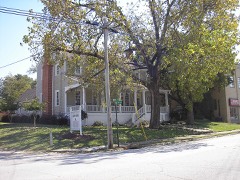 | Lamar-Blanchard House | building | 1982 | 82002450 |
 | Lincoln County Courthouse | building | 1980 | 80001106 |
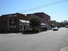 | Lincolnton Historic District | district | 1993 | 93000932 |
 | Lincolnton Presbyterian Church and Cemetery | building | 1982 | 82002451 |
 | Matthews House | building | 1976 | 76000641 |
| Simmons-Cullars House | district | 1999 | 99001473 | |
| Woodlawn Historic District | district | 1993 | 93000935 |
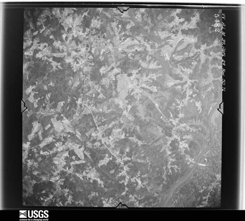
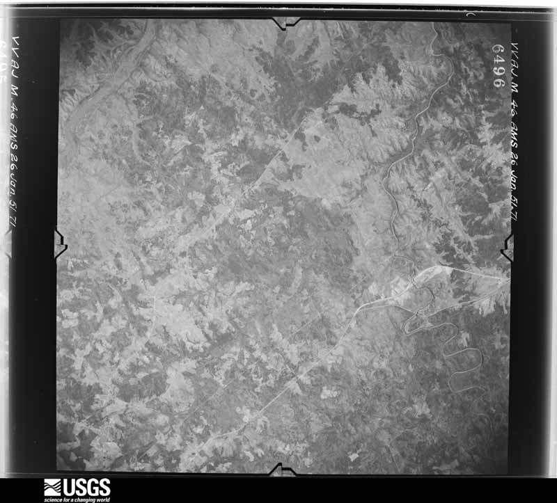
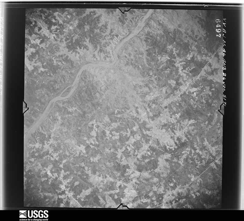
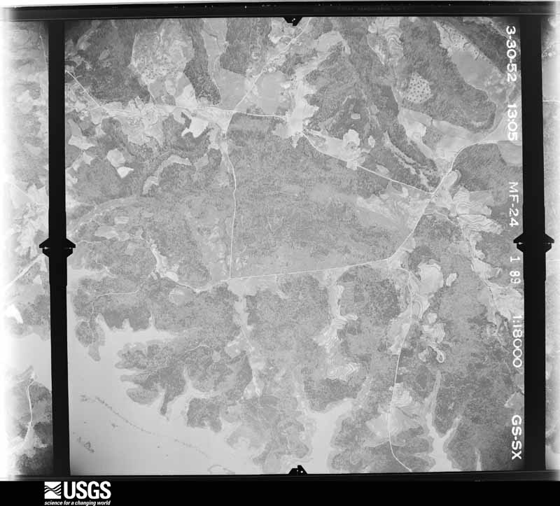
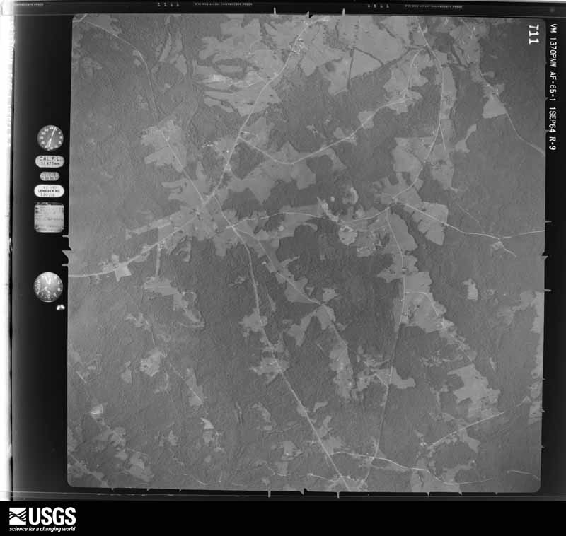
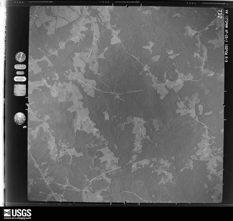
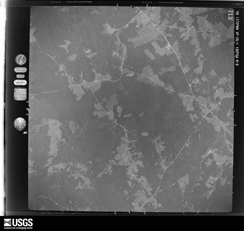
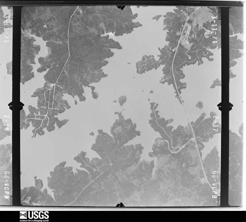
Flown by the U.S. Geological Survey between 1937 and 1989, the Aerial Photo Single Frames collection is the definitive mid-century view of the land: fields, roads and rivers as the camera saw them. The Survey holds 717 frames inside the rectangle that bounds this county; the 24 frames below were taken over the county itself, chosen across the decades of flights (at most four a year from that rectangle), so one flight cannot crowd out the rest. The full set is free to browse and download at EarthExplorer under the dataset Aerial Photo Single Frames.
















The thermometers that kept this county's weather, as the federal records hold them. The extremes below are measured values from those records, not estimates.
Who lived here in 1950, one enumeration district at a time, as the Census Bureau described each district. Each row opens its official National Archives result, with Population Schedules and ED Maps available there.
Every wildfire the federal occurrence database records inside this county: 393 of them, burning about 1,866 acres. 24 started naturally and 22 were recorded as arson. Each settlement page carries the fires within five miles of it.
| Reported cause | Fires |
|---|---|
| Debris and open burning | 221 |
| Missing data/not specified/undetermined | 55 |
| Equipment and vehicle use | 28 |
| Natural | 24 |
| Arson/incendiarism | 22 |
| Smoking | 18 |
| Misuse of fire by a minor | 13 |
| Recreation and ceremony | 12 |
The five largest, by the area the report gives. None of them was recorded as arson.
| Date | Cause | Size | Reported by | Name on the report |
|---|---|---|---|---|
| 24 March 2017 | Natural | 90 acres | Georgia Forestry Commission | FY2017-LINCOLN-008 |
| 28 June 2008 | Natural | 73 acres | Georgia Forestry Commission | not named |
| 7 March 2004 | Missing data/not specified/undetermined | 62 acres | Georgia Forestry Commission | not named |
| 18 February 2011 | Debris and open burning | 57 acres | Georgia Forestry Commission | FY2011-LINCOLN-009 |
| 28 March 1998 | Debris and open burning | 55 acres | Georgia Forestry Commission | not named |
| 20 January 2014 | Debris and open burning | 50 acres | Georgia Forestry Commission | FY2014-LINCOLN-007 |
| 5 December 1999 | Debris and open burning | 48 acres | Georgia Forestry Commission | not named |
| 27 August 2004 | Missing data/not specified/undetermined | 40 acres | Georgia Forestry Commission | not named |
Every settlement page carries the fires within five miles of it - see the settlement index below.
The NOAA Storm Events Database holds 165 reports for this county, causing no deaths, 9 injuries and about $1,405,340 in recorded property damage. Each settlement page carries the reports that name it.
| Kind of event | Reports |
|---|---|
| Thunderstorm Wind | 105 |
| Hail | 41 |
| Tornado | 10 |
| Flash Flood | 7 |
| Lightning | 1 |
| Heavy Rain | 1 |
The most serious of them, by death, then injury, then recorded damage. The accounts are quoted exactly as the forecast office filed them.
| When | Event | Place named | Harm | What the report says |
|---|---|---|---|---|
| May 1998 | Tornado (F2) | Lincolnton | 8 hurt, $300,000 | An F2 tornado hit the Pine Woods subdivision destryoing 12 homes and causing major damage to 15 homes and minor damage to 8 homes. |
| June 2015 | Thunderstorm Wind | Amity | 1 hurt, $28,000 | Lincoln DOT reported several trees down along Thomson Highway. One tree fell on a vehicle injuring the occupant. |
| May 1998 | Tornado (F2) | New Hope | $350,000 | An F2 tornado destroyed 7 homes and did major and minor damage to about a dozen others at Indian Cove. |
| November 1992 | Tornado (F3) | not stated | $250,000 | no account filed |
| April 1997 | Thunderstorm Wind | Lincolnton | $75,000 | no account filed |
| May 1998 | Tornado (F1) | New Hope | $50,000 | An F1 tornado did major damage and minor damage to several homes and mobile homes. |
| May 1998 | Tornado (F1) | Lincolnton | $50,000 | An F1 tornado destroyed two chicken sheds, tore a roof off a home, and turned a home 90 degrees and moved it off its foundation. |
| June 2015 | Flash Flood | Goshen | $35,000 | Sheriff reported flash flooding along Reed creek with 2-4 feet of water closing roads and washing out a 16 inch culvert. |
| June 2009 | Thunderstorm Wind | Lincolnton | $25,000 | County paper reported trees down countywide with one falling on a home in Lincolnton. |
| June 1995 | Thunderstorm Wind | Elijah Clark | $25,000 | Thunderstorm winds knocked over a camper, along with several large tree limbs. Seven awnings, a pop-up camper and two cars also sustained damage. |
| July 2013 | Thunderstorm Wind | Curry Hill | $18,000 | Sheriff reported numerous trees and powerlines down around the county. |
| April 2011 | Thunderstorm Wind | Lincolnton | $18,000 | Many trees, large limbs and powerlines were down throughout the county with power outages reported as well. |
| June 2003 | Thunderstorm Wind | Lincolnton | $14,000 | Sheriff reported trees down on a vehicle on Lewis Family road. |
| April 2013 | Tornado (EF0) | Clay Hill | $12,000 | NWS storm survey found many trees down along and near Greaham Park Road near Clay Hill. |
| May 2012 | Thunderstorm Wind | Goshen | $12,000 | Dispatch reported trees down along Hwy 79 near Tabernacle Church Road and area west of there. |
| June 2011 | Thunderstorm Wind | Lincolnton | $12,000 | Sheriff reported trees and powerlines down from the north end of the county to in and around Lincolnton. |
| November 2002 | Thunderstorm Wind | Lincolnton | $12,000 | A microburst took down trees in the L.B.K. Circle subdivision with two trees falling on homes. |
| May 2010 | Thunderstorm Wind | Lincolnton | $10,000 | Sheriff reported trees down over the southern end of the county near the lake on Double Branches road and Waters Edge road. |
| May 2008 | Lightning | Lincolnton | $10,000 | Jones Chapel Church at 2322 Thomson Hwy was struck by lightening causing a small fire. It appears that the church steeple was stuck, causing fire/damage to the steeple and roof structure below it. Heavy rain at the time minimized the fire spread. The fire was quickly contained causing minimal damage. Initial damage estimates were $10,000 to the structure. |
| July 2012 | Thunderstorm Wind | Lincolnton | $8,000 | Sheriff reported trees down in the Lincolnton area. |
| July 2014 | Thunderstorm Wind | New Hope | $6,000 | Dispatch reported power lines down on Augusta Hwy. Emergency also reported a few trees down in the same area and a utility shed had its roof taken off. |
| June 2013 | Thunderstorm Wind | Lincolnton | $6,000 | Dispatch reported trees down on Goshen Street, Loveless Road, and Peachtree Street. |
| July 2010 | Thunderstorm Wind | Lincolnton | $6,000 | Sheriff reported several trees down in Lincolnton from a microburst. |
| July 2020 | Flash Flood | Leathersville | $5,000 | Lincoln Co dispatch reported Amity-Woodlawn Rd washed out near State Road 220. Exact location and times estimated. |
| July 2020 | Flash Flood | New Hope | $5,000 | Lincoln Co dispatch reported flooding on Augusta Hwy (State Road 47) near State Road 220. Exact location and times estimated. |
| July 2020 | Flash Flood | Loco | $5,000 | Lincoln Co dispatch reported Old Crook Rd flooded and impassable. Exact location and times estimated. |
| June 1994 | Thunderstorm Wind | Lincolnton | $5,000 | Numerous trees, large limbs and power lines were downed by thunderstorm winds. |
| June 1994 | Thunderstorm Wind | Lincolnton | $5,000 | Numerous large trees were downed by thunderstorm winds. |
| April 2013 | Thunderstorm Wind | Amity | $4,000 | Storm survey found trees down in the Amity area down toward the lake. |
| June 2011 | Thunderstorm Wind | Martins Xrds | $4,000 | Sheriff reported trees down near Soap Creek Bridge and Indian Roan along Hwy 220. |
| February 2011 | Thunderstorm Wind | Gill | $4,000 | Sheriff reported power outages across northern Lincoln county from powerlines being down. |
| May 2011 | Thunderstorm Wind | Curry Hill | $4,000 | Sheriff reported trees down on powerlines on Elberton Hwy. |
| June 2010 | Thunderstorm Wind | Lincolnton | $4,000 | Public reported trees down at the intersection of Hwy 220 and Hwy 601. |
| May 2015 | Thunderstorm Wind | Goshen | $3,000 | Emergency Manager reported trees down in the Goshen area. |
| May 2014 | Thunderstorm Wind | Leathersville | $3,000 | Lincolnton police reported trees down on powerlines on Salem Church Road. |
| December 2009 | Thunderstorm Wind | Lincolnton | $3,000 | Sheriff reported a couple of trees and powerlines down at Highway 79 and Elberton Highway from a passing thunderstorm. |
| June 2015 | Flash Flood | Goshen | $2,000 | Sheriff reported flash flooding on Elberton Highway closing the road. |
| June 2015 | Flash Flood | Goshen | $2,000 | Sheriff reported flooding at the intersection of Augusta Hwy and Old Petersburg Road. |
| September 2014 | Thunderstorm Wind | Goshen | $2,000 | DOT reported a few trees down on Savannah Scenic Way North. |
| September 2014 | Thunderstorm Wind | Martins Xrds | $2,000 | DOT reported a few trees down on Chamberlin S Ferry Road. |
| June 2011 | Thunderstorm Wind | Lincolnton | $2,000 | Sheriff reported trees down along Metasville road west of Lincolnton. |
| January 2010 | Thunderstorm Wind | Lincolnton | $2,000 | Sheriff reported trees down along Hwy 220E near Chamberlains Ferry Road. |
| November 2010 | Thunderstorm Wind | Lincolnton | $2,000 | Sheriff reported a couple of trees down on Crater road in the vicinity of Lincolnton. |
| July 2010 | Thunderstorm Wind | Loco | $2,000 | Sheriff reported a few trees down on Hepzibah Church road. |
| December 2009 | Thunderstorm Wind | Double Branches | $2,000 | SKYWARN net reported a few trees down on Price Reese Road. |
| March 2012 | Thunderstorm Wind | Lincolnton | $1,000 | Dispatch reported a couple of trees down on Augusta Hwy southeast of Lincolnton. |
| January 2023 | Hail | Amity | $100 | Dime size hail reported by the public near Amity, GA. Exact location not given. Time estimated. |
| May 2019 | Hail | Lincolnton | $100 | Lincoln Co EM reported hail slightly smaller than dime size in the town of Lincolnton. Time estimated. |
| May 2019 | Hail | Lincolnton | $100 | COOP Observer on The Lewis Family Rd reported pea size hail. |
| April 2022 | Flash Flood | Leathersville | $10 | Several roads flooded and closed including Salem Church Rd. Exact locations unknown. | Time estimated. |
| March 2021 | Hail | Keysville | $10 | Public reported dime size hail near Elberton Hwy (Hwy 79) and Bolton Ln. Time estimated. |
| August 2019 | Hail | Lincolnton | $10 | Several reports of hail up to dime and nickel size were received in Lincolnton and vicinity. |
| April 2017 | Hail | Amity | $10 | Lincoln Co EM reported nickel size hail on Greenwood Church Rd near the intersection of GA Hwy 43. |
| February 2025 | Thunderstorm Wind | Goshen | - | Lincoln county dispatch reported trees down along Hwy 79. |
| February 2025 | Thunderstorm Wind | Martins Xrds | - | Lincoln county dispatch reported trees down along Hwy 47 east of Lincolnton. |
| June 2025 | Thunderstorm Wind | Lincolnton | - | Lincoln County dispatch reported several trees down throughout the county. Time estimated by radar. |
| January 2024 | Thunderstorm Wind | Lincolnton | - | Trees and power lines were downed on US Hwy 378 and Crook Rd. |
| January 2024 | Thunderstorm Wind | Loco | - | Trees and power lines were downed on the 3200 block of GA Hwy 220. |
| May 2024 | Thunderstorm Wind | Agnes | - | Lincoln County dispatch reported power lines down along Hidden Harbor Road. Time estimated by radar. |
| July 2024 | Thunderstorm Wind | Amity | - | Lincoln County dispatch reports trees down on Amity Woodlawn Rd near the intersection of Thomson Hwy. Time estimated from radar. |
The Survey's mineral resources record lists 20 workings inside this county. 1 still produces and 19 are closed or unrecorded. Each settlement page carries the workings within five miles of it.
| Commodity | Workings |
|---|---|
| Gold | 10 |
| Manganese | 6 |
| Kyanite | 2 |
| Copper, Gold | 1 |
| Lead, Silver | 1 |
| Iron-Pyrite, Zinc | 1 |
| Iron-Pyrite | 1 |
| Copper, Gold, Silver, Zinc, Lead | 1 |
The least common of them first, because a county's hundredth gravel pit says nothing its first ten did not.
| Where | Site | Commodity | Status | Recorded |
|---|---|---|---|---|
| Graves Mountain Kyanite Occurrence | Kyanite, Iron-Pyrite | Past Producer | Rutile, Lazulite, Pyrophyllite, Kyanite | |
| Magruder Mine | Copper, Gold, Silver, Zinc, Lead | Past Producer | ||
| Seminole/Magruder/Wardlaw/Jackson Veins | Copper, Gold, Lead, Silver, Iron-Pyrite, Zinc | Past Producer | Silver, Gold, Copper, Pyrite, Sphalerite, Galena, Chalcopyrite | |
| Ce Minerals, Al Silicates | Kyanite | Producer | ||
| Colley Mine | Manganese | Past Producer | Residual | |
| Colley Mine | Manganese | Past Producer | 1943 | |
| Colley Mine | Manganese | Past Producer | 1918 | |
| Goldman Mn Mine | Manganese | Past Producer | Residual | |
| Morgan Farm | Manganese | Prospect | 1945 | |
| Piedmont Manganese Belt, Ga-Sc | Manganese | Past Producer | 1845, 1918 | |
| Bohler (Mathis) | Gold | Past Producer | Vein | |
| Bussey Property | Gold | Past Producer | Vein | |
| Chamber Mine | Gold | Past Producer | ||
| Dill | Gold | Past Producer | Vein | |
| Edmunds Prospect | Gold | Past Producer | Vein | |
| Julia Or Phelps Mine | Gold | Prospect | Vein | |
| Paschal | Gold | Prospect | Vein | |
| Ramsey Property | Gold | Past Producer | Vein | |
| Sales & Lamar Mine | Gold | Past Producer | Vein | |
| Samuels Place (Rhodes Taturn?) | Gold | Past Producer | Vein |
Named settlements recorded in the Geographic Names Information System, each with the topographic sheets covering it. Villages, hamlets and abandoned places alike. Each is shown with the nearest named watercourse or landform and the survey quadrangle it falls on.
South Lincoln census division · 30817 · Woodlawn quadrangle
19 sheets, 1892 to 1988
No longer a settlement
South Lincoln census division · 30817 · On Double Branches · Leah quadrangle
20 sheets, 1892 to 1988
South Lincoln census division · 30817 · On Lloyd Creek · Woodlawn quadrangle
19 sheets, 1892 to 1988
South Lincoln census division · 30817 · Plum Branch quadrangle
16 sheets, 1892 to 1988
Lincolnton census division · 30817 · On Goshen Branch · Metasville quadrangle
14 sheets, 1906 to 1988
South Lincoln census division · 30817 · On Dry Fork Creek · Lincolnton quadrangle
16 sheets, 1892 to 1988
Lincolnton census division · 30668 · On Pistol Creek · Chennault quadrangle
14 sheets, 1906 to 1988
Lincolnton census division · 30817 · On Mine Branch · Metasville quadrangle
14 sheets, 1906 to 1988
South Lincoln census division · 30817 · Plum Branch quadrangle
16 sheets, 1892 to 1988
South Lincoln census division · 30817 · On Wells Creek · Plum Branch quadrangle
16 sheets, 1892 to 1988
Lincolnton census division · 30817 · On Beach Branch · Chennault quadrangle
14 sheets, 1906 to 1988
South Lincoln census division · 30817 · On Grays Creek · Woodlawn quadrangle
19 sheets, 1892 to 1988
No longer a settlement
South Lincoln census division · 30817 · Lincolnton quadrangle
16 sheets, 1892 to 1988
No longer a settlement
The vanished settlements of Lincoln County: the places named above that are no longer on the map.