 Block
From the record
15 National Register listings published here.
Sources: the National Register database, National Park Service
33 topographic sheets and 7 fire insurance atlases across 1 place.
15 National Register listings published here.
Sources: the National Register database, National Park Service
Taken for the Office of War Information and the Farm Security Administration, who photographed the country between 1935 and 1944. Works of United States government photographers, with no known restriction on use. Each opens its catalogue record.



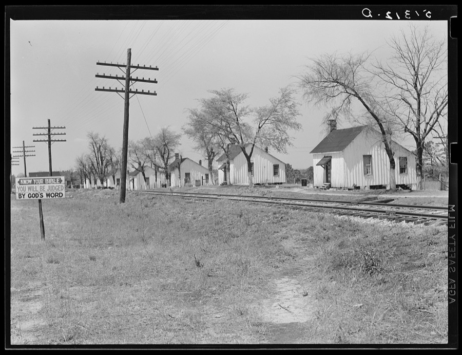




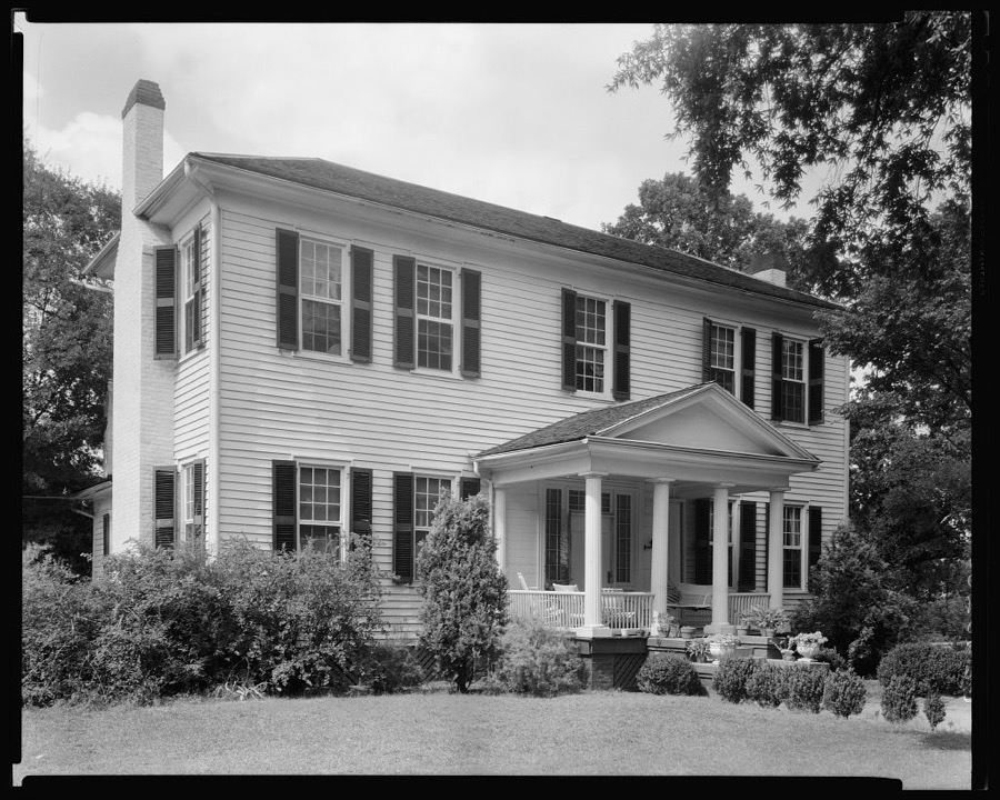

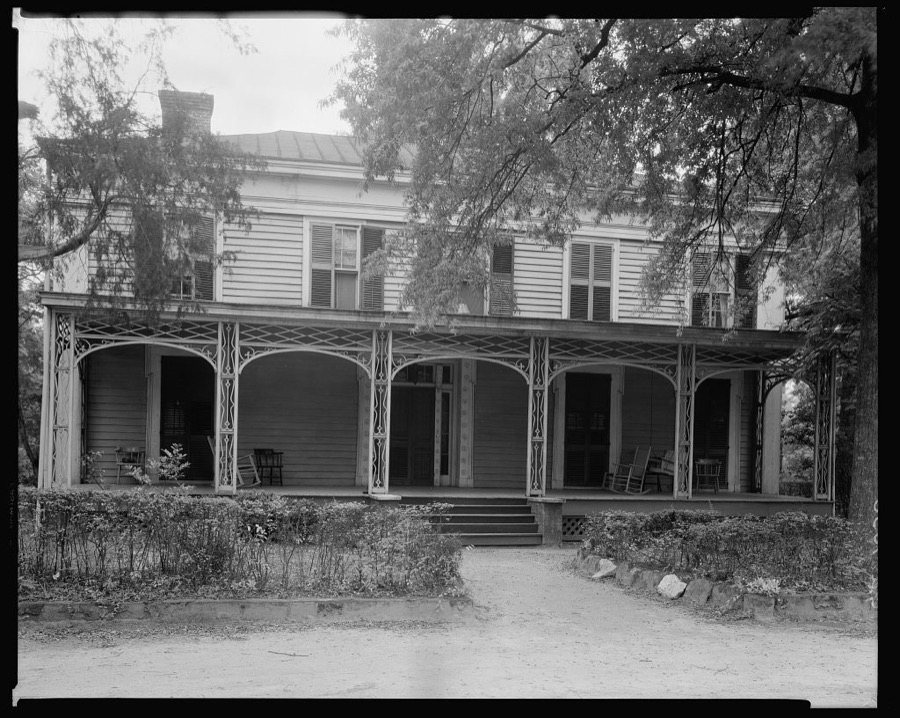




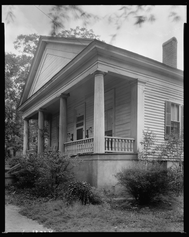





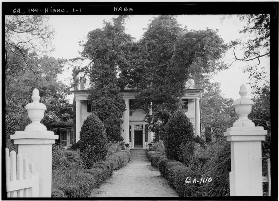
Every property in this county listed on the National Register of Historic Places, with the year it was listed and the federal nomination document.
| Photograph | Property | Type | Listed | Reference |
|---|---|---|---|---|
 | Apalachee School | building | 2000 | 00000527 |
 | Nathan Bennett House | building | 1974 | 74000695 |
 | Bonar Hall | building | 1972 | 72000388 |
| Bostwick Historic District | district | 2002 | 02001221 | |
| Buckhead Historic District | district | 2002 | 02000097 | |
| Cedar Lane Farm | building | 1971 | 71000281 | |
 | Hard Labor Creek State Park | district | 2013 | 13000107 |
 | Madison Historic District | district | 1974 | 74000696 |
 | Madison Historic District (Boundary Increase) | district | 1990 | 89002159 |
| James A. Nolan House | building | 2019 | 100004106 | |
 | John O'Flaherty House | building | 1991 | 91001155 |
| Rutledge Historic District | district | 2003 | 03000429 | |
 | Susie Agnes Hotel | building | 1994 | 94000664 |
 | Wilson-Finney-Land House | building | 2004 | 04000021 |
 | Zachry-Kingston House | building | 1987 | 87000796 |
Selected from the Digital Public Library of America's 1 image records catalogued for this county. Every one shown here carries a public-domain status or a licence that permits reuse on a site that carries advertising; non-commercial, share-alike and restricted images are excluded. The selection is spread across the county's towns (at most eight per town), so no single institution's bulk upload crowds out the rest. Each opens the holding library's record, and the complete set at the Digital Public Library of America is one click away.

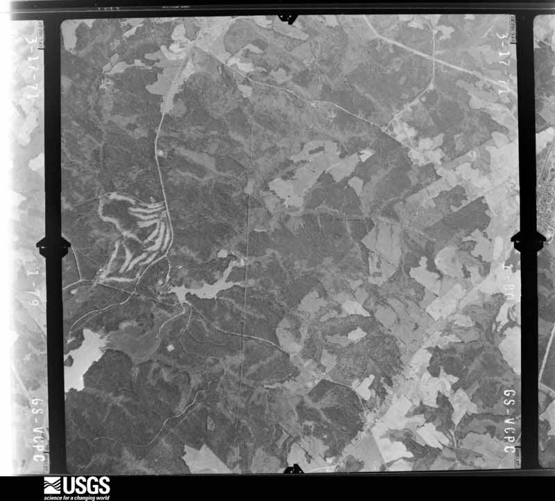
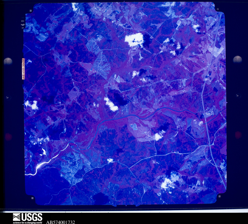
Flown by the U.S. Geological Survey between 1937 and 1989, the Aerial Photo Single Frames collection is the definitive mid-century view of the land: fields, roads and rivers as the camera saw them. The Survey holds 383 frames inside the rectangle that bounds this county; the 16 frames below were taken over the county itself, chosen across the decades of flights (at most four a year from that rectangle), so one flight cannot crowd out the rest. The full set is free to browse and download at EarthExplorer under the dataset Aerial Photo Single Frames.














The thermometers that kept this county's weather, and the gages that measured the flow of its streams, as the federal records hold them.
Who lived here in 1950, one enumeration district at a time, as the Census Bureau described each district. Each row opens its official National Archives result, with Population Schedules and ED Maps available there.
Every wildfire the federal occurrence database records inside this county: 422 of them, burning about 2,320 acres. 25 started naturally and 31 were recorded as arson. Each settlement page carries the fires within five miles of it.
| Reported cause | Fires |
|---|---|
| Debris and open burning | 241 |
| Equipment and vehicle use | 49 |
| Arson/incendiarism | 31 |
| Smoking | 31 |
| Natural | 25 |
| Missing data/not specified/undetermined | 17 |
| Recreation and ceremony | 15 |
| Misuse of fire by a minor | 9 |
| Railroad operations and maintenance | 4 |
The five largest, by the area the report gives. Three of them were set deliberately.
| Date | Cause | Size | Reported by | Name on the report |
|---|---|---|---|---|
| 6 May 2000 | Debris and open burning | 215 acres | Georgia Forestry Commission | FY2000-MORGAN-019 |
| 10 May 2000 | Arson/incendiarism | 119 acres | Georgia Forestry Commission | FY2000-MORGAN-021 |
| 26 February 2017 | Debris and open burning | 103 acres | Georgia Forestry Commission | FY2017-MORGAN-015 |
| 16 April 2004 | Debris and open burning | 90 acres | Georgia Forestry Commission | not named |
| 13 April 2007 | Arson/incendiarism | 83 acres | Georgia Forestry Commission | not named |
| 10 April 1999 | Debris and open burning | 69 acres | Georgia Forestry Commission | not named |
| 19 April 1999 | Recreation and ceremony | 63 acres | Georgia Forestry Commission | not named |
| 16 February 1999 | Arson/incendiarism | 48 acres | Georgia Forestry Commission | not named |
Every settlement page carries the fires within five miles of it - see the settlement index below.
The NOAA Storm Events Database holds 230 reports for this county, causing no deaths, 9 injuries and about $16,043,500 in recorded property damage. Each settlement page carries the reports that name it.
| Kind of event | Reports |
|---|---|
| Thunderstorm Wind | 153 |
| Hail | 42 |
| Flash Flood | 14 |
| Lightning | 9 |
| Tornado | 7 |
| Funnel Cloud | 3 |
| Flood | 2 |
The most serious of them, by death, then injury, then recorded damage. The accounts are quoted exactly as the forecast office filed them.
| When | Event | Place named | Harm | What the report says |
|---|---|---|---|---|
| August 1999 | Thunderstorm Wind | Buckhead | 4 hurt, $325,000 | Severe thunderstorm winds damaged farm buildings and knocked down several trees in the east and south part of Madison county. In the Godfrey community, winds damaged as many as 9 chicken houses, 5 of which were almost totally destroyed. Six people were trapped in the collapsed buildings and four were injured. |
| June 1986 | Thunderstorm Wind | not stated | 2 hurt | no account filed |
| June 1994 | Thunderstorm Wind | Madison | 1 hurt, $50,000 | A driver of an automobile was injured from a fallen tree toppled by thunderstorm winds. Several large trees and and power lines were downed in the city of Madison by thunderstorm winds. |
| June 2014 | Thunderstorm Wind | Rutledge | 1 hurt, $40,000 | The Morgan County Emergency Manager and 911 Center reported that a chicken house collapsed on Fairplay Road. Four trees were blown down in the Rutledge area, and another fell across Monticello Highway near Little Indian Creek. A motorist drove into the tree and was injured. |
| January 2020 | Thunderstorm Wind | Beacon Hgts | 1 hurt, $1,000 | The Morgan County Emergency Manager reported a large tree blown near the intersection of Bethany Road and Baldwin Dairy Road. |
| April 2011 | Tornado (EF1) | Reece | $7,000,000 | A damage survey conducted by the National Weather Service Forecast Office in Peachtree City, Georgia confirmed that the EF1 tornado that originally touched down in southeast Newton county tracked across central Morgan county before finally moving into western Greene county, where the tornado finally lifted approximately six miles west of Greensboro. The total path length of the tornado was 25 miles, of which nearly 20 miles fell within Morgan county. The maximum path width was 1/2 mile with maximum winds estimated to be 105 mph. Indeed, the majority of the damage associated with this tornado occurred within Morgan county. Several dozen homes were heavily damaged, many around Madison, largely from fallen or uprooted trees. A shopping center in Madison also lots part of its roof from the tornado. Several mobile homes sustained moderate to major damage, including three that were flipped over. All-in-all, 18 homes and/or businesses were destroyed, 37 suffered major damage, and another 128 sustained minor damage resulting in a total of 183 affected structures. Thousands of trees were destroyed along the path of the tornado. There were no fatalities or injuries associated with this tornado in Morgan county.||[04/27-04/28/11: Tornado #13, County #2-3, EF1, Newton-Morgan-Greene, 2011:022]. |
| June 1994 | Tornado (F2) | Bostwick to | $5,000,000 | A tornado touched down and destroyed 12 homes, severely damaged 28 to 30 additional homes and destroyed four chicken houses. Numerous large pine trees were uprooted or snapped half-way up from the crown. Damage to property in the Bostwick area was estimated at nearly 500,000 dollars. |
| August 2002 | Thunderstorm Wind | Bostwick | $450,000 | The Madison county Emergency Management Director reported that major damage was caused by thunderstorm winds across the north part of the county, particularly along and near Bostwick Road. Numerous trees and power lines were blown down or uprooted throughout the north part of the county. One tree caused significant damage to a home when it fell through the roof and also collapsed the front porch. A nearby parked vehicle also sustained damage during this incident. Several homes sustained minor to moderate damage when shingles or portions of their roofs were blown off, including one home with a tin roof which was partially ripped off and another with siding damage. A mobile home was also totally destroyed by downed trees and wind damage. |
| March 2008 | Hail | Madison | $400,000 | The public reported golf ball to baseball-sized hail in southeast Morgan county as yet another severe thunderstorm moved through the county. |
| December 2015 | Flash Flood | Centennial | $334,000 | A USGS stream gauge on the Little River at Newborn Road or around 3 miles northeast of Newborn reached flood stage of 12 feet. The river crest at 13.7 feet. Minor flooding occurred in the natural flood plain and woodlands along the river upstream and downstream from the gauge. Several roads and culverts were washed out by tributaries flowing into the Little River. |
| August 2002 | Lightning | Madison | $308,000 | The Madisonian Newspaper reported that lightning struck and set on fire a historic home in town on Washington Street. Many of its contents were antiques and irreplaceable. The structure and its contents were destroyed. The county's 911 communication system was also struck and knocked out of service by lightning. |
| April 2011 | Thunderstorm Wind | Rutledge | $250,000 | The Morgan County Emergency Management Director reported that thunderstorm winds had caused extensive damage throughout the county. A storm spotter reported that anywhere from 60 to 80 trees were down across the county. At least five homes in the Madison area were damaged as a result of downed trees. A family was trapped in one of these damaged homes, but was removed safely and without injury. In addition, the roof was blown off a home in Buckhead. |
| September 2009 | Flash Flood | Rutledge | $250,000 | The Morgan County Emergency Management Director reported flash flooding along Little Sandy Creek at Georgia Highway 83 and U.S. Highway 441, north of Madison. The Georgia Highway 83 bridge was washed out. U.S. Highway 441 was not damaged, but the road was closed for several hours as water was flowing over the road at the bridge. Flash flooding was also reported along Hunnicut Creek in southern Morgan county as well. |
| July 2002 | Lightning | Madison | $250,000 | The Madisonian newspaper of Madison reported that lightning struck a large two-story home in the Cedar Lakes subdivision. The lightning struck the bonus room above the garage, but fire, smoke and water left the house virtually destroyed. |
| April 2010 | Tornado (EF1) | Rehobeth | $218,000 | A damage survey conducted by the National Weather Service Forecast Office in Peachtree City, Georgia confirmed that a brief EF1 tornado had touched down in northeast Morgan county, approximately two miles north-northeast of Bostwick. The tornado first touched down on High Shoals Road, just south of the intersection with Rehoboth Road, then continued on an east-northeastward path across Rehoboth Road, Price Mill Road, and River Walk Road before lifting near the Appalachee River. At the tornado touchdown point on High Shoals Road, the roof was blown off a chicken house. As the tornado crossed Rehoboth Road, the roof of a home sustained significant damage and an adjacent barn was destroyed. As the tornado continued across Price Mill Road, one home sustained major damage and was left uninhabitable. Many trees were also either blown down or uprooted in the area. As the tornado reached its final point along River Walk Road, a high voltage power line was destroyed and two additional homes sustained minor damage. In total, five homes, one chicken house, and five out buildings were damaged. |
| July 2003 | Tornado (F1) | Madison | $184,000 | A storm damage survey conducted by an employee of the National Weather Service Forecast Office in Peachtree City, Georgia and reports from the Emergency Management Director, storm spotters, and the public confirmed that an F1 tornado touched down about 3 miles north-northeast of Pennington near Spears Road and just west of Georgia Highway 83, also known as Monticello Road. The tornado continued on a sporadic path for approximately 3 miles, terminating near Interstate-20, about four miles southwest of Madison. The tornado was associated with the remnants of Tropical Storm Bill and occurred just east of the center of the circulation associated with the remnants of the tropical storm. The Morgan county Emergency Management Director reported that extensive damage occurred to a dairy farm on Spears Road. Two dairy sheds were severely damaged, a 50 by 50 foot hay barn was destroyed, a 30 by 60 foot feed barn and a John Deere Tractor were significantly damaged, a two-car carport was destroyed as well as a Chevrolet Tahoe that was parked inside, and three other approximately 8 by 12 foot metal storage buildings were severely damaged or destroyed. One dairy cow was also killed by a falling tree. Seven other homes along Spears Road, Monticello Highway, and Brownwood Road sustained minor to moderate damage during the incident, mostly roof damage. One of the homes had half of its roof shingles blown off. One home sustained damage to several windows, and another residence had both a utility trailer and a car damaged by fallen trees. At an eighth location, a metal outbuilding sustained damage. The damage survey conducted by the National Weather Service found that hundreds of trees were blown down along the path of the tornado in the heavily forested area west of Georgia Highway 83 and southwest of Madison. |
| July 2007 | Lightning | Madison | $150,000 | The Morgan County Emergency Management Director reported that two homes were struck by lightning and set on fire. |
| July 2011 | Thunderstorm Wind | Madison Heliport | $125,000 | The Morgan County Emergency Management Director reported that at least a half dozen trees were down about five miles northeast of Godfrey. The public reported that several large trees were down near exit 114 on Interstate-20, just south of Madison. The large downed sweet gum and oak trees caused two mobile homes near the Interstate to be destroyed. |
| March 2008 | Hail | Rutledge | $100,000 | The public observed golf ball-sized hail about two miles south of Rutledge. However, a large swath of half-dollar-sized hail was observed by the public across the central part of Morgan county from Rutledge in the west to Buckhead in the east. Half-dollar-sized hail also fell in the Lake Oconee area in the southern part of the county. |
| September 2010 | Thunderstorm Wind | Rutledge | $50,000 | The Morgan County Emergency Management Director reported that up to 15 trees were down across the county. Trees were down in Rutledge, Madison, High Shoals, and Buckhead. The Buckhead community suffered the most damage where one tree was down on a home and another was down on a vehicle. |
| February 2019 | Thunderstorm Wind | Reece | $30,000 | The Morgan County Emergency Manager reported numerous trees and power lines blow down across far southern portions of the county from around Broughton Road and Shiloh Road to 7 Island Road around Pierce Dairy Road to Reids Ferry Road north of Woods Road. A home near the intersection of 7 Island Roads and Bethany Church Road sustained wind damage to the roof and porch. |
| July 2004 | Thunderstorm Wind | Countywide | $25,000 | The Morgan County Emergency Management Director reported widespread wind damage to trees and power lines countywide. A few trees were down on homes in the Buckhead area, causing damage to the structures. |
| June 1998 | Thunderstorm Wind | Countywide | $25,000 | The public reported several trees down on homes county-wide. Power outages occurred throughout the county. |
| May 1978 | Tornado (F1) | not stated | $25,000 | no account filed |
| April 1972 | Tornado (F1) | not stated | $25,000 | no account filed |
| June 2015 | Thunderstorm Wind | Rutledge | $20,000 | The Morgan County 911 Center reported trees and power lines blown down along Atlanta Highway, Beaver Dam Road, Briar Creek Road and Greensboro Highway. |
| May 2011 | Thunderstorm Wind | Rutledge | $20,000 | The Morgan County Emergency Management Director reported that a number of trees and power lines were down across the county, especially the northern part. In addition, a tin roof was blown off a porch near Madison. |
| August 2000 | Thunderstorm Wind | Apalachee | $20,000 | The Morgan county 911 center reported that a tree fell on and damaged a mobile home in Apalachee and a power line was knocked down in Madison. Pea size hail was also observed with this thunderstorm. |
| October 2021 | Flash Flood | Bethany | $15,000 | The Emergency Manager reported the Enterprise Road Bridge over Little Sugar Creek was damaged due to high water. Radar estimates indicate that 2.5 to 4 inches of rain occurred over the area, resulting in the flash flooding. |
| August 2015 | Thunderstorm Wind | Dorsey | $15,000 | The Morgan County 911 Center reported numerous trees and power lines blown down in the Madison area. One tree fell on a home causing structural damage. No injuries were reported. |
| July 2003 | Thunderstorm Wind | Bostwick | $15,000 | The Morgan county Emergency Management Director reported that a number of trees and power lines were blown down and that it appeared as if a downburst or microburst had hit around the 1200 block of Nolan Store Road. |
| April 2019 | Thunderstorm Wind | Reece | $12,000 | The Morgan County Emergency Manager reported a multiple trees blown down across the southern portion of the county from around the intersection of Clack Road and Weaver Jones Road to around the 2000 block of Pierce Dairy Road. |
| June 2015 | Thunderstorm Wind | Rutledge | $12,000 | The Morgan County 911 Center reported trees blown down across the county. The most concentrated area of damage was in the Rutledge area. |
| June 2015 | Thunderstorm Wind | Swords | $10,000 | The Morgan County 911 center reported numerous trees down along I-20 in the vicinity of mile marker 125. Traffic was backed up along the interstate for well over an hour. |
| May 2008 | Thunderstorm Wind | Madison | $10,000 | The Morgan County Emergency Management Director reported that many trees and power lines were blown down throughout the city. |
| July 2003 | Flash Flood | Rutledge | $10,000 | A storm spotter reported extensive flooding of roads in the Rutledge area. Water, six inches or greater in depth, was flowing across roads in the area as well as across the yards of several homes. In Bostwick, a number of roads were flooded and impassable with water flowing across the roads. |
| May 2003 | Thunderstorm Wind | Countywide | $10,000 | The Morgan county 911 center reported that a number of trees had been blown down across the county. Some of the trees fell on homes causing minor damage. |
| August 1999 | Lightning | Buckhead | $10,000 | Ten cows were killed when struck by lightning while they were huddled underneath a tree. |
| August 2020 | Thunderstorm Wind | Parks Mill | $8,000 | The Morgan County 911 center reported trees blown down across the southeastern portion of the county from around the intersection of Kingston Road and Cochran Road to I-20 east of Buckhead. |
| June 2005 | Thunderstorm Wind | Buckhead | $7,000 | The Morgan County Emergency Management Director reported that a microburst or downburst associated with a small, yet strong thunderstorm in the area, blew down or damaged from 10 to 20 large oak trees, rolled a tin roof up on a barn, and blew some shingles off a nearby home. |
| November 2004 | Thunderstorm Wind | Bostwick | $7,000 | The Morgan County Fire Department and Rescue Squad reported that the tin roof was partially blown off a barn. In addition, several trees were also down in the area. |
| June 2017 | Flash Flood | Bethany | $6,000 | Emergency Manager reported multiple driveways were washed out south of Interstate 20 near South Sugar Creek. Radar estimates indicate that 4 to 5 inches of rain occurred over the area. |
| June 2015 | Thunderstorm Wind | Apalachee | $6,000 | The Morgan County 911 Center reported several trees blown down along Parsonage Road just northwest of Apalachee. |
| August 2018 | Thunderstorm Wind | Reece | $5,000 | The Morgan County Emergency Manager reported multiple trees blown down on Broughton Road near Godfrey. |
| August 2014 | Thunderstorm Wind | Canaan | $5,000 | The Emergency Manager reported numerous trees and power lines down, mainly in and west of Madison. |
| September 2009 | Flood | Rutledge | $5,000 | The Morgan County Emergency Management Director reported that considerable flooding continued across the county much of the night following earlier flash flooding. Several roads, especially in the southern part of the county, remained under water and closed, particularly U.S. Highway 441 and Georgia Highway 83. Several creeks and streams in the central and southern part of the county were out of their banks. Minor additional road damage was observed during this period. |
| May 2008 | Thunderstorm Wind | Pennington | $5,000 | The Morgan County 911 Center reported that several trees and power lines were down across the southern portion of the county. |
| July 2006 | Lightning | Madison | $5,000 | The Madisonian of Morgan reported that lightning struck and set a barn on fire on Monticello Highway. The barn was completely destroyed from the subsequent fire. |
| July 2004 | Thunderstorm Wind | Madison | $5,000 | The Madisonian newspaper reported that a number of trees and several power lines were blown down by strong thunderstorm winds. |
| August 2004 | Thunderstorm Wind | Countywide | $5,000 | The Morgan County 911 Center reported that a number of trees had been blown down throughout the county. |
| July 2003 | Thunderstorm Wind | Madison | $5,000 | A storm survey conducted by an employee of the National Weather Service Forecast Office in Peachtree City, Georgia determined that approximately 30 or more isolated trees were blown down by straight line winds on Monticello Road, Clack Road, and Spears Road. The survey determined these downed trees to be separate from the F1 tornado damage that occurred later. |
| August 2003 | Flash Flood | Rutledge | $5,000 | The Morgan county 911 center reported that several businesses were flooded. Several roads in the area were also flooded. High water on Interstate-20 near Centennial may have caused an accident involving a car which hydroplaned and flipped over. |
| November 2002 | Thunderstorm Wind | Rutledge | $5,000 | The Morgan county 911 center reported that numerous trees were down across the south part of the county between Rutledge, Pennington, and Godfrey. At least 20 trees were reported to have been blown down in the Rutledge vicinity alone. |
| November 2002 | Thunderstorm Wind | Madison | $5,000 | The Morgan county Emergency Management Director reported several trees and some power lines were blown down in, just west, and just south of the city. Power was briefly lost at the 911 communications center. |
| September 2002 | Flood | Madison | $5,000 | The Madisonian Newspaper of Madison reported that over three inches of rain fell in approximately 30 minutes resulting in the flooding of downtown streets. A motorist was stranded in his vehicle near the intersection of Main and Park Street as water rose up to the level of the windows. The motorist was safely removed from the flood waters, however the vehicle suffered extensive water damage. |
| February 2001 | Thunderstorm Wind | Countywide | $5,000 | The Morgan county 911 center reported that trees and power lines were down throughout the county. |
| June 2001 | Thunderstorm Wind | Countywide | $5,000 | The Morgan County 911 center reported that trees were down throughout the county. |
| May 1995 | Thunderstorm Wind | Godfrey | $5,000 | Thunderstorm winds knocked a couple of trees down in Godfrey. Seven to eight miles south of Madison had trees knocked over. Also had grass fire in Godfrey believed to be started by lightning. |
| May 1994 | Thunderstorm Wind | Buckhead | $5,000 | Several large trees and power lines were downed by thunder- storm winds. |
| June 1994 | Thunderstorm Wind | Madison | $5,000 | Several large trees were downed by thunderstorm winds. |
The Survey's mineral resources record lists 3 workings inside this county. None of them still produces: all are closed or unrecorded. Each settlement page carries the workings within five miles of it.
| Commodity | Workings |
|---|---|
| Gold | 1 |
| Beryllium | 1 |
| Mica | 1 |
The least common of them first, because a county's hundredth gravel pit says nothing its first ten did not.
| Where | Site | Commodity | Status | Recorded |
|---|---|---|---|---|
| Alliston Prospect | Mica | Prospect | ||
| Carter Prospect | Beryllium | Prospect | ||
| Parker Prospect | Gold | Past Producer | Vein |
Named settlements recorded in the Geographic Names Information System, each with the topographic sheets covering it. Villages, hamlets and abandoned places alike. Each is shown with the nearest named watercourse or landform and the survey quadrangle it falls on. The 1 place that was also surveyed for fire insurance comes first, with the number of atlases and photographs held for them.
Madison census division · 30650 · Madison quadrangle
11 sheets, 1953 to 1988
Fire insurance: 7 atlases
Bostwick census division · 30650 · On Beaverdam Creek · Apalachee quadrangle
11 sheets, 1953 to 1988
Madison census division · 30650 · On Fourmile Branch · Madison quadrangle
11 sheets, 1953 to 1988
No longer a settlement
Buckhead census division · 30625 · On North Sugar Creek · Buckhead quadrangle
11 sheets, 1953 to 1988
Bostwick census division · 30650 · On Hester Branch · Rutledge North quadrangle
16 sheets, 1896 to 1988
Bostwick census division · 30650 · On Little Creek · Apalachee quadrangle
11 sheets, 1953 to 1988
Godfrey census division · 30663 · On Campbell Creek · Rutledge South quadrangle
16 sheets, 1896 to 1988
Bostwick census division · 30621 · On Bucks Creek · Watkinsville quadrangle
12 sheets, 1953 to 1988
No longer a settlement
Bostwick census division · 30650 · On Big Sandy Creek · Apalachee quadrangle
11 sheets, 1953 to 1988
No longer a settlement
Madison census division · 30650 · On Horse Branch · Madison quadrangle
11 sheets, 1953 to 1988
Madison census division · 30650 · On Briar Creek · Madison quadrangle
11 sheets, 1953 to 1988
Buckhead census division · 30625 · On Apalachee River · Buckhead quadrangle
11 sheets, 1953 to 1988
The vanished settlements of Morgan County: the places named above that are no longer on the map.
11 topographic sheets and 7 fire insurance atlases, 1885 to 1941
The complete index, with nothing left out. Each of these is a separate record with its own page: a federal survey report, or the case file that argued a property on to the National Register. Both are public domain and reproduced word for word.
The vanished settlements of Morgan County, the places these records name that are no longer on the map.