 Block
From the record
4 National Register listings published here.
Sources: the National Register database, National Park Service
28 topographic sheets cover 22 settlements here, and 4 properties are on the National Register of Historic Places.
4 National Register listings published here.
Sources: the National Register database, National Park Service
Every property in this county listed on the National Register of Historic Places, with the year it was listed and the federal nomination document.
| Photograph | Property | Type | Listed | Reference |
|---|---|---|---|---|
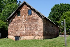 | William Barker Whiskey Bonding Barn | building | 2008 | 08000396 |
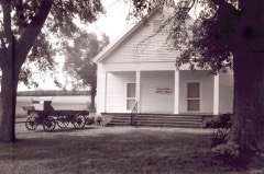 | New Hebron Baptist Church | building | 2017 | 100000906 |
 | Pike County Courthouse | building | 1980 | 80001222 |
 | R. F. Strickland Company | building | 1982 | 82002458 |
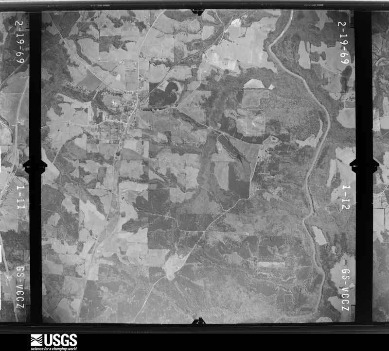
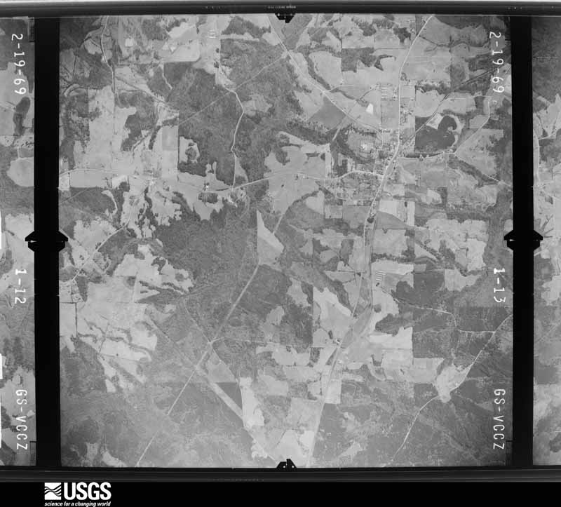
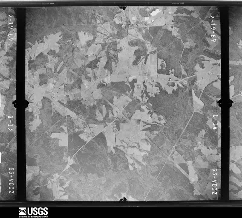
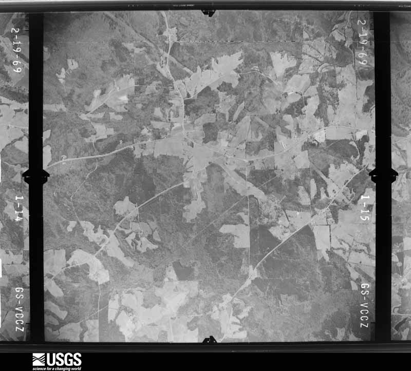
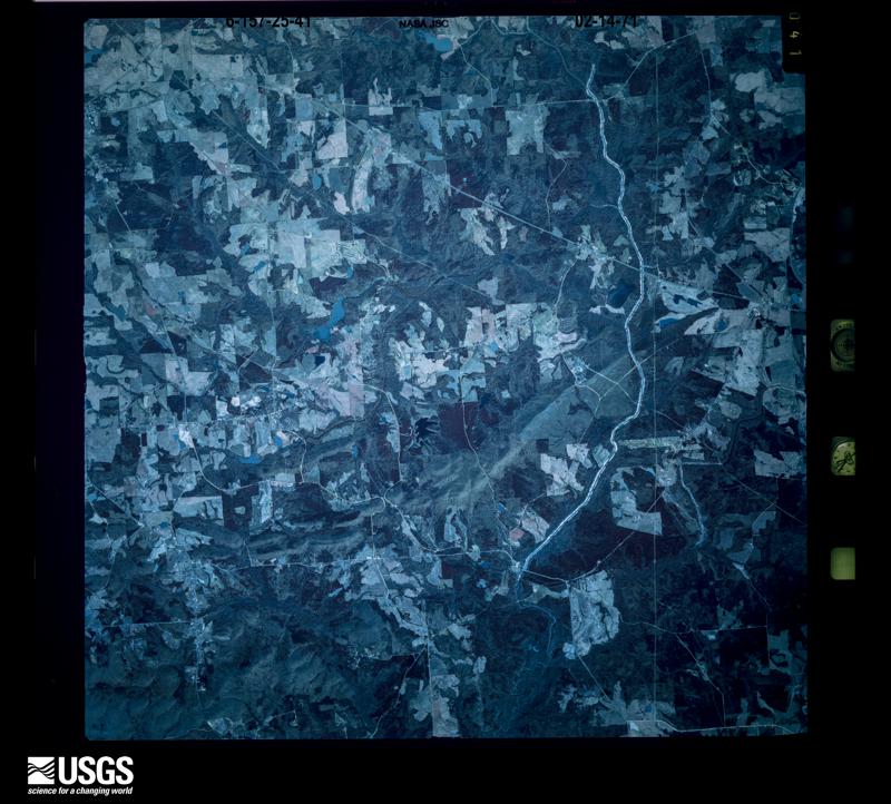
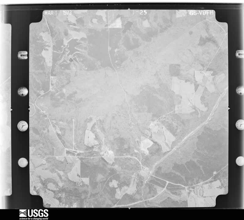
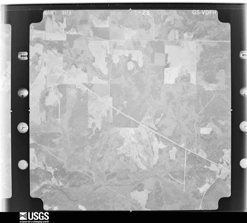
Flown by the U.S. Geological Survey between 1937 and 1989, the Aerial Photo Single Frames collection is the definitive mid-century view of the land: fields, roads and rivers as the camera saw them. The Survey holds 487 frames inside the rectangle that bounds this county; the 28 frames below were taken over the county itself, chosen across the decades of flights (at most four a year from that rectangle), so one flight cannot crowd out the rest. The full set is free to browse and download at EarthExplorer under the dataset Aerial Photo Single Frames.





















The thermometers that kept this county's weather, and the gages that measured the flow of its streams, as the federal records hold them. The extremes below are measured values from those records, not estimates.
Who lived here in 1950, one enumeration district at a time, as the Census Bureau described each district. Each row opens its official National Archives result, with Population Schedules and ED Maps available there.
Every wildfire the federal occurrence database records inside this county: 680 of them, burning about 2,471 acres. 21 started naturally and 83 were recorded as arson. Each settlement page carries the fires within five miles of it.
| Reported cause | Fires |
|---|---|
| Debris and open burning | 439 |
| Arson/incendiarism | 83 |
| Equipment and vehicle use | 40 |
| Missing data/not specified/undetermined | 39 |
| Recreation and ceremony | 22 |
| Misuse of fire by a minor | 21 |
| Natural | 21 |
| Smoking | 15 |
The five largest, by the area the report gives. Three of them were set deliberately.
| Date | Cause | Size | Reported by | Name on the report |
|---|---|---|---|---|
| 8 September 1995 | Arson/incendiarism | 122 acres | Georgia Forestry Commission | not named |
| 18 February 1996 | Arson/incendiarism | 70 acres | Georgia Forestry Commission | not named |
| 22 March 2008 | Debris and open burning | 54 acres | Georgia Forestry Commission | not named |
| 13 March 1996 | Arson/incendiarism | 50 acres | Georgia Forestry Commission | not named |
| 22 February 2000 | Missing data/not specified/undetermined | 46 acres | Georgia Forestry Commission | FY2000-PIKE-019 |
| 17 January 1992 | Debris and open burning | 46 acres | Georgia Forestry Commission | not named |
| 12 March 2004 | Debris and open burning | 44 acres | Georgia Forestry Commission | not named |
| 21 October 2016 | Debris and open burning | 42 acres | Georgia Forestry Commission | FY2017-PIKE-006 |
Every settlement page carries the fires within five miles of it - see the settlement index below.
The NOAA Storm Events Database holds 189 reports for this county, causing 1 death, 24 injuries and about $7,423,000 in recorded property damage. Each settlement page carries the reports that name it.
| Kind of event | Reports |
|---|---|
| Thunderstorm Wind | 101 |
| Flash Flood | 38 |
| Hail | 27 |
| Tornado | 14 |
| Lightning | 6 |
| Flood | 2 |
| Heavy Rain | 1 |
The most serious of them, by death, then injury, then recorded damage. The accounts are quoted exactly as the forecast office filed them.
| When | Event | Place named | Harm | What the report says |
|---|---|---|---|---|
| February 1993 | Tornado (F2) | Concord to | 1 killed, 2 hurt, $5,000,000 | Storm survey indicated a tornado with multiple vortices that followed a path about a 0.5-mile-wide. The tornado touched down east of the Flint river and continued east to the city of Zebulon at Georgia Highway 85. The Damage path was over 8 miles, but not continuous. A 10,000 square foot home valued at $776,000 was leveled with only kindling like litter left where it once stood. Ten homes were completely destroyed, 10 suffered substantial damage, and 10 others suffered minor damage. Damage to farm buildings estimated at $14,000. Several large trees and power lines were downed. The tornado caused one death, one critically injured, and one minor injury. The death and injuries occurred in a mobile home that was anchored to the ground yet lifted by the tornadic wind and destroyed the trailer which crushed the occupant. (F46M) |
| January 2023 | Tornado (EF3) | Hollonville | 18 hurt | New high resolution areal imagery in concert with a reanalysis of radar data, areal surveys and ground surveys it has been determined that there were multiple tornadoes on the ground simultaneously in southwest Spalding and Northwestern Pike Counties as well as crossing tornado paths. The tornadoes were part of a larger mesocyclone which can be traced west all the way back to the Selma Alabama tornado. Our analysis determined that this tornado would become the dominant circulation which impacted Griffin and much of Spalding County and Southern Henry County. The tornado first touched down in Northwest Pike County along HWY 362 west of Irish Hill Drive where a few trees were snapped and uprooted and quickly increased in intensity to EF1 as it crossed Kings Bridge Road, Huff Creek Rd and Scott Road where numerous trees were snapped and uprooted. As the storm crossed Blanton Mill Road more severe damage was noted both on the ground and areal survey and it was determined that EF2 damage was present in the area around Nunnally Rd and Bethany Road where widespread snapping of trees occurred and a few structures were severely damaged. However, the updated analysis shows that this area also experienced crossing tornado paths both from this tornado and another which struck the area approximately 2 minutes later. The combination of the 2 paths likely resulted in more intense damage indicators. As the storm continued north into southern Spalding County, the circulation briefly weakened causing only sporadic low end EF0 damage northward along Scott Barch Road. It should also be noted that this circulation would pass into southern Spalding County along Scott Barch Road just 2 minutes ahead of another EF1 tornado to cross its path coming in from the west. The tornado continued north crossing Scott Barch Road and uprooting trees in an area south of Blanton Mill Road. Per both radar data and damage on the ground the tornado would pivot within the larger mesocyclone in an area north of Blanton Mill and begin its track east crossing Rover Zetlla Road destroying a barn. It was near this point the tornado and the wind damage would significantly increase as the tornado was intensifying rapidly. The tornado would quickly reach peak intensity of 150-155 mph and several homes were completely destroyed along Kendall Drive and West Road. 2 homes in particular were noted to be completely destroyed down to the foundation however further inspection of the homes revealed that the walls were not anchored fully anchored into the concrete thus a higher rating could not be determined from those homes. The resident of one of those homes rode out the storm in his bathtub, however the bathtub and all plumbing fixtures were torn away from the slab and tossed into the nearby woods. The survivor of the home was miraculously uninjured and got out to help neighbors. Further west along Kendall Drive several homes were also completely destroyed with several others suffering major damage thus the EF3 rating. The damage along West Road in particular garnered a slight upgrade in the wind speed to high end EF3 damage per a reanalysis. Major to severe damage was also noted along Maloy Road, Hwy 16, areas around Griffin High School, The club at Shoal Creek and North Pine Hill Road. As the tornado approached Hwy 19, per UGA faculty, the UGA facility at Dempsey Farm recorded a wind speed of 81.1 mph before the anemometer/wind combo instrument blew off the tower. The tornado continued ENE through the community of Experiment to the NW of the town of Griffin crossing HWY 92 where numerous business and homes suffered damage either from wind or fallen trees consistent with EF0 through EF1 damage. A weather instrument on the south end of the tornado swath at the UGA Griffin Campus recorded a 73.9 mph wind gust as the storm passed by. Damage in the area was consistent with EF0 type wind damage. The tornado struck a Hobby Lobby building in an around Experiment St and Hwy 92 which suffered severe damage to the roof, and exterior walls on the northeast side. Damage to the building was consistent with EF2 winds of approximately 130 mph. The tornado continued Northeast through the northside of Griffin with mostly EF0-EF1 type wind damage. Pockets of more severe damage were noted along Northside Drive and McIntosh Road consistent with high end EF1 damage. The tornado continued northeast crossing Smoak Road and N. McDonough road where it was noted both on the ground and from the air that the circulation weakened and the damage become more sporadic in nature particularly the area from Amelia rd eastward to I75 in southern Henry County. Once the circulation crossed I75 intensity of the tornado increased to a mid to high end EF1 with damage in the city of Locust Grove. The tornado crossed LG Griffin Road where it impacted numerous homes in a subdivision and snapped or uprooted trees. The storm crossed Stanley K Tanger Road and through another neighborhood affecting several homes including some high end EF1 damage. As the storm crossed Hwy 23 numerous trees were snapped or uprooted and a new TDS appeared on radar. The tornado continued NE across Jackson St, Grove Park Drive, Skyland Dr, S. Unity Grove Road and S Ola grove road snapping and uprooting trees as well as causing EF0 or in some cases EF1 damage to homes. The storm continued ENE snapping and uprooting trees through Peaksville Road where it shortly there after become less defined and eventually merged with the circulation/tornado ongoing to the south in the Jenkinsburg area. |
| January 2006 | Tornado (F3) | Hollonville | 3 hurt, $750,000 | A damage survey conducted by the National Weather Service and confirmed by Emergency Managers from both Pike and Meriwether counties concluded that an F3 tornado touched down one mile southeast of Hollonville in northwest Pike county and traveled east for approximately 3 miles, terminating at a point about 4 miles east-southeast of Hollonville in north central Pike county. Five homes along the path were extensively damaged or destroyed. One home was moved 60 feet from its foundation. Two vehicles were thrown 250 yards. Several farm structures were also damaged in the area. A number of trees and power lines were also down in the area. Three injuries were reported during the event. Two men that were working in a barn were injured when the tornado blew the barn away. A third man was injured while clinging to a fence post that the tornado ripped from the ground. The tornado had an overall path length of 3 miles with a path width of 1/4 mile. One interesting note is that family photographs from one of the homes destroyed near Hollonville were found as far away as Williamson, near the Spalding county line. |
| February 1971 | Tornado (F1) | not stated | 1 hurt, $25,000 | no account filed |
| January 2006 | Hail | Molena | $400,000 | The public reported golf ball to softball-sized hail in the southwest part of Pike county near Molena. This hail was caused by a different thunderstorm from the one that spawned the F3 tornado in northern Pike southeast of Hollenville earlier. The thunderstorm that caused the large hail in southwest and south central Pike county was a separate supercell thunderstorm moving east across the southern part of the county. |
| October 1998 | Lightning | Zebulon | $300,000 | Fire set by lightning destroyed a large home on County Line Road in northeast Pike county. Most of the family's belongings were also lost. |
| March 2013 | Tornado (EF2) | Pedenville | $160,000 | A National Weather Service survey team determined that an EF-2 tornado that touched down in Meriwether County continued into Pike County. A home sustained minor roof damage, had both doors blown out, and four front windows were damaged. One barn was completely destroyed, and another shifted several feet off its foundation. A pontoon boat was thrown into a third barn. Two neighboring houses sustained minor damage, one to the roof and another to the garage. Thousands of trees were snapped or uprooted, some falling on homes.|[03/18/13: Tornado #1, County #2-2, EF2, Meriwether-Pike, 2013:004]. |
| July 2024 | Lightning | Zebulon | $100,000 | Zebulon UMC caught fire due to lightning strike. Building is a total loss. |
| October 2020 | Tornado (EF0) | Hilltop | $50,000 | A National Weather Service survey team found that an EF0 tornado with maximum wind speeds of 80 mph and a maximum path width of 200 yards travelled 2.1 miles across a portion of northern Pike County northeast of Concord. The tornado touched down just northeast of Concord near the intersection of Hill Street and West Road snapping or uprooting multiple trees along West Road as it moved north northeast before lifting near the intersection with Hollonville Road. The most extensive damage occurred along West Road near Bottoms Road where several pine trees were uprooted or snapped. No injuries were reported. [10/10/20: Tornado #4, County #1/1, EF-0, Pike, 2020:031]. |
| June 2016 | Thunderstorm Wind | Zebulon | $50,000 | The Pike County Emergency Manager reported numerous, over 50, trees blown down across the eastern portion of the county from around Zebulon to Meansville and the Lamar County line. Damage was reported along and between Highways 18 and 109. |
| October 1997 | Lightning | Zebulon | $50,000 | Lightning set fire to a home on the east side of Zebulon. Firefighters battled the blaze for five hours, but the house was a total loss. |
| July 1994 | Thunderstorm Wind | Zebulon | $50,000 | Downburst winds from a thunderstorm downed a few small tennant buildings, ripped plywood and roofing material off a church roof, along with numerous trees along a 1-mile-wide swath in Zebulon. |
| June 2011 | Thunderstorm Wind | Hollonville | $35,000 | The Pike County 911 Center reported that at least 10 trees were down across the western and central portions of the county from near Hollonville to Hilltop. One tree was down on a home causing damage to the structure. A portion of Georgia Highway 18 just east of Zubulon was blocked from two large downed trees. |
| January 2020 | Tornado (EF0) | Reidsboro | $25,000 | A National Weather Service survey team found that an EF0 tornado with peak winds of 80 mph and a maximum path width of 100 yards touched down in the 500 block of Wood Creek Road southwest of Williamson in northern Pike County. Several large trees were snapped or uprooted intermittently along a path following Reidsboro Road northeastward, including in the Eagles Landing subdivision, where one home sustained |minor roof damage. The tornado lifted just southwest of Pike County Fire Station #6 west of Williamson-Zebulon Road. [01/13/20: Tornado #1, County #1/1, EF-0, Pike, 2020:004]. |
| July 2011 | Thunderstorm Wind | Williamson | $25,000 | The Pike County 911 Center reported that three trees were down in the north and northeast part of the county, between Williamson and Zebulon. One tree was down on a home, another was down across a power line and adjacent road, and a third was down another road. |
| May 2010 | Lightning | Meansville | $25,000 | The Pike County 911 Center reported that two homes were struck by lightning. No further information or damage details were provided. |
| June 1998 | Thunderstorm Wind | Zebulon | $25,000 | The Pike county sheriff's office reported trees down and some damage to houses, mostly to roofs. |
| May 1980 | Tornado (F1) | not stated | $25,000 | no account filed |
| April 2009 | Lightning | Lifsey | $24,000 | The Pike County Journal and Reporter of Zebulon reported that lightning struck a group of 16 cows lying down near a tree at a dairy farm on Kings Road near Meansville. All of the cows were dead at the scene. |
| August 2019 | Thunderstorm Wind | Molena | $20,000 | The Pike County Emergency Manager reported wind damage to the roof of a gas station at the intersection of Highway 18 and Jones Street as well as the canopy over the gasoline pumps. A vehicle was damaged by the debris, but no injuries were reported. |
| March 2003 | Thunderstorm Wind | Hollonville | $20,000 | A Pike county citizen reported that around 75 trees were blown down just north of Georgia Highway 362 at Hollonville. The same citizen also reported roof damage to his house. The Pike county 911 center also reported that two power poles were down in the same general area. |
| March 1996 | Thunderstorm Wind | Meansville | $20,000 | no account filed |
| March 2023 | Flash Flood | Weaver | $15,000 | The Emergency Manager reported Campground Road washed out by high water on a creek. In addition to the 1.5 inches of rain that fell the previous day, radar estimates indicate that 4 to 6 inches, with isolated amounts of up to 8 inches, fell on March 26, resulting in the flash flooding. |
| April 2000 | Tornado (F1) | Zebulon | $15,000 | Sight survey by NWS employees, together with newspaper and public reports, confirmed an F0 to F1 tornado touched down in northeastern PIke county near the intersection of Gresham Road and Kendrick Road. It crossed the extreme northwest corner of Lamar county and moved into extreme southeast Spalding county before lifting. The storm path had a total length of approximately 7.5 miles and an average width of 50 yards, but was occasionally as wide as 100 yards. Four homes sustained damage. Most observed damage was shingles blown off roofs or fallen trees and limbs on houses. |
| October 1997 | Thunderstorm Wind | Hollonville | $15,000 | Severe thunderstorm winds in the Hollonville and Williamson areas knocked trees down across roads and onto two houses, causing considerable damage. Pike county 911 reported several trees were knocked down on a mobile home northeast of Zebulon. |
| April 2017 | Thunderstorm Wind | Williamson | $10,000 | The Pike County Emergency Manager reported trees and power lines blown down near the intersection of Patton Road and Sunset Road. The metal roof was also blown off of a barn and wrapped around trees. |
| April 2011 | Tornado (EF1) | Clearwater Springs | $10,000 | A damage survey conducted by the National Weather Service Forecast Office in Peachtree City, Georgia confirmed that yet another tornado had touched down in the far southeast corner of Pike county and traveled 30 miles across Lamar, Monroe, and into extreme southern Butts county before finally lifting. The tornado began as an EF1 in Pike county before strengthening into an EF3 as it moved across Lamar county, then weakened back to an EF2 as it moved across Monroe and finally an EF0 as it briefly crossed into extreme southeast Butts county. This tornado was spawned by the same supercell thunderstorm that generated the EF2 tornado across Harris, Meriwether, and Upson counties earlier. The tornado touched down in Pike county on U.S. Highway 19 approximately three miles south of Meansville. The tornado tracked through a mostly rural area of Pike county and as such damage was confined primarily to a number of downed trees and several power lines. There were no fatalities or injuries within Pike county from this tornado.||[04/27-04/28/11: Tornado #12, County #1-4, EF3, Pike-Lamar-Monroe-Butts, 2011:021]. |
| July 2005 | Thunderstorm Wind | Concord | $10,000 | The public and the Pike County 911 Center reported that strong thunderstorm winds blew down several trees, 10 or more, in the area between Concord and Hollonville on Pryer and River Roads. The public reported that two outbuildings were completely moved from their foundation. |
| July 2000 | Thunderstorm Wind | Molena | $10,000 | The public reported numerous trees and power lines down. |
| June 2015 | Thunderstorm Wind | Williamson | $6,000 | The Pike County Emergency Manager reported trees down along Highway 362 and on Midland Street and Little Street in the Williamson area. |
| February 2025 | Thunderstorm Wind | Zebulon | $5,000 | Multiple trees reported down along hwy 19 and hwy 18 out of zebulon. |
| February 2025 | Thunderstorm Wind | Hilltop | $5,000 | Multiple trees were downed along oxford circle. |
| February 2025 | Thunderstorm Wind | Williamson | $5,000 | Multiple trees were downed in the area of chapel hill rd at patton rd. |
| May 2025 | Thunderstorm Wind | Lifsey | $5,000 | Emergency manager reported several trees down along both eastbound and westbound Hwy 109 in southern Pike County. |
| July 2020 | Thunderstorm Wind | Concord | $5,000 | The Pike County 911 center reported several trees blown down along Roberts Quarters Road. |
| September 2004 | Flash Flood | Countywide | $5,000 | The Pike County 911 Center reported that several roads were flooded with up to a foot of water flowing over some of these roads. |
| May 2003 | Thunderstorm Wind | Countywide | $5,000 | The Pike county Sheriff's office and the public reported that several trees were blown down in the county. |
| June 2002 | Thunderstorm Wind | Molena | $5,000 | An amateur radio operator reported that trees and power lines were down in downtown Molena at the intersection of Georgia Highways 109 and 18. |
| June 1998 | Thunderstorm Wind | Countywide | $5,000 | Pike county sheriff's office reported several trees down and power outages across the county. |
| July 1994 | Thunderstorm Wind | Zebulon | $5,000 | Thunderstorm winds greater than 55 mph, accompanied by small hail, damaged several homes and historical buildings within Zebulon. Numerous tree limbs and power lines were also downed. |
| April 1997 | Thunderstorm Wind | Concord | $4,500 | no account filed |
| June 2019 | Thunderstorm Wind | Lifsey | $4,000 | The Pike County Emergency Manager reported trees and power lines blown down south of Zebulon from west through east of Meansville. |
| July 2018 | Thunderstorm Wind | Zebulon | $4,000 | The Pike County Emergency Manager reported several trees blown around the intersection of Concord Street and Pope Street. |
| March 2026 | Thunderstorm Wind | Williamson | $3,000 | Ema reports a few trees down in the chapel hill rd area. |
| April 2025 | Thunderstorm Wind | Jolly | $3,000 | Several trees down in vicinity of hollonville rd and hwy 18. |
| April 2025 | Thunderstorm Wind | Meansville | $3,000 | Several trees down along pine valley road one tree on a home. |
| June 2019 | Thunderstorm Wind | Weaver | $3,000 | The Pike County Emergency Manager reported trees blown down near the intersection of Caldwell Road and Quail Drive. |
| November 2016 | Thunderstorm Wind | Lawrences Mill | $3,000 | The Pike County 911 center reported trees blown down on Lawrence Mill Road, Roberts Quarters Road and Drew Allen Road. |
| July 2007 | Thunderstorm Wind | Lifsey | $3,000 | The Pike County 911 Center reported that several trees and power lines were down in the southeast part of the county. |
| August 2006 | Thunderstorm Wind | Williamson | $3,000 | The Pike County 911 Center reported that from six to nine trees were down in the area northwest of Williamson to near the Spalding county line. About six trees were down on Bethany Church Road and one tree was down on Georgia Highway 362 west of Williamson. The public reported that three other trees were down in the same area. One residence on Bethany Church Road also reported having a swing set and trampoline blown over during the thunderstorm. |
| March 2013 | Thunderstorm Wind | Hollonville | $2,500 | The Pike County Emergency Manager reported that several trees were blown down in Hollonville, especially along Falcon Road. |
| April 2025 | Thunderstorm Wind | Hollonville | $2,000 | Two trees down along hollonville road just south of hwy 362. |
| April 2025 | Thunderstorm Wind | Jolly | $2,000 | Two tree down near hollonville road and reidsboro road. |
| April 2025 | Thunderstorm Wind | Reidsboro | $2,000 | Two trees down near reidsboro road and drew allen road. |
| April 2025 | Thunderstorm Wind | Weaver | $2,000 | Two trees down along hwy 19 near flat rock church road. |
| July 2025 | Thunderstorm Wind | Jolly | $2,000 | EM reports a few trees down and power out along Hollondville Rd just north of the intersection with Reidsboro Rd. |
| July 2023 | Thunderstorm Wind | Reidsboro | $2,000 | Report of trees down along Drew Allen Rd. |
| June 2023 | Thunderstorm Wind | Reidsboro | $2,000 | Emergency manager reported two trees down near the intersection of Reidsboro Rd and Drew Allen Rd. |
| July 2023 | Thunderstorm Wind | Hilltop | $2,000 | Trees down on roadway near Mclendon and Concord St. |
| June 2019 | Thunderstorm Wind | Lawrences Mill | $2,000 | The Pike County Emergency Manager reported trees blown down along Lawrence Mill Road near Kelly Road. |
The Survey's mineral resources record lists 4 workings inside this county. 1 still produces and 3 are closed or unrecorded. Each settlement page carries the workings within five miles of it.
| Commodity | Workings |
|---|---|
| Manganese | 2 |
| Iron | 2 |
| Sand and Gravel, Construction | 1 |
| Granite | 1 |
The least common of them first, because a county's hundredth gravel pit says nothing its first ten did not.
| Where | Site | Commodity | Status | Recorded |
|---|---|---|---|---|
| Flat Rock Porphyritic Granite Pros | Granite | Prospect | ||
| Molina Sand Co--Lawrence Mine | Sand and Gravel, Construction | Producer | ||
| R.I.Beckem Property | Iron, Manganese | Occurrence | ||
| W.M.Hartley Property | Manganese, Iron | Prospect |
Named settlements recorded in the Geographic Names Information System, each with the topographic sheets covering it. Villages, hamlets and abandoned places alike. Each is shown with the nearest named watercourse or landform and the survey quadrangle it falls on.
Concord-Molena census division · 30258 · On Mountain Creek · Concord quadrangle
9 sheets, 1953 to 1979
Williamson census division · 30292 · Hollonville quadrangle
9 sheets, 1953 to 1979
No longer a settlement
Concord-Molena census division · 30258 · On Mountain Creek · Gay quadrangle
8 sheets, 1953 to 1979
Meansville census division · 30295 · Zebulon quadrangle
9 sheets, 1953 to 1979
No longer a settlement
Williamson census division · 30206 · On Birch Creek · Concord quadrangle
9 sheets, 1953 to 1979
Zebulon census division · 30295 · Zebulon quadrangle
9 sheets, 1953 to 1979
No longer a settlement
Zebulon census division · 30295 · On Lewis Creek · Zebulon quadrangle
9 sheets, 1953 to 1979
The vanished settlements of Pike County: the places named above that are no longer on the map.