 Block
From the record
2 National Register listings published here.
Sources: the National Register database, National Park Service
12 topographic sheets cover 5 settlements here, and 2 properties are on the National Register of Historic Places.
2 National Register listings published here.
Sources: the National Register database, National Park Service
Every property in this county listed on the National Register of Historic Places, with the year it was listed and the federal nomination document.
| Photograph | Property | Type | Listed | Reference |
|---|---|---|---|---|
 | Quitman County Courthouse and Old Jail | building | 1995 | 95000718 |
| Quitman County Jail | building | 1981 | 81000200 |
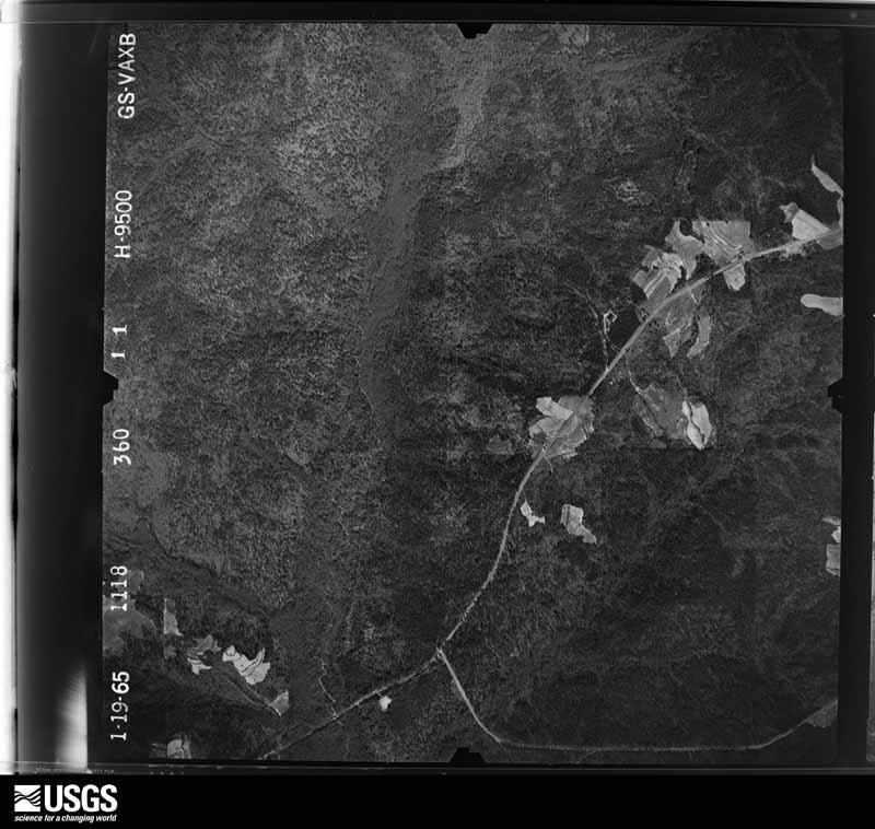
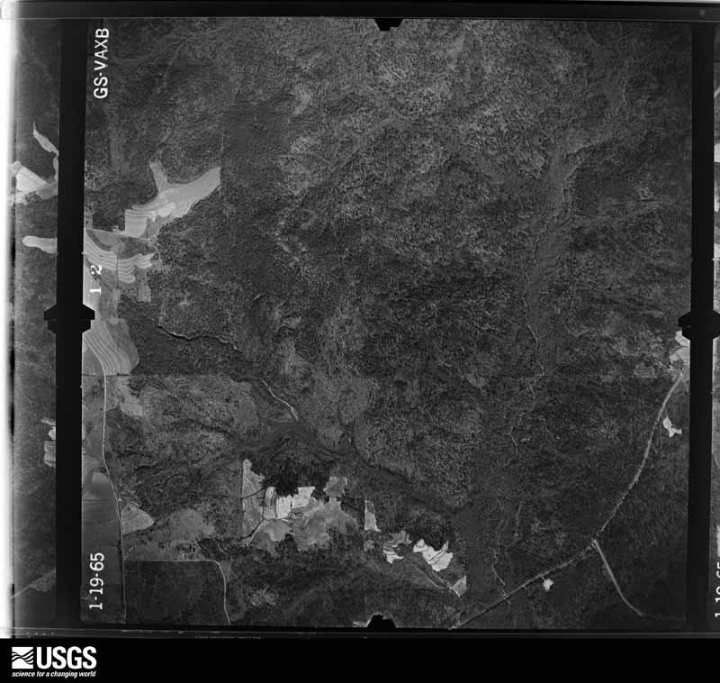
Flown by the U.S. Geological Survey between 1937 and 1989, the Aerial Photo Single Frames collection is the definitive mid-century view of the land: fields, roads and rivers as the camera saw them. The Survey holds 262 frames inside the rectangle that bounds this county; the 15 frames below were taken over the county itself, chosen across the decades of flights (at most four a year from that rectangle), so one flight cannot crowd out the rest. The full set is free to browse and download at EarthExplorer under the dataset Aerial Photo Single Frames.













The thermometers that kept this county's weather, and the gages that measured the flow of its streams, as the federal records hold them. The extremes below are measured values from those records, not estimates.
Who lived here in 1950, one enumeration district at a time, as the Census Bureau described each district. Each row opens its official National Archives result, with Population Schedules and ED Maps available there.
Every wildfire the federal occurrence database records inside this county: 316 of them, burning about 1,491 acres. 17 started naturally and 14 were recorded as arson. Each settlement page carries the fires within five miles of it.
| Reported cause | Fires |
|---|---|
| Debris and open burning | 206 |
| Equipment and vehicle use | 28 |
| Missing data/not specified/undetermined | 21 |
| Natural | 17 |
| Arson/incendiarism | 14 |
| Smoking | 12 |
| Misuse of fire by a minor | 8 |
| Recreation and ceremony | 5 |
| Railroad operations and maintenance | 5 |
The five largest, by the area the report gives. One of them was set deliberately.
| Date | Cause | Size | Reported by | Name on the report |
|---|---|---|---|---|
| 25 May 2011 | Natural | 99 acres | Georgia Forestry Commission | FY2011-QUITMAN-007 |
| 16 April 2004 | Debris and open burning | 98 acres | Georgia Forestry Commission | not named |
| 13 October 2016 | Debris and open burning | 97 acres | Georgia Forestry Commission | FY2017-QUITMAN-003 |
| 24 May 1996 | Natural | 55 acres | Georgia Forestry Commission | not named |
| 22 August 1993 | Natural | 51 acres | Georgia Forestry Commission | not named |
| 20 April 1997 | Arson/incendiarism | 38 acres | Georgia Forestry Commission | not named |
| 26 August 2000 | Railroad operations and maintenance | 36 acres | Georgia Forestry Commission | FY2001-QUITMAN-007 |
| 20 March 2004 | Debris and open burning | 33 acres | Georgia Forestry Commission | not named |
Every settlement page carries the fires within five miles of it - see the settlement index below.
The NOAA Storm Events Database holds 66 reports for this county, causing no deaths, 2 injuries and about $725,250 in recorded property damage. Each settlement page carries the reports that name it.
| Kind of event | Reports |
|---|---|
| Thunderstorm Wind | 43 |
| Hail | 10 |
| Tornado | 7 |
| Lightning | 2 |
| Flash Flood | 2 |
| Flood | 1 |
| Heavy Rain | 1 |
The most serious of them, by death, then injury, then recorded damage. The accounts are quoted exactly as the forecast office filed them.
| When | Event | Place named | Harm | What the report says |
|---|---|---|---|---|
| March 2020 | Tornado (EF1) | Bonapartes Retreat | 1 hurt, $50,000 | The tornado moved across the Chattahoochee River from Barbor County, Alabama and crossed into Georgia along Deer Point Rd. Trees were snapped and a home suffered roof damage along the river. The tornado continued moving east northeast just to the south of Deer Point Rd snapping and uprooting dozens of trees along its path. A home had an outbuilding completely destroyed and a barn was destroyed as well. The tornado continued further into Quitman County eventually crossing HWY 82 where several trees were downed including one that crushed a mobile home. A man in the mobile home was transported to the hospital with non-life threatening injuries. Damage, consisting of snapped and uprooted trees continued to the east northeast through eastern Quitman County into Randolph County. The last accessible damage was along HWY 27 six miles north of Cuthbert where a few dozen pine trees were snapped and other trees were uprooted. The tornado continued into inaccessible areas further east at this point. The tornado was rated EF1 was max winds estimated at 100 mph for both Quitman and Randolph counties. Damage cost was estimated. |
| June 2009 | Thunderstorm Wind | Bonapartes Retreat | 1 hurt, $50,000 | A large tree fell on a house and injured a child. |
| December 1954 | Tornado (F2) | not stated | $250,000 | no account filed |
| April 2017 | Tornado (EF2) | Bonapartes Retreat | $100,000 | The tornado touched down in extreme southeastern Barbour County in the White Oak community producing EF1 damage on White Oak Drive. The tornado then crossed Sandy Creek into Henry County's White Oak subdivision producing mostly EF1 damage across the entire width of the neighborhood between Sandy Creek and White Oak Creek. However, a double-wide manufactured home on Laurel Drive was shifted about 8 feet despite being strapped to the ground by 2 to 3 foot anchors which were completely pulled from the ground. This justified EF2 damage in this location with winds estimated at 115 mph. The tornado then crossed the Walter F. George Reservoir, also known as Lake Eufaula, into the state of Georgia with EF1 damage on the eastern shore of the lake along County Road 28. The tornado came ashore at the Quitman-Clay County line producing damage in both counties primarily in the form of uprooted trees. The trees damaged several homes. Debris from a lakeside porch was lofted and deposited on the opposite side of the home and strewn across an adjacent field. The tornado continued northeastward across rural Quitman County hitting the Self Family Farm on Self Road. The tornado did significant damage to the roof of a well constructed brick home, removing the majority of the roof. The walls of a brick outbuilding collapsed. There were also numerous trees snapped or uprooted adjacent to the home, two of which were debarked. This damage was consistent with EF2 winds of about 115 mph. Just northeast of the house, an irrigation pivot was toppled with the northern portion falling toward the southwest and the southern portion falling in the opposite direction. The tornado continued northeast across more rural areas causing EF1 damage to trees on County Road 82 before lifting shortly thereafter. |
| July 2008 | Lightning | Georgetown | $100,000 | A Georgetown restaurant was destroyed by fire. The cause of the blaze was lightning. |
| July 1996 | Lightning | South Brook | $75,000 | no account filed |
| September 1998 | Flash Flood | Countywide | $35,000 | no account filed |
| April 2017 | Thunderstorm Wind | Bonapartes Retreat | $15,000 | A tree was blown down onto a house. |
| May 2020 | Thunderstorm Wind | Georgetown | $5,000 | A large tree was blown down on Highway 82 along with several hundred power outages in the Georgetown area. |
| April 2005 | Thunderstorm Wind | Wire Bridge | $5,000 | The Quitman County Sheriff reported several downed trees and power lines along Highway 39. |
| April 1997 | Thunderstorm Wind | Georgetown | $5,000 | Several trees and limbs were downed knocking down power lines. |
| January 2013 | Thunderstorm Wind | Bonapartes Retreat | $4,000 | Several trees were blown down across the county. Monetary damage was estimated. |
| May 2021 | Thunderstorm Wind | Crossroads | $3,000 | A few trees and power lines were blown down in Quitman county. |
| March 2019 | Thunderstorm Wind | State Rd 27/County Rd 14 | $3,000 | A barn was damaged along Highway 27 South. |
| April 2017 | Thunderstorm Wind | State Rd 27/County Rd 14 | $3,000 | Several trees and power lines were blown down. |
| April 2017 | Thunderstorm Wind | Georgetown | $3,000 | Power lines were blown down onto a truck. Trees were down on Highway 39 and 82. |
| April 2015 | Thunderstorm Wind | Georgetown | $3,000 | Trees and power lines were blown down. |
| April 1998 | Hail | Morris | $3,000 | Quarter sized hail was reported over eastern Quitman County around Morris. Report came through the Georgetown PD. |
| May 2006 | Thunderstorm Wind | Countywide | $2,500 | The Quitman County Sheriff reported some trees and power lines down throughout the county. |
| April 2020 | Thunderstorm Wind | Georgetown | $2,000 | A tree was blown down onto power lines along Highway 82. |
| June 2006 | Thunderstorm Wind | Georgetown | $2,000 | Several downed trees reported by the Quitman County Sheriff. |
| July 2000 | Thunderstorm Wind | Georgetown | $2,000 | Some trees and power lines down at U.S. Highway 82 and Hatcher Road. Reported by the Quitman County EMA. |
| July 2015 | Thunderstorm Wind | Wire Bridge | $1,000 | A tree was blown down onto a power line south of Georgetown. |
| June 2014 | Thunderstorm Wind | Hatcher | $1,000 | A tree was blown down on Hatcher Road. |
| March 2007 | Thunderstorm Wind | Hatcher | $1,000 | The Quitman County Sheriff reported numerous trees down just southeast of Hatcher. |
| March 2007 | Tornado (EF0) | Hatcher | $1,000 | The tornado moved from Clay County into Quitman County along Hatcher Road before it lifted. Numerous trees were snapped. |
| July 1994 | Thunderstorm Wind | Georgetown | $500 | Thunderstorm winds uprooted several trees onto power lines which along U.S. Highway 82 which caused one to two power outages in Georgetown. |
| August 2007 | Thunderstorm Wind | Georgetown | $250 | A few trees were down southeast of Quitman. |
| February 2025 | Thunderstorm Wind | Crossroads | - | A tree was blown down onto a power line at Windina Road and Bourbon Street. |
| March 2024 | Flash Flood | State Rd 27/County Rd 14 | - | Flooding was reported along Highway 39 near the Quitman-Stewart County line. |
| July 2023 | Thunderstorm Wind | State Rd 27/County Rd 14 | - | A tree was blown down onto Highway 27 just south of the Stewart-Quitman county line. |
| August 2023 | Thunderstorm Wind | Georgetown | - | Two trees were blown down on Winding Way Road. |
| June 2023 | Tornado (EF1) | Hatcher | - | A tornado touched down near the Clay-Quitman county line, causing minor tree damage. The tornado continued northeast and crossed Beachom Road in Quitman county. The most significant tree damage was seen in this location with numerous trees uprooted or snapped. The tornado continued northeastward through inaccessible areas before crossing Lower Morris Road and dissipating just south of US Highway 82. Special thanks to WTVM-TV meteorologist Dana Barker for providing photos and a detailed description of the damage path for this survey. |
| May 2022 | Thunderstorm Wind | Hatcher | - | A tree was blown down near the Clay county line. |
| August 2022 | Thunderstorm Wind | Georgetown | - | Downed power lines were reported in an area of Florence St and Depot St . |
| June 2022 | Thunderstorm Wind | Wire Bridge | - | Numerous trees were blown down. |
| March 2020 | Thunderstorm Wind | Wire Bridge | - | A tree was blown down along Cool Branch Road. |
| April 2020 | Thunderstorm Wind | Georgetown | - | Scattered trees were blown down. |
| January 2019 | Thunderstorm Wind | Wire Bridge | - | A tree was blown down on Highway 39 South, mile marker 9, blocking the northbound lane. |
| March 2019 | Tornado (EF1) | State Rd 27/County Rd 14 | - | A strong/cycling tornado crossed into Georgia along the Chattahoochee River, about 2-3 miles south of Lakepoint Resort State Park, causing considerable tree damage along State Hwy 39 in northern Quitman county. The tornado raced east with more trees snapped or uprooted along Hwy 27, just south of CR 10. Based on the surveyable damage (mainly trees), EF-0 to EF-1 damage was noted with max wind speeds estimated around 100 mph. The tornado appeared to briefly weaken near Hwy 27,|but quickly re-intensified as it crossed the Quitman/Stewart county line. |
| August 2018 | Thunderstorm Wind | Hatcher | - | Two trees were reported blown down in Quitman county. |
| February 2016 | Thunderstorm Wind | Georgetown | - | There were 2 reports of trees down in Quitman county. |
| June 2016 | Thunderstorm Wind | Georgetown | - | Trees were blown down in Quitman county. |
| July 2016 | Thunderstorm Wind | Georgetown | - | Several trees were reported down by the Quitman County Sheriff's Office. |
| April 2015 | Hail | Crossroads | - | Quarter size hail was reported near Pataula Creek between Ft. Gaines and Georgetown. |
| May 2012 | Hail | State Rd 27/County Rd 14 | - | A storm chaser reported hail up to quarter size on State Route 27. |
| December 2011 | Heavy Rain | Crossroads | - | A 24 hour rainfall total of 3.05 inches was measured by the USGS river gauge located at Pataula Creek near the intersection of US Highway 82 and County Road 46. |
| March 2011 | Tornado (EF0) | Georgetown | - | The Eufaula police department reported a tornado on the ground near Georgetown. However, no damage was reported. |
| December 2009 | Flood | Georgetown | - | Water up to a foot deep covered several streets and roadways in Georgetown, including portions of U.S. Highway 82. Several retention ponds were overflowing. |
| June 2009 | Thunderstorm Wind | Georgetown | - | Numerous trees were down. |
| June 2008 | Thunderstorm Wind | Georgetown | - | A few trees were down northeast of Georgetown. |
| February 2008 | Thunderstorm Wind | Georgetown | - | Several trees were down across the northern half of the county. |
| June 2007 | Hail | Georgetown | - | Half dollar size hail was reported. |
| April 2005 | Hail | Georgetown | - | Nickel size hail reported by the Quitman County Sheriff. |
| December 2005 | Hail | Georgetown | - | The Quitman County Sheriff reported quarter size hail. |
| June 2002 | Hail | Georgetown | - | Nickel size hail fell on U.S. Highway 82. Reported by the Quitman County Sheriff. |
| April 1999 | Thunderstorm Wind | Countywide | - | Several trees were knocked down across the northern part of the county. |
| May 1998 | Hail | Hatcher | - | Nickel size hail was reported in Hatcher. |
| June 2023 | Hail | Crossroads | - | no account filed |
| March 2011 | Hail | Georgetown | - | no account filed |
The Survey's mineral resources record lists 2 workings inside this county. None of them still produces: all are closed or unrecorded. Each settlement page carries the workings within five miles of it.
| Commodity | Workings |
|---|---|
| Lead | 1 |
| Iron | 1 |
The least common of them first, because a county's hundredth gravel pit says nothing its first ten did not.
| Where | Site | Commodity | Status | Recorded |
|---|---|---|---|---|
| Lumpkin Mine | Iron | Past Producer | ||
| McKenzie Mine | Lead | Past Producer |
Named settlements recorded in the Geographic Names Information System, each with the topographic sheets covering it. Villages, hamlets and abandoned places alike. Each is shown with the nearest named watercourse or landform and the survey quadrangle it falls on.
Georgetown North census division · 39854 · On Smithee Jack Creek · Morris quadrangle
7 sheets, 1953 to 1981
Georgetown North census division · 39854 · On Tobannee Creek · Georgetown quadrangle
8 sheets, 1953 to 1981
Georgetown South census division · 39854 · On Cotton Creek · Hatcher quadrangle
7 sheets, 1953 to 1981
Georgetown South census division · 39867 · On Short Creek · Morris quadrangle
7 sheets, 1953 to 1981