 Block
From the record
3 National Register listings published here.
Sources: the National Register database, National Park Service
17 topographic sheets and 11 fire insurance atlases across 2 places.
3 National Register listings published here.
Sources: the National Register database, National Park Service
Every property in this county listed on the National Register of Historic Places, with the year it was listed and the federal nomination document.
| Photograph | Property | Type | Listed | Reference |
|---|---|---|---|---|
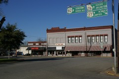 | Cuthbert Historic District | district | 1975 | 75000607 |
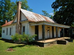 | Fletcher Henderson House | building | 1982 | 82002460 |
 | Shellman Historic District | district | 1985 | 85001935 |
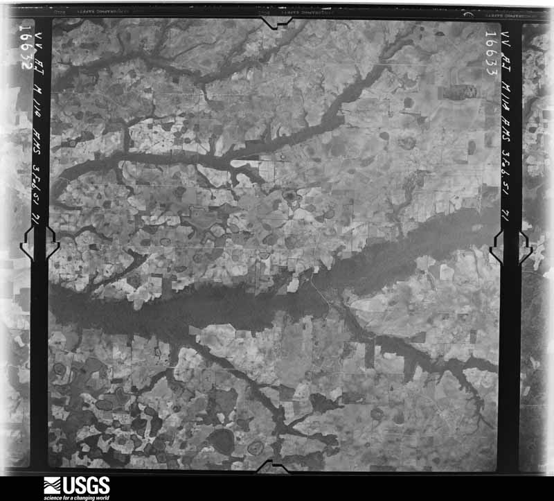
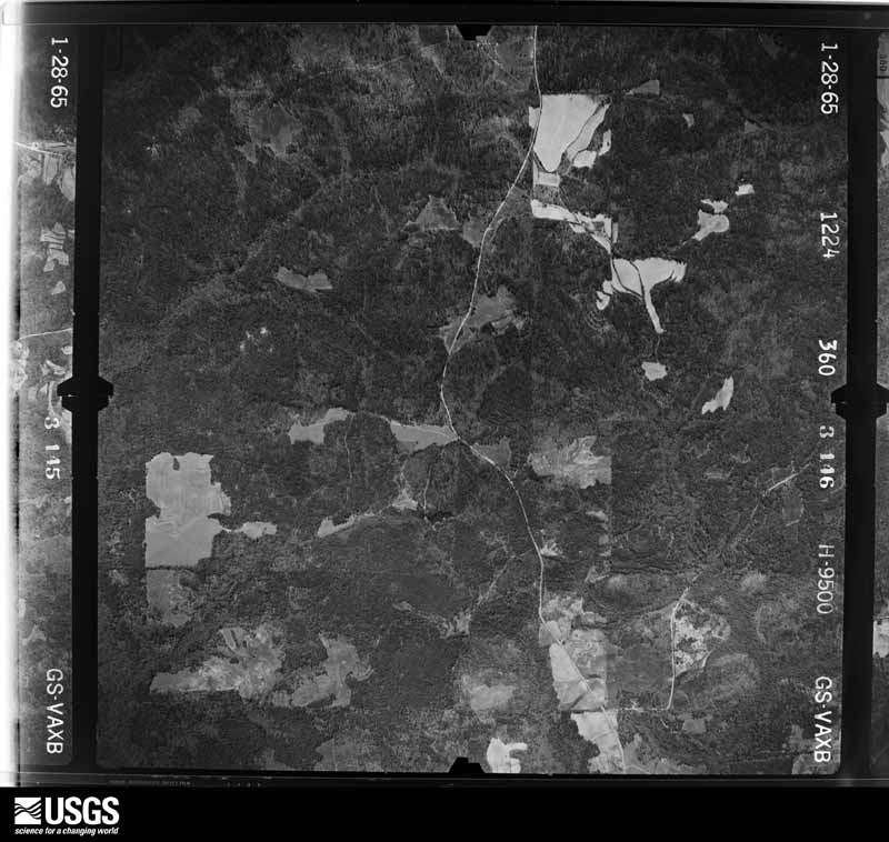
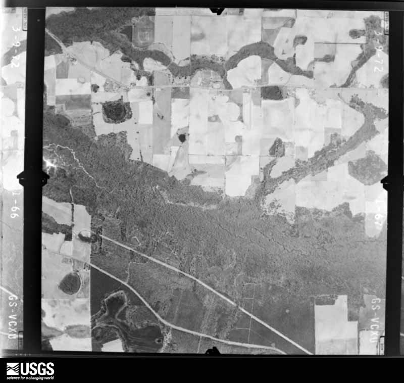
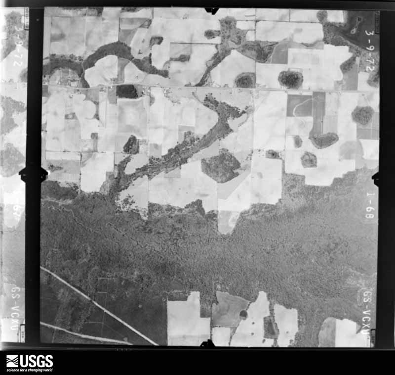
Flown by the U.S. Geological Survey between 1937 and 1989, the Aerial Photo Single Frames collection is the definitive mid-century view of the land: fields, roads and rivers as the camera saw them. The Survey holds 488 frames inside the rectangle that bounds this county; the 9 frames below were taken over the county itself, chosen across the decades of flights (at most four a year from that rectangle), so one flight cannot crowd out the rest. The full set is free to browse and download at EarthExplorer under the dataset Aerial Photo Single Frames.





The thermometers that kept this county's weather, as the federal records hold them. The extremes below are measured values from those records, not estimates.
Who lived here in 1950, one enumeration district at a time, as the Census Bureau described each district. Each row opens its official National Archives result, with Population Schedules and ED Maps available there.
Every wildfire the federal occurrence database records inside this county: 696 of them, burning about 3,673 acres. 50 started naturally and 23 were recorded as arson. Each settlement page carries the fires within five miles of it.
| Reported cause | Fires |
|---|---|
| Debris and open burning | 453 |
| Equipment and vehicle use | 74 |
| Natural | 50 |
| Railroad operations and maintenance | 40 |
| Missing data/not specified/undetermined | 25 |
| Arson/incendiarism | 23 |
| Smoking | 13 |
| Recreation and ceremony | 11 |
| Misuse of fire by a minor | 7 |
The five largest, by the area the report gives. Two of them were set deliberately.
| Date | Cause | Size | Reported by | Name on the report |
|---|---|---|---|---|
| 30 March 2013 | Debris and open burning | 143 acres | Georgia Forestry Commission | FY2013-RANDOLPH-027 |
| 24 March 2017 | Debris and open burning | 137 acres | Georgia Forestry Commission | FY2017-RANDOLPH-025 |
| 4 June 2007 | Equipment and vehicle use | 86 acres | Georgia Forestry Commission | not named |
| 9 June 1997 | Equipment and vehicle use | 84 acres | Georgia Forestry Commission | not named |
| 7 November 2001 | Debris and open burning | 78 acres | Georgia Forestry Commission | FY2002-RANDOLPH-011 |
| 12 April 1996 | Arson/incendiarism | 77 acres | Georgia Forestry Commission | not named |
| 24 April 1993 | Arson/incendiarism | 72 acres | Georgia Forestry Commission | not named |
| 2 June 2019 | Debris and open burning | 71 acres | Georgia Forestry Commission | FY2019RANDOLPH010 |
Every settlement page carries the fires within five miles of it - see the settlement index below.
The NOAA Storm Events Database holds 130 reports for this county, causing no deaths, 12 injuries and about $4,285,080 in recorded property damage. Each settlement page carries the reports that name it.
| Kind of event | Reports |
|---|---|
| Thunderstorm Wind | 98 |
| Tornado | 16 |
| Hail | 10 |
| Flash Flood | 3 |
| Lightning | 1 |
| Heavy Rain | 1 |
| Flood | 1 |
The most serious of them, by death, then injury, then recorded damage. The accounts are quoted exactly as the forecast office filed them.
| When | Event | Place named | Harm | What the report says |
|---|---|---|---|---|
| May 2004 | Tornado (F1) | Carnegie | 6 hurt, $100,000 | The tornado continued on a northeast track from Clay County, downing trees and power lines along its path through southern Randolph County. Before lifting, it destroyed a mobile home on County Road 6, off Fountain Bridge Road. Its six occupants sustained minor injuries. Reported by the Cuthbert Fire/EMS and Albany Herald. |
| March 2020 | Thunderstorm Wind | Cuthbert | 3 hurt, $100,000 | There were multiple homes with trees blown onto them along with numerous trees and power lines down across the city. Three injuries resulted due to trees falling. |
| September 1998 | Tornado (F1) | Cuthbert | 1 hurt, $500,000 | Tornado touched down two miles east of Cuthbert off U.S. 82 bypass. A manufacturing plant was destroyed where one employee was injured by falling debris. Several large pine trees were uprooted. |
| April 1957 | Tornado (F2) | not stated | 1 hurt, $25,000 | no account filed |
| September 2011 | Thunderstorm Wind | Cuthbert | 1 hurt, $5,000 | Trees and power lines were blown down county wide. A woman was injured when she was struck by a falling tree limb in hunt camp. The monetary damage figure provided is a rough estimate. |
| January 1963 | Tornado (F1) | not stated | $2,500,000 | no account filed |
| April 1971 | Tornado (F3) | not stated | $250,000 | no account filed |
| January 2017 | Tornado (EF2) | Carnegie | $200,000 | The tornado touched down in Clay County and moved northeast through the northwest corner of Calhoun County and into southern Randolph County. It caused extensive tree damage with nearly every tree in its path snapped through the Clay and Calhoun portions of the track. In addition, it flipped a mobile home in Clay County, injuring one person who was inside. The tornado caused major roof damage in Clay and Calhoun counties removing the roofing structure from two homes. It also caused minor roofing damage to several homes in all three counties. Damage cost was estimated. |
| May 1998 | Lightning | Shellman | $100,000 | Fire destroyed more than 4,000 tons of peanuts after lightning struck a warehouse at the Locke Farm Center in Shellman. |
| March 2011 | Tornado (EF1) | Benevolence | $65,000 | The Randolph county sheriff's department and emergency management reported a tornado touchdown in the city of Benevolence. Damage included several trees and power lines down, one mobile home destroyed, one mobile home severely damaged, and several outbuildings destroyed. The monetary damage figure provided is a rough estimate. |
| June 2023 | Tornado (EF1) | Pachitla | $50,000 | A pair of tornadoes touched down east of Cuthbert near Trinity Church Road. This tornado was the southern circulation, which touched along Wilton Rigsby Road south of Trinity Church Road. The tornado continued across several fields, causing tree damage along the way. A substantial steel farm storage building collapsed along Trinity Church Road, just east of Wooten Road. This damage was rated EF-1, with winds estimated to be approximately 110 mph. A grain silo was partially destroyed at this location as well. The tornado continued to move east southeast down Trinity Church Road, causing tree damage and damage to several home and manufactured homes. This damage was mostly rated EF-0 and low-end EF-1. The tornado appears to have weakened as it moved to the southeast and dissipated in a field east of Trinity Church Road. |
| June 2023 | Tornado (EF1) | Pachitla | $50,000 | A pair of tornadoes touched down east of Cuthbert near Trinity Church Road. This tornado was the northern circulation, which touched down near the intersection of Trinity Church Road and Wilton Rigsby Road, causing tree damage and damage to an old out building. Further east, roof damage to a single family home and significant tree damage was noted supportive of an EF-1 rating with winds of approximately 110 mph. The tornado continued east, damaging a church, a mobile home, several stands of trees, and tossing debris into nearby fields. This circulation appears to have dissipated in a field near the intersection of Trinity Church Road and Wooten Road. |
| June 2016 | Thunderstorm Wind | Cuthbert | $50,000 | Trees were blown down in Cuthbert including a few on homes. Damage was estimated. |
| February 2008 | Thunderstorm Wind | Springvale | $50,000 | Straight line winds damaged three mobile homes and downed numerous trees across the northern portion of the county. |
| August 2004 | Flash Flood | Southeast Portion | $25,000 | Radar estimates from four to six inches of rain fell during a two-hour period in the upper drainages of the Pachitla and Ichawaynochaway Creeks. Two to three feet of water covered Lower Shellman Road by Pachitla Creek. Reported by the Randolph County EMA. |
| October 1997 | Thunderstorm Wind | Brooksville | $25,000 | Severe thunderstorm winds downed trees along Georgia Highway 41 near Brooksvile. Minor flooding reported. |
| March 1980 | Tornado (F1) | not stated | $25,000 | no account filed |
| April 2011 | Thunderstorm Wind | Cuthbert | $20,000 | Numerous trees were blown down across the county. One tree punctured a roof in Cuthbert. The monetary damage figure provided is a rough estimate. |
| February 2011 | Thunderstorm Wind | Cuthbert | $20,000 | Several trees were reported down in Cuthbert with a few trees on structures. Damage was also reported to some outbuildings. The monetary damage figure provided is a rough estimate. |
| March 2026 | Thunderstorm Wind | Cuthbert | $15,000 | A tree was blown down onto a house and a car with power lines also down. |
| July 2018 | Thunderstorm Wind | Cuthbert | $10,000 | A tree was blown down onto a home in Cuthbert. Damage cost was estimated. |
| April 2015 | Thunderstorm Wind | Shellman | $10,000 | A large tree was blown down into a home near Shellman. Monetary damage was estimated. |
| January 2023 | Thunderstorm Wind | Cuthbert | $5,000 | Power poles were broken with several tree limbs also blown down. |
| March 2020 | Thunderstorm Wind | Peterson Hill | $5,000 | There were multiple reports of trees and power lines down across the western part of Randolph county. |
| April 2020 | Thunderstorm Wind | Cuthbert | $5,000 | A roll up door was blown in at two county facilities. A poll that was part of a gas station overheard canopy was bent about 30 degrees. |
| April 2020 | Thunderstorm Wind | Shellman | $5,000 | Minor structural damage occurred to the back wall of a warehouse. |
| January 2013 | Thunderstorm Wind | Coles | $5,000 | At least 5 trees and a power lines were blown down in the county from another round of thunderstorms. Monetary damage was estimated. |
| July 2012 | Thunderstorm Wind | Shellman | $5,000 | The Randolph county 911 dispatch reported that numerous trees were blown down across the county from near Shellman westward to near Springvale. Monetary damage was estimated. |
| August 2006 | Thunderstorm Wind | Countywide | $5,000 | Some trees and utility poles were down throughout the county. Reported by the Citizen News-Edison. |
| March 1993 | Thunderstorm Wind | Benevolence | $5,000 | Several tree limbs were downed from thunderstorm winds which caused several power outages between Benevolence and Troutman. |
| April 2015 | Thunderstorm Wind | Cuthbert | $4,000 | Trees and power lines were blown down. |
| October 2022 | Thunderstorm Wind | Coles | $3,000 | Downed trees resulted in a few power outages. |
| July 2016 | Thunderstorm Wind | Coleman | $3,000 | Numerous power lines were blown down due to high winds south of Coleman. |
| June 2016 | Thunderstorm Wind | Shellman | $3,000 | A few trees and power lines were blown down in the Shellman area. |
| July 2016 | Thunderstorm Wind | Peterson Hill | $3,000 | Power lines were blown down west of Cuthbert. |
| July 2012 | Thunderstorm Wind | Cuthbert | $3,000 | The Randolph county 911 dispatch reported multiple trees down near Cuthbert. Monetary damage was estimated. |
| April 2002 | Thunderstorm Wind | Cuthbert | $3,000 | Several downed trees and power lines reported by the Randolph County Sheriff. |
| May 2025 | Thunderstorm Wind | Shellman | $2,000 | Several trees and a power line were blown down in the Shellman area. |
| August 2024 | Thunderstorm Wind | Cuthbert | $2,000 | Trees and power lines were blown down. Power was knocked out along Blakely Street south of Cuthbert. |
| January 2023 | Thunderstorm Wind | Peterson Hill | $2,000 | Power lines were blown down on Reid Station Road. |
| January 2020 | Thunderstorm Wind | Cuthbert | $2,000 | A tree and a power line were blown down at 216 Seaboard St. |
| May 2017 | Tornado (EF0) | Coleman | $2,000 | Damage consisted primarily of minor tree damage. A single family home suffered minor roof damage, and a carport collapsed along Fountain Bridge Road. This tornado was rated EF0 with peak winds estimated near 80 mph. Damage cost was estimated. |
| May 2012 | Thunderstorm Wind | Cuthbert | $2,000 | Two power lines were blown down in the city of Cuthbert. Monetary damage was estimated. |
| May 2012 | Thunderstorm Wind | Coles | $2,000 | Two trees were blown down on Highway 82 West. Monetary damage was estimated. |
| January 2002 | Thunderstorm Wind | Southwest Portion | $2,000 | Some downed trees. Reported by the Randolph County Sheriff. |
| May 2017 | Thunderstorm Wind | Carnegie | $1,000 | A tree was blown down and resulted in a power outage via the Georgia Power outage website. |
| May 2015 | Thunderstorm Wind | Springvale | $1,000 | A tree was blown down across Highway 82 in the Springvale area. |
| January 2013 | Thunderstorm Wind | Coleman | $1,000 | A couple of trees were blown down near Coleman. |
| May 2012 | Thunderstorm Wind | Cuthbert-Randolph Arpt | $1,000 | A tree was blown down along County Road 266. Monetary damage was estimated. |
| January 2012 | Thunderstorm Wind | Benevolence | $1,000 | A tree was blown down near Benevolence. Monetary damage was estimated. |
| January 2012 | Thunderstorm Wind | Wades | $1,000 | A tree was blown down on Rigsby Road. Monetary damage was estimated. |
| June 2011 | Thunderstorm Wind | Wades | $1,000 | A tree was blown down near Lumpkin Road. The monetary damage figure provided is a rough estimate. |
| March 2007 | Thunderstorm Wind | Cuthbert | $1,000 | The Cuthbert Fire/Rescue reported numerous downed trees and debris on State Highway 50. |
| May 2006 | Thunderstorm Wind | Countywide | $1,000 | The Randolph County Sheriff reported some trees down throughout the county. |
| July 1997 | Thunderstorm Wind | Cuthbert | $800 | no account filed |
| July 1995 | Thunderstorm Wind | Coleman | $500 | Thunderstorm winds blew a few trees down across power lines along Georgia Highway 266. |
| June 1994 | Thunderstorm Wind | Cuthbert | $500 | A few large trees and several large branches were downed by thunderstorm winds. |
| July 1994 | Thunderstorm Wind | Cuthbert | $500 | News media reported thunderstorm winds had knocked numerous large tree limbs down on Georgia State Road 27. |
| July 1994 | Thunderstorm Wind | Cuthbert | $500 | Thunderstorm winds downed a few large tree limbs and power lines along U.S. Highway 82. |
| March 2007 | Thunderstorm Wind | Cuthbert | $250 | The Cuthbert Fire/Rescue reported several trees down just northwest of Cuthbert. |
The Survey's mineral resources record lists 6 workings inside this county. None of them still produces: all are closed or unrecorded. Each settlement page carries the workings within five miles of it.
| Commodity | Workings |
|---|---|
| Aluminum | 4 |
| Stone, Crushed/Broken | 2 |
The least common of them first, because a county's hundredth gravel pit says nothing its first ten did not.
| Where | Site | Commodity | Status | Recorded |
|---|---|---|---|---|
| Wade Quarry | Stone, Crushed/Broken | Past Producer | ||
| Williamson Quarry | Stone, Crushed/Broken | Past Producer | ||
| Fussell Mine | Aluminum | Past Producer | ||
| Garner Mine | Aluminum | Past Producer | ||
| Springvale Mine | Aluminum | Past Producer | ||
| Yarboro Mine | Aluminum | Past Producer |
Named settlements recorded in the Geographic Names Information System, each with the topographic sheets covering it. Villages, hamlets and abandoned places alike. Each is shown with the nearest named watercourse or landform and the survey quadrangle it falls on. The 2 places that were also surveyed for fire insurance come first, with the number of atlases and photographs held for them.
Cuthbert census division · 39840 · Cuthbert quadrangle
7 sheets, 1953 to 1981
Fire insurance: 9 atlases
Shellman census division · 39886 · Shellman quadrangle
7 sheets, 1953 to 1981
Fire insurance: 2 atlases
Cuthbert census division · 39836 · Bluffton quadrangle
7 sheets, 1953 to 1981
No longer a settlement
Benevolence census division · 39886 · On Soapstone Branch · Brooksville quadrangle
7 sheets, 1953 to 1981
Cuthbert census division · 39840 · On Goffs Mill Creek · Martins Crossroads quadrangle
7 sheets, 1953 to 1981
Cuthbert census division · 39840 · On Yankee Branch · Carnegie quadrangle
7 sheets, 1953 to 1981
No longer a settlement
Shellman census division · 39886 · Martins Crossroads quadrangle
7 sheets, 1953 to 1981
Cuthbert census division · 39840 · On McCallop Creek · Cuthbert quadrangle
7 sheets, 1953 to 1981
Benevolence census division · 39840 · On Little Pumpkin Creek · County Line quadrangle
7 sheets, 1953 to 1981
Cuthbert census division · 39840 · On Shivers Mill Creek · Martins Crossroads quadrangle
7 sheets, 1953 to 1981
The vanished settlements of Randolph County: the places named above that are no longer on the map.
7 topographic sheets and 9 fire insurance atlases, 1885 to 1943