 Block
Stewart, Georgia
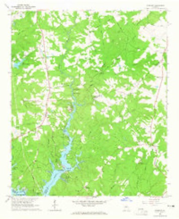
12 topographic sheets cover this place, the earliest surveyed in 1953 and the latest in 1988. It stands in the South Newton census division. It lies in ZIP code area 30014. It stands on Potts Creek. The Survey maps it on the Stewart quadrangle.
Topographic sheets covering this place
7 surveys from 12 printed sheetsMatched by testing this settlement's coordinate against the published boundary of every sheet in the United States Geological Survey's historical collection. Each opens the scanned sheet at the Survey.
- 1953 USGS Athens quadrangle1:250000, 3 printings
- 1958 USGS Athens quadrangle1:250000
- 1959 USGS Athens quadrangle1:250000
- 1963 USGS Athens quadrangle1:250000
- 1964 USGS Stewart quadrangle1:24000, 3 printings
- 1981 USGS Milledgeville quadrangle1:100000, 2 printings
- 1988 USGS Athens quadrangle1:250000

Fires near this place
299 since 1992Regional context, not property-specific evidence. The federal wildfire occurrence database lists 299 fires within 5 miles of Stewart between 1992 and 2020, burning about 718 acres in total. 23 started naturally. 28 were recorded as arson. Distance is straight-line from the map coordinates, so a fire counted here may appear on a neighbouring settlement's page as well.
| Reported cause | Fires |
|---|---|
| Debris and open burning | 170 |
| Arson/incendiarism | 28 |
| Equipment and vehicle use | 25 |
| Natural | 23 |
| Missing data/not specified/undetermined | 17 |
| Misuse of fire by a minor | 17 |
| Smoking | 10 |
| Recreation and ceremony | 9 |
The most recent of them, most recent first, with the day each was reported and the service that recorded it.
| Date | Cause | Size | Reported by | Name on the report |
|---|---|---|---|---|
| 7 September 1997 | Debris and open burning | under an acre | Georgia Forestry Commission | not named |
| 5 September 1997 | Debris and open burning | under an acre | Georgia Forestry Commission | not named |
| 5 September 1993 | Debris and open burning | under an acre | Georgia Forestry Commission | not named |
| 4 September 1997 | Debris and open burning | under an acre | Georgia Forestry Commission | not named |
| 24 September 1993 | Smoking | under an acre | Georgia Forestry Commission | not named |
| 20 September 2010 | Missing data/not specified/undetermined | under an acre | Georgia Forestry Commission | FY2011-NEWTON-003 |
| 19 September 2005 | Equipment and vehicle use | under an acre | Georgia Forestry Commission | not named |
| 18 September 1999 | Smoking | under an acre | Georgia Forestry Commission | not named |
Settlements close enough to share some of these fires:
Storms near this place
19 since 1999Regional context, not property-specific evidence. The National Weather Service names Stewart in 19 storm reports between 1999 and 2025: 10 thunderstorm wind, 5 hail, 4 tornado. The reports record 1 death and 10 injuries. Each account below is quoted exactly as the forecast office filed it, from the NOAA Storm Events Database, and each date opens the federal record of that event.
| When | Event | Place named | Harm | What the report says |
|---|---|---|---|---|
| January 2023 | Tornado (EF2) | Stewart | 1 killed, 10 hurt | Radar data, areal surveys and ground surveys confirm that a long track EF2 tornado occurred beginning a few miles east of Griffin GA through Butts, Newton and into Jasper counties. The tornado was part of a larger mesocyclone which can be traced west all the way back to the Selma Alabama tornado which spawned numerous tornadoes during its lifecycle. This particular tornado first touched down in an area around Crouch road and Wild Plum Road snapping and uprooting trees. The tornado struck a Rinai building causing damage to the roof, windows and outside walls. The tornado continued northeast snapping and uprooting trees quickly intensifying as it crossed hwy 19 becoming and EF2. Widespread tree damage was noted along S. McDonough Road and Walnut Grove Road north of Hwy 16. A well built home sustained significant roof and structure damage consistent with high end EF2 winds. The tornado continued northeast crossing High Falls Road, N. Walkers Mill Road, Yamacraw road snapping and uprooting trees consistent with EF1 damage. As the tornado continued northeast, it became the dominant circulation within the larger mesocyclone as the previous Griffin tornado began to occlude within the large circulation. The tornado crossed Jackson road and paralleled Jenkinsburg road before crossing I75 near Jenkinsburg Road. Snapped and uprooted trees were noted along both sides of I75 where the tornado crossed. As the storm became the dominant circulation within the mesocyclone, the wind field expanded and the damage became fairly consistent with high end EF1 to low EF2 thereafter. The tornado crossed Locust Road, Dean Patrick Road and England Chapel Road were numerous trees were snapped and uprooted. Some home damage was noted in the area as well, particularly as it approached Shiloah Road. Several homes were damaged along Plaza Dr and Smith Dr. The tornado continued NE crossing Hwy 23 striking a large warehouse. Severe roof and exterior wall damage was noted as debris was spread across the highway and to the NE of the hwy. As the tornado crossed the highway it struck a train on the tracks and overturned 3 rail cars just west Walter Moore Rd. The storm continued northeast crossing Wolf Creek Road snapping and uprooting trees near several homes consistent with EF1 wind damage. The tornado continued northeast crossing Rising Star Church road and Brown road snapping and uprooting trees. As the storm continued northeast beyond this point, the remnant circulation which last produced damage near Locust Grove regenerated a new tornado a little over a mile to the northwest along Fincherville Road. The two tornadoes would continue to the NE nearly parallel through the Jackson Lake area. This particular tornado continued northeast and would intensify to EF2 as it crossed Hwy 36 north of Keys Ferry Road and Haley Road. The fatality and critical injury directly associated with this tornado occurred along Haley Road when a tree fell onto a vehicle injuring the driver and fatally wounding a passenger. EF2 damage was noted East of hwy36 along Haley Road, Pocahontas St. Chickasaw lane and several neighborhoods along the lake. The tornado crossed into Southern Newton County causing severe damage along Parker Road, Ray Road, Malcom Rd, Quarry Ct, Pebble Ridge Dr, Hunters Trace, Campbell Rd and Hwy 212 as it entered Jasper County near the Franks Restaurant. EF1 to low end EF2 damage was intermittent along Yancy Rd, Dallas Tr, Gem Lane, Lees Cove, Alcovy N. Dr, Rainbow Dr and County Line Road. The Bear Creek Marian was destroyed and several campers were destroyed. The storm continued NE crossing Henderson Mill Road snapping and uprooting trees, County line Trail and Hwy 11 before weakening and lifting as it approached Margery Lake. A second fatality was resulted the following day when a lineman was knocked out of a bucket truck in Jasper County after being struck by a large tree branch while attempting to restore powerlines. The fatality, is considered indirect but will be tied to this particular tornado. Widespread wind damage can be seen via areal survey and ground survey throughout northern Butts, Southern Newton and Western Jasper counties and surveying this particular storm was a challenge to discern where the tornado actually ended and where the severe wind damage started. The path width is an approximation based on the most severe damage swaths which were surveyed however, strong inflow winds occurred for much of the lifecycle of this tornado making a very wide swath of damage along its 30+ mile long path. |
| March 2008 | Hail | Stewart | $700,000 | The Newton County Sheriff's office observed golf ball-sized hail near Covington. Radar supported that this thunderstorm tracked mainly across southern Newton county. |
| April 2009 | Hail | Stewart | $150,000 | The public observed golf ball-sized hail in extreme southern Newton county near Stewart. |
| April 2019 | Thunderstorm Wind | Stewart | $22,000 | The Newton County Emergency Manager reported numerous trees and power lines blown down from the Stewart Glen subdivision to around the intersection of Highway 36 and Fincher Road. |
| July 2000 | Thunderstorm Wind | Stewart | $15,000 | The Newton county 911 center reported that several trees were uprooted and that a funnel cloud was observed by the chief of police. In addition, the public reported that a roof was blown off a gas station. |
| June 2016 | Thunderstorm Wind | Stewart | $8,000 | The Newton County Emergency Manager reported numerous trees blown down along Highway 36 from Highway 162 to Highway 212. |
| August 2015 | Thunderstorm Wind | Stewart | $3,000 | The Newton County 911 Center reported trees blown down from Campbell Road in the Malcolm Woods area to County Road 213 and Mill Pond Road in the Mansfield area. |
| November 2014 | Tornado (EF0) | Stewart | $2,000 | A NWS storm survey team found that the EF-1 tornado that touched down in Lamar County and crossed Butts County, crossed the South River on the upper reaches of Lake Jackson into Newton County. The tornado only travelled a little over a half mile northeast into Newton County before lifting near the intersection of State Highway 36 and Parker Road. Maximum wind speeds were around 90 MPH with mainly damage to trees. Several hardwood and softwood trees were snapped or uprooted. [11/23/14: Tornado #8, County #3-3, EF1, Lamar-Butts-Newton, 2014:025]. |
| April 2009 | Thunderstorm Wind | Stewart | $2,000 | The Newton County Emergency Management Director reported several trees and large tree limbs were down in the far southern part of the county near Georgia Highways 36, 162, and 212. |
| August 2003 | Thunderstorm Wind | Stewart | $2,000 | The Newton county 911 center reported that several trees were down on Georgia Highway 212 near Stewart, one tree was down on Georgia Highway 36 near Stewart, one tree was down on Georgia Highway 11 near Mansfield, one tree was down on Georgia Highway 142 near Newborn, and yet another tree was down on Rutledge Road near the Morgan county line. |
| May 1999 | Thunderstorm Wind | Stewart | $2,000 | The public reported boat docks blown off the lake, and the county 911 center reported a couple of trees down. |
| June 2011 | Thunderstorm Wind | Stewart | $1,000 | The Newton County 911 Center reported that three trees were down in the far southern part of the county, near Stewart. |
| April 2008 | Thunderstorm Wind | Stewart | $1,000 | The Newton County 911 Center reported that several trees were blown down in far southern Newton county, west of Stewart near the Butts county line along Georgia Highway 36 and also near Georgia Highway 212. |
| February 2025 | Tornado (EF0) | Stewart | - | An EF1 tornado with maximum winds of 100 to 105 mph touched down in northeastern Butts County February 15, 2025 at 5:16AM EST. The tornado spun up within a strong line of storms moving rapidly eastward across northern GA early in the morning hours. The Tornado first touched down in a wooded region west of Winding Way road located west of Hwy 36. The tornado crossed Winding Way snapping and uprooting trees including one onto a home causing severe damage to the home. The tornado continued ENE reaching maximum intensity as it crossed Keys Ferry Road snapping and uprooting numerous trees. Additionally, approximately a dozen homes along Keys Ferry road sustained damage either directly from the wind or from falling trees consistent with mid and high end EF1 winds. Several homes had portions of the roof blown off while others were missing shingles. Several homes with trees on them sustained more significant damage. The tornado continued ENE crossing Walthall Road snapping and uprooting trees before reaching HWY 36 where one business sustained roof damage. The tornado continued eastward crossing Martin Road snapping trees and through an uninhabited area north of Haley Road snapping trees. Coincidentally, the area along Hwy 36 eastward through Martin road to the edge of Lake Jackson is the same area hit by the January 2023 tornado and damage from that tornado was still very evident among the new tornado damage. The tornado began to weaken as it crossed Henry Higgins Road and Haley road while still snapping and uprooting some trees. A home was damaged along Henry Higgins road from a tree. The tornado damage became more sporadic as it crossed Jackson Lake into Newton County where trees were downed in a wooded region along Mitchell Road. The tornado crossed the lake again knocking over a few trees near hwy 212 before lifting as it reached Blue Herron Dr. |
| February 2024 | Thunderstorm Wind | Stewart | - | UGA mesonet station UGA49 Covington report 58 mph gust. |
| January 2023 | Tornado (EF1) | Stewart | - | The circulation which was the long track EF3 tornado through Griffin GA regenerated a tornado in NW Butts County after crossing out of Henry County. This particular tornado first touched West of Fincherville Rd snapping and uprooting numerous trees on both sides of the road and in the forest land to the west and east. The storm continued Northeast crossing Keys Ferry Road where much of the wind damage became intertwined with the long track tornado to the south of it. Damage was noted near Parker Rd and Hwy 36, Hwy 162 and Hwy 36 and along Hwy 36 just south of the Yellow River Bridge. The tornado paralleled Hwy 36 snapping and uprooting trees from Malcom Rd and Hwy 36 through Stewart Church Road, Heatherstone Way and the intersection of Hwy 212 and Hwy 36 where a barn was destroyed, several trees were snapped and uprooted, and a large section of roof was removed from a car wash. Severe tree damage and damage to a greenhouse and a few homes were noted along Stewart Church road. Areal survey confirms the tornado did not last long after crossing hwy 212 and lifted as it approached the Alcovy River. It should be noted that the damage from this tornado is very close to and possibly butting up against the damage area defined by the long track tornado which crossed through the Jackson Lake area. As a result, the damage area from both in some cases is nearly 2.5 miles across with swaths of more severe damage where the circulation of the actual tornado can be tracked. Combined with the severe winds and inflow winds, significant damage was noted all across this region of northern Butts, Southern Newton and western Jasper counties and much of the Jackson Lake area. |
| March 2022 | Hail | Stewart | - | Pea and quarter sized hail reported on the east bank of Jackson Lake. |
| February 2009 | Hail | Stewart | - | The Newton County Emergency Management Director relayed reports of golf ball-sized hail from the far south end of the county along Hunter's Trace Road, west through south of Stewart. |
| July 1999 | Hail | Stewart | - | The public reported quarter size hail near the intersection of highways 36 and 212. |
Nearest settlements
The eight closest, with where each one stands in the county. Distances are straight-line, computed from the Geographic Names Information System coordinates.
| Map | Place | Distance | Sheets |
|---|---|---|---|
| Saddle Acres | 0.7 miles | 12 | |
| Fincher Farms | 1.3 miles | 12 | |
| Malcolm Woods | 2.0 miles | 12 | |
| Sherwood Forest | 2.4 miles | 12 | |
| Idlewood | 2.6 miles | 12 | |
| Lakeside Grove | 2.9 miles | 12 | |
| Long Acres | 3.0 miles | 12 | |
| Hollow Oaks | 5.0 miles | 11 |
Provenance
This settlement is recorded in the Geographic Names Information System as feature 326533. The sheet list is computed by point-in-boundary test against the United States Geological Survey's historical topographic inventory. Both are works of the United States government and carry no copyright under 17 U.S.C. 105.
Wildfire. Short, Karen C. 2022. Spatial wildfire occurrence data for the United States, 1992-2020 [FPA_FOD_20221014]. 6th Edition. Fort Collins, CO: Forest Service Research Data Archive. https://doi.org/10.2737/RDS-2013-0009.6 Collected with United States Government funding and usable without additional permissions or fees.
Storms. NOAA National Centers for Environmental Information, Storm Events Database https://www.ncei.noaa.gov/stormevents/ A work of the United States government, no copyright under 17 U.S.C. 105. Narratives are quoted verbatim from the National Weather Service report and are not edited or summarised.