 Block
Whitehall, Georgia
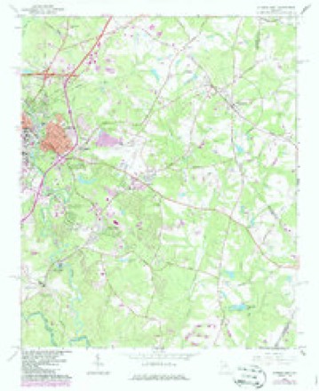
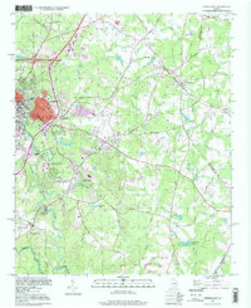
13 topographic sheets cover this place, the earliest surveyed in 1953 and the latest in 1998. It stands in the Athens census division. It lies in ZIP code area 30605. The Survey maps it on the Athens East quadrangle.
On record in Whitehall
Buildings and businesses the archive holds for this place. Each opens its own page, with the source record it came from.
On the National Register 1 record
 White Halllisted 1979
Topographic sheets covering this place
8 surveys from 13 printed sheetsMatched by testing this settlement's coordinate against the published boundary of every sheet in the United States Geological Survey's historical collection. Each opens the scanned sheet at the Survey.
- 1953 USGS Athens quadrangle1:250000, 3 printings
- 1958 USGS Athens quadrangle1:250000
- 1959 USGS Athens quadrangle1:250000
- 1963 USGS Athens quadrangle1:250000
- 1964 USGS Athens East quadrangle1:24000, 3 printings
- 1980 USGS Athens quadrangle1:100000, 2 printings
- 1988 USGS Athens quadrangle1:250000
- 1998 USGS Athens East quadrangle1:24000
Fires near this place
112 since 1992Regional context, not property-specific evidence. The federal wildfire occurrence database lists 112 fires within 5 miles of Whitehall between 1992 and 2018, burning about 290 acres in total. 3 started naturally. 36 were recorded as arson. Distance is straight-line from the map coordinates, so a fire counted here may appear on a neighbouring settlement's page as well.
| Reported cause | Fires |
|---|---|
| Debris and open burning | 42 |
| Arson/incendiarism | 36 |
| Missing data/not specified/undetermined | 10 |
| Equipment and vehicle use | 10 |
| Smoking | 5 |
| Natural | 3 |
| Misuse of fire by a minor | 3 |
| Railroad operations and maintenance | 2 |
| Recreation and ceremony | 1 |
The most recent of them, most recent first, with the day each was reported and the service that recorded it.
| Date | Cause | Size | Reported by | Name on the report |
|---|---|---|---|---|
| 30 September 2016 | Debris and open burning | under an acre | Georgia Forestry Commission | FY2017-OCONEE-002 |
| 30 September 2007 | Missing data/not specified/undetermined | under an acre | Georgia Forestry Commission | not named |
| 18 September 1993 | Smoking | under an acre | Georgia Forestry Commission | not named |
| 16 September 2003 | Missing data/not specified/undetermined | under an acre | Georgia Forestry Commission | not named |
| 13 September 1997 | Smoking | under an acre | Georgia Forestry Commission | not named |
| 6 August 1998 | Debris and open burning | 2.5 acres | Georgia Forestry Commission | not named |
| 5 August 1999 | Equipment and vehicle use | under an acre | Georgia Forestry Commission | not named |
| 31 August 1995 | Debris and open burning | under an acre | Georgia Forestry Commission | not named |
Settlements close enough to share some of these fires:
Mines and quarries near this place
2 within 5 milesRegional context, not property-specific evidence. The federal mineral resources record lists 2 workings within 5 miles of Whitehall: 1 producer, 1 past producer. 1 still produces. What was taken out: Stone, Crushed/Broken, Iron. Distance is straight-line from the map coordinates, so a quarry counted here may appear on a neighbouring settlement's page as well.
| Where | Site | Commodity | Status | Recorded |
|---|---|---|---|---|
| Athens Quarry | Stone, Crushed/Broken | Producer | ||
| The Georgia Loan & Trust Co. Mine | Iron | Past Producer |
Storms near this place
14 since 2002Regional context, not property-specific evidence. The National Weather Service names Whitehall in 14 storm reports between 2002 and 2025: 7 thunderstorm wind, 4 hail, 1 funnel cloud, 1 lightning. No death or injury is recorded in these reports. Each account below is quoted exactly as the forecast office filed it, from the NOAA Storm Events Database, and each date opens the federal record of that event.
| When | Event | Place named | Harm | What the report says |
|---|---|---|---|---|
| June 2011 | Lightning | Whitehall | $100,000 | The Atlanta Journal-Constitution reported that lightning ignited a fire at a residence in Athens located on Ashbrook Drive. Specific details regarding damages were not provided. |
| March 2025 | Thunderstorm Wind | Whitehall | $25,000 | Approx 25 trees down across the uga golf course from severe thunderstorm winds. The damage was contained within the south end of the course moving from southwest to northeast. |
| July 2002 | Thunderstorm Wind | Whitehall | $10,000 | The Athens Daily News reported that trees were down all across the southeast portion of Clarke county, including the Athens area. The trees brought down many power lines as well, causing nearly 5000 residents to be without power during the evening hours. Much of the damage occurred in the Cedar Creek Subdivision. Some of the downed trees blocked roads, including Midway road, on which both lanes of traffic were blocked, and on Oglethorpe Avenue near the entrance to the U.S. Navy Supply Corps School, where both lanes were blocked as well. |
| May 2025 | Thunderstorm Wind | Whitehall | $1,000 | Broadcast media reports tree down at old lexington road near crestwood dr in east athens. |
| August 2023 | Thunderstorm Wind | Whitehall | $1,000 | Emergency manager reports a tree down at the State Botanical Gardens of Georgia. |
| August 2016 | Heavy Rain | Whitehall | $1,000 | The Grounds Keeper of the State Botanical Garden of Georgia in south Clarke County or 4 miles south of Athens reported two large trees fell on the property due to heavy rain. One fell on an access road to the main building and the other fell in the courtyard. |
| July 2016 | Thunderstorm Wind | Whitehall | $1,000 | Spotter reported a 10 inch diameter live pine tree completely blocking road. High winds between 7:25 and 7:30. Many small limbs and leaves also down. Scattered power outages in southeast Clarke county. |
| June 2009 | Thunderstorm Wind | Whitehall | $1,000 | The Clarke County 911 Center reported that a few trees were down around Athens. |
| April 2015 | Thunderstorm Wind | Whitehall | $250 | The Clarke County 911 center reported a tree down on Beaver Trail just off Red Fox Run. |
| March 2017 | Hail | Whitehall | - | The public reported quarter size hail on Lindmar Court. |
| March 2017 | Hail | Whitehall | - | A nursery at Barnett Shoals Road and Hancock Lane reported quarter size hail. |
| June 2011 | Hail | Whitehall | - | The public observed quarter-sized hail in the far southeast part of Clarke County, south of Winterville and near the Oglethorpe county line. |
| March 2008 | Funnel Cloud | Whitehall | - | The public observed a funnel cloud near the intersection of Gaines School and Lexington Roads in southern Clarke county. |
| July 2008 | Hail | Whitehall | - | The public observed penny to nickel-sized hail in southern Clarke county, just south of the University of Georgia and the city of Athens in the Whitehall area. |
Nearest settlements
The eight closest, with where each one stands in the county. Distances are straight-line, computed from the Geographic Names Information System coordinates.
| Map | Place | Distance | Sheets |
|---|---|---|---|
| Ansley Park | 0.6 miles | 13 | |
| Snapfinger | 0.8 miles | 13 | |
| Riverbend East | 0.8 miles | 13 | |
| River Hill East | 0.9 miles | 13 | |
| Clarkedale | 1.0 miles | 13 | |
| Chamberlin | 1.1 miles | 13 | |
| Ashton Place | 1.1 miles | 13 | |
| University Heights | 1.2 miles | 13 |
Provenance
This settlement is recorded in the Geographic Names Information System as feature 325202. The sheet list is computed by point-in-boundary test against the United States Geological Survey's historical topographic inventory. Both are works of the United States government and carry no copyright under 17 U.S.C. 105.
Wildfire. Short, Karen C. 2022. Spatial wildfire occurrence data for the United States, 1992-2020 [FPA_FOD_20221014]. 6th Edition. Fort Collins, CO: Forest Service Research Data Archive. https://doi.org/10.2737/RDS-2013-0009.6 Collected with United States Government funding and usable without additional permissions or fees.
Mines and quarries. USGS Mineral Resources Data System (MRDS) https://mrdata.usgs.gov/mrds/ A work of the United States government, no copyright under 17 U.S.C. 105.
Storms. NOAA National Centers for Environmental Information, Storm Events Database https://www.ncei.noaa.gov/stormevents/ A work of the United States government, no copyright under 17 U.S.C. 105. Narratives are quoted verbatim from the National Weather Service report and are not edited or summarised.