 Block
Zetella, Georgia
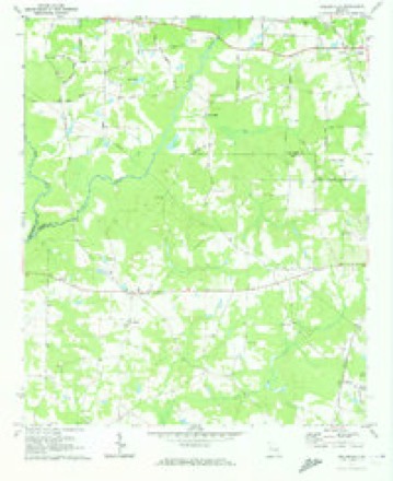
9 topographic sheets cover this place, the earliest surveyed in 1953 and the latest in 1979. It stands in the Vaughn census division. It lies in ZIP code area 30223. The Survey maps it on the Hollonville quadrangle.
Topographic sheets covering this place
5 surveys from 9 printed sheetsMatched by testing this settlement's coordinate against the published boundary of every sheet in the United States Geological Survey's historical collection. Each opens the scanned sheet at the Survey.
- 1953 USGS Atlanta quadrangle1:250000, 2 printings
- 1957 USGS Atlanta quadrangle1:250000
- 1958 USGS Atlanta quadrangle1:250000
- 1971 USGS Hollonville quadrangle1:24000, 2 printings
- 1979 USGS Griffin quadrangle1:100000, 3 printings



Fires near this place
257 since 1992Regional context, not property-specific evidence. The federal wildfire occurrence database lists 257 fires within 5 miles of Zetella between 1992 and 2019, burning about 799 acres in total. 9 started naturally. 34 were recorded as arson. Distance is straight-line from the map coordinates, so a fire counted here may appear on a neighbouring settlement's page as well.
| Reported cause | Fires |
|---|---|
| Debris and open burning | 170 |
| Arson/incendiarism | 34 |
| Equipment and vehicle use | 14 |
| Missing data/not specified/undetermined | 10 |
| Misuse of fire by a minor | 10 |
| Natural | 9 |
| Recreation and ceremony | 9 |
| Smoking | 1 |
The most recent of them, most recent first, with the day each was reported and the service that recorded it.
| Date | Cause | Size | Reported by | Name on the report |
|---|---|---|---|---|
| 7 September 2016 | Debris and open burning | under an acre | Georgia Forestry Commission | FY2017-PIKE-003 |
| 4 September 1999 | Debris and open burning | 5.0 acres | Georgia Forestry Commission | not named |
| 30 September 2019 | Debris and open burning | 3.0 acres | Georgia Forestry Commission | FY2020SPALDING003 |
| 3 September 2011 | Debris and open burning | 3.4 acres | Georgia Forestry Commission | FY2012-SPALDING-007 |
| 27 September 2003 | Arson/incendiarism | under an acre | Georgia Forestry Commission | not named |
| 27 September 1998 | Misuse of fire by a minor | under an acre | Georgia Forestry Commission | not named |
| 2 September 1992 | Debris and open burning | 2.9 acres | Georgia Forestry Commission | not named |
| 17 September 1998 | Equipment and vehicle use | under an acre | Georgia Forestry Commission | not named |
Settlements close enough to share some of these fires:
Mines and quarries near this place
4 within 5 milesRegional context, not property-specific evidence. The federal mineral resources record lists 4 workings within 5 miles of Zetella: 2 producers, 1 occurrence, 1 prospect. 2 still produce. What was taken out: Stone, Crushed/Broken, Gemstone. Distance is straight-line from the map coordinates, so a quarry counted here may appear on a neighbouring settlement's page as well.
| Where | Site | Commodity | Status | Recorded |
|---|---|---|---|---|
| Allen Prospect | Gemstone | Prospect | ||
| Griffin Granite Quarry | Stone, Crushed/Broken | Producer | ||
| Griffin Quarry | Stone, Crushed/Broken | Producer | ||
| Unnamed Beryl Deposit | Gemstone | Occurrence |
Storms near this place
6 since 2023Regional context, not property-specific evidence. The National Weather Service names Zetella in 6 storm reports between 2023 and 2025: 3 tornado, 3 thunderstorm wind. No death or injury is recorded in these reports. Each account below is quoted exactly as the forecast office filed it, from the NOAA Storm Events Database, and each date opens the federal record of that event.
| When | Event | Place named | Harm | What the report says |
|---|---|---|---|---|
| April 2025 | Thunderstorm Wind | Zetella | $2,000 | Trees and powerlines down along hwy 16 Newnan Rd west of Griffin. |
| June 2025 | Thunderstorm Wind | Zetella | $1,000 | Tree downed across 300 block of Anderson Road. |
| June 2023 | Thunderstorm Wind | Zetella | $1,000 | Report of powerlines down on Briarcliff Rd. |
| January 2023 | Tornado (EF1) | Zetella | - | New high resolution areal imagery in concert with a reanalysis of radar data, areal surveys and ground surveys it has been determined that there were multiple tornadoes on the ground simultaneously in southwest Spalding and Northwestern Pike Counties as well as crossing tornado paths. This particular EF1 tornado formed on the southern extent of the larger mesocyclone in close proximity to the EF2 tornado to the north. This tornado formed in and around the Nunnally Road and Dunbar School Road area snapping and uprooting trees. It would continue ENE crossing Hutchinson Rd and Bethany Road snapping and uprooting trees. EF1 damage to several storage buildings and homes occurred as the tornado crossed W. Williamson Road just to the south of the Rock Quarry along Rover Zetella Road. This tornado would continue east and pass to the south of the Rock Quarry snapping and uprooting trees before crossing Rover Zetella Road near the intersection of N. Rover Road. A small barn was destroyed and numerous trees were snapped and uprooted. It was near this point the tornado would begin a more north to northeastward path as it became more wrapped up into the larger mesocyclone and more dominate tornado developing and occurring to the north near Hwy16. This EF1 would cross Emanuel Way, Wilder Way, Maloy Road and Delray Cir causing damage to numerous homes and uprooting trees. 2 large storage bins just east of Wilder Way and Saint Luke Dr were completely destroyed. Trees were snapped and uprooted as the tornado continued north into the larger circulation where it would merge just south of HWY16 to the NE of Princess Circle. Areal satellite imagery and radar data confirms the northward moving tornado into the more dominate Griffin EF3 tornado with trees snapped and uprooted to the north and an area of trees snapped and uprooted to the east. Exact width is an estimate due to the challenges of determining where one tornado damage swath ended and where another one started. The one thing that can be certain is that the vorticies/tornadoes did merge near or just after the EF3 damage occurred. |
| January 2023 | Tornado (EF1) | Zetella | - | New high resolution areal imagery in concert with a reanalysis of radar data, areal surveys and ground surveys it has been determined that there were multiple tornadoes on the ground simultaneously in southwest Spalding and Northwestern Pike Counties as well as crossing tornado paths. The tornadoes were part of a larger mesocyclone which can be traced west all the way back to the Selma Alabama tornado. Our analysis determined that this tornado spun up near the center of the main mesocylone as it crossed the Flint River in SW Spalding County. The first evidence of a tornado touching down appear along Blanton Mill Road where several trees were uprooted. This tornado would become caught within the larger circulation and swing SE around the center through mostly wooded or swampy areas of SW Spalding County. Numerous trees were snapped or uprooted in a path that that tracks ESE until it reaches Scott Barch Road. It is in this area it crosses the path of a tornado which passes approximately 2 minutes early moving NE on the eastern periphery of the larger mesocyclone. Low end EF1 damage occurred to a barn in this area, however, it could have occurred with the first tornado. Numerous trees are uprooted or snapped in this area as well. The tornado continued ESE crossing Flat Creek causing mid range EF1 damage to trees. It is noted per areal imagery and radar data that as the tornado approached Yarborough Rd and Shackleford Road it become absorbed/merged with a larger stronger circulation/tornado moving to the NE. Damage on the ground in this area is indicative of tornadoes coming in from 2 different directions. The particular circulation is terminated at this point as the larger more dominate tornado continues NE toward a rock quarry along Rover Zetalla Road. It should also be noted that EF2 damage occurred shortly after these 2 tornadoes merged near Yarborough Road but will be attributed to the more dominate circulation. |
| January 2023 | Tornado (EF2) | Zetella | - | New high resolution areal imagery in concert with a reanalysis of radar data, areal surveys and ground surveys it has been determined that there were multiple tornadoes on the ground simultaneously in southwest Spalding and Northwestern Pike Counties as well as crossing tornado paths. The tornadoes were part of a larger mesocyclone which can be traced west all the way back to the Selma Alabama tornado. This particular tornado was spinning up in extreme SW Spalding County near Holonville Road and the Flint River as the EF2 tornado crossing Meriweather County into NW Pike was weaking and winding down. The particular tornado first showed a debris signature on radar in a marshy area near the flint River east of Holonville Road. Areal satellite imagery and newly acquired information from a homeowner along Huff Creek Road confirm the track continued east just north of Huff Creek Road snapping and uprooting hundreds of trees. The tornado Crossed Hancock Road as a high end EF 1 before reaching Blanton Mill Road where several outbuildings were destroyed, a home was damaged and hundredes of trees were uprooted or snapped. As the tornado coninued east toward Nunnally Road it was noted that the tornado which would become the Griffin Tornado had crossed approximately 2 minutes prior and as this tornado approached that area. Damage in the Nunnally Road area is consistent with multiple cirulations crossing this region. Also as this EF1 tornado reached the Nunnally/Bethany Road area, a strong surge in wind can be seen on radar rotating ENE around the larger mesocyclone and catching this tornado in this region. The particular tornado would be not only becoming part of that wind surge but also merge with an EF1 tornado sinking ESE out of Spalding County approximately at the Spalding/Pike county line in and around the Yarborough Mill Road region. This tornado would become the dominate circulation per radar analysis thus this track is continued ENE. As the EF1 tornado merges from the WNW, this tornado increases to max intensity of EF2 in and around the Yarborough Mill Road and Crystal Creek Drive area where several structures were severely damaged or destroyed in addition to hundreds of trees snapped and uprooted. Per damage analysis from imagery, this merging which occurred likely resulted in the increased intensification of the tornado to EF2 in this region. The tornado continued eastward toward a large rock quarry along Rover Zetella Road. The tornado snapped trees up to the Rock Quarry however, it appears that due to the size of the quarry, the tornado redeveloped on the N side of the quarry along Rover Zetalla Road and continued east before resuming a northward path. Numerous trees were snapped or uprooted wet of Candler Road north across North Rover Road,Agape Avenue and Bethel Lane. Numerous homes sustained everything from minor to moderate damage in this area consistent with EF0 to EF1 winds. This particular tornado continued north toward the stronger EF3 tornado occurring simultaneously ultimately absorbing this tornado into the circulation in the area around Maloy road. Due to the scope of the damage and the width, the exact location and the damage attribution (which tornado caused which damage) becomes difficult to discern even with the imagery. As a result, the exact width is an estimate due to the challenges of determining where one tornado damage swath ended and where another one started. The one thing that can be certain is that the vorticies/tornadoes did merge near or just after the EF3 damage occurred. |
Nearest settlements
The eight closest, with where each one stands in the county. Distances are straight-line, computed from the Geographic Names Information System coordinates.
| Map | Place | Distance | Sheets |
|---|---|---|---|
| Valdo (historical) | 2.7 miles | 9 | |
| Rio | 2.7 miles | 9 | |
| Vaughn | 2.8 miles | 9 | |
| Blantons Mill | 3.1 miles | 9 | |
| Esmond | 3.1 miles | 9 | |
| Rover | 3.5 miles | 9 | |
| Burdett (historical) | 5.6 miles | 9 | |
| Experiment | 5.6 miles | 9 |
Provenance
This settlement is recorded in the Geographic Names Information System as feature 325664. The sheet list is computed by point-in-boundary test against the United States Geological Survey's historical topographic inventory. Both are works of the United States government and carry no copyright under 17 U.S.C. 105.
Wildfire. Short, Karen C. 2022. Spatial wildfire occurrence data for the United States, 1992-2020 [FPA_FOD_20221014]. 6th Edition. Fort Collins, CO: Forest Service Research Data Archive. https://doi.org/10.2737/RDS-2013-0009.6 Collected with United States Government funding and usable without additional permissions or fees.
Mines and quarries. USGS Mineral Resources Data System (MRDS) https://mrdata.usgs.gov/mrds/ A work of the United States government, no copyright under 17 U.S.C. 105.
Storms. NOAA National Centers for Environmental Information, Storm Events Database https://www.ncei.noaa.gov/stormevents/ A work of the United States government, no copyright under 17 U.S.C. 105. Narratives are quoted verbatim from the National Weather Service report and are not edited or summarised.