 Block
From the record
One of 24 National Register listings published here for Meriwether County · listed in 2002 · category: Building.
Sources: the case file at the National Archives · the National Register database, National Park Service

Listed on the National Register of Historic Places in 2002.
One of 24 National Register listings published here for Meriwether County · listed in 2002 · category: Building.
Sources: the case file at the National Archives · the National Register database, National Park Service
Regional context, not property-specific evidence. The federal wildfire occurrence database lists 249 fires within 5 miles of Manchester Community Building between 1992 and 2020, burning about 875 acres in total. 7 started naturally. 34 were recorded as arson. Distance is straight-line from the map coordinates, so a fire counted here may appear on a neighbouring settlement's page as well.
| Reported cause | Fires |
|---|---|
| Debris and open burning | 144 |
| Arson/incendiarism | 34 |
| Missing data/not specified/undetermined | 18 |
| Railroad operations and maintenance | 13 |
| Misuse of fire by a minor | 9 |
| Recreation and ceremony | 9 |
| Equipment and vehicle use | 9 |
| Natural | 7 |
| Smoking | 6 |
The most recent of them, most recent first, with the day each was reported and the service that recorded it.
| Date | Cause | Size | Reported by | Name on the report |
|---|---|---|---|---|
| 9 September 2019 | Natural | under an acre | Georgia Forestry Commission | FY2020MERIWETHER004 |
| 9 September 2007 | Arson/incendiarism | under an acre | Georgia Forestry Commission | not named |
| 9 September 1998 | Debris and open burning | under an acre | Georgia Forestry Commission | not named |
| 8 September 2016 | Debris and open burning | under an acre | Georgia Forestry Commission | FY2017-TALBOT-007 |
| 8 September 2016 | Misuse of fire by a minor | under an acre | Georgia Forestry Commission | FY2017-TALBOT-005 |
| 30 September 2016 | Debris and open burning | under an acre | Georgia Forestry Commission | FY2017-TALBOT-009 |
| 29 September 2005 | Natural | under an acre | Georgia Forestry Commission | not named |
| 29 September 1993 | Debris and open burning | 4.0 acres | Georgia Forestry Commission | not named |
Regional context, not property-specific evidence. The federal mineral resources record lists 2 workings within 5 miles of Manchester Community Building: 2 past producers. None of them still produces. What was taken out: Kaolin, Iron. Distance is straight-line from the map coordinates, so a quarry counted here may appear on a neighbouring settlement's page as well.
| Where | Site | Commodity | Status | Recorded |
|---|---|---|---|---|
| G.B. Grant Property | Iron | Past Producer | Residual | |
| Warm Springs Bauxite | Kaolin | Past Producer | 1910, 1915 |
Regional context, not property-specific evidence. The National Weather Service names Manchester, the town this property stands in, in 19 storm reports between 1995 and 2024: 15 thunderstorm wind, 3 hail, 1 heavy rain. No death or injury is recorded in these reports. Each account below is quoted exactly as the forecast office filed it, from the NOAA Storm Events Database, and each date opens the federal record of that event.
| When | Event | Place named | Harm | What the report says |
|---|---|---|---|---|
| April 2011 | Hail | Manchester | $98,000 | The Meriwether County Emergency Management Director reported golf ball-sized hail along the southern border of the county near Manchester. This hail was from the same supercell thunderstorm that spawned an EF0 tornado in northeast Harris county and also dumped baseball-sized hail across central and northeast Harris county near Hamilton and Pine Mountain Valley. |
| April 2011 | Thunderstorm Wind | Manchester | $20,000 | The public reported that a tree had fallen on a home on Spruce Street in Manchester, causing moderate damage to the roof of the home. |
| July 2024 | Thunderstorm Wind | Manchester | $8,000 | Tree down on a house and vehicle in Manchester. |
| August 2024 | Thunderstorm Wind | Manchester | $5,000 | Multiple trees down in the city of manchester. One tree on a house in the 600 block of atlantic st. Trees down on 4th and 5th street along with powerlines down. |
| June 2023 | Thunderstorm Wind | Manchester | $5,000 | Several trees reported down across much of southern Meriwether County, particularly near Warm Springs and Manchester. |
| May 1997 | Thunderstorm Wind | Manchester | $2,500 | Several trees were knocked down by thunderstorm winds. Falling trees caused structural damage to a couple of homes, as well as a fence and sidewalk. In another incident a man narrowly escaped injury when a tree fell on his car as he travelled east on Foster Street. |
| April 1997 | Thunderstorm Wind | Manchester | $2,500 | no account filed |
| March 2009 | Heavy Rain | Manchester | $2,000 | The Manchester Star Mercury reported that heavy rain, upwards of two inches during the afternoon on already saturated ground, caused a 27-foot long gas tank at the Quick Stop Food Mart on Georgia Highway 85 to rise out of the ground. This occurred despite the fact that there were eight inches of concrete on top of the tank. The tank had been empty for some time. |
| July 2004 | Thunderstorm Wind | Manchester | $2,000 | The Meriwether County 911 center reported that several trees were down across U.S. Highway Alternate 27/Georgia Highway 85. |
| March 2001 | Thunderstorm Wind | Manchester | $2,000 | A storm spotter reported several trees down in Manchester, one of which was down on Georgia Highway 190. |
| March 2001 | Thunderstorm Wind | Manchester | $2,000 | The Georgia Highway Department reported several trees down in the city of Manchester. |
| March 1997 | Thunderstorm Wind | Manchester | $2,000 | no account filed |
| July 2024 | Thunderstorm Wind | Manchester | $1,000 | A tree limb downed a powerline leading to outages in northern Manchester. |
| June 2001 | Thunderstorm Wind | Manchester | $1,000 | The public reported that two large tree limbs were down on power lines at Perry Street and Lee Street. |
| August 1996 | Thunderstorm Wind | Manchester | $750 | no account filed |
| June 1995 | Thunderstorm Wind | Manchester | $500 | Thunderstorm winds knocked trees down along Georgia Highway 222 between Woodbury and Manchester. |
| April 2015 | Thunderstorm Wind | Manchester | $250 | A trained spotter reported one large oak tree and several large branches down on Spruce Street in Manchester. |
| March 2011 | Hail | Manchester | - | The public observed quarter-sized hail across the far southern part of Meriwether county. This was from the same thunderstorm cell that brought golf ball-sized hail to north central and northeast Harris county. |
| June 1999 | Hail | Manchester | - | no account filed |
No historic map-sheet match is published for this property yet. That does not mean no map exists. This record needs a coordinate-quality review before it can be joined to a sheet boundary. Browse the county's mapped places while that work is pending.
Other National Register properties close enough to walk or drive between, ordered by distance from this one. Both positions come from the same geocoding pass that matched these properties to their map sheets.
| Photograph | Property | Distance | Listed |
|---|---|---|---|
| Benjamin F. Bulloch House | 4.4 miles | 1994 | |
| Bulloch Family House | 4.5 miles | 2002 | |
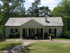 | Roosevelt's Little White House, Pools | 5.2 miles | 1974 |
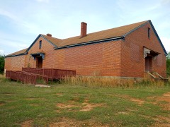 | Eleanor Roosevelt School | 5.2 miles | 2010 |
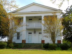 | Oakland | 7.2 miles | 1982 |
| National Archives record | The nomination case file for reference 01001537 in Record Group 79. |
| Meriwether County | All 24 listed properties in this county. |