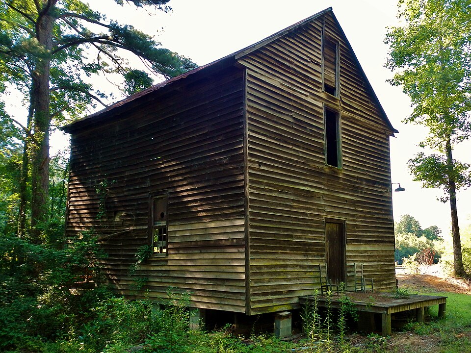
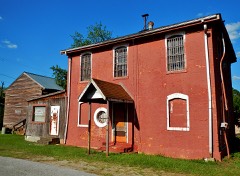
Listed on the National Register of Historic Places in 2009.
From the record
“Boyd Mill Place, also known as Davenport's Mill and Hearon's Mill, is the site of a historic grist mill constructed circa 1870 in Weston, Georgia in Webster County, Georgia. The mill was built by John Boyd and operated from c.1870 to 1963.”
Wikipedia article Boyd Mill Place, CC BY-SA 4.0.
One of 3 National Register listings published here for Webster County · listed in 2009 · category: District.
National Register reference number.09000752- the number the National Park Service assigned this property when it was listed, and the key its nomination file is catalogued under at the National Archives.
Fires near this property
143 since 1992
Regional context, not property-specific
evidence. The
federal wildfire occurrence database
lists 143 fires within 5 miles of Boyd Mill Place
between 1992 and 2020, burning about 266 acres in total. 7 started naturally. 3 were recorded as arson.
Distance is straight-line from the map coordinates, so a fire counted
here may appear on a neighbouring settlement's page as well.
Reported cause
Fires
Debris and open burning
93
Equipment and vehicle use
19
Missing data/not specified/undetermined
13
Natural
7
Recreation and ceremony
3
Arson/incendiarism
3
Misuse of fire by a minor
3
Smoking
2
The most recent of
them, most recent first, with the day each was reported and the service
that recorded it.
Regional context, not property-specific
evidence. The National Weather Service names
Weston, the town this property stands in, in 13 storm reports between 1997 and 2019: 5 hail, 4 thunderstorm wind, 4 tornado.
The reports record 3 injuries. Each account below is quoted exactly as the forecast office
filed it, from the NOAA Storm Events Database, and each date
opens the federal record of that event.
A damage survey conducted by the National Weather Service in Peachtree City, GA concluded that a strong, violent, and long-lived EF3 tornado tracked across southeast Webster, much of Sumter, and far southern Macon counties. The tornado touched down near Chambliss on the Webster/Terrell county line and tracked east-northeast exiting the county into Sumter county near Bottsford. While the overall path length of the tornado was around 40 miles, the path length within Webster county was between seven and eight miles. While the tornado reached its maximum path width of 1.0 mile in Sumter county near Americus, it was determined to be less than this within Webster county. A path of significant damage was noted across southeast Webster county. A concrete block house and two machine shops on East Centerpoint Road just northeast of Chambliss were completely destroyed. Three injuries resulted from the damage here. Twenty-five feet of asphalt in front of the home was also ripped up by the tornado. On a nearby farm, five cows were killed when they were tossed about by the tornado. A tractor-trailer traveling on Georgia Highway 520 near Chambliss was overturned causing it to catch on fire and burn. Very nearby, at the intersection of Georgia Highway 520 and TV Tower Road, a 1096 foot Georgia Public Television transmission tower was destroyed when two-thirds of the tower was twisted off by the tornado and destroyed. Only 150 feet of the 1096 foot tower was left standing after the tornado passed. Numerous trees and power lines were also down in the area.
A National Weather Service survey team found that the tornado that began in Randolph County and moved across southeastern Stewart County moved into Webster County at EF1 intensity, with maximum wind speeds of 104 MPH and a maximum path width of 880 yards, south of Goodwins Pond Road. The tornado continued moving east crossing Highway 41 and Highway 520 before ending around the intersection of Hudson Leverette Road and County Road 23. The damage was mostly to trees, power lines, and small farm outbuildings. One peanut farm storage building was destroyed, but fortunately the employees had been sent home earlier in the day due to the threat for severe weather. The owner of the farm had left minutes prior to the arrival of the tornado after receiving a phone call stating that Weston was in the path of the storm. No injuries were reported. [04/05/17: Tornado #3, County #2/2, EF-1, Stewart, Webster, 2017:062].
The Americus Times Recorder reported that thunderstorm winds caused significant damage within Webster county. A total of 12 mobile homes, one brick home, a pole barn, and a sanitation shop sustained minor to moderate damage. The majority of the damage was from Lynn Lane at Georgia Highway 520 northeastward through the county. Numerous trees and power lines were down within this same area.
The Webster County EMS/Fire Department found damage along a 5.1 mile long, 300 yard wide path from an EF-0 tornado. Maximum wind speeds were estimated at 80 MPH. The path stretched from just northeast of Weston along State Highway 41 to around the intersection of East Centerpoint Road and County Road 24. Numerous trees were uprooted or snapped along this path. Along County Road 26, minor roof damage occurred on two houses and the skirting along the bottom of a manufactured home was ripped off. A small shed was destroyed along East Centerpoint road. No injuries were reported. [04/07/16: Tornado #2, County #1-1, EF0, Webster, 2016:006].
A National Weather Service survey found that the EF2 tornado that moved across Stewart County weakened to EF0 by the time it moved into Webster County along the Ichawaynochaway Creek west of Highway 41. The tornado moved only a short distance into the county before dissipating near the intersection of Highway 41 and Goodwin Cutoff Road. Despite weakening, the tornado still managed to snap large tree branches and overturn a large agricultural irrigation system around this intersection. No injuries were reported. [03/03/19: Tornado #14, County #2/2, EF0, WSebster, 2019:019].
Two reports of golf ball-sized hail were received from the public in the Weston area. Radar data indicates that golf ball-sized hail likely fell from Weston east-southeastward to the southeast corner of the county.
No historic map-sheet match is published
for this property yet. That does not mean no map exists. This record needs
a coordinate-quality review before it can be joined to a sheet boundary.
Browse the county's mapped places while that work is
pending.
Listed places nearby
2 within 8 miles
Other National Register properties close
enough to walk or drive between, ordered by distance from this one. Both
positions come from the same geocoding pass that matched these properties
to their map sheets.
Listing record. National Park Service National Register of Historic Places, listed-properties dataset, current to 2026-05-22.
Map join. Address geocoded through the United States Census geocoder, then tested against the published boundary of every sheet in the USGS Historical Topographic Map Collection.
How this page is made. Listing fields come from federal records; map-sheet coverage is a labelled coordinate-to-boundary calculation, not a source-field claim.
Wildfire. Short, Karen C. 2022. Spatial wildfire occurrence data for the United States, 1992-2020 [FPA_FOD_20221014]. 6th Edition. Fort Collins, CO: Forest Service Research Data Archive. https://doi.org/10.2737/RDS-2013-0009.6 Collected with United States Government funding and usable without additional permissions or fees.
Storms. NOAA National Centers for Environmental Information, Storm Events Database https://www.ncei.noaa.gov/stormevents/ A work of the United States government, no copyright under 17 U.S.C. 105. Narratives are quoted verbatim from the National Weather Service report and are not edited or summarised.
 Block