 Block
From the record
One of 16 National Register listings published here for Spalding County · listed in 1972 · category: Building.
Sources: the case file at the National Archives · the National Register database, National Park Service
Listed on the National Register of Historic Places in 1972.
One of 16 National Register listings published here for Spalding County · listed in 1972 · category: Building.
Sources: the case file at the National Archives · the National Register database, National Park Service
Regional context, not property-specific evidence. The federal wildfire occurrence database lists 385 fires within 5 miles of Old Medical College Historical Area between 1992 and 2019, burning about 640 acres in total. 6 started naturally. 65 were recorded as arson. Distance is straight-line from the map coordinates, so a fire counted here may appear on a neighbouring settlement's page as well.
| Reported cause | Fires |
|---|---|
| Debris and open burning | 224 |
| Arson/incendiarism | 65 |
| Misuse of fire by a minor | 34 |
| Missing data/not specified/undetermined | 24 |
| Equipment and vehicle use | 17 |
| Recreation and ceremony | 10 |
| Natural | 6 |
| Smoking | 5 |
The most recent of them, most recent first, with the day each was reported and the service that recorded it.
| Date | Cause | Size | Reported by | Name on the report |
|---|---|---|---|---|
| 9 September 2003 | Misuse of fire by a minor | under an acre | Georgia Forestry Commission | not named |
| 8 September 1997 | Natural | under an acre | Georgia Forestry Commission | not named |
| 5 September 1998 | Missing data/not specified/undetermined | under an acre | Georgia Forestry Commission | not named |
| 5 September 1997 | Misuse of fire by a minor | under an acre | Georgia Forestry Commission | not named |
| 4 September 1999 | Debris and open burning | 5.0 acres | Georgia Forestry Commission | not named |
| 30 September 2019 | Debris and open burning | 3.0 acres | Georgia Forestry Commission | FY2020SPALDING003 |
| 30 September 2005 | Debris and open burning | under an acre | Georgia Forestry Commission | not named |
| 30 September 1993 | Debris and open burning | 1.1 acres | Georgia Forestry Commission | not named |
Regional context, not property-specific evidence. The federal mineral resources record lists 4 workings within 5 miles of Old Medical College Historical Area: 2 prospects, 1 past producer, 1 occurrence. None of them still produces. What was taken out: Iron, Manganese, Granite, Mica. Distance is straight-line from the map coordinates, so a quarry counted here may appear on a neighbouring settlement's page as well.
| Where | Site | Commodity | Status | Recorded |
|---|---|---|---|---|
| Melton Prospects | Mica | Prospect | ||
| The Turner Quarry | Granite | Past Producer | ||
| Unnamed Beryl Deposit | Gemstone | Occurrence | ||
| Walker Property | Iron, Manganese | Prospect |
Regional context, not property-specific evidence. The National Weather Service names Griffin, the town this property stands in, in 99 storm reports between 1993 and 2025: 60 thunderstorm wind, 25 hail, 11 lightning, 1 tornado. The reports record 1 injury. Each account below is quoted exactly as the forecast office filed it, from the NOAA Storm Events Database, and each date opens the federal record of that event.
| When | Event | Place named | Harm | What the report says |
|---|---|---|---|---|
| February 2009 | Lightning | Griffin | 1 hurt | The Spalding County Emergency Management Director reported that a person was struck and injured by lightning. |
| March 2009 | Hail | Griffin | $600,000 | An amateur radio operator relayed a report of golf ball-sized hail on the east side of Griffin. Nickel-sized hail was observed in Griffin. Radar data suggests that hail of nickel or larger size likely continued to the far east central portion of the county as the storm produced hail just across the line in Henry county. |
| April 1998 | Tornado (F1) | Griffin | $400,000 | The Spalding county EMA reported 30 homes suffered minor to heavy damage. One on North Walkers Mill Road was completely destroyed. In the Amelia Road area, homes sustained moderate damage with one shifted off its foundation. Light to moderate damage was in the Gainer Road area. The path length and width were estimated, but the storm apparently only touched down intermittently along the track. |
| July 1997 | Thunderstorm Wind | Griffin | $250,000 | Several trees were knocked down on houses near the Spalding county airport. The most substantial damage was several aircraft which were parked at the airport. Five planes received irreparable damage with at least three planes flipped onto their backs, and one on its nose. As many as six other aircraft were damaged to a lesser degree due to wind stress on the ropes tying them down , or contact with the other aircraft. One airplane was lifted off the groung, and then carried approximately 70 feet over a fuel truck along the edge of the airport property, landing upside-down on the county fairgrounds. The terminal building at the airport also experienced significant damage to its roof. One airplane, a DC-3, awaiting restoration at the field was turned like a wind vane from facing southwest to facing west-northwest. The county fairgrounds to the east of the airport also sustained damages. A free standing ticket booth was destroyed and a storage trailer was toppled along the western edge of the fairgrounds. Further east, five small sets of aluminum bleachers were rolled by the winds and destroyed. |
| September 2004 | Lightning | Griffin | $100,000 | The Griffin Daily News reported that lightning struck a home on Manley Road. The home suffered significant damage as the attic and some of the living area was set on fire. Even areas that did not burn suffered extensive smoke damage. |
| June 1998 | Thunderstorm Wind | Griffin | $100,000 | The squall line moved through Spalding county downing numerous trees and large limbs in Griffin. A large oak tree fell on 1 home destroying it. Other houses and vehicles were damaged by falling trees and limbs. Power outages resulted to 80 percent of Griffin Electric's 14,000 customers as power poles snapped and lines fell. |
| August 1999 | Lightning | Griffin | $60,000 | Six structural fires were caused by lightning. |
| July 2009 | Thunderstorm Wind | Griffin | $50,000 | The public reported that a downburst or microburst caused extensive damage to trees and power lines from the south side of Griffin, near the Spalding Regional Medical Center, to the southern border of the county east of Orchard Hill. The most significant damage was noted along Maple Drive, East College Street, and Macon Road heading south toward Orchard Hill. More than 200 trees and power lines were down along the roads blocking the roadways. Trees were also down in several residential neighborhoods in these areas as well. Some minor structural damage was reported from downed trees. Power was out for several hours to as many as 4000 people in the area. |
| July 2010 | Thunderstorm Wind | East Griffin | $25,000 | The Spalding County 911 Center reported that two trees were down on the east side of Griffin. One tree fell on a home causing damage to the structure. The other tree fell on a power line. |
| April 2005 | Hail | Griffin | $25,000 | The public reported penny to half-dollar-sized hail. The hail dented some vehicles in the area. |
| August 2005 | Lightning | Griffin | $25,000 | The Griffin Daily News reported that lightning struck a home on Amberwood Lane, setting the structure on fire. The fire was contained fairly quickly with only minor damage. |
| August 1996 | Thunderstorm Wind | Griffin | $15,000 | no account filed |
| December 2005 | Lightning | Griffin | $10,000 | The Griffin Daily News reported that lightning struck three homes on McDonough Road. The lightning struck a phone line adjacent to the homes and traveled through the phone line and electrical wires inside the homes. While two of the homes only suffered minor electrical damage, about $8,000 in smoke damage was sustained a the bedroom of the third home. |
| February 2003 | Thunderstorm Wind | Griffin | $10,000 | The Griffin Daily News reported that numerous trees and power lines were blown down, especially on the west side of Griffin. Several traffic signals were also blown down at busy intersections in Griffin. In addition, several hundred residents were without power because of the downed trees and power lines. |
| May 2002 | Lightning | Griffin | $10,000 | The Griffin Daily News reported that lightning caused fire to two homes on the northwest side of Griffin, one on West McIntosh Road and one on Fayetteville Road. The first home sustained some roof and ceiling damage and the other home sustained fire damage to the flooring and some of the crawl space area. |
| June 1999 | Thunderstorm Wind | Griffin | $10,000 | A newspaper account said thunderstorm winds blew trees into power lines, causing power outages to some 4000 customers in central and western Spalding county. Most of the damage was on the north side of Griffin. Also, the wind damaged a gas pump shelter at a filling station. |
| June 1998 | Thunderstorm Wind | Griffin | $10,000 | Spalding county 911 reported numerous trees and power lines were blown down county-wide. |
| April 2017 | Thunderstorm Wind | Griffin | $8,000 | An amateur radio operator reported trees blown down from S. 17th Street to Kennedy and N. 2nd Street. |
| April 2017 | Thunderstorm Wind | Griffin | $8,000 | An amateur radio operator reported multiple trees and power lines blown down around the intersection of Poplar Street and 13th Street. |
| July 2023 | Thunderstorm Wind | East Griffin | $5,000 | Multiple trees down on roadways and on powerlines in SE Griffin. |
| March 2021 | Thunderstorm Wind | Griffin | $5,000 | The Spalding County Emergency Manager reported power lines blown down in Griffin along ands near Broad Street between South 9th Street and South 6th Street. |
| March 2018 | Hail | Griffin | $5,000 | The public reported quarter size hail in the Griffin area. |
| July 2011 | Thunderstorm Wind | Griffin | $5,000 | The Spalding County 911 Center and an amateur radio operator reported that several trees and power lines were down throughout the Griffin area. A downburst was evident on WSR-88D with this thunderstorm. |
| September 2004 | Lightning | Griffin | $5,000 | The Griffin Daily News reported that lightning struck one of the city's main water pump distribution stations causing damage to one of the city's two main water supply lines. The line was shut down most of the day while repairs were made. |
| July 2000 | Thunderstorm Wind | Griffin | $5,000 | The Spalding county 911 center reported powerlines down in the southern part of Griffin. |
| August 1998 | Lightning | Griffin | $5,000 | Lightning struck an electrical sub-station setting fire to a bank of capacitors. |
| August 1998 | Flash Flood | Griffin | $5,000 | Slow moving thunderstorms produced 3 to 5 inches of rain in Griffin and parts of eastern Spalding county. Flooding of some streets and highways resulted. |
| May 1994 | Thunderstorm Wind | Griffin | $5,000 | Several large trees and power lines were downed by thunder- storm winds. About 60 electrical customers were without power for at least two hours. |
| May 1993 | Thunderstorm Wind | Griffin | $5,000 | Four to five large trees and several power lines were downed from thunderstorm winds. Hall County 2 W Gainesville,13,1215EST,,,0,0,2,?,Thunderstorm Winds Numerous tree limbs were downed from thunderstorm winds. |
| April 2017 | Thunderstorm Wind | Griffin | $4,000 | An amateur radio operator reported trees blown down at the intersection of 14th Street and West Poplar Street. |
| May 1997 | Thunderstorm Wind | Griffin | $3,500 | no account filed |
| July 1999 | Thunderstorm Wind | Griffin | $3,000 | A newspaper reported tree limbs and at least one large tree were knocked down on power lines. causing power outages. |
| August 2020 | Thunderstorm Wind | East Griffin | $2,000 | The Spalding County Emergency Manager reported power lines blown down in the 100 block of High Falls Road. |
| April 2009 | Thunderstorm Wind | Griffin | $2,000 | Amateur radio operators reported that several trees were down on the northwest side of Griffin. The trees were at least eight inches in diameter. |
| August 2007 | Thunderstorm Wind | Griffin | $2,000 | The Spalding County 911 Center reported that four trees and two power lines were down in the area around Griffin. Three of the trees down were northwest of Griffin, while one tree and one power line was down just north, and another tree and power line down just east of Griffin. |
| July 2004 | Lightning | Griffin | $2,000 | The Spalding County 911 center reported that lightning struck a couple of power poles in the Griffin area and knocked down the lines. |
| July 1998 | Thunderstorm Wind | Griffin | $2,000 | The public reported several trees were blown down and numerous power outages. |
| July 1995 | Thunderstorm Wind | Griffin | $2,000 | Thunderstorm winds knocked down a large tree into a street. Trees were also reported to have fallen on a couple of different power lines, resulting in widespread power outages. |
| September 1995 | Thunderstorm Wind | Griffin | $2,000 | Thunderstorm winds knocked several trees down on Jackson Road, Evree Inn road, and on Southtown Street. |
| April 1997 | Thunderstorm Wind | Griffin | $2,000 | no account filed |
| June 2013 | Thunderstorm Wind | East Griffin | $1,500 | The Spalding County 911 Center reported several trees down in the Parrish Street/Brook Circle/Spalding Street area on the east side of Griffin. |
| February 2025 | Thunderstorm Wind | East Griffin | $1,000 | Em reports tree down along hamilton blvd and arthur k bolton pkwy. |
| June 2025 | Thunderstorm Wind | Griffin | $1,000 | The Emergency Manager relayed a report of a downed tree in the 800 block of West Wall Street. |
| August 2024 | Thunderstorm Wind | East Griffin | $1,000 | Tree down along 4th street, east side of Griffin. |
| July 2024 | Thunderstorm Wind | Griffin | $1,000 | A tree fell onto the 1300 block of DF Fuller Drive. |
| July 2024 | Thunderstorm Wind | Griffin | $1,000 | Utility lines were reported down along Terrace Street. |
| May 2024 | Thunderstorm Wind | Griffin | $1,000 | Tree reported down across the road at the 900 block of West Quilly St. |
| July 2023 | Thunderstorm Wind | East Griffin | $1,000 | A tree was downed in the 1800 block of High Falls Road. |
| August 2023 | Thunderstorm Wind | Griffin | $1,000 | Tree down at Newnan Rd and 85 Connector . |
| July 2023 | Thunderstorm Wind | Griffin | $1,000 | Report of tree was downed on Old Mount Zion Road. |
| July 2023 | Thunderstorm Wind | Griffin | $1,000 | Utility lines were downed in the 1000 block of West College Street. |
| August 2023 | Thunderstorm Wind | Griffin | $1,000 | Emergency manager reported powerlines were downed in the 200 block of Carver Rd. |
| September 2023 | Thunderstorm Wind | East Griffin | $1,000 | Tree down on 900 block of North Second Street in Griffin. |
| August 2008 | Thunderstorm Wind | Griffin | $1,000 | The Spalding County 911 Center reported that a couple of power lines were down in the county. |
| June 2007 | Lightning | Griffin | $1,000 | The Spalding County 911 Center reported that lightning strikes caused a couple of power lines to fall down. |
| August 2006 | Thunderstorm Wind | Griffin | $1,000 | The Griffin Daily News reported that a tree fell across McIntosh Road. The tree also brought down a power line, causing a power loss to several nearby homes. |
| July 2005 | Thunderstorm Wind | Griffin | $1,000 | The Griffin Daily News reported that a tree was blown down by a thunderstorm wind gust onto a power line. Power was out in the area for nearly two hours as a result. |
| July 2002 | Thunderstorm Wind | Griffin | $1,000 | The Spalding county 911 center reported that some trees and power lines were down. |
| February 1999 | Thunderstorm Wind | Griffin | $1,000 | Spalding county 911 reported power lines were blown down. |
| June 1999 | Thunderstorm Wind | Griffin | $1,000 | Spalding county 911 reported trees were blown down near the Henry county line. |
No historic map-sheet match is published for this property yet. That does not mean no map exists. This record needs a coordinate-quality review before it can be joined to a sheet boundary. Browse the county's mapped places while that work is pending.
Other National Register properties close enough to walk or drive between, ordered by distance from this one. Both positions come from the same geocoding pass that matched these properties to their map sheets.
| Photograph | Property | Distance | Listed |
|---|---|---|---|
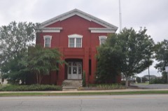 | Spalding County Courthouse-Spalding County Jail | under 500 feet | 2000 |
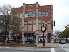 | Griffin Commercial Historic District | 0.2 miles | 1988 |
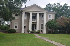 | Mills House | 0.2 miles | 1972 |
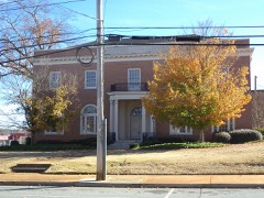 | Hawkes Library | 0.3 miles | 1973 |
 | Sam Bailey Building | 0.3 miles | 1973 |
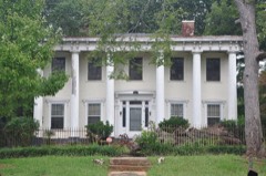 | Pritchard-Moore-Goodrich House | 0.4 miles | 1973 |
| National Archives record | The nomination case file for reference 72001469 in Record Group 79. |
| Spalding County | All 16 listed properties in this county. |