Block
From the record
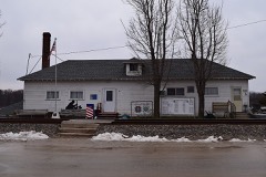
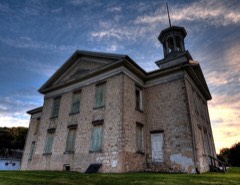
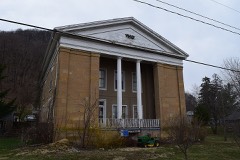
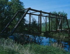
21 National Register listings published here.
Sources: the National Register database, National Park Service
43 topographic sheets cover 26 settlements here, and 21 properties are on the National Register of Historic Places.
21 National Register listings published here.
Sources: the National Register database, National Park Service
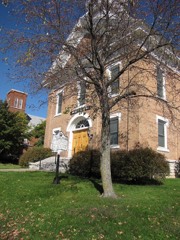
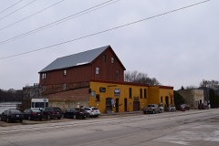
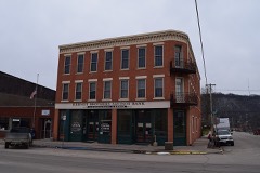
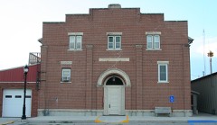
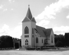
Every property in this county listed on the National Register of Historic Places, with the year it was listed and the federal nomination document.
Every wildfire the federal occurrence database records inside this county: 101 of them, burning about 1,822 acres. None started naturally and 3 were recorded as arson. Each settlement page carries the fires within five miles of it.
| Reported cause | Fires |
|---|---|
| Debris and open burning | 49 |
| Missing data/not specified/undetermined | 34 |
| Recreation and ceremony | 10 |
| Equipment and vehicle use | 3 |
| Arson/incendiarism | 3 |
| Misuse of fire by a minor | 1 |
| Other causes | 1 |
The five largest, by the area the report gives. One of them was set deliberately.
| Date | Cause | Size | Reported by | Name on the report |
|---|---|---|---|---|
| 26 April 2018 | Debris and open burning | 300 acres | Iowa Department of Natural Resources | not named |
| 28 April 2018 | Debris and open burning | 85 acres | Iowa Department of Natural Resources | not named |
| 26 April 2018 | Debris and open burning | 80 acres | Iowa Department of Natural Resources | not named |
| 21 March 2015 | Debris and open burning | 80 acres | Iowa Department of Natural Resources | not named |
| 26 April 2018 | Debris and open burning | 70 acres | Iowa Department of Natural Resources | not named |
| 1 April 2010 | Missing data/not specified/undetermined | 70 acres | Iowa Department of Natural Resources | 1312 OLD STAGE RD., WAUKON, IOWA |
| 23 April 2017 | Debris and open burning | 50 acres | Iowa Department of Natural Resources | not named |
| 14 March 1996 | Arson/incendiarism | 46 acres | McGregor District, Upper Mississippi River Complex | TURKYRIVER |
Every settlement page carries the fires within five miles of it - see the settlement index below.
The NOAA Storm Events Database holds 308 reports for this county, causing no deaths, 4 injuries and about $18,648,700 in recorded property damage. Each settlement page carries the reports that name it.
| Kind of event | Reports |
|---|---|
| Thunderstorm Wind | 121 |
| Hail | 96 |
| Flash Flood | 33 |
| Flood | 32 |
| Heavy Rain | 13 |
| Tornado | 11 |
| Funnel Cloud | 1 |
| Lightning | 1 |
The most serious of them, by death, then injury, then recorded damage. The accounts are quoted exactly as the forecast office filed them.
| When | Event | Place named | Harm | What the report says |
|---|---|---|---|---|
| June 2008 | Flash Flood | Quandahl | 3 hurt, $2,000,000 | Excessive rainfall caused fairly widespread flash flooding across the county. Steep terrain enhanced the flash flood threat causing mud slides and damaged infrastructure. Numerous roads were washed out and bridges damaged. A mud slide at Camp Tahigwa Girl Scout camp near Dorchester trapped part of the staff, but no one was injured. In Dorchester, the Waterloo Creek flash flooded swamping several mobile homes or trailers and cars along Highway 76. Water swept through town very quickly trapping people on their cars and roof tops. There were three injuries as a result. |
| July 2017 | Thunderstorm Wind | Rossville | 1 hurt, $30,000 | A farmer sustained injuries when the barn he was doing chores in was blown down on top of him. |
| June 2013 | Flash Flood | Lansing | $6,400,000 | Mudslides occurred over the eastern section of the county from Lansing to north of Harpers Ferry covering portions of County Road X52. Other flash flooding occurred over much of the county. A campground in the Yellow River State Forest had to be evacuated with 80 campers moved to community building in Harpers Ferry. No injuries occurred, but one car was swept away by flood waters on Little Paint Creek. In Waukon, a number of businesses had water up to two feet deep in them with basements completely filled with water. The flooding also caused the utility company to shut off natural gas service to about 60 customers to prevent the possibility of gas leaks to appliances that could have been submerged and pilot lights extinguished. Homes in the Lansing area were damaged by the mudslides with a least one home knocked off its foundation and evacuations of other homes were required along Wall Street. |
| July 1987 | Tornado (F2) | not stated | $2,500,000 | no account filed |
| June 2008 | Flood | Quandahl | $1,250,000 | Many roads, mainly secondary, were washed out in the county. Rainfall totals of 5-7 inches were reported for the weekend of June 7-8 with widespread flood problems. About 2500 acres of crops were damaged. |
| June 2008 | Flash Flood | Quandahl | $750,000 | Another round of thunderstorms led to additional flash flooding with numerous more mudslides reported by the county and more roads damaged. |
| June 2008 | Flood | Hanover | $750,000 | The Upper Iowa River at Dorchester crested around 1 a.m. CDT on June 9 at a record level of 22.46 feet. The previous record crest was 22.2 feet on February 28, 1948. Flood stage is 14.0 feet. |
| August 2016 | Flash Flood | Lansing | $513,000 | Runoff from heavy rain caused flooding to occur in Lansing along Clear Creek. Two people had to be rescued when the cabin they were sleeping in was moved off its foundation. The cabin became lodged against some trees allowing rescuers to reach them with a boat. The cabin was destroyed. 5.2 inches of rain was reported around 130 a.m. The runoff also caused a mudslide to occur north of Lansing. |
| August 2007 | Flash Flood | Dorchester | $500,000 | Rounds of thunderstorms led to significant flash flooding over much of the county, but especially the northern parts where mudslides occurred. Rainfall was 2-5 over the county. Damage was mainly to infrastructure. |
| July 1994 | Tornado (F1) | Churchtown | $500,000 | no account filed |
| July 1994 | Thunderstorm Wind | New Albin | $500,000 | no account filed |
| August 2016 | Flash Flood | Waukon | $400,000 | Runoff from heavy rain caused flooding to occur in and around Waukon. Several rescues had to be performed to save people from the flooding. Some businesses and homes were damaged by the flooding. |
| May 1964 | Tornado (F2) | not stated | $250,000 | no account filed |
| July 2022 | Thunderstorm Wind | Waukon | $200,000 | A barn was blown down and two silos collapsed on a farm southwest of Waukon. |
| June 1998 | Thunderstorm Wind | New Albin | $130,000 | no account filed |
| May 1996 | Hail | Dorchester | $130,000 | no account filed |
| June 2000 | Flash Flood | Countywide | $125,000 | no account filed |
| May 1998 | Thunderstorm Wind | Waukon | $85,000 | no account filed |
| July 2022 | Thunderstorm Wind | Waukon | $80,000 | An estimated 60 mph wind gust occurred in Waukon. The roof was blown off a business, a home lost part of its roof and several other businesses sustained some roof damage. |
| July 2000 | Flash Flood | Countywide | $75,000 | no account filed |
| May 2004 | Flash Flood | Countywide | $70,000 | no account filed |
| July 2022 | Tornado (EF1) | Waukon | $60,000 | A brief EF1 tornado touched down southwest of Waukon. The tornado damaged the roofs on farm outbuildings along with some trees. |
| June 2024 | Thunderstorm Wind | Volney | $50,000 | Trees were reported down on an RV, and another RV was tipped over at the Scenic View Campground. |
| August 2024 | Tornado (EF1) | Hanover | $50,000 | This EF-1 tornado damaged mainly trees along its path about 5 miles north of Waukon. One home had a garage roof taken off and several outbuildings/vehicles were damaged as well. |
| September 2019 | Flash Flood | Waukon Jct | $50,000 | Runoff from heavy rain caused mudslides and pushed down trees across the southeast corner of Allamakee County that closed State Highway 76 south of Waukon Junction. Numerous trails and campgrounds were closed in the Yellow River State Forest because of the flooding. Some county roads were closed because of culvert washouts or debris washed onto them from flood waters. |
| October 2006 | Hail | Volney | $50,000 | no account filed |
| May 2004 | Flash Flood | Northeast Portion | $50,000 | no account filed |
| July 1994 | Thunderstorm Wind | Lansing | $50,000 | no account filed |
| May 1994 | Thunderstorm Wind | Postville | $50,000 | no account filed |
| August 2000 | Thunderstorm Wind | Waukon | $45,000 | no account filed |
| September 2016 | Flood | Chester | $40,000 | Runoff from heavy rains caused the Upper Iowa River to go out of its banks near Dorchester. The river crested three feet over the flood stage at 17.04 feet. This was the second time in two days that flooding occurred at this site. The river had crested at 16.55 feet during the evening of Sept.7th. |
| May 1996 | Thunderstorm Wind | Dorchester | $40,000 | no account filed |
| June 2024 | Flood | Postville | $35,000 | Significant rainfall later into June pushed the Little Cedar River at Ionia into flood stage on June 24th. The river stage crested around midnight on June 25th in minor flood stage at 17.26 ft. |
| May 2002 | Flash Flood | Waukon | $35,000 | no account filed |
| July 2000 | Flash Flood | Countywide | $35,000 | no account filed |
| July 2024 | Flood | Lansing | $31,000 | Significant rainfall throughout June pushed the Mississippi River at Lansing into flood stage in June and continued into July. The river stage crested during the early morning on July 5th in minor flood stage at 18.06 ft. |
| June 2021 | Flash Flood | Waukon Jct | $30,000 | Runoff from locally heavy rains created mudslides and flooded roads around Waukon Junction. The Yellow River was pushed out of its banks with water going over several roads in the Yellow River State Forest. Damage to these roads prompted officials to evacuate the campgrounds until safety inspections could be made. |
| December 2021 | Thunderstorm Wind | Waukon | $30,000 | Power poles, lines and trees were blown down in Waukon. Almost 2,700 customers lost power because of the downed poles and lines. |
| August 2019 | Thunderstorm Wind | Ludlow | $30,000 | A barn was destroyed by damaging winds east of Frankville. Tin from the barn was thrown into power lines causing a power outage. |
| June 2024 | Flood | Chester | $25,000 | Significant rainfall throughout June pushed the Upper Iowa River at Dorchester into flood stage on June 24th. The river stage crested during the early morning on June 25th in minor flood stage at 14.97 ft. |
| August 2007 | Flood | Postville | $25,000 | Heavy rainfall caused flooding of basements, which may have indirectly contributed to the death of man in Postville. He was electricuted from entering a flooded basement with live power. |
| November 1975 | Tornado (F1) | not stated | $25,000 | no account filed |
| July 2012 | Thunderstorm Wind | Chester | $21,000 | A barn was destroyed by winds near Dorchester killing 7 calves that were inside the barn. |
| July 2017 | Thunderstorm Wind | Maud | $20,000 | A tree was blown down onto a house, an outbuilding was damaged and corn was blown down south of Waukon. |
| June 1998 | Flash Flood | Waukon | $20,000 | no account filed |
| July 1998 | Hail | Waukon | $20,000 | no account filed |
| July 1998 | Thunderstorm Wind | Waukon | $20,000 | no account filed |
| June 1998 | Hail | Lansing | $20,000 | no account filed |
| July 2000 | Thunderstorm Wind | Hanover | $18,000 | no account filed |
| June 2019 | Thunderstorm Wind | Waukon | $15,000 | Lots of trees and power lines were blown down across the northern part of the county. |
| August 2019 | Thunderstorm Wind | Waukon | $15,000 | Thunderstorms with high winds produced damage in and near Waukon. Trees and crops were blown over, a camper was rolled onto its side and house windows were broken. |
| May 2000 | Hail | Dorchester | $15,000 | no account filed |
| June 1998 | Thunderstorm Wind | Waukon | $15,000 | no account filed |
| April 1997 | Thunderstorm Wind | Waukon | $15,000 | no account filed |
| September 2016 | Flash Flood | New Albin | $13,000 | At least two mudslides occurred along State Highway 26 between New Albin and Lansing. |
| September 2016 | Flash Flood | Ludlow | $12,000 | Flood waters covered Pole Line Road northeast of Frankville. |
| May 2024 | Thunderstorm Wind | Waukon Muni Arpt | $10,000 | A trained spotter reported a tree split in half that destroyed a recreational vehicle. |
| June 2024 | Flash Flood | Lansing | $10,000 | The public reported a mud slide caused a block wall to come down on X52 and the rail track next to it. Mud debris was reported to be on the train track. |
| July 2020 | Thunderstorm Wind | Waukon | $10,000 | Trees and power lines were blown down in Waukon. |
| July 2017 | Thunderstorm Wind | Waukon | $10,000 | Part of a roof was removed from an outbuilding and corn was pushed over near Waukon. |
The Survey's mineral resources record lists 75 workings inside this county. 20 still produce and 55 are closed or unrecorded. Each settlement page carries the workings within five miles of it.
| Commodity | Workings |
|---|---|
| Stone, Crushed/Broken | 59 |
| Sand and Gravel, Construction | 6 |
| Lead | 5 |
| Iron | 3 |
| Lead, Zinc | 2 |
The least common of them first, because a county's hundredth gravel pit says nothing its first ten did not.
| Where | Site | Commodity | Status | Recorded |
|---|---|---|---|---|
| Lansing Or Captain Turner's Mine | Lead, Zinc | Past Producer | Galena, Hemimorphite, Smithsonite | |
| Mineral Creek Mines | Lead, Zinc | Past Producer | Galena, Smithsonite | |
| Iron Hill | Iron | Past Producer | ||
| Unnamed Occurrence | Iron | Past Producer | Hematite, Limonite | |
| Waukon Iron Mine | Iron | Past Producer | Hematite, Limonite | |
| Harpers Ferry Diggings | Lead | Past Producer | Galena | |
| Hatfield and Clayton Prospects | Lead | Occurrence | Galena | |
| Lansing Mine | Lead | Past Producer | ||
| Mineral Creek Mines | Lead | Past Producer | ||
| Prospects Near Lansing | Lead | Occurrence | Galena | |
| Harpers Ferry Pit | Sand and Gravel, Construction | Past Producer | ||
| Iverson Pit | Sand and Gravel, Construction | Past Producer | ||
| Lonning Pit | Sand and Gravel, Construction | Producer | ||
| Unknown | Sand and Gravel, Construction | Unknown | ||
| Unknown | Sand and Gravel, Construction | Past Producer | ||
| Unknown | Sand and Gravel, Construction | Past Producer | ||
| Boonies Quarry | Stone, Crushed/Broken | Past Producer | ||
| Brazell Quarry | Stone, Crushed/Broken | Producer | ||
| Burke Quarry | Stone, Crushed/Broken | Producer | ||
| Carlson Quarry | Stone, Crushed/Broken | Past Producer | ||
| Christofferson Quarry | Stone, Crushed/Broken | Past Producer | ||
| Churchtown Quarry | Stone, Crushed/Broken | Producer | ||
| Dee Quarry | Stone, Crushed/Broken | Producer | ||
| Dixon Quarry | Stone, Crushed/Broken | Past Producer | ||
| Hammell Quarry | Stone, Crushed/Broken | Unknown | ||
| Hammell Quarry | Stone, Crushed/Broken | Producer | ||
| Hammell Quarry | Stone, Crushed/Broken | Past Producer | ||
| Hanover Quarry | Stone, Crushed/Broken | Producer | ||
| Held Quarry | Stone, Crushed/Broken | Past Producer | ||
| Hughes Quarry | Stone, Crushed/Broken | Past Producer | ||
| Johnson Quarry | Stone, Crushed/Broken | Past Producer | ||
| Livingood Quarry | Stone, Crushed/Broken | Producer | ||
| Ludlow Quarry | Stone, Crushed/Broken | Producer | ||
| Ludlow Quarry | Stone, Crushed/Broken | Producer | ||
| Manning Quarry | Stone, Crushed/Broken | Past Producer | ||
| Mccabe Quarry | Stone, Crushed/Broken | Producer | ||
| Meyer Quarry | Stone, Crushed/Broken | Past Producer | ||
| Mohs Quarry | Stone, Crushed/Broken | Producer | ||
| Morken Quarry | Stone, Crushed/Broken | Producer | ||
| Postville Quarry | Stone, Crushed/Broken | Producer | ||
| Riehms Quarry | Stone, Crushed/Broken | Producer | ||
| Rossville Quarry | Stone, Crushed/Broken | Producer | ||
| Rud Quarry | Stone, Crushed/Broken | Producer | ||
| Shrader Quarry | Stone, Crushed/Broken | Unknown | ||
| Swenson Quarry | Stone, Crushed/Broken | Producer | ||
| Troendle Quarry | Stone, Crushed/Broken | Producer | ||
| Unknown | Stone, Crushed/Broken | Past Producer | ||
| Unknown | Stone, Crushed/Broken | Past Producer | ||
| Unknown | Stone, Crushed/Broken | Past Producer | ||
| Unknown | Stone, Crushed/Broken | Past Producer | ||
| Unknown | Stone, Crushed/Broken | Unknown | ||
| Unknown | Stone, Crushed/Broken | Past Producer | ||
| Unknown | Stone, Crushed/Broken | Past Producer | ||
| Unknown | Stone, Crushed/Broken | Unknown | ||
| Unknown | Stone, Crushed/Broken | Past Producer | ||
| Unknown | Stone, Crushed/Broken | Unknown | ||
| Unknown | Stone, Crushed/Broken | Past Producer | ||
| Unknown | Stone, Crushed/Broken | Past Producer | ||
| Unknown | Stone, Crushed/Broken | Past Producer | ||
| Unknown | Stone, Crushed/Broken | Past Producer | ||
| Unknown | Stone, Crushed/Broken | Unknown | ||
| Unknown | Stone, Crushed/Broken | Past Producer | ||
| Unknown | Stone, Crushed/Broken | Past Producer | ||
| Unknown | Stone, Crushed/Broken | Past Producer | ||
| Unknown | Stone, Crushed/Broken | Past Producer | ||
| Unknown | Stone, Crushed/Broken | Unknown | ||
| Unknown | Stone, Crushed/Broken | Unknown | ||
| Unknown | Stone, Crushed/Broken | Past Producer | ||
| Unknown | Stone, Crushed/Broken | Past Producer | ||
| Unknown | Stone, Crushed/Broken | Unknown | ||
| Unknown | Stone, Crushed/Broken | Past Producer | ||
| Unknown | Stone, Crushed/Broken | Past Producer | ||
| Van Horn Quarry | Stone, Crushed/Broken | Past Producer | ||
| Wexford Quarry | Stone, Crushed/Broken | Producer | ||
| Wilde Quarry | Stone, Crushed/Broken | Past Producer |
Named settlements recorded in the Geographic Names Information System, each with the topographic sheets covering it. Villages, hamlets and abandoned places alike. Each is shown with the nearest named watercourse or landform and the survey quadrangle it falls on.
Waterloo township · 52140 · On Duck Creek · Dorchester quadrangle
11 sheets, 1906 to 1985
Taylor township · 52146 · On Springs Branch Creek · Harpers Ferry quadrangle
19 sheets, 1903 to 1985
Center township · 52151 · On Erickson Spring Branch · Church quadrangle
14 sheets, 1903 to 1985
Linton township · 52159 · On Dry Hollow Creek · Waterville quadrangle
14 sheets, 1903 to 1985
Taylor township · 52146 · On Paint Creek · Harpers Ferry quadrangle
19 sheets, 1903 to 1985
Fairview township · 52146 · By Eagle Rock · Prairie du Chien quadrangle
20 sheets, 1903 to 1985