 Block
From the record
10 National Register listings published here.
Sources: the National Register database, National Park Service
21 topographic sheets cover 16 settlements here, and 10 properties are on the National Register of Historic Places.
10 National Register listings published here.
Sources: the National Register database, National Park Service
Every property in this county listed on the National Register of Historic Places, with the year it was listed and the federal nomination document.
| Photograph | Property | Type | Listed | Reference |
|---|---|---|---|---|
 | Jesse J. and Mary F. Allee House | building | 1992 | 92000271 |
| Brooke Creek Bridge | structure | 1998 | 98000754 | |
 | Chicago, Milwaukee and Pacific Railroad-Albert City Station | building | 1976 | 76000737 |
| Danish Lutheran Church | building | 2011 | 11000814 | |
 | Harker House | building | 1990 | 90001855 |
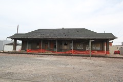 | Illinois Central Passenger Depot-Storm Lake | building | 1990 | 90001300 |
| Lewis "Lew" J. Metcalf Residence | building | 2026 | 100012735 | |
| Sioux Theatre | building | 2012 | 12000030 | |
| Storm Lake High School | building | 2017 | 100000485 | |
 | Storm Lake Public Library | building | 1983 | 83000346 |
Every wildfire the federal occurrence database records inside this county: 18 of them, burning about 239 acres. None started naturally and none was recorded as arson. Each settlement page carries the fires within five miles of it.
| Reported cause | Fires |
|---|---|
| Missing data/not specified/undetermined | 14 |
| Debris and open burning | 3 |
| Smoking | 1 |
The five largest, by the area the report gives. None of them was recorded as arson.
| Date | Cause | Size | Reported by | Name on the report |
|---|---|---|---|---|
| 25 April 2018 | Debris and open burning | 80 acres | Iowa Department of Natural Resources | not named |
| 11 April 2009 | Missing data/not specified/undetermined | 45 acres | Iowa Department of Natural Resources | not named |
| 28 March 2009 | Missing data/not specified/undetermined | 45 acres | Iowa Department of Natural Resources | not named |
| 24 April 2020 | Smoking | 37 acres | Iowa Department of Natural Resources | not named |
| 22 November 2017 | Missing data/not specified/undetermined | 6.0 acres | Iowa Department of Natural Resources | not named |
| 29 September 2011 | Missing data/not specified/undetermined | 5.0 acres | Iowa Department of Natural Resources | 200-580TH ST., IA |
| 7 April 2018 | Debris and open burning | 4.0 acres | Iowa Department of Natural Resources | not named |
| 2 April 2011 | Missing data/not specified/undetermined | 3.0 acres | Iowa Department of Natural Resources | 210TH & 600TH, IA |
Every settlement page carries the fires within five miles of it - see the settlement index below.
The NOAA Storm Events Database holds 379 reports for this county, causing no deaths, 8 injuries and about $12,308,500 in recorded property damage. Each settlement page carries the reports that name it.
| Kind of event | Reports |
|---|---|
| Hail | 151 |
| Thunderstorm Wind | 129 |
| Flood | 48 |
| Tornado | 28 |
| Flash Flood | 17 |
| Lightning | 3 |
| Heavy Rain | 3 |
The most serious of them, by death, then injury, then recorded damage. The accounts are quoted exactly as the forecast office filed them.
| When | Event | Place named | Harm | What the report says |
|---|---|---|---|---|
| June 1984 | Tornado (F2) | not stated | 3 hurt, $2,500,000 | no account filed |
| June 1994 | Thunderstorm Wind | Lakeside | 2 hurt, $50,000 | no account filed |
| May 2018 | Thunderstorm Wind | Linn Grove | 2 hurt | Saturated ground along with sub-severe thunderstorm winds caused a large tree to fall on a vehicle. Two persons were injured, with one person requiring extrication from the vehicle, followed by transport by flight for medical treatment of severe injuries. |
| August 2010 | Thunderstorm Wind | Storm Lake Arpt | 1 hurt, $25,000 | Thunderstorm winds blew over a large semi truck, blocking the road and causing minor injuries to the driver. |
| June 2024 | Flood | Hanover | $2,440,000 | Rainfall amounts across Buena Vista County from June 20-22 ranged from around a quarter of an inch across southern areas to nearly 3 inches across northern areas. Farther north and upstream, 3 to 7 inches of rain fell across portions of northwest Iowa. This rainfall resulted in major to record flooding along the Little Sioux River and overland flooding along the adjoining flood plain. ||The majority of flood impacts occurred across the far northern portion of the county, including the communities of Sioux Rapids and Linn Grove. Several area homes were proactively evacuated. Most of the business district in Sioux Rapids flooded with some buildings collapsing. Approximately 80 homes and 30 businesses were damaged by flood waters.||Infrastructure was also severely impacted. The U.S. Highway 71 bridge north of Sioux Rapids was under water and closed. The Sioux Rapids water wells and wastewater treatment plant were inundated with water and the Linn Grove water system was also inundated. Preliminary damage assessments estimate loss to public infrastructure to be 2.44 million dollars. ||For additional information on river flooding, please see other flood entries for Buena Vista County. |
| March 2019 | Flood | Hanover | $1,640,000 | Flooding resulted in extensive damage to public infrastructure including numerous county and township roads, culverts, and some bridges. |
| October 2013 | Tornado (EF1) | Hanover | $1,200,000 | A tornado destroyed a garage and damaged several other buildings and farm equipment on a farm, and damaged trees and power lines. The tornado also damaged a metal building system. The tornado also severely damaged the roof and air conditioning units at a school near Alta, and destroyed bleachers at the school. |
| April 2011 | Tornado (EF2) | Newell | $1,000,000 | A tornado affected several farmsteads, damaging several homes, some beyond repair. The tornado destroyed or damaged numerous outbuildings, several silos, farm equipment, and livestock shelters. Numerous power lines, power poles, and trees were blown down. The tornado crossed into Buena Vista County from Sac County, then crossed out of Buena Vista County into Pocahontas County. |
| May 2013 | Flash Flood | Newell | $500,000 | Widespread heavy rainfall of up to 8 inches caused flash flooding which was also widespread, affecting the western and southern parts of the county. There was significant flooding of numerous streets and homes, with an estimated 1,500 homes and businesses in the city of Storm Lake affected by basement or lower level flooding. The Storm Lake City Hall was included, with two feet of water in its basement. Rural areas in the western part of the county were also impacted, with numerous roads, fields, and homes flooded. |
| August 2010 | Thunderstorm Wind | Storm Lake | $500,000 | Thunderstorm winds blew the roof off a manufacturing plant, damaged docks and boats along the lake, caused widespread tree damage including numerous large trees blown down, blew down power lines and poles, resulting in power outages, damaged or destroyed several small sheds, blew down several awnings on businesses, snapped a 4 inch by 4 inch street sign pole, and blew shingles off roofs. Numerous vehicles, homes, and businesses sustained minor damage directly from the wind, while other vehicles and homes were damaged by falling trees and tree debris, some heavily. |
| December 2021 | Tornado (EF2) | Rembrandt | $250,000 | The tornado spun up just north of Rembrandt at 1718CST near the intersection of 120th Avenue and 470th Street. The tornado tracked northeast, and dissipated near the Little Sioux River one mile east of Sioux Rapids at 1722CST. A residence near the touchdown had siding and roofing torn from the home, along with snapped large pine trees. Along 460th Street just west of U.S. Highway 71, several large wooden power poles were snapped. The tornado continued northeast, crossing U.S. 71 one-half mile north of 460th Street where it destroyed several small buildings. More power poles were snapped along 450th Street east of U.S. 71, with the final damage noted in snapped trees along the Little Sioux River east of Sioux Rapids. The average path width was 75 yards and the maximum estimated wind speed was 115 mph. Property damage costs are a rough estimate. |
| June 1990 | Tornado (F1) | not stated | $250,000 | no account filed |
| August 1969 | Tornado (F2) | not stated | $250,000 | no account filed |
| July 1960 | Tornado (F1) | not stated | $250,000 | no account filed |
| December 2021 | Tornado (EF1) | Hanover | $200,000 | This is the third segment of a tornado which developed 2 miles north-northwest of Galva at 1658CST, and tracked northeast through extreme southeast Cherokee County. The tornado entered Buena Vista County at 1701CST, one-half mile south of the intersection of 10th Avenue and 640th Street. Along 640th Street, the tornado destroyed two outbuildings on a farmstead and damaged three others, removed a chimney from the roof of the residence, downed several light poles, and snapped and uprooted several large trees. Numerous other large trees were snapped or uprooted as the tornado tracked northeast over the next two miles, before damaging the roof of a hog confinement along 620th Street between 20th and 30th Avenues. Several houses lost shingles and siding, with occasional tree damage before the tornado lifted one mile southwest of Alta at 1706CST. The tornado was rated EF0 in Ida County, EFU in Cherokee County, and EF1 in Buena Vista County. The average path width in Buena Vista County was 50 yards and the maximum estimated wind speed was 100 mph. Property damage costs are a rough estimate. |
| June 2005 | Flash Flood | Storm Lake | $200,000 | Heavy rainfall of around 5 inches caused widespread flooding of streets, with up to 4 feet of water covering some intersections. Numerous vehicles stalled, including a police car responding to an emergency. Numerous basements and some surface floors of buildings were flooded, with several houses having up to 6 inches of water on ground level floors. The overflow of storm sewers caused treated sewage water to drain into the lake. Nearby fields and crops were also flooded. |
| December 2021 | Tornado (EF1) | Alta | $100,000 | The tornado which spun up 7 miles south-southwest of Aurelia continued into Buena Vista County at 1707CST near the intersection of 510th Street and 10th Avenue. The tornado continued northeast and lifted one mile south of the Buena Vista County Conservation Park at 1712CST. Along the track, the tornado caused siding and roof damage to outbuildings near 20th Ave and 490th Street, and removed walls of a machine shed along 480th Street west of 30th Avenue. Numerous wooden power poles were snapped along 470th and 460th Streets. The tornado was rated EF1 in both Cherokee and Buena Vista Counties. The average path width was 75 yards in Buena Vista County and the maximum estimated wind speed was 110 mph. Property damage costs are a rough estimate. |
| June 2014 | Flash Flood | Storm Lake | $100,000 | Heavy rain caused flash flooding of numerous streets in Storm Lake. Basements were also flooded. |
| May 2024 | Flood | Linn Grove | $85,000 | Multiple rounds of thunderstorms, along with already saturated ground, resulted in significant ponding of water in fields and low lying areas. A few county gravel roads were also briefly inundated after the heaviest rain the afternoon of May 21st requiring minor repair to the gravel surface. Water was also reported in some basements in the Linn Grove area due to a high water table. No reports of damage or impacts to structures from surface water flooding were received. Property damage costs are a rough estimate. |
| June 2014 | Flood | Linn Grove | $50,000 | Persistent moderate to heavy rain caused flooding of fields and other lowlands, including several roads, homes, and businesses. This flooding lasted for almost two days, and was aggravated locally by additional storms during that time. Some roads were damaged or washed out. |
| July 2010 | Flash Flood | Alta | $50,000 | Heavy rain caused flash flooding of streets, local small creeks, and basements. A few homes and businesses were flooded. Some exhibits at the county fairgrounds were damaged when a building there was flooded. |
| June 1994 | Thunderstorm Wind | Spencer | $50,000 | no account filed |
| June 1994 | Tornado (F1) | Sulphur Springs | $50,000 | no account filed |
| June 1994 | Hail | Sioux Rapids | $50,000 | no account filed |
| June 1994 | Thunderstorm Wind | Alta | $50,000 | no account filed |
| June 1994 | Hail | Alta | $50,000 | no account filed |
| June 2000 | Thunderstorm Wind | Alta | $40,000 | Thunderstorm winds caused widespread tree damage, specifically in the towns of Alta, Rembrandt, Sioux Rapids, and Marathon. The winds also heavily damaged a hog barn just east of Sioux Rapids. |
| March 2009 | Thunderstorm Wind | Storm Lake | $30,000 | Thunderstorm winds blew a 6 by 20 foot roof section off Kings Pointe Lodge. The roof section damaged other parts of the roof after it blew off. Roof debris and insulation damaged a vehicle in the lodge parking lot. |
| May 1980 | Tornado (F1) | not stated | $25,000 | no account filed |
| July 1978 | Tornado | not stated | $25,000 | no account filed |
| June 1964 | Tornado (F1) | not stated | $25,000 | no account filed |
| July 2010 | Thunderstorm Wind | Linn Grove | $20,000 | Thunderstorm winds blew down power lines and poles, causing power outages. The winds also caused tree damage, including several trees blown down. |
| June 2009 | Thunderstorm Wind | Storm Lake | $20,000 | Thunderstorm winds caused tree damage, including several trees blown down. Four vehicles were damaged by falling trees or tree debris. The winds also blew down power lines, causing a power outage. |
| September 2004 | Thunderstorm Wind | Storm Lake | $20,000 | Thunderstorm winds caused tree and power line damage. The damage resulted in a power outage that lasted two and a half hours and affected over a thousand city households, about a third of the city's population. |
| May 1997 | Thunderstorm Wind | Rembrandt | $20,000 | no account filed |
| May 2017 | Thunderstorm Wind | Newell | $12,000 | Utility poles along Highway 7 tilted by the strong winds. |
| May 2023 | Flash Flood | Marathon | $10,000 | A basement wall collapsed due to heavy rainfall and resultant flooding. Property damage costs are a rough estimate. |
| May 2017 | Thunderstorm Wind | Newell | $10,000 | Damage to a hog barn. |
| May 2017 | Thunderstorm Wind | Newell | $10,000 | Garage damaged. |
| June 2013 | Thunderstorm Wind | Sioux Rapids | $10,000 | Thunderstorm winds caused tree damage, including several trees blown down. The winds also caused roof damage to homes. |
| June 2011 | Thunderstorm Wind | Storm Lake | $10,000 | Thunderstorm winds blew down trees and power lines. |
| April 2011 | Tornado (EF1) | Newell | $10,000 | A tornado caused damage to outbuildings and other farm structures. |
| April 2011 | Tornado (EF2) | Newell | $10,000 | A tornado crossed into Buena Vista County from Sac County, and damaged farm structures and trees on a farmstead before dissipating. |
| August 2010 | Thunderstorm Wind | Hanover | $10,000 | Thunderstorm winds caused widespread tree damage, including numerous large branches blown down. The winds also bent a flag pole. |
| August 2006 | Lightning | Storm Lake Arpt | $10,000 | Lightning caused a barn roof to burn. |
| September 2004 | Thunderstorm Wind | Alta | $10,000 | Thunderstorm winds caused tree damage at a cemetery, and moved a 20 inch tombstone 36 feet. |
| September 2004 | Thunderstorm Wind | Linn Grove | $10,000 | Thunderstorm winds uprooted trees, blew off the top of a 100 foot silo, and blew down a chicken pen. |
| July 2003 | Flash Flood | Storm Lake | $10,000 | Heavy rain caused flooding of roads, fields and other low areas, and small streams. The flooding washed out two bridges. |
| May 1998 | Lightning | Sioux Rapids | $10,000 | no account filed |
| July 1996 | Thunderstorm Wind | Sioux Rapids | $10,000 | no account filed |
| May 2017 | Thunderstorm Wind | Newell | $5,000 | Garage damaged. |
| August 2009 | Thunderstorm Wind | Storm Lake | $5,000 | Thunderstorm winds caused tree damage, including large branches and limbs blown down. At least two vehicles, a pickup truck and a restored automobile, suffered damage from tree debris. |
| June 2008 | Thunderstorm Wind | Hanover | $5,000 | Thunderstorm winds caused tree damage, including two 40 to 50 foot tall trees blown down, and another large limb blown down onto a garage, causing minor damage to the garage. |
| May 1997 | Thunderstorm Wind | Albert City | $5,000 | no account filed |
| May 1994 | Hail | Sioux Rapids | $5,000 | no account filed |
| June 1994 | Hail | Sioux Rapids | $5,000 | no account filed |
| July 1994 | Hail | not stated | $5,000 | no account filed |
| August 1958 | Tornado (F2) | not stated | $2,500 | no account filed |
| April 2011 | Thunderstorm Wind | Newell | $2,000 | Thunderstorm winds caused roof damage to outbuildings on a farmstead. |
| May 1995 | Hail | Holstien | $2,000 | Small hail accumulated up to six inches. Damage was mainly to tomato and other garden plants. Although corn was exposed to the hail, little damage occurred as the growing point of the corn plants had not yet emerged to the surface. |
The Survey's mineral resources record lists 39 workings inside this county. 11 still produce and 28 are closed or unrecorded. Each settlement page carries the workings within five miles of it.
| Commodity | Workings |
|---|---|
| Sand and Gravel, Construction | 39 |
The least common of them first, because a county's hundredth gravel pit says nothing its first ten did not.
| Where | Site | Commodity | Status | Recorded |
|---|---|---|---|---|
| Angier Pit | Sand and Gravel, Construction | Producer | ||
| Aurelia Pit | Sand and Gravel, Construction | Past Producer | ||
| Bjorklund Pit | Sand and Gravel, Construction | Producer | ||
| Buena Vista County Pits | Sand and Gravel, Construction | Producer | ||
| Clark Pit | Sand and Gravel, Construction | Producer | ||
| Francis Pit | Sand and Gravel, Construction | Past Producer | ||
| Goldsmith Pit | Sand and Gravel, Construction | Producer | ||
| Kracht Pit | Sand and Gravel, Construction | Past Producer | ||
| Linn Grove | Sand and Gravel, Construction | Producer | ||
| Linn Grove Pit | Sand and Gravel, Construction | Producer | ||
| Marathon Pit | Sand and Gravel, Construction | Past Producer | ||
| Molgaard Pit | Sand and Gravel, Construction | Past Producer | ||
| Overly Pit | Sand and Gravel, Construction | Past Producer | ||
| Railroad Pit | Sand and Gravel, Construction | Producer | ||
| Sturchler Pit | Sand and Gravel, Construction | Past Producer | ||
| Unknown | Sand and Gravel, Construction | Past Producer | ||
| Unknown | Sand and Gravel, Construction | Past Producer | ||
| Unknown | Sand and Gravel, Construction | Past Producer | ||
| Unknown | Sand and Gravel, Construction | Past Producer | ||
| Unknown | Sand and Gravel, Construction | Past Producer | ||
| Unknown | Sand and Gravel, Construction | Past Producer | ||
| Unknown | Sand and Gravel, Construction | Past Producer | ||
| Unknown | Sand and Gravel, Construction | Past Producer | ||
| Unknown | Sand and Gravel, Construction | Past Producer | ||
| Unknown | Sand and Gravel, Construction | Past Producer | ||
| Unknown | Sand and Gravel, Construction | Past Producer | ||
| Unknown | Sand and Gravel, Construction | Past Producer | ||
| Unknown | Sand and Gravel, Construction | Past Producer | ||
| Unknown | Sand and Gravel, Construction | Past Producer | ||
| Unknown | Sand and Gravel, Construction | Past Producer | ||
| Unknown | Sand and Gravel, Construction | Past Producer | ||
| Unknown | Sand and Gravel, Construction | Past Producer | ||
| Unknown | Sand and Gravel, Construction | Past Producer | ||
| Unknown | Sand and Gravel, Construction | Past Producer | ||
| Unknown | Sand and Gravel, Construction | Past Producer | ||
| Wetherell Pit | Sand and Gravel, Construction | Past Producer | ||
| Wetherell-Borklund Pit | Sand and Gravel, Construction | Producer | ||
| Wetherell-Oatman Pit | Sand and Gravel, Construction | Producer | ||
| Whitney Pit | Sand and Gravel, Construction | Producer |
Named settlements recorded in the Geographic Names Information System, each with the topographic sheets covering it. Villages, hamlets and abandoned places alike. Each is shown with the nearest named watercourse or landform and the survey quadrangle it falls on.
Barnes township · 51033 · On Bluebird Creek · Sioux Rapids quadrangle
9 sheets, 1954 to 1985
Sioux Rapids city · 50585 · On Soldier Creek · Sioux Rapids quadrangle
9 sheets, 1954 to 1985