 Block
From the record
13 National Register listings published here.
Sources: the National Register database, National Park Service
22 topographic sheets cover 21 settlements here, and 13 properties are on the National Register of Historic Places.
13 National Register listings published here.
Sources: the National Register database, National Park Service
Every property in this county listed on the National Register of Historic Places, with the year it was listed and the federal nomination document.
| Photograph | Property | Type | Listed | Reference |
|---|---|---|---|---|
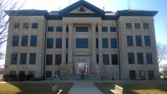 | Calhoun County Courthouse | building | 1981 | 81000227 |
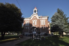 | Central School | building | 1985 | 85000001 |
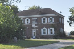 | Chicago and North Western Office Building/Passenger Depot-Lake City | building | 1990 | 90001205 |
| First National Bank of Pomeroy | building | 2023 | 100009076 | |
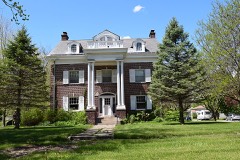 | Perry C. and Mattie Forrest Holdoegel House | building | 1992 | 91001831 |
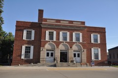 | Lake City Community Memorial Building | building | 1990 | 90001210 |
 | Lake City Public Library | building | 1990 | 90001209 |
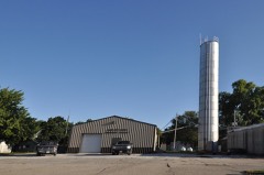 | Lake City Water Standpipe | structure | 1990 | 90001211 |
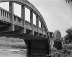 | Marsh Rainbow Arch Bridge | structure | 1989 | 88002529 |
| Rockwell City Bridge | structure | 1998 | 98000752 | |
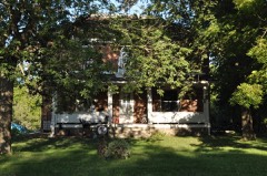 | Smith Farmhouse | building | 1990 | 90001206 |
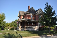 | Gen. Cass and Belle Smith House | building | 1990 | 90001207 |
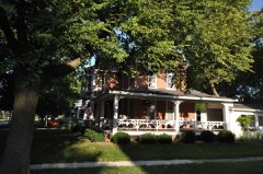 | Peter and Mary Smith House | building | 1990 | 90001208 |
Every wildfire the federal occurrence database records inside this county: 41 of them, burning about 295 acres. None started naturally and none was recorded as arson. Each settlement page carries the fires within five miles of it.
| Reported cause | Fires |
|---|---|
| Missing data/not specified/undetermined | 20 |
| Debris and open burning | 10 |
| Equipment and vehicle use | 6 |
| Smoking | 4 |
| Recreation and ceremony | 1 |
The five largest, by the area the report gives. None of them was recorded as arson.
| Date | Cause | Size | Reported by | Name on the report |
|---|---|---|---|---|
| 1 October 2012 | Missing data/not specified/undetermined | 80 acres | Iowa Department of Natural Resources | not named |
| 29 September 2011 | Missing data/not specified/undetermined | 35 acres | Iowa Department of Natural Resources | 1 MILE N AND 2 1/4 MILES WEST OF LOHRVILLE, IA |
| 5 April 2013 | Debris and open burning | 30 acres | Iowa Department of Natural Resources | not named |
| 26 April 2019 | Debris and open burning | 25 acres | Iowa Department of Natural Resources | not named |
| 1 April 2019 | Debris and open burning | 15 acres | Iowa Department of Natural Resources | not named |
| 3 October 2012 | Equipment and vehicle use | 15 acres | Iowa Department of Natural Resources | not named |
| 16 March 2015 | Missing data/not specified/undetermined | 10 acres | Iowa Department of Natural Resources | not named |
| 9 April 2019 | Debris and open burning | 10 acres | Iowa Department of Natural Resources | not named |
Every settlement page carries the fires within five miles of it - see the settlement index below.
The NOAA Storm Events Database holds 370 reports for this county, causing 4 deaths, 33 injuries and about $40,914,050 in recorded property damage. Each settlement page carries the reports that name it.
| Kind of event | Reports |
|---|---|
| Hail | 132 |
| Thunderstorm Wind | 130 |
| Tornado | 37 |
| Heavy Rain | 29 |
| Flash Flood | 23 |
| Funnel Cloud | 10 |
| Flood | 7 |
| Lightning | 2 |
The most serious of them, by death, then injury, then recorded damage. The accounts are quoted exactly as the forecast office filed them.
| When | Event | Place named | Harm | What the report says |
|---|---|---|---|---|
| June 1979 | Tornado (F4) | not stated | 3 killed, 26 hurt, $25,000,000 | no account filed |
| June 1954 | Tornado (F4) | not stated | 1 killed, $250,000 | no account filed |
| May 2013 | Thunderstorm Wind | Rinard | 5 hurt, $3,000 | no account filed |
| May 1998 | Hail | Lohrville | 1 hurt, $1,000,000 | no account filed |
| May 2001 | Flash Flood | Countywide | 1 hurt, $250,000 | Injury occurred 1 E of Yetter |
| July 2021 | Tornado (EF3) | Lake City | $2,500,000 | This was the first and strongest tornado of the day. It developed west southwest of Lake City and produced tree and power line damage. The tornado moved into and across the southern portion of Lake City. Imagery from UAV's and chasers show that the tornado was multi-vortex as it passed through the city. Up to EF2 damage occurred as it passed through town. As the tornado moved east of the town, it began to consolidate into a larger funnel and strengthen. It passed through a farmstead producing considerable damage to the farmhouse and out buildings with EF3 damage noted on the house. The tornado continued for a few more miles and impacted a confinement facility before lifting to the northwest of Lohrville. Fortunately, no injuries or deaths occurred with this tornado. |
| June 1990 | Tornado (F2) | not stated | $2,500,000 | no account filed |
| April 1984 | Tornado (F2) | not stated | $2,500,000 | no account filed |
| May 2015 | Tornado (EF1) | Lake City | $1,000,000 | Tornado moved from Carroll County into Calhoun County. It moved across the western side of Lake City, doing EF1 damage to houses and the high school. It remained in rural areas of Calhoun County for the remainder of it's path, broadening as it went along. The tornado lifted shortly before crossing Highway 20. |
| May 1998 | Hail | Lake City | $750,000 | Trees damaged by the hail |
| August 2009 | Thunderstorm Wind | Somers | $500,000 | A trained spotter reports extensive tree, window, roof, and crop damage fro high winds and large hail around somers. |
| June 2014 | Hail | Rockwell City | $500,000 | no account filed |
| July 2010 | Flash Flood | Rockwell City | $250,000 | Highway 4 south of Rockwell City is closed due to flooding. Humpty Dumpty Park in Rockwell City is flooded. Water reported in numerous basements in Manson. |
| May 2015 | Hail | Lake City | $250,000 | no account filed |
| June 2014 | Hail | Rockwell City | $250,000 | no account filed |
| April 2007 | Flood | Farnhamville | $250,000 | no account filed |
| July 1986 | Tornado (F2) | not stated | $250,000 | no account filed |
| June 1998 | Thunderstorm Wind | Manson | $200,000 | no account filed |
| June 2014 | Hail | Rockwell City | $150,000 | Windshields broken in cars across Rockwell City. |
| June 1996 | Flash Flood | Rockwell City | $150,000 | no account filed |
| May 2015 | Hail | Manson | $100,000 | no account filed |
| August 2001 | Flash Flood | North Portion | $100,000 | no account filed |
| August 2007 | Flash Flood | Yetter | $75,000 | Six inches of water was reported in basements due to heavy rain. Numerous basements were flooded. |
| June 1998 | Flash Flood | Lytton | $75,000 | no account filed |
| May 1998 | Hail | Farnhamville | $75,000 | no account filed |
| December 2021 | Tornado (EF2) | Farnhamville | $50,000 | This tornado had a path in both Calhoun and Webster Counties. The path started west northwest of Farnhamville with the tornado heading north northeast passing on the east side of Somers. There was EF2 damage observed to the east southeast of Rinard where large utility poles were snapped. Additional tree and barn damage was observed south of Somers. The path continued top the northeast before exiting the county into Webster County just south of US Highway 20. |
| June 2018 | Flash Flood | Farnhamville | $50,000 | Law enforcement reported a one mile stretch of P21, Zearing Ave, closed due to water over the road. Depth was unknown at the time, but Calhoun County Sheriff's Deputy felt strongly enough that it needed barricades. The location was between 320th and 330th. Cause likely from Hardin Creek. |
| May 2015 | Hail | Manson | $50,000 | Significant damage was done to a vehicle from the large hail. |
| May 2014 | Thunderstorm Wind | Lytton | $50,000 | A 26 x 48 tunnel was ripped from the ground and twisted. A playset was blown over. Winds were estimated to be 70 MPH. |
| June 2010 | Heavy Rain | Pomeroy | $50,000 | Six inches of water standing in streets. Half inch diameter hail and wind gusts to 20 MPH. |
| June 2010 | Flash Flood | Pomeroy | $50,000 | Underpass and viaduct flooding along Highway 4. |
| May 2008 | Tornado (EF1) | Somers | $50,000 | A small tornado moved across the northern part of town, causing roof damage to homes and garages. |
| August 2007 | Flash Flood | Knoke | $50,000 | Numerous vehicles were stranded in flooded streets in Rockwell City. |
| August 2007 | Flash Flood | Manson | $50,000 | Highway 7 was closed east of Manson due to water over the road. All roads in Manson were flooded. Water was over the road at 330th and P21. |
| May 2005 | Tornado (F1) | Farnhamville | $50,000 | Tornado touched down on a farm north of Farnhamville, damaging several buildings on the farm. The tornado moved from Calhoun County into Webster County. |
| June 2005 | Flash Flood | Countywide | $50,000 | no account filed |
| June 2004 | Flash Flood | Countywide | $50,000 | no account filed |
| April 1998 | Flood | Rockwell City | $50,000 | no account filed |
| June 1998 | Flood | Rockwell City | $50,000 | no account filed |
| March 2006 | Thunderstorm Wind | Manson | $40,000 | no account filed |
| May 1998 | Thunderstorm Wind | Manson | $40,000 | no account filed |
| May 1998 | Thunderstorm Wind | Lake City | $40,000 | no account filed |
| May 2008 | Tornado (EF0) | Farnhamville | $30,000 | A tornado caused damage to 4 farmsteads with damage to trees and some minor damage to the farmstead. |
| June 1996 | Flood | Rockwell City | $30,000 | no account filed |
| June 2012 | Thunderstorm Wind | Jolley | $25,000 | Several large trees were blown down across town. One tree fell on top of power lines, knocking them to the ground. |
| July 2012 | Thunderstorm Wind | Lohrville | $25,000 | Big limbs down everywhere. Casey's diesel pump blown over and laying on its side. A tree was laying on top of a car. Some crop damage also reported. |
| September 2012 | Thunderstorm Wind | Pomeroy | $25,000 | Numerous large tree branches greater than 6 inches in diameter were down. Loose metal sheeting was observed blowing through the streets. |
| June 2010 | Flash Flood | Knoke | $25,000 | Flooding along Highway D15 near Garber and Janesville Avenues. |
| August 2007 | Flash Flood | Farnhamville | $25,000 | Streets were reported as impassable with water over the roads south of Farnhamville at 370th and Highway P21. |
| August 2007 | Flash Flood | Knierim | $25,000 | Water was reported over blacktop county road, making it impassable via semi at 2 to 3 places between Knierim and Twin Lakes. |
| June 2014 | Hail | Rockwell City | $25,000 | no account filed |
| June 2014 | Hail | Yetter | $25,000 | no account filed |
| August 2009 | Hail | Yetter | $25,000 | no account filed |
| May 1998 | Hail | Lake City | $25,000 | no account filed |
| June 1981 | Tornado (F1) | not stated | $25,000 | no account filed |
| May 1965 | Tornado (F4) | not stated | $25,000 | no account filed |
| May 2021 | Lightning | Rockwell City | $20,000 | Emergency management reported a lightning strike to the the county court house, resulting in over 20,000 dollars in damage. |
| December 2021 | Tornado (EF1) | Wightman | $20,000 | This path was found via storm survey and extended using high resolution satellite imagery. The storm started south southwest of Lohrville and passed just west of town producing mainly tree damage and some minor house damage. The path continue northeast through eastern Calhoun county with additional damage to trees and outbuildings with path clearly evident in satellite imagery. The tornado passed the east side of Knierim and dissipated not long afterwards. |
| June 2015 | Thunderstorm Wind | Rockwell City | $20,000 | Multiple large tree branches down in and around Rockwell City. |
| December 2015 | Flood | Yetter | $20,000 | Flooding was reported along the North Raccoon River from near Sac City to northwest of Lanesboro. |
The Survey's mineral resources record lists 18 workings inside this county. 2 still produce and 16 are closed or unrecorded. Each settlement page carries the workings within five miles of it.
| Commodity | Workings |
|---|---|
| Sand and Gravel, Construction | 18 |
The least common of them first, because a county's hundredth gravel pit says nothing its first ten did not.
| Where | Site | Commodity | Status | Recorded |
|---|---|---|---|---|
| Bailey Pit | Sand and Gravel, Construction | Past Producer | ||
| Burke Pit | Sand and Gravel, Construction | Past Producer | ||
| Drennan Pit | Sand and Gravel, Construction | Past Producer | ||
| Johnson Pit | Sand and Gravel, Construction | Past Producer | ||
| Kreft Pit | Sand and Gravel, Construction | Past Producer | ||
| Minor Pit | Sand and Gravel, Construction | Past Producer | ||
| Otto Pit | Sand and Gravel, Construction | Producer | ||
| Packer Pit | Sand and Gravel, Construction | Producer | ||
| Parsons Pit | Sand and Gravel, Construction | Past Producer | ||
| Parsons Pit | Sand and Gravel, Construction | Past Producer | ||
| Tapps Pit | Sand and Gravel, Construction | Past Producer | ||
| Unknown | Sand and Gravel, Construction | Past Producer | ||
| Unknown | Sand and Gravel, Construction | Past Producer | ||
| Unknown | Sand and Gravel, Construction | Past Producer | ||
| Unknown | Sand and Gravel, Construction | Past Producer | ||
| Unknown | Sand and Gravel, Construction | Past Producer | ||
| Unknown | Sand and Gravel, Construction | Past Producer | ||
| Unknown | Sand and Gravel, Construction | Past Producer |
Named settlements recorded in the Geographic Names Information System, each with the topographic sheets covering it. Villages, hamlets and abandoned places alike. Each is shown with the nearest named watercourse or landform and the survey quadrangle it falls on.
Logan township · 50579 · Lohrville quadrangle
8 sheets, 1954 to 1993
No longer a settlement
The vanished settlements of Calhoun County: the places named above that are no longer on the map.