 Block
From the record
11 National Register listings published here, 1 of them a National Historic Landmark.
Sources: the National Register database, National Park Service
19 topographic sheets cover 15 settlements here, and 11 properties are on the National Register of Historic Places.
11 National Register listings published here, 1 of them a National Historic Landmark.
Sources: the National Register database, National Park Service
Every property in this county listed on the National Register of Historic Places, with the year it was listed and the federal nomination document.
| Photograph | Property | Type | Listed | Reference |
|---|---|---|---|---|
 | American Legion Memorial Building | building | 2006 | 06001121 |
 | Atlantic High School | building | 2002 | 02001248 |
 | Cass County Court House | building | 2003 | 03000819 |
 | Charles F. and and Ruth Chase House | building | 1999 | 99000451 |
 | Chicago, Rock Island & Pacific Railroad Depot | building | 1994 | 94000087 |
 | Griswold National Bank | building | 1979 | 79003695 |
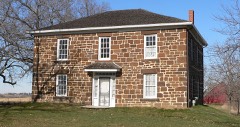 | Rev. George B. Hitchcock House | building | 1977 | 77000500 |
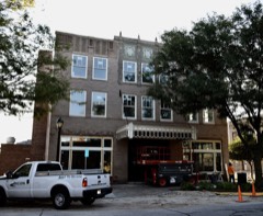 | Hotel Whitney | building | 2016 | 16000640 |
 | S. F. Martin House | building | 1984 | 84001211 |
 | Job A. and Rebecca E. McWaid House | building | 1994 | 94001030 |
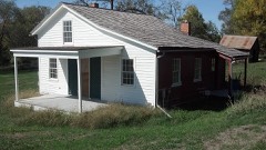 | Nishnabotna Ferry House | building | 2001 | 00001676 |
Every wildfire the federal occurrence database records inside this county: 76 of them, burning about 861 acres. None started naturally and 8 were recorded as arson. Each settlement page carries the fires within five miles of it.
| Reported cause | Fires |
|---|---|
| Missing data/not specified/undetermined | 34 |
| Debris and open burning | 24 |
| Arson/incendiarism | 8 |
| Equipment and vehicle use | 8 |
| Smoking | 2 |
The five largest, by the area the report gives. None of them was recorded as arson.
| Date | Cause | Size | Reported by | Name on the report |
|---|---|---|---|---|
| 21 March 2009 | Missing data/not specified/undetermined | 115 acres | Iowa Department of Natural Resources | not named |
| 12 April 2014 | Equipment and vehicle use | 100 acres | Iowa Department of Natural Resources | not named |
| 8 April 2014 | Missing data/not specified/undetermined | 90 acres | Iowa Department of Natural Resources | not named |
| 19 March 2011 | Missing data/not specified/undetermined | 80 acres | Iowa Department of Natural Resources | 540TH & LANSING RD, IA |
| 16 March 2017 | Missing data/not specified/undetermined | 75 acres | Iowa Department of Natural Resources | not named |
| 23 April 2009 | Missing data/not specified/undetermined | 60 acres | Iowa Department of Natural Resources | not named |
| 15 March 2015 | Debris and open burning | 50 acres | Iowa Department of Natural Resources | not named |
| 14 March 2009 | Missing data/not specified/undetermined | 45 acres | Iowa Department of Natural Resources | not named |
Every settlement page carries the fires within five miles of it - see the settlement index below.
The NOAA Storm Events Database holds 551 reports for this county, causing no deaths, 11 injuries and about $17,134,250 in recorded property damage. Each settlement page carries the reports that name it.
| Kind of event | Reports |
|---|---|
| Thunderstorm Wind | 203 |
| Hail | 174 |
| Heavy Rain | 83 |
| Tornado | 40 |
| Flash Flood | 34 |
| Flood | 10 |
| Funnel Cloud | 5 |
| Lightning | 2 |
The most serious of them, by death, then injury, then recorded damage. The accounts are quoted exactly as the forecast office filed them.
| When | Event | Place named | Harm | What the report says |
|---|---|---|---|---|
| June 1984 | Tornado (F2) | not stated | 8 hurt, $2,500,000 | no account filed |
| June 1985 | Tornado (F1) | not stated | 1 hurt, $250,000 | no account filed |
| May 1998 | Thunderstorm Wind | Atlantic | 1 hurt, $50,000 | no account filed |
| April 1964 | Tornado (F3) | not stated | 1 hurt, $25,000 | no account filed |
| June 1998 | Flash Flood | Atlantic | $2,000,000 | no account filed |
| June 1997 | Thunderstorm Wind | Cumberland | $1,100,000 | no account filed |
| May 2007 | Tornado (EF2) | Griswold | $1,000,000 | Tornado touched down on the southern Cass County line and moved northeast. The last 2 miles of the track showed an intermittent nature. Average path width was 100 to 200 yards wide with a maximum width of about one half mile. Estimated wind speed was 120 to 130 MPH. |
| May 2007 | Flood | Anita | $1,000,000 | no account filed |
| June 1997 | Thunderstorm Wind | Atlantic | $500,000 | no account filed |
| April 1994 | Hail | Griswold | $500,000 | no account filed |
| December 2021 | Tornado (EF2) | Lewis | $300,000 | Tornado developed northwest of Lewis and moved rapidly to the northeast. Damage occurred to several houses and trees along the path with mostly EF0 and EF1 ratings. Three high voltage steel towers were toppled providing the EF2 rating for this tornado. The tornado crossed Interstate 80 near milepost 59 blowing several semi onto their sides. The path was also observed in high resolution satellite imagery. This tornado then crossed into Audubon county. |
| April 2018 | Thunderstorm Wind | Lorah | $250,000 | Delayed report from Cass County Public Safety of several campers blown over and damaged at an RV Sales lot. |
| March 2009 | Tornado (EF0) | Cumberland | $250,000 | Several farms had damage to grain bins, out buildings, trees, and powerlines. Track was intermittent. |
| May 2007 | Flash Flood | Cumberland | $250,000 | no account filed |
| June 1999 | Thunderstorm Wind | Atlantic | $250,000 | no account filed |
| June 1990 | Tornado (F1) | not stated | $250,000 | no account filed |
| June 2014 | Hail | Anita | $200,000 | Large hail and severe winds combined to produce damage to crop and houses. A semi was blown over on Interstate 80 near mile marker 71 by the strong winds. The wind driven hail stripped crops across the far northeast corner of the county. |
| August 2009 | Thunderstorm Wind | Atlantic | $200,000 | An apparent microburst downed trees and branches in Atlantic through the center of town between 10th and 11th street. The damage path was about 3 blocks long. Whole trees were downed, up to 3 feet in diameter. |
| May 2007 | Flood | Anita | $200,000 | no account filed |
| May 2007 | Flash Flood | Cumberland | $200,000 | no account filed |
| May 2007 | Flash Flood | Atlantic | $200,000 | no account filed |
| May 2007 | Flash Flood | Griswold | $200,000 | no account filed |
| April 1999 | Tornado (F3) | Massena | $186,000 | no account filed |
| June 2017 | Thunderstorm Wind | Griswold | $150,000 | The emergency manager reported several grain bins destroyed, a damaged machine shed, a damaged storage silo, several large trees uprooted or snapped off, and damage to a center pivot. |
| March 2011 | Tornado (EF1) | Dewey | $150,000 | NWS storm survey term related this tornado as an EF1 with a peak wind of 89 MPH. Track was continuous 2 3/4 mile path. Most damage was EF0 with one localized EF1 damage area. |
| July 2000 | Flash Flood | Countywide | $150,000 | no account filed |
| May 1998 | Thunderstorm Wind | Lewis | $150,000 | no account filed |
| May 2014 | Flash Flood | Atlantic Arpt | $100,000 | Highway 6 just northwest of Atlantic has water flowing up to curb level. Bull Creek drainage area was beginning to overflow. Considerable street flooding in the town of Atlantic. |
| June 2008 | Flash Flood | Atlantic | $100,000 | Significant urban flooding in Atlantic with 25 to 30 intersections covered by water, several waist high. Mainly due to Bull Creek. |
| May 2004 | Tornado (F1) | Lewis | $100,000 | Intermittent path through rural areas. |
| May 2007 | Thunderstorm Wind | Anita | $100,000 | no account filed |
| May 2007 | Flash Flood | Cumberland | $100,000 | no account filed |
| May 2004 | Thunderstorm Wind | Lewis | $100,000 | no account filed |
| May 1999 | Flash Flood | Atlantic | $100,000 | no account filed |
| July 1998 | Flash Flood | Atlantic | $100,000 | no account filed |
| June 1997 | Thunderstorm Wind | Massena | $100,000 | no account filed |
| July 1995 | Thunderstorm Wind | Atlantic | $100,000 | no account filed |
| October 2007 | Flash Flood | Marne | $75,000 | A foot of water was reported in the basement of a residence. Rainfall of 3.26 inches was measured since 530 PM, and 1.85 inches in last 55 minutes. |
| May 2007 | Flood | Massena | $75,000 | no account filed |
| March 2002 | Thunderstorm Wind | Massena | $75,000 | no account filed |
| May 2001 | Hail | Atlantic | $75,000 | no account filed |
| May 1998 | Tornado (F1) | Anita | $75,000 | no account filed |
| May 1996 | Flash Flood | Atlantic | $75,000 | no account filed |
| May 1998 | Thunderstorm Wind | Atlantic | $70,000 | no account filed |
| May 2024 | Thunderstorm Wind | Lewis | $50,000 | Emergency manager reported numerous power poles and branches down throughout town. Time estimated from radar, this was a delayed report. |
| May 2019 | Flash Flood | Massena | $50,000 | Quick rises have happened along the West Nodaway River in Cass County. Evacuations along the West Nodaway River are being recommended to nearby residents. |
| April 2018 | Lightning | Lorah | $50,000 | Cass County Public Safety reported a barn destroyed by a fire from a lightning strike. |
| June 2017 | Thunderstorm Wind | Griswold | $50,000 | Trained spotter reported numerous large limbs down in town. Some 1-2 foot trees snapped off, one landed on a house. Another landed on a camper. |
| June 2014 | Flash Flood | Griswold | $50,000 | Cass County Emergency Manager reported major street flooding in Griswold. Water was covering the car tires and up to 18 inches of water covered municipal roadways in places. |
| June 2008 | Flash Flood | Cumberland | $50,000 | Water damage was reported to a bridge on County Highway 28 with the highway closed south of Highway 92. Bridge was damaged 3 miles south of Highway 92. |
| October 2007 | Flood | Atlantic | $50,000 | Jackson Road at 650th was closed due to flooding. |
| June 2008 | Flash Flood | Cumberland | $50,000 | no account filed |
| August 2007 | Flash Flood | Griswold | $50,000 | no account filed |
| April 2007 | Flash Flood | Cumberland | $50,000 | no account filed |
| April 2007 | Flash Flood | Atlantic | $50,000 | no account filed |
| May 2007 | Flash Flood | Atlantic | $50,000 | no account filed |
| May 2007 | Flash Flood | Atlantic | $50,000 | no account filed |
| May 2007 | Flood | Atlantic | $50,000 | no account filed |
| May 2004 | Thunderstorm Wind | Anita | $50,000 | no account filed |
| May 2004 | Thunderstorm Wind | Anita | $50,000 | no account filed |
The Survey's mineral resources record lists 12 workings inside this county. 3 still produce and 9 are closed or unrecorded. Each settlement page carries the workings within five miles of it.
| Commodity | Workings |
|---|---|
| Stone, Crushed/Broken | 6 |
| Sand and Gravel, Construction | 6 |
The least common of them first, because a county's hundredth gravel pit says nothing its first ten did not.
| Where | Site | Commodity | Status | Recorded |
|---|---|---|---|---|
| Atlantic Pit | Sand and Gravel, Construction | Past Producer | ||
| Atlantic Quarry | Stone, Crushed/Broken | Producer | ||
| Indian Creek Quarry | Stone, Crushed/Broken | Past Producer | ||
| Lewis Quarry | Stone, Crushed/Broken | Past Producer | ||
| Lewis Quarry | Stone, Crushed/Broken | Producer | ||
| Lyman Pit | Sand and Gravel, Construction | Past Producer | ||
| Mcdermott Pit | Sand and Gravel, Construction | Past Producer | ||
| Miller Property | Sand and Gravel, Construction | Past Producer | ||
| Seventy-One Quarry | Stone, Crushed/Broken | Past Producer | ||
| Unknown | Stone, Crushed/Broken | Past Producer | ||
| Unknown | Sand and Gravel, Construction | Past Producer | ||
| Valley Plant | Sand and Gravel, Construction | Producer |
Named settlements recorded in the Geographic Names Information System, each with the topographic sheets covering it. Villages, hamlets and abandoned places alike. Each is shown with the nearest named watercourse or landform and the survey quadrangle it falls on.
Pleasant township · 51535 · On Lone Tree Branch · Griswold quadrangle
9 sheets, 1954 to 1985
Grove township · 50022 · On Jim Branch · Wiota quadrangle
9 sheets, 1954 to 1993
No longer a settlement
Cass township · 51544 · On Spring Creek · Lewis quadrangle
10 sheets, 1954 to 1985
No longer a settlement
Grove township · 50022 · On Troublesome Creek · Wiota quadrangle
9 sheets, 1954 to 1993
The vanished settlements of Cass County: the places named above that are no longer on the map.