 Block
From the record
15 National Register listings published here.
Sources: the National Register database, National Park Service
27 topographic sheets cover 22 settlements here, and 15 properties are on the National Register of Historic Places.
15 National Register listings published here.
Sources: the National Register database, National Park Service
Every property in this county listed on the National Register of Historic Places, with the year it was listed and the federal nomination document.
| Photograph | Property | Type | Listed | Reference |
|---|---|---|---|---|
| Beaver Creek Bridge | structure | 1998 | 98000799 | |
| Buck Grove Bridge | structure | 1998 | 98000797 | |
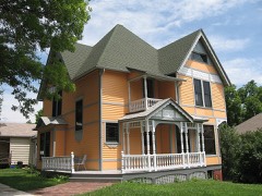 | Carey, John T. and Marietta (Greek) House | building | 2005 | 05000276 |
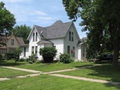 | Clarence D. Chamberlin House | building | 1977 | 77000505 |
 | Crawford County Courthouse | building | 1981 | 81000232 |
| Denison Opera House | building | 2023 | 100008627 | |
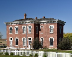 | Dow House | building | 1972 | 72000471 |
| Z. T. Dunham Pioneer Stock Farm | building | 1993 | 93000652 | |
| East Soldier River Bridge | structure | 1998 | 98000798 | |
| Klondike Hotel | building | 1996 | 96001060 | |
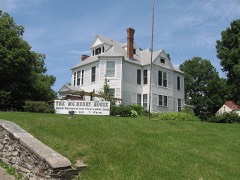 | William A. McHenry House | building | 1976 | 76000755 |
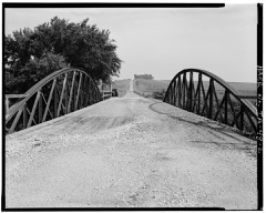 | Nishnabotna River Bridge | structure | 1998 | 98000801 |
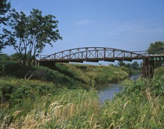 | Nishnabotna River Bridge | structure | 1999 | 99000309 |
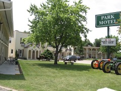 | Park Motel | building | 2000 | 00000565 |
| Yellow Smoke Park Bridge | structure | 1998 | 98000800 |
Every wildfire the federal occurrence database records inside this county: 47 of them, burning about 359 acres. None started naturally and none was recorded as arson. Each settlement page carries the fires within five miles of it.
| Reported cause | Fires |
|---|---|
| Missing data/not specified/undetermined | 17 |
| Debris and open burning | 16 |
| Equipment and vehicle use | 9 |
| Smoking | 4 |
| Recreation and ceremony | 1 |
The five largest, by the area the report gives. None of them was recorded as arson.
| Date | Cause | Size | Reported by | Name on the report |
|---|---|---|---|---|
| 22 August 2012 | Equipment and vehicle use | 40 acres | Iowa Department of Natural Resources | not named |
| 14 April 2009 | Missing data/not specified/undetermined | 35 acres | Iowa Department of Natural Resources | not named |
| 29 March 2009 | Missing data/not specified/undetermined | 30 acres | Iowa Department of Natural Resources | not named |
| 2 February 2012 | Debris and open burning | 30 acres | Iowa Department of Natural Resources | not named |
| 20 April 2019 | Debris and open burning | 30 acres | Iowa Department of Natural Resources | not named |
| 9 April 2020 | Debris and open burning | 25 acres | Iowa Department of Natural Resources | not named |
| 21 November 2017 | Missing data/not specified/undetermined | 20 acres | Iowa Department of Natural Resources | not named |
| 11 April 2010 | Missing data/not specified/undetermined | 17 acres | Iowa Department of Natural Resources | 1724 UNION AVE, DOW CITY, IA 51528, IOWA |
Every settlement page carries the fires within five miles of it - see the settlement index below.
The NOAA Storm Events Database holds 444 reports for this county, causing no deaths, 6 injuries and about $23,341,030 in recorded property damage. Each settlement page carries the reports that name it.
| Kind of event | Reports |
|---|---|
| Thunderstorm Wind | 185 |
| Hail | 148 |
| Tornado | 38 |
| Heavy Rain | 37 |
| Flash Flood | 20 |
| Flood | 9 |
| Funnel Cloud | 5 |
| Lightning | 2 |
The most serious of them, by death, then injury, then recorded damage. The accounts are quoted exactly as the forecast office filed them.
| When | Event | Place named | Harm | What the report says |
|---|---|---|---|---|
| June 1992 | Tornado (F3) | not stated | 3 hurt, $2,500,000 | no account filed |
| August 1994 | Thunderstorm Wind | Schleswig | 1 hurt, $5,000 | no account filed |
| July 1957 | Tornado (F1) | not stated | 1 hurt, $30 | no account filed |
| August 2014 | Lightning | Denison Muni Arpt | 1 hurt | One person was injured at the airport by lightning. |
| June 1996 | Flash Flood | Denison | $11,000,000 | no account filed |
| April 1991 | Tornado (F3) | not stated | $2,500,000 | no account filed |
| May 1999 | Tornado (F2) | Ricketts | $500,000 | no account filed |
| June 1998 | Tornado (F2) | Dow City | $500,000 | no account filed |
| May 2013 | Flash Flood | Denison | $300,000 | Crawford County law enforcement reported water running four feet deep over Highway 30 in Denison with cars stalled and debris being swept into the river. Highway 30 also was partly under water near Dow City and there was a possible mudslide on Kenwood Road south of Charter Oak. |
| July 1996 | Flash Flood | Denison | $300,000 | no account filed |
| August 2014 | Flash Flood | Denison | $250,000 | A dam failure occurred with Highway 39 closed due to flash flooding. |
| July 1979 | Tornado (F1) | not stated | $250,000 | no account filed |
| July 1969 | Tornado (F2) | not stated | $250,000 | no account filed |
| June 1969 | Tornado (F2) | not stated | $250,000 | no account filed |
| March 2019 | Flood | Ricketts | $200,000 | Trained spotter reported that Boyer River was out of its banks near Deloit, Dow City, and bankfull at the Crawford County Fairgrounds. Many county roads had water reported over them in low lying areas near creeks and streams. |
| August 2001 | Tornado (F1) | Buck Grove | $200,000 | Several outbuilding destroyed and many crops flattened. |
| May 2008 | Tornado (EF1) | Denison | $150,000 | Tornado took a barn roof off, some of the shingles of the house were blown off and numerous trees were downed. A hog confinement was leveled and damage was done to a trailer park. |
| April 2023 | Hail | Charter Oak | $100,000 | Significant car damage was reported. |
| April 2023 | Hail | Schleswig | $100,000 | Delayed report, time estimated by radar. Severely damaged cars with ground covered in hail. |
| May 2016 | Thunderstorm Wind | Westside | $100,000 | Trained spotter reported strong winds that derailed several train cars near Westside. |
| April 2001 | Thunderstorm Wind | Denison | $100,000 | no account filed |
| April 1998 | Flood | Denison | $100,000 | no account filed |
| May 1998 | Tornado (F1) | Denison | $100,000 | no account filed |
| June 1998 | Flash Flood | Denison | $100,000 | no account filed |
| May 1995 | Tornado (F1) | Westside to | $100,000 | no account filed |
| July 1999 | Thunderstorm Wind | Vail | $94,000 | no account filed |
| August 2007 | Lightning | Denison | $75,000 | no account filed |
| April 2024 | Tornado (EF2) | Astor | $50,000 | This tornado formed in Shelby County and passed into Crawford County shortly after developing. This tornado moved almost due north for much of its path and passed just west of Manilla. An farm building was completely destroyed just northwest of Manilla producing EF2 damage. The tornado then paralleled 320th street for much of the remainder of its path before lifting several miles southwest of Vail. |
| July 2014 | Flash Flood | Denison | $50,000 | Water flowing over the road at 7th street and Highway 30 at least six inched deep. Road barricaded. |
| July 2014 | Flash Flood | Denison | $50,000 | Water over the road at Ave C and 7th ST, over 6 inches deep. |
| July 2008 | Hail | Kiron | $50,000 | Softball size hail was reported by the Crawford County Sheriff. |
| July 2008 | Hail | Denison | $50,000 | KDSN radio station reported hail up to golf ball size. |
| August 2007 | Thunderstorm Wind | Kenwood | $50,000 | WOWT TV in Omaha reported a grain bin was flattened by high winds. |
| June 1994 | Thunderstorm Wind | Denison | $50,000 | A weak cold front dropped southeast into Iowa. The airmass was not as unstable as it had been over the previous days. Thunderstorms developed early in the day and took some of the punch out of the system. During the late afternoon hours, a line of thunderstorms developed ahead of the cold front. They were severe for a brief period of time. One tornado touched down in Plymouth County at Merrill. The tornado only made a brief touchdown and did not cause any significant damage. A short time later, a funnel cloud was seen near Moville in Woodbury County. Most of the damage by the storms was due to gusty winds. There were numerous reports of trees and power lines downed. The strongest winds were in Plymouth County. A 77 mph wind gust blew through Le Mars. The winds caused roof damage to one building there. Sixty to sixty five mph winds were reported at Remsen and Kingsley. High winds in Crawford County, at Denison, downed power lines and power poles. After that report, the storms weakened and were below severe levels through the rest of the evening. |
| June 2005 | Thunderstorm Wind | Aspinwall | $50,000 | no account filed |
| May 1999 | Tornado (F1) | Denison | $50,000 | no account filed |
| April 1997 | Hail | Charter Oak | $50,000 | no account filed |
| April 1994 | Thunderstorm Wind | Dunlap | $50,000 | no account filed |
| June 1994 | Thunderstorm Wind | Schleswig | $50,000 | no account filed |
| June 1994 | Thunderstorm Wind | Denison | $50,000 | no account filed |
| July 1994 | Thunderstorm Wind | Charter Oak | $50,000 | no account filed |
| July 1994 | Thunderstorm Wind | Charter Oak | $50,000 | no account filed |
| August 1993 | Thunderstorm Wind | Dennison | $50,000 | no account filed |
| August 1993 | Thunderstorm Wind | Vail | $50,000 | no account filed |
| August 1993 | Thunderstorm Wind | Westside | $50,000 | no account filed |
| August 1993 | Hail | Dennison | $50,000 | no account filed |
| August 1993 | Thunderstorm Wind | Jackson Township | $50,000 | no account filed |
| June 2011 | Thunderstorm Wind | Denison | $40,000 | High winds caused damage to a barn and some minor damage to a farm house. |
| May 1995 | Thunderstorm Wind | Schleswig | $40,000 | no account filed |
| April 2024 | Tornado (EF1) | Astor | $30,000 | This tornado formed near Defiance in Shelby County and moved into Crawford County southwest of Manilla. The tornado moved northeast through southern and eastern Crawford county impacting several farmsteads along the way. Most of the damage was to trees although a few outbuildings were severely damaged as well. The tornado lifted several miles due south of Vail. |
| May 2012 | Thunderstorm Wind | Kenwood | $30,000 | Several trees and an old barn was blown over at the intersection of 140th St. and Q Avenue. |
| July 2010 | Thunderstorm Wind | Dow City | $30,000 | A shed was blown over in Dow City. |
| May 2008 | Tornado (EF0) | Dow City | $30,000 | Damage was done to a farm house with shingles removed and tree damage to the yard. Windows were also blown out of the house. |
| August 2007 | Thunderstorm Wind | Berne | $30,000 | High winds blew part of the roof off of a house. |
| March 2006 | Thunderstorm Wind | Aspinwall | $30,000 | no account filed |
| April 2001 | Thunderstorm Wind | Vail | $30,000 | no account filed |
| June 1996 | Flood | Denison | $30,000 | no account filed |
| July 2014 | Flash Flood | Denison | $25,000 | Water at least a foot deep flowing through yards in the southwest part of a trailer park east of Denison in the Lincoln Highway drainage area. Water overflowing park entrance area. |
| May 2011 | Thunderstorm Wind | Schleswig | $25,000 | Power poles blown down. |
| April 2011 | Tornado (EF1) | Ricketts | $25,000 | Reports of power lines taken down by tornado. |
The Survey's mineral resources record lists 26 workings inside this county. None of them still produces: all are closed or unrecorded. Each settlement page carries the workings within five miles of it.
| Commodity | Workings |
|---|---|
| Sand and Gravel, Construction | 26 |
The least common of them first, because a county's hundredth gravel pit says nothing its first ten did not.
| Where | Site | Commodity | Status | Recorded |
|---|---|---|---|---|
| Adams Pit | Sand and Gravel, Construction | Past Producer | ||
| Arion Pit | Sand and Gravel, Construction | Past Producer | ||
| Ballantine Pit | Sand and Gravel, Construction | Past Producer | ||
| Deloit Pit | Sand and Gravel, Construction | Past Producer | ||
| Denison Pit | Sand and Gravel, Construction | Unknown | ||
| Denison Plant | Sand and Gravel, Construction | Past Producer | ||
| Dow City Pit | Sand and Gravel, Construction | Past Producer | ||
| Dunlap Pit | Sand and Gravel, Construction | Past Producer | ||
| Finley Pit | Sand and Gravel, Construction | Past Producer | ||
| Krueger Pit | Sand and Gravel, Construction | Past Producer | ||
| Meyer Pit | Sand and Gravel, Construction | Past Producer | ||
| Rause Pit | Sand and Gravel, Construction | Past Producer | ||
| Rogers Pit | Sand and Gravel, Construction | Past Producer | ||
| Unknown | Sand and Gravel, Construction | Past Producer | ||
| Unknown | Sand and Gravel, Construction | Past Producer | ||
| Unknown | Sand and Gravel, Construction | Past Producer | ||
| Unknown | Sand and Gravel, Construction | Past Producer | ||
| Unknown | Sand and Gravel, Construction | Past Producer | ||
| Unknown | Sand and Gravel, Construction | Past Producer | ||
| Unknown | Sand and Gravel, Construction | Past Producer | ||
| Unknown | Sand and Gravel, Construction | Past Producer | ||
| Unknown | Sand and Gravel, Construction | Past Producer | ||
| Unknown | Sand and Gravel, Construction | Past Producer | ||
| Unknown | Sand and Gravel, Construction | Unknown | ||
| Unknown | Sand and Gravel, Construction | Past Producer | ||
| Wescott Pit | Sand and Gravel, Construction | Unknown |
Named settlements recorded in the Geographic Names Information System, each with the topographic sheets covering it. Villages, hamlets and abandoned places alike. Each is shown with the nearest named watercourse or landform and the survey quadrangle it falls on.
Paradise township · 51520 · On Paradise Creek · Dow City quadrangle
8 sheets, 1954 to 1980
No longer a settlement
Charter Oak township · 51439 · On Emigrant Creek · Charter Oak quadrangle
8 sheets, 1954 to 1985
Denison township · 51442 · On East Boyer River · Denison quadrangle
8 sheets, 1954 to 1985
The vanished settlements of Crawford County: the places named above that are no longer on the map.