 Block
From the record
7 National Register listings published here.
Sources: the National Register database, National Park Service
23 topographic sheets cover 21 settlements here, and 7 properties are on the National Register of Historic Places.
7 National Register listings published here.
Sources: the National Register database, National Park Service
Every property in this county listed on the National Register of Historic Places, with the year it was listed and the federal nomination document.
| Photograph | Property | Type | Listed | Reference |
|---|---|---|---|---|
 | Decatur County Courthouse | building | 1981 | 81000233 |
 | Grand River Bridge | structure | 1998 | 98000794 |
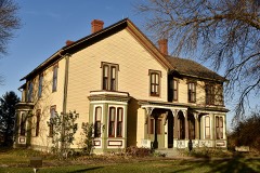 | Liberty Hall | building | 1983 | 83000350 |
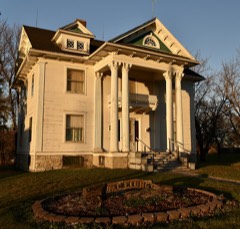 | J. J. McClung House | building | 1990 | 90001856 |
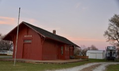 | Missouri, Iowa & Nebraska Railway Co. Depot-Weldon | building | 1991 | 91001827 |
 | C. S. Stearns House | building | 1978 | 78001214 |
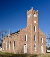 | Union Church | building | 1976 | 76000759 |
Every wildfire the federal occurrence database records inside this county: 4 of them, burning about 884 acres. None started naturally and none was recorded as arson. Each settlement page carries the fires within five miles of it.
| Reported cause | Fires |
|---|---|
| Debris and open burning | 2 |
| Missing data/not specified/undetermined | 2 |
The five largest, by the area the report gives. None of them was recorded as arson.
| Date | Cause | Size | Reported by | Name on the report |
|---|---|---|---|---|
| 17 March 2005 | Debris and open burning | 800 acres | Iowa Department of Natural Resources | not named |
| 22 April 2018 | Debris and open burning | 80 acres | Iowa Department of Natural Resources | not named |
| 30 March 2008 | Missing data/not specified/undetermined | 3.0 acres | Iowa Department of Natural Resources | not named |
| 27 April 2008 | Missing data/not specified/undetermined | under an acre | Iowa Department of Natural Resources | not named |
Every settlement page carries the fires within five miles of it - see the settlement index below.
The NOAA Storm Events Database holds 311 reports for this county, causing no deaths, 7 injuries and about $60,456,000 in recorded property damage. Each settlement page carries the reports that name it.
| Kind of event | Reports |
|---|---|
| Thunderstorm Wind | 110 |
| Hail | 95 |
| Heavy Rain | 33 |
| Flood | 25 |
| Tornado | 19 |
| Flash Flood | 19 |
| Lightning | 6 |
| Funnel Cloud | 4 |
The most serious of them, by death, then injury, then recorded damage. The accounts are quoted exactly as the forecast office filed them.
| When | Event | Place named | Harm | What the report says |
|---|---|---|---|---|
| April 1961 | Tornado (F2) | not stated | 2 hurt, $2,500,000 | no account filed |
| April 2001 | Thunderstorm Wind | Leon | 2 hurt, $25,000 | no account filed |
| April 2001 | Thunderstorm Wind | Leon | 2 hurt, $5,000 | no account filed |
| August 2010 | Lightning | Leon | 1 hurt | A 15 year old girl was struck by lightning. |
| May 1989 | Tornado (F4) | not stated | $25,000,000 | no account filed |
| June 1984 | Tornado (F4) | not stated | $25,000,000 | no account filed |
| June 1980 | Tornado (F4) | not stated | $2,500,000 | no account filed |
| March 2022 | Tornado (EF2) | Leon | $500,000 | This tornado passed through three counties including Decatur, Wayne and Lucas. The tornado developed east of Leon in central Decatur county and headed northeast. The torndo remained in rural areas of the county for the duration of its path. Damage was primarily to broken power poles, although residential house damage was also noted. A roof was removed from a house just east of Garden Grove producing EF2 damage with other damage to nearby outbuildings also noted. The tornado exited into Wayne county just north of 140th Street. |
| June 2014 | Flash Flood | Davis City | $400,000 | Water of 2 feet to 3 feet deep in some places was reported in Davis City as the drainage system could not keep up with the rain. |
| June 2010 | Flood | Lamoni | $250,000 | no account filed |
| July 1986 | Tornado (F1) | not stated | $250,000 | no account filed |
| June 1964 | Tornado (F2) | not stated | $250,000 | no account filed |
| June 2011 | Thunderstorm Wind | Leon | $200,000 | Significant tree damage in the town of Leon. An estimated 100 to 200 trees felled in town with large trees littering the town. Trees fell on the roofs of many houses, but no major structural damage. |
| August 2007 | Flash Flood | High Pt | $200,000 | Water was reported over the road at J20 and 340th Avenue near the Wayne County line. |
| May 1995 | Tornado (F3) | Lamoni to | $200,000 | Border crosser from Missouri at beginning point. |
| June 2014 | Flash Flood | Davis City | $150,000 | The Decatur County Engineer reported an estimated 25 culverts damaged and 12 bridges damaged from water. Another 40 locations of roadway were overtopped by water resulting in at least 20 road closures. |
| May 1998 | Thunderstorm Wind | Van Wert | $150,000 | no account filed |
| September 2019 | Flood | Terre Haute | $100,000 | Flooding was reported across much of the county in rural areas with numerous side and gravel roads closed due to water. |
| October 2018 | Flood | Westerville | $100,000 | Emergency manager reported two roads closed across the county due to culvert failure and approximately 10 culverts damaged from flooding. |
| May 2015 | Thunderstorm Wind | Decatur City | $100,000 | Many large branches were down in town and several car ports flipped. |
| July 2015 | Flash Flood | Westerville | $100,000 | Law enforcement reported many county gravel roads flooded across northern Decatur county. One road closure south of Weldon as well. Additionally water was out of the banks of some local creeks and streams. |
| June 2010 | Flash Flood | Lamoni | $100,000 | Eight inches of standing water in town. Highway 69 closed due to water on the road and stranded vehicles. |
| July 2014 | Thunderstorm Wind | (30i)Lamoni Muni Arp | $100,000 | no account filed |
| June 2010 | Flood | Grand River | $100,000 | no account filed |
| May 1998 | Thunderstorm Wind | Van Wert | $100,000 | no account filed |
| June 2021 | Thunderstorm Wind | Leon | $90,000 | Osceola Fire Department reported a grain bin toppled and blocking US Highway 69. Time estimated via radar. |
| May 1997 | Hail | Pleasanton | $75,000 | no account filed |
| May 2019 | Flood | Davis City | $50,000 | The Thompson River at Davis City crested at 13.21 feet on 29 May 2019 at 14:30 UTC. |
| October 2018 | Flood | Davis City | $50,000 | The Thompson River at Davis City crested at 13.07 ft on 9 October 2018 at 13:00 UTC. |
| May 2015 | Thunderstorm Wind | Van Wert | $50,000 | Trees were reported down on houses in town and power was out. Relayed by KCCI TV. |
| July 2008 | Flash Flood | Davis City | $50,000 | Water was eroding the gravel from 275th St. |
| July 2008 | Flash Flood | Pleasanton | $50,000 | Water has partially washed out 240th Ave. |
| May 2011 | Flood | Grand River | $50,000 | no account filed |
| June 2010 | Flood | Grand River | $50,000 | no account filed |
| June 2008 | Flood | Grand River | $50,000 | no account filed |
| May 2007 | Flash Flood | Grand River | $50,000 | no account filed |
| May 2007 | Flash Flood | Grand River | $50,000 | no account filed |
| April 2001 | Lightning | Garden Grove | $50,000 | no account filed |
| September 1993 | Thunderstorm Wind | Davis City | $50,000 | no account filed |
| September 1993 | Thunderstorm Wind | Leon | $50,000 | no account filed |
| September 1993 | Thunderstorm Wind | Lamoni | $50,000 | no account filed |
| June 2010 | Thunderstorm Wind | Garden Grove | $40,000 | Grain bin destroyed. |
| June 2008 | Hail | Leon | $30,000 | Extensive hail damage to a RV camper and a residential skylight. |
| September 1996 | Lightning | Leon | $30,000 | no account filed |
| April 2010 | Thunderstorm Wind | Van Wert | $25,000 | A grain bin was blown across the road and large tree branches were downed. Siding was ripped off of a house. |
| September 2010 | Flash Flood | Pleasanton | $25,000 | Law enforcement relayed that 290th Ave was washed out in Morgan Township, Section 5. |
| July 2009 | Flash Flood | Garden Grove | $25,000 | Rural roads were under 5 to 6 feet of water. |
| July 2008 | Flash Flood | Terre Haute | $25,000 | Local law enforcement reports the bridge on Elk Chapel Road just south of Highway 2 was under a foot of water. |
| July 2008 | Flash Flood | Lamoni | $25,000 | Water was over 280th Street 1 mile west of County Road R14. |
| July 2014 | Thunderstorm Wind | (30i)Lamoni Muni Arp | $25,000 | no account filed |
| March 2010 | Flood | Grand River | $25,000 | no account filed |
| March 2009 | Flood | Grand River | $25,000 | no account filed |
| May 2007 | Flood | Davis City | $25,000 | no account filed |
| August 2007 | Flood | Grand River | $25,000 | no account filed |
| June 2005 | Hail | Grand River | $25,000 | no account filed |
| August 2004 | Thunderstorm Wind | Le Roy | $25,000 | no account filed |
| June 2001 | Thunderstorm Wind | Garden Grove | $25,000 | no account filed |
| July 2001 | Hail | Decatur City | $25,000 | no account filed |
| June 1999 | Flash Flood | Davis City | $25,000 | no account filed |
| May 1998 | Thunderstorm Wind | Leon | $25,000 | no account filed |
The Survey's mineral resources record lists 18 workings inside this county. 4 still produce and 14 are closed or unrecorded. Each settlement page carries the workings within five miles of it.
| Commodity | Workings |
|---|---|
| Stone, Crushed/Broken | 14 |
| Sand and Gravel, Construction | 3 |
| Clay | 1 |
The least common of them first, because a county's hundredth gravel pit says nothing its first ten did not.
| Where | Site | Commodity | Status | Recorded |
|---|---|---|---|---|
| Mills Brick Yard | Clay | Past Producer | ||
| Davis City Pit | Sand and Gravel, Construction | Past Producer | ||
| Sargents Pit | Sand and Gravel, Construction | Past Producer | ||
| Unknown | Sand and Gravel, Construction | Past Producer | ||
| Davis City Quarry | Stone, Crushed/Broken | Past Producer | ||
| Davis City Quarry | Stone, Crushed/Broken | Producer | ||
| Decatur City Quarry and Mill | Stone, Crushed/Broken | Producer | ||
| Dekalb Quarry | Stone, Crushed/Broken | Producer | ||
| Elk Chapel | Stone, Crushed/Broken | Past Producer | ||
| Elk Chapel Quarry | Stone, Crushed/Broken | Past Producer | ||
| Grand River Quarry | Stone, Crushed/Broken | Producer | ||
| Millsap Quarries | Stone, Crushed/Broken | Past Producer | ||
| Old Dekalb Quarry | Stone, Crushed/Broken | Past Producer | ||
| Spaulding Quarry | Stone, Crushed/Broken | Past Producer | ||
| Unknown | Stone, Crushed/Broken | Past Producer | ||
| Unknown | Stone, Crushed/Broken | Past Producer | ||
| Unknown | Stone, Crushed/Broken | Past Producer | ||
| West Decatur City Quarry | Stone, Crushed/Broken | Past Producer |
Named settlements recorded in the Geographic Names Information System, each with the topographic sheets covering it. Villages, hamlets and abandoned places alike. Each is shown with the nearest named watercourse or landform and the survey quadrangle it falls on.
Burrell township · 50067 · On Elk Creek · Davis City quadrangle
10 sheets, 1945 to 1981
No longer a settlement
Eden township · 50144 · On McGruder Creek · Davis City quadrangle
10 sheets, 1945 to 1981
No longer a settlement
Garden Grove township · 50103 · On Mormon Pool · Garden Grove quadrangle
7 sheets, 1954 to 1981
Richland township · 50108 · On Sand Creek · Grand River quadrangle
7 sheets, 1954 to 1981
New Buda township · 50065 · On Dickersons Branch · Akron quadrangle
10 sheets, 1945 to 1981
New Buda township · 50065 · Lamoni South quadrangle
11 sheets, 1945 to 1981
No longer a settlement
The vanished settlements of Decatur County: the places named above that are no longer on the map.