 Block
From the record
12 National Register listings published here, 1 of them a National Historic Landmark.
Sources: the National Register database, National Park Service
18 topographic sheets cover 15 settlements here, and 12 properties are on the National Register of Historic Places.
12 National Register listings published here, 1 of them a National Historic Landmark.
Sources: the National Register database, National Park Service
Every property in this county listed on the National Register of Historic Places, with the year it was listed and the federal nomination document.
| Photograph | Property | Type | Listed | Reference |
|---|---|---|---|---|
 | Beeds Lake State Park, Civilian Conservation Corps Area | district | 1990 | 90001672 |
 | H. E. Boehmler House | building | 1991 | 91001829 |
 | Franklin County Courthouse | building | 1976 | 76000772 |
 | Franklin County G. A. R. Soldiers' Memorial Hall | building | 1991 | 91001828 |
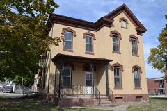 | Franklin County Sheriff's Residence and Jail | building | 1996 | 96000896 |
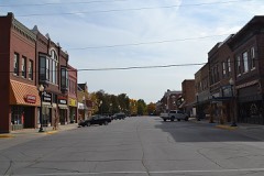 | Hampton Double Square Historic District | district | 2003 | 03000834 |
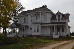 | Dr. O. B. Harriman House | building | 1987 | 87000011 |
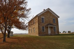 | Maysville Schoolhouse | building | 1981 | 81000237 |
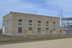 | Reeve Electric Association Plant | building | 1990 | 89002307 |
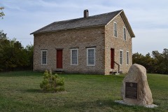 | Leander Reeve House | building | 1979 | 79000896 |
 | St. John's Danish Evangelical Lutheran Church Historic District | district | 2015 | 15000726 |
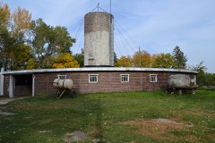 | Herman Wood Round Barn | building | 1986 | 86001431 |
Every wildfire the federal occurrence database records inside this county: 4 of them, burning about 8 acres. None started naturally and none was recorded as arson. Each settlement page carries the fires within five miles of it.
| Reported cause | Fires |
|---|---|
| Missing data/not specified/undetermined | 3 |
| Debris and open burning | 1 |
The five largest, by the area the report gives. None of them was recorded as arson.
| Date | Cause | Size | Reported by | Name on the report |
|---|---|---|---|---|
| 31 October 2006 | Missing data/not specified/undetermined | 5.0 acres | Iowa Department of Natural Resources | not named |
| 20 October 2011 | Missing data/not specified/undetermined | 2.0 acres | Iowa Department of Natural Resources | OLIVE AVE AND 110TH ST SOUTH OF HAMPTON, IA, IA |
| 20 September 2011 | Missing data/not specified/undetermined | 1.0 acres | Iowa Department of Natural Resources | HWY 3 AND 122 SOUTH 1 MILE AND 1/4 MILE UNIT, IA |
| 1 November 2012 | Debris and open burning | under an acre | Iowa Department of Natural Resources | not named |
Every settlement page carries the fires within five miles of it - see the settlement index below.
The NOAA Storm Events Database holds 367 reports for this county, causing no deaths, no injuries and about $33,209,530 in recorded property damage. Each settlement page carries the reports that name it.
| Kind of event | Reports |
|---|---|
| Thunderstorm Wind | 142 |
| Hail | 125 |
| Tornado | 30 |
| Flash Flood | 26 |
| Heavy Rain | 18 |
| Funnel Cloud | 14 |
| Flood | 12 |
The most serious of them, by death, then injury, then recorded damage. The accounts are quoted exactly as the forecast office filed them.
| When | Event | Place named | Harm | What the report says |
|---|---|---|---|---|
| June 2014 | Flash Flood | Alexander | $25,000,000 | Numerous dirt roads were washed out and were under water in various portions of Franklin county. |
| June 1990 | Tornado (F3) | not stated | $2,500,000 | no account filed |
| June 2014 | Thunderstorm Wind | Alexander | $400,000 | Swath of wind damage that began in far NE Wright County broadened and strengthened as it entered NW Franklin County. An EF1 tornado was embedded within this wind damage. Wind gusts of 70-80 mph were found in a 1 to 2 mile wide and 4 to 5 mile long corridor, with locally higher gusts over 100 mph. One house lost half of its roof and multiple outbuildings were destroyed. One hog confinement building disintegrated--its remnants scattered for over 2 miles to the south. Damage point is at the house that lost its roof. Hog building was 1.5 miles SE of this point. |
| June 2013 | Tornado (EF2) | Alexander | $300,000 | The tornado heavily damaged several farms while the rear flank downdraft winds produced an even wider damage path to the south of the tornado. |
| December 2021 | Tornado (EF2) | Geneva | $250,000 | This tornado began a few miles north of Geneva and moved northeast producing plenty of tree damage as well as extensive outbuilding damage on two farmsteads. Additional damage to a home with missing roofing and siding occurred along 170th Street west of Yarrow Avenue. The tornado continue producing tree and power pole damage to the northeast before lifting on the north side of 190th Street near the West Fork Wildlife Area. |
| July 1992 | Tornado (F1) | not stated | $250,000 | no account filed |
| June 1991 | Tornado (F1) | not stated | $250,000 | no account filed |
| June 2014 | Thunderstorm Wind | Geneva | $225,000 | Large tree limbs down throughout the city. Empty grain bin on the east side of the town blown down. |
| March 2019 | Flash Flood | Dows | $200,000 | Emergency manager reported an ice jam in Iowa Falls has caused rapid rises along the Iowa river. This backed up portions of the river flooding low lying areas and roads across southwestern portions of the county. |
| June 1997 | Flash Flood | Hampton | $200,000 | no account filed |
| December 2021 | Tornado (EF1) | Chapin | $100,000 | This tornado produced EF1 damage on the east side of Sheffield nearly destroying a business outbuilding. The track farther to the southwest was found in high resolution satellite imagery and also confirmed through a private weather station which recorded a wind gust to 108 mph as the tornado passed its location. |
| September 2018 | Flood | Alexander | $100,000 | Emergency manager reported several road closures due to water over the roadways. |
| May 2013 | Flash Flood | Bradford | $100,000 | Highway 65 at 50th street washed out west of Mallard Ave. |
| August 2011 | Thunderstorm Wind | Hampton | $100,000 | Winds of 60 to 65 MPH produced widespread tree damage in the town of Hampton. Numerous trees and limbs were downed through town. Many location were without power due to branches falling on power lines. |
| June 2010 | Flash Flood | Hampton Muni Arpt | $100,000 | Highway 65 south of town was under water, with several other roads in town covered with water. |
| April 2008 | Flood | Sheffield | $100,000 | no account filed |
| June 1998 | Flood | Hampton | $100,000 | no account filed |
| May 2024 | Thunderstorm Wind | Beeds Lake Arpt | $75,000 | Emergency manager reported around a dozen power poles blown down along 170th st, west of Highway 65. This is a delayed report. Time and location estimated from radar. |
| August 2007 | Flash Flood | Bradford | $75,000 | Several county gravel roads were completely or partially washed out. Roads mainly affected were south of 105th Street and in the area of Raven and 40th Street. |
| March 2007 | Thunderstorm Wind | Hansell | $75,000 | no account filed |
| March 2007 | Thunderstorm Wind | Hansell | $75,000 | no account filed |
| May 1998 | Thunderstorm Wind | Geneva | $75,000 | no account filed |
| July 2023 | Tornado (EF1) | Burdette | $70,000 | This tornado was captured on video along with reports from the emergency manage. High resolution satellite imagery also helped in determining the final path. This tornado developed shortly after the first tornado in Franklin county and moved mostly south for the duration of the path. The tornado did encounter a hog confinement building producing EF1 damage. Otherwise, the bulk of the path remained in rural cropland. |
| July 2023 | Tornado (EF1) | Popejoy | $60,000 | This was a rather slow moving tornado which moved east initially through open cropland. The tornado then turned southeast, east and eventually northeast as it journeyed through the farmland. The tornado did hit a hog confinement with the roof collapsing producing EF1 damage. |
| July 1998 | Thunderstorm Wind | Hampton | $60,000 | no account filed |
| August 2018 | Thunderstorm Wind | Sheffield | $50,000 | Law enforcement reported numerous trees down in and around Sheffield. Highway 65 was reported blocked by down power lines as well. |
| September 2018 | Flood | Alexander | $50,000 | Law enforcement reported flooding in portions of the county with some roads impassible. Many roads have standing water and larger creeks and streams are rising out of their banks. |
| September 2018 | Flash Flood | Alexander | $50,000 | Emergency manager reported several road closures due to water over the roadways. |
| May 2017 | Thunderstorm Wind | Hampton | $50,000 | Public reported traffic poles downed and roof damage. Reported via social media. |
| August 2017 | Thunderstorm Wind | Alexander | $50,000 | Emergency manager reported a large machine shed partially destroyed, partial roof damage, a hog building with door damage and tin ripped up, and grain storage bins with damage to 2 doors. This is a delayed report and time estimated from radar. |
| September 2016 | Flash Flood | Sheffield | $50,000 | Law enforcement reported numerous secondary roads in Franklin County with water over them to varying depths. Some roads are closed. |
| September 2016 | Flash Flood | Geneva | $50,000 | Law enforcement reported water flowing over Highway 65 south of 95th street in Franklin County. |
| June 2015 | Thunderstorm Wind | Hampton | $50,000 | Trained spotter reported power lines down along Highway 65 between Hampton and Sheffield. Also reported up to 12 inch diameter limbs down in Hampton. |
| July 2013 | Thunderstorm Wind | Coulter | $50,000 | Approximately 20 large trees were downed in town. |
| May 2013 | Flash Flood | Hampton Muni Arpt | $50,000 | Highway 65 near County HIghway C47 about 4 miles south of Hampton closed due to Maynes Creek. |
| June 2013 | Tornado (EF1) | Latimer | $50,000 | The tornado damaged a barn roof and about a dozen trees on two farmsteads. |
| June 2010 | Thunderstorm Wind | Popejoy | $50,000 | Grain bin destroyed and laying in field along 50th Street. |
| March 2007 | Thunderstorm Wind | Hansell | $50,000 | no account filed |
| March 2007 | Thunderstorm Wind | Hansell | $50,000 | no account filed |
| June 2005 | Flash Flood | Countywide | $50,000 | no account filed |
| April 2001 | Thunderstorm Wind | Sheffield | $50,000 | no account filed |
| July 2000 | Flash Flood | Countywide | $50,000 | no account filed |
| June 1998 | Flood | Hampton | $50,000 | no account filed |
| June 1998 | Flood | Hampton | $50,000 | no account filed |
| August 2004 | Thunderstorm Wind | Hampton | $40,000 | no account filed |
| August 2013 | Thunderstorm Wind | Chapin | $30,000 | The Franklin County Emergency Manager reported 18 to 24 inch diameter trees snapped off at the base in and near the town of Chapin. Power lines were also down in the town of Chapin. Some outbuildings and grain bins were also damaged outside of town. Two large trees were on a house at 230th street. |
| June 2009 | Thunderstorm Wind | Coulter | $30,000 | Two semis were blown off of Interstate 35. |
| April 2001 | Thunderstorm Wind | Hampton | $30,000 | no account filed |
| June 1998 | Thunderstorm Wind | Hampton | $30,000 | no account filed |
| June 2015 | Thunderstorm Wind | Hampton | $25,000 | Trained spotter reported power lines down in the city. |
| June 2014 | Tornado (EF1) | Alexander | $25,000 | This tornado moved in from Wright county and produce its most intense damage as it entered the county when it hit a farmstead. It then continued to the southeast remaining mostly in open farm fields. |
| May 2013 | Thunderstorm Wind | Hansell | $25,000 | Winds from a decaying thunderstorms blew a tree onto a house. A porch was also damaged by the high winds. |
| May 2013 | Flash Flood | Latimer | $25,000 | Water over Jonquil Ave about 1.5 miles north of Highway 3 due to flooding of Spring Creek. |
| June 2010 | Flash Flood | Sheffield | $25,000 | Law enforcement reports fast moving water over roads in two places near Sheffield. |
| August 2007 | Flash Flood | Hampton Muni Arpt | $25,000 | The Hampton police department reported roadways under water at 1800CST with 2 to 3 feet of water at the 800 to 900 block of Forest Street, or Highway 65 on the north side of the city. |
| August 2004 | Thunderstorm Wind | Bradford | $25,000 | no account filed |
| July 2003 | Hail | Latimer | $25,000 | no account filed |
| June 1969 | Tornado (F1) | not stated | $25,000 | no account filed |
| May 1964 | Tornado (F0) | not stated | $25,000 | no account filed |
| August 1960 | Tornado (F1) | not stated | $25,000 | no account filed |
The Survey's mineral resources record lists 39 workings inside this county. 13 still produce and 26 are closed or unrecorded. Each settlement page carries the workings within five miles of it.
| Commodity | Workings |
|---|---|
| Sand and Gravel, Construction | 27 |
| Stone, Crushed/Broken | 10 |
| Clay | 2 |
The least common of them first, because a county's hundredth gravel pit says nothing its first ten did not.
| Where | Site | Commodity | Status | Recorded |
|---|---|---|---|---|
| Sheffield Clay Pit | Clay | Producer | ||
| Unknown | Clay | Unknown | ||
| Chapin Quarry | Stone, Crushed/Broken | Past Producer | ||
| Dows Quarry | Stone, Crushed/Broken | Producer | ||
| Geneva Quarry | Stone, Crushed/Broken | Past Producer | ||
| Heitland Quarry | Stone, Crushed/Broken | Producer | ||
| Hibness Quarry | Stone, Crushed/Broken | Producer | ||
| Humke Quarry | Stone, Crushed/Broken | Unknown | ||
| Miller Quarry | Stone, Crushed/Broken | Producer | ||
| Unknown | Stone, Crushed/Broken | Past Producer | ||
| Unknown | Stone, Crushed/Broken | Past Producer | ||
| Unknown | Stone, Crushed/Broken | Past Producer | ||
| Brandt Pit | Sand and Gravel, Construction | Producer | ||
| Geneva | Sand and Gravel, Construction | Producer | ||
| Geneva | Sand and Gravel, Construction | Producer | ||
| Geneva Pit | Sand and Gravel, Construction | Producer | ||
| Harold Pit | Sand and Gravel, Construction | Producer | ||
| Heuberger Pit | Sand and Gravel, Construction | Producer | ||
| Koch Pit | Sand and Gravel, Construction | Past Producer | ||
| Nachazel Pit | Sand and Gravel, Construction | Past Producer | ||
| Stuck Pit | Sand and Gravel, Construction | Producer | ||
| Unknown | Sand and Gravel, Construction | Past Producer | ||
| Unknown | Sand and Gravel, Construction | Past Producer | ||
| Unknown | Sand and Gravel, Construction | Past Producer | ||
| Unknown | Sand and Gravel, Construction | Past Producer | ||
| Unknown | Sand and Gravel, Construction | Past Producer | ||
| Unknown | Sand and Gravel, Construction | Past Producer | ||
| Unknown | Sand and Gravel, Construction | Past Producer | ||
| Unknown | Sand and Gravel, Construction | Past Producer | ||
| Unknown | Sand and Gravel, Construction | Past Producer | ||
| Unknown | Sand and Gravel, Construction | Past Producer | ||
| Unknown | Sand and Gravel, Construction | Past Producer | ||
| Unknown | Sand and Gravel, Construction | Past Producer | ||
| Unknown | Sand and Gravel, Construction | Past Producer | ||
| Unknown | Sand and Gravel, Construction | Past Producer | ||
| Unknown | Sand and Gravel, Construction | Past Producer | ||
| Unknown | Sand and Gravel, Construction | Past Producer | ||
| Unknown | Sand and Gravel, Construction | Past Producer | ||
| Wagner Pit | Sand and Gravel, Construction | Producer |
Named settlements recorded in the Geographic Names Information System, each with the topographic sheets covering it. Villages, hamlets and abandoned places alike. Each is shown with the nearest named watercourse or landform and the survey quadrangle it falls on.