 Block
From the record
16 National Register listings published here.
Sources: the National Register database, National Park Service
32 topographic sheets cover 13 settlements here, and 16 properties are on the National Register of Historic Places.
16 National Register listings published here.
Sources: the National Register database, National Park Service
Every property in this county listed on the National Register of Historic Places, with the year it was listed and the federal nomination document.
| Photograph | Property | Type | Listed | Reference |
|---|---|---|---|---|
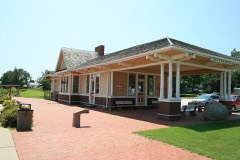 | Chicago, Milwaukee & St. Paul Depot-Jefferson | building | 1994 | 93000326 |
| Frantz Round Barn | building | 1986 | 86001432 | |
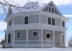 | George H. Gallup House | building | 1985 | 85001581 |
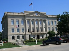 | Greene County Courthouse | building | 1978 | 78001222 |
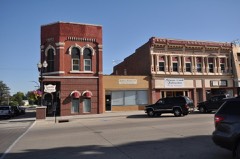 | Jefferson Square Commercial Historic District | district | 2011 | 11000503 |
| Lincoln Highway Marker (2) | object | 1993 | 93000164 | |
| Lincoln Highway-Buttrick's Creek Abandoned Segment | site | 1993 | 93000166 | |
| Lincoln Highway-Buttrick's Creek to Grand Junction Segment | district | 1993 | 93000167 | |
| Lincoln Highway-Grand Junction Segment | district | 1993 | 93000168 | |
| Lincoln Highway-Little Beaver Creek Bridge | structure | 1993 | 93000170 | |
| Lincoln Highway-Raccoon River Rural Segment | district | 1993 | 93000162 | |
| Lincoln Highway-West Beaver Creek Abandoned Segment | district | 1993 | 93000169 | |
| Lincoln Highway-West Greene County Rural Segment | district | 1993 | 93000161 | |
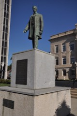 | Lincoln Statue | object | 1993 | 93000165 |
| Squirrel Hollow County Park Historic District | district | 1991 | 91001835 | |
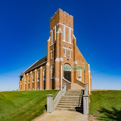 | St. Patrick's Catholic Church, Cedar | building | 1992 | 92000840 |
Every wildfire the federal occurrence database records inside this county: 23 of them, burning about 596 acres. None started naturally and none was recorded as arson. Each settlement page carries the fires within five miles of it.
| Reported cause | Fires |
|---|---|
| Missing data/not specified/undetermined | 16 |
| Debris and open burning | 3 |
| Equipment and vehicle use | 2 |
| Smoking | 1 |
| Recreation and ceremony | 1 |
The five largest, by the area the report gives. None of them was recorded as arson.
| Date | Cause | Size | Reported by | Name on the report |
|---|---|---|---|---|
| 8 April 2019 | Missing data/not specified/undetermined | 329 acres | Iowa Wetland Management District | DUNBAR SLOUGH WF |
| 29 September 2011 | Missing data/not specified/undetermined | 70 acres | Iowa Department of Natural Resources | 1567 110TH ST. PATON, IA, IA |
| 4 December 2012 | Missing data/not specified/undetermined | 70 acres | Iowa Department of Natural Resources | not named |
| 22 April 2008 | Missing data/not specified/undetermined | 30 acres | Iowa Department of Natural Resources | not named |
| 21 March 2009 | Debris and open burning | 21 acres | Iowa Wetland Management District | KLOCKE WF |
| 23 February 2006 | Smoking | 13 acres | Iowa Wetland Management District | MURPHY |
| 25 October 2017 | Equipment and vehicle use | 10 acres | Iowa Department of Natural Resources | not named |
| 5 October 2012 | Equipment and vehicle use | 10 acres | Iowa Department of Natural Resources | not named |
Every settlement page carries the fires within five miles of it - see the settlement index below.
The NOAA Storm Events Database holds 337 reports for this county, causing 4 deaths, 2 injuries and about $7,218,950 in recorded property damage. Each settlement page carries the reports that name it.
| Kind of event | Reports |
|---|---|
| Hail | 123 |
| Thunderstorm Wind | 117 |
| Heavy Rain | 37 |
| Tornado | 30 |
| Flash Flood | 14 |
| Flood | 13 |
| Funnel Cloud | 3 |
The most serious of them, by death, then injury, then recorded damage. The accounts are quoted exactly as the forecast office filed them.
| When | Event | Place named | Harm | What the report says |
|---|---|---|---|---|
| May 1991 | Hail | not stated | 4 killed | no account filed |
| June 1971 | Tornado (F2) | not stated | 1 hurt, $250,000 | no account filed |
| April 1954 | Tornado (F2) | not stated | 1 hurt, $250,000 | no account filed |
| December 2021 | Tornado (EF2) | Scranton | $1,200,000 | This tornado occurred southwest of Jefferson and remained in rural Greene County during its entire path. The tornado damaged a confinement building and farther northeast destroyed an outbuilding. However, the most intense damage was a series of high voltage utility dual pole towers which were snapped by the tornado. At least 8 towers were snapped over J Avenue between 250th and 260th Streets. Additional utility poles were snapped along 250th Street as well. The tornado lifted in the vicinity of an apple orchard located southwest of Jefferson. |
| December 2021 | Tornado (EF2) | Cooper | $800,000 | Tornado moved into Greene County from Guthrie County. This tornado produced damage through rural south and east portions of the county. The tornado passed just southeast of the hamlet of Cooper and through Grand Junction. Most of the damage was EF0 to EF1 with tree and minor house damage. However, the tornado strengthened north of Grand Junction with power pole damage and then toppling an industrial wind mill along W Avenue with an EF2 rating at that location. The circulation then destroyed a confinement building before dissipating several miles northeast of Dana. |
| December 2021 | Tornado (EF2) | Scranton | $500,000 | Another QLCS tornado which began west southwest of Jefferson and ended to the northwest of town. This tornado began in rural areas but toppled several large single pole utility poles along I Avenue south of 250th Street and moved northeast with tree and minor house damage on 240th Street near the intersection with K Avenue. The tornado ended up crossing US Highway 30 about 1.5 miles west of the intersection with State Highway 4 and severely leaned high voltage poles along the highway. The tornado dissipated not long afterwards near M Avenue north of Highway 30. |
| December 2021 | Tornado (EF2) | Cooper | $350,000 | Tornado continued into Greene County from Guthrie County. The path through Greene County was long but remained in rural portions of the county. Damage to rural outbuildings occurred in southern Greene county with more intense damage south of Jefferson. Utility poles were snapped along 280th Street near where N Avenue intersects the road. The tornado then impacted a farmstead on the west side of Highway 4 destroying several outbuildings and producing minor damage to the home. The tornado proceeded northeast crossing US Highway 30 east of Jefferson and then continued in rural areas before lifting north of Dana. |
| April 2007 | Flood | Jefferson | $250,000 | no account filed |
| April 2007 | Flood | Churdan | $250,000 | no account filed |
| July 1969 | Tornado (F1) | not stated | $250,000 | no account filed |
| April 2018 | Thunderstorm Wind | Jefferson | $150,000 | Emergency Manager relayed damages in Jefferson to several buildings and trees, power lines down, and trees on cars. |
| June 2001 | Flash Flood | Countywide | $150,000 | no account filed |
| December 2021 | Tornado (EF2) | Cooper | $100,000 | This tornado moved from Guthrie into Greene County. The tornado destroyed several grain bins shortly after entering the county and then snapped several large power poles along 330th Street between F and G Avenues. The tornado continued northeast producing sporadic damage in rural southern Greene County before dissipating north of 300th Street between H and I Avenues. |
| March 2019 | Flood | Adaza | $100,000 | Iowa DOT reported Iowa 25 down to one lane due to water over the road. |
| May 2019 | Flood | Ralston | $100,000 | The North Raccoon River at Jefferson crested twice at 21.05 feet on 27 May 2019 at 09:30 UTC and at 20.25 feet on 30 May 2019 at 05:30 UTC. |
| April 2018 | Thunderstorm Wind | Jefferson | $100,000 | Delayed report from a former TV meteorologist of damage to numerous buildings, trees, and power lines. Based on damage, estimated wind speeds of 70 to 80 mph. |
| April 2018 | Thunderstorm Wind | Jefferson | $100,000 | Trained spotter reported large campers flipped, power lines snapped, multiple buildings damaged. |
| June 2014 | Hail | Grand Jct | $100,000 | Hail up to baseball size fell throughout town. |
| May 2008 | Flash Flood | Scranton | $100,000 | Numerous locations have water across the road throughout the county. Locations include Highway 25 south of Scranton, Old Highway 30 east and west of Jefferson, Highway 4 north of Jefferson. A car went into the ditch after losing control driving through the water. |
| May 2004 | Flash Flood | Countywide | $100,000 | no account filed |
| June 1998 | Flood | Jefferson | $100,000 | no account filed |
| April 2018 | Thunderstorm Wind | Jefferson | $50,000 | KCIM Radio in Carroll relayed listener report of roof damage at McAtee Tire. Also reported power outages. Time estimated from radar. |
| September 2015 | Flash Flood | Scranton | $50,000 | Emergency Manager reported water E57 and E63 in southern portions of the county. |
| September 2015 | Flash Flood | Cooper | $50,000 | Emergency Manager reported water over 330th street near J avenue just north of Bagley. |
| September 2015 | Flash Flood | Ralston | $50,000 | Emergency Manager reported water over 210th street near Highway 30. |
| August 2010 | Flash Flood | Rippey | $50,000 | Trained spotter in Rippey reports fast flowing water about 6 inches deep in the streets. The city park was largely under water as well. |
| August 2010 | Flash Flood | Rippey | $50,000 | Water 3 to 4 inches deep in yards, water over curbs, city park and city ball field beginning to flood. |
| July 2008 | Thunderstorm Wind | Grand Jct | $50,000 | Numerous trees were down, some up to 2 feet in diameter. Power was out, especially widespread in rural areas. |
| September 2004 | Tornado (F1) | Jefferson | $50,000 | Small tornado caused garage, porch, and tree damage from about 310th Street and O Avenue to 290th Street and P avenue showing the most damage. Damage in Rural areas was to trees and power poles. |
| March 2007 | Flood | Jefferson | $50,000 | no account filed |
| May 2007 | Flood | Jefferson | $50,000 | no account filed |
| April 2001 | Thunderstorm Wind | Scranton | $50,000 | no account filed |
| April 1998 | Flood | Jefferson | $50,000 | no account filed |
| May 1998 | Thunderstorm Wind | Churdan | $50,000 | no account filed |
| May 1993 | Hail | Paton | $50,000 | no account filed |
| August 2014 | Thunderstorm Wind | Jefferson | $30,000 | Numerous reports of trees down and power lines down across the county. |
| May 1998 | Flood | Scranton | $30,000 | no account filed |
| December 2021 | Tornado (EF2) | Paton | $25,000 | This tornado moved through both Greene and Webster Counties. The tornado developed southwest of Paton in Greene County and blew apart an old shed. It continued to strengthen and snapped several large utility poles along 110th Street west of U Avenue. The tornado then exited the county into Webster County north of Paton. |
| August 2012 | Thunderstorm Wind | Cooper | $25,000 | Numerous trees down in Squirrel Hollow Park. Some damage to the park bridge with fallen trees. |
| June 2010 | Thunderstorm Wind | Scranton | $25,000 | Power poles were downed in town. |
| August 2010 | Flash Flood | Hope | $25,000 | Water over County Highway P46 just south of the Webster County line. |
| May 2008 | Flash Flood | Farlin | $25,000 | Two feet of water was reported over Highway 4 north of Farlin. |
| May 1998 | Hail | Jefferson | $25,000 | Wind gusts to 50 MPH. |
| May 2008 | Thunderstorm Wind | Rippey | $25,000 | no account filed |
| May 2003 | Flash Flood | Countywide | $25,000 | no account filed |
| July 2003 | Thunderstorm Wind | Grand Jct | $25,000 | no account filed |
| April 2002 | Hail | Rippey | $25,000 | no account filed |
| July 1998 | Flood | Jefferson | $25,000 | no account filed |
| September 1969 | Tornado (F1) | not stated | $25,000 | no account filed |
| May 1959 | Tornado (F2) | not stated | $25,000 | no account filed |
| December 2021 | Tornado (EF2) | Farlin | $20,000 | This was a relatively brief tornado but none the less strong as it snapped power poles along I Avenue south of 180th Street to the northwest of Farlin. Otherwise, the tornado remained in rural areas of Greene County with no other reports of damage. |
| June 2015 | Flood | Rippey | $20,000 | Many primary and secondary roads were flooded. Some roads were washed out. |
| May 2013 | Flash Flood | Jefferson | $20,000 | Water over the road at K Ave and 250th caused by flash flooding. |
| July 2008 | Thunderstorm Wind | Scranton | $20,000 | Numerous trees down due to very high winds. |
| August 2007 | Tornado (EF0) | Angus | $20,000 | The tornado caused minor roof damage with some windows blown out 5 miles southwest of Rippey. The tornado touched down on at least two separate times on an intermittent path. |
| April 2010 | Hail | Cooper | $20,000 | no account filed |
| July 2008 | Thunderstorm Wind | Scranton | $20,000 | no account filed |
| April 2018 | Thunderstorm Wind | Scranton | $15,000 | Amateur radio operator reported wind driven hail caused broken windows. Hail size unknown at the time. |
| August 2014 | Thunderstorm Wind | Jefferson | $15,000 | Trees were blown down in Jefferson. |
| June 2014 | Hail | Churdan | $15,000 | no account filed |
The Survey's mineral resources record lists 33 workings inside this county. 5 still produce and 28 are closed or unrecorded. Each settlement page carries the workings within five miles of it.
| Commodity | Workings |
|---|---|
| Sand and Gravel, Construction | 32 |
| Clay, Bituminous | 1 |
The least common of them first, because a county's hundredth gravel pit says nothing its first ten did not.
| Where | Site | Commodity | Status | Recorded |
|---|---|---|---|---|
| Goodwin Brick and Tile Works | Clay, Bituminous | Past Producer | ||
| Armstrong Pit | Sand and Gravel, Construction | Past Producer | ||
| Baldwin Pit | Sand and Gravel, Construction | Past Producer | ||
| Beazor Pit and Plant | Sand and Gravel, Construction | Producer | ||
| Farlin-Schlick Pit | Sand and Gravel, Construction | Past Producer | ||
| Ferguson Pit | Sand and Gravel, Construction | Past Producer | ||
| Finch Pit | Sand and Gravel, Construction | Past Producer | ||
| Goodale Pit | Sand and Gravel, Construction | Past Producer | ||
| H B Jenel | Sand and Gravel, Construction | Past Producer | ||
| Hamilton Pit | Sand and Gravel, Construction | Producer | ||
| Head Pit | Sand and Gravel, Construction | Past Producer | ||
| J Hancock Mutual | Sand and Gravel, Construction | Past Producer | ||
| Kennedy Pit | Sand and Gravel, Construction | Producer | ||
| Mcgregor Pit | Sand and Gravel, Construction | Past Producer | ||
| Morden Pit | Sand and Gravel, Construction | Past Producer | ||
| Pound Pit | Sand and Gravel, Construction | Producer | ||
| Ralson Pit | Sand and Gravel, Construction | Past Producer | ||
| Richardson Pit | Sand and Gravel, Construction | Producer | ||
| Sprague Pit | Sand and Gravel, Construction | Past Producer | ||
| Spring Lake St Park | Sand and Gravel, Construction | Past Producer | ||
| Thorpe Pit | Sand and Gravel, Construction | Past Producer | ||
| Unknown | Sand and Gravel, Construction | Past Producer | ||
| Unknown | Sand and Gravel, Construction | Past Producer | ||
| Unknown | Sand and Gravel, Construction | Past Producer | ||
| Unknown | Sand and Gravel, Construction | Past Producer | ||
| Unknown | Sand and Gravel, Construction | Past Producer | ||
| Unknown | Sand and Gravel, Construction | Past Producer | ||
| Unknown | Sand and Gravel, Construction | Past Producer | ||
| Unknown | Sand and Gravel, Construction | Past Producer | ||
| Unknown | Sand and Gravel, Construction | Past Producer | ||
| Unknown | Sand and Gravel, Construction | Past Producer | ||
| Unknown | Sand and Gravel, Construction | Past Producer | ||
| W W Peterson | Sand and Gravel, Construction | Past Producer |
Named settlements recorded in the Geographic Names Information System, each with the topographic sheets covering it. Villages, hamlets and abandoned places alike. Each is shown with the nearest named watercourse or landform and the survey quadrangle it falls on.
Hardin township · 50129 · On East Buttrick Creek · Jefferson East quadrangle
9 sheets, 1954 to 1993