 Block
From the record
16 National Register listings published here.
Sources: the National Register database, National Park Service
28 topographic sheets cover 30 settlements here, and 16 properties are on the National Register of Historic Places.
16 National Register listings published here.
Sources: the National Register database, National Park Service
Every property in this county listed on the National Register of Historic Places, with the year it was listed and the federal nomination document.
| Photograph | Property | Type | Listed | Reference |
|---|---|---|---|---|
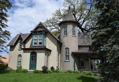 | Thomas Arthur House | building | 1982 | 82000410 |
 | August H. Bergman House | building | 1989 | 89000856 |
| Byal Orchard Historic District | district | 1994 | 94001255 | |
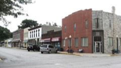 | Colfax Spring City Commercial Historic District | district | 2018 | 100003065 |
 | Emerson Hough Elementary School | building | 2002 | 02001232 |
| First Avenue East Historic District | district | 2020 | 100005888 | |
| First Avenue West Historic District | district | 2020 | 100005889 | |
| Fred Maytag Park Historic District | district | 2010 | 10000917 | |
| German Evangelical Reformed Church | building | 1979 | 79000902 | |
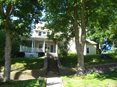 | Hall, James Norman, House | building | 1984 | 84003853 |
 | Jasper County Courthouse | building | 1981 | 81000249 |
| J. G. and Regina Long House | building | 1997 | 97000307 | |
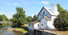 | Lynnville Mill and Dam | building | 1977 | 77000522 |
 | Newton Downtown Historic District | district | 2014 | 14000665 |
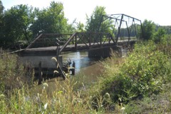 | Red Bridge | structure | 1998 | 98000521 |
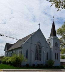 | St. Stephen's Episcopal Church | building | 1977 | 77000523 |
Every wildfire the federal occurrence database records inside this county: 39 of them, burning about 265 acres. 1 started naturally and 4 were recorded as arson. Each settlement page carries the fires within five miles of it.
| Reported cause | Fires |
|---|---|
| Missing data/not specified/undetermined | 18 |
| Debris and open burning | 12 |
| Arson/incendiarism | 4 |
| Smoking | 3 |
| Power generation/transmission/distribution | 1 |
| Natural | 1 |
The five largest, by the area the report gives. Two of them were set deliberately.
| Date | Cause | Size | Reported by | Name on the report |
|---|---|---|---|---|
| 26 March 1992 | Arson/incendiarism | 70 acres | Neal Smith National Wildlife Refuge | SWITCH1 |
| 3 April 2009 | Missing data/not specified/undetermined | 50 acres | Iowa Department of Natural Resources | not named |
| 12 November 1999 | Smoking | 20 acres | Neal Smith National Wildlife Refuge | BASSWOOD |
| 23 April 2009 | Missing data/not specified/undetermined | 20 acres | Iowa Department of Natural Resources | not named |
| 24 April 2013 | Debris and open burning | 17 acres | Iowa Department of Natural Resources | not named |
| 31 March 2015 | Debris and open burning | 15 acres | Iowa Department of Natural Resources | not named |
| 23 March 1992 | Arson/incendiarism | 10 acres | Neal Smith National Wildlife Refuge | REEDCAN1 |
| 4 May 2016 | Debris and open burning | 10 acres | Iowa Department of Natural Resources | KELLOGG |
Every settlement page carries the fires within five miles of it - see the settlement index below.
The NOAA Storm Events Database holds 579 reports for this county, causing 2 deaths, 6 injuries and about $64,517,000 in recorded property damage. Each settlement page carries the reports that name it.
| Kind of event | Reports |
|---|---|
| Hail | 220 |
| Thunderstorm Wind | 189 |
| Heavy Rain | 72 |
| Tornado | 45 |
| Flood | 23 |
| Funnel Cloud | 13 |
| Flash Flood | 12 |
| Lightning | 5 |
The most serious of them, by death, then injury, then recorded damage. The accounts are quoted exactly as the forecast office filed them.
| When | Event | Place named | Harm | What the report says |
|---|---|---|---|---|
| September 1978 | Tornado (F3) | not stated | 2 killed, 2 hurt, $250,000 | no account filed |
| June 2008 | Tornado (EF1) | Reasnor | 2 hurt, $250,000 | Newly built machine shed destroyed with roof off of a house. Hit campground near Kellogg with 2 injuries along with flipped campers. Semis blown off Interstate 80. |
| April 1999 | Tornado (F2) | Prairie City | 1 hurt, $1,000,000 | broken track |
| April 2024 | Tornado (EF1) | Monroe | 1 hurt, $250,000 | Jasper County EMA reported a path of damage starting just east of Monroe impacting several rural homesteads. Much of the damage was to trees and outbuildings with a few smaller sheds being destroyed. Otherwise, the bulk of the path was across rural farmland between Monroe and Reasnor in southern Jasper County. |
| March 2022 | Tornado (EF2) | Vandalia | $50,000,000 | The tornado moved into Jasper county from Polk county. The tornado remained largely in rural areas for much of its path across Jasper county. Despite its rural venture, the tornado impacted several residences in western Jasper county producing several areas of EF2 damage. The tornado did pass not far from the southeast side of Colfax damaging structures near the intersection of Highway 117 and S 44th Avenue West. The tornado crossed Interstate 80 east of Colfax near mile marker 160 and then proceeded towards Newton, grazing both the communities of Lambs Grove and Newton on the north sides. Most of the damage was to trees and minor damage to structures including loss of shingles and broken windows. The tornado did remove about a 100 foot segment of the roof of the former TPI Composites Plant northeast of Newton with the tornado dissipating shortly thereafter. In all, the tornado had a path length of just over 70 miles and passed through four counties including Madison, Warren, Polk and Jasper. The six deaths were the most by a tornado in Iowa since the Parkersburg tornado in May of 2008. The damage was into the hundreds of millions of dollars. |
| September 1986 | Tornado (F4) | not stated | $2,500,000 | no account filed |
| March 2002 | Thunderstorm Wind | Newton Muni Arpt | $1,500,000 | no account filed |
| September 2007 | Tornado (EF2) | Sully Muni Arpt | $1,000,000 | Tornado moved into Jasper County from Mahaska County, then continued northeast into Poweshiek County.| |
| March 2022 | Tornado (EF2) | Kellogg | $500,000 | This tornado developed from the same supercell that produced the Winterset to Newton tornado. It remained in rural areas of central and eastern Jasper county downing power poles and trees along its path. Machine sheds were destroyed at a residence along East 116th Street North with additional damage to outbuildings along East 132nd Street North. The tornado passed just west and north of the hamlet of Newburg before exiting the county into Poweshiek county just south of North 99th Avenue East. |
| July 2003 | Hail | Newton | $500,000 | no account filed |
| July 2003 | Hail | Newton | $500,000 | no account filed |
| August 2010 | Flood | Valeria | $400,000 | no account filed |
| May 2013 | Flash Flood | Kellogg | $250,000 | Spotter reports sandbagging of the Kellogg water treatment plant and fire department. |
| May 2013 | Flood | Kellogg | $250,000 | Twenty sections of county roads were closed due to flooding, many along the North Skunk River. |
| May 1988 | Tornado (F1) | not stated | $250,000 | no account filed |
| June 1973 | Tornado (F2) | not stated | $250,000 | no account filed |
| May 2013 | Flash Flood | Kellogg | $200,000 | Water covered the road at Illinois Ave and Highway 6. Parts of Northfield Drive were reported under water with one house surrounded by water. |
| June 2008 | Flood | Valeria | $200,000 | no account filed |
| July 2003 | Hail | Newton | $200,000 | no account filed |
| May 2024 | Thunderstorm Wind | Prairie City | $125,000 | Trained spotter reported widespread power lines and trees down and property damage in Prairie City. Estimated wind gusts of 65 to 70 mph and hail up to 1 inch in diameter. Time estimated from radar. |
| June 1998 | Thunderstorm Wind | Sully | $120,000 | no account filed |
| June 2018 | Flood | Baxter | $100,000 | Flooding continued across portions of Jasper County near the Baxter area and at the Colfax fairgrounds. |
| September 2015 | Flood | Galesburg | $100,000 | The South Skunk River at Colfax crested at 18.33 feet on 01 September 2015 at 5:15 PM CDT. |
| May 2013 | Flash Flood | Turner | $100,000 | Highway 6 was under water and closed. Numerous cars were stalled. |
| September 2010 | Thunderstorm Wind | Sully | $100,000 | An air exchanger on the rooftop was ripped off. Around one quarter of the roof of the gym of the Lynnville-Sully school was peeled back with a section of the roof thrown 50 to 100 feet to the east of the building, causing some tree damage. One window was blown out. |
| August 2013 | Hail | Monroe | $100,000 | no account filed |
| June 2012 | Hail | Newton | $100,000 | no account filed |
| July 2003 | Hail | Newton | $100,000 | no account filed |
| April 2012 | Thunderstorm Wind | Killduff | $75,000 | Siding was ripped off a house. Small hail also reported. |
| June 2008 | Tornado (EF1) | Prairie City | $75,000 | Twelve outbuildings sustained damage with significant damage to trees. |
| June 1998 | Thunderstorm Wind | Sully | $75,000 | no account filed |
| November 2015 | Thunderstorm Wind | Prairie City | $60,000 | Law Enforcement reported two roofs off of buildings near Casey's General Store. |
| June 1998 | Thunderstorm Wind | Newton | $60,000 | no account filed |
| December 2021 | Tornado (EF0) | Newton Muni Arpt | $50,000 | This tornado developed nearly 5 miles south of Newton and raced northeast. The tornado produced damage to several trees and a few outbuildings along the way. The tornado passed over the south end of the Newton Airport runway and then proceeded across the Iowa Speedway with minor damage to several structures onsite. The tornado proceeded to the northeast across Interstate 80 and eventually US Highway 6 east of Newton, dissipating shortly after passing over Highway 6. |
| October 2018 | Flood | Searsboro | $50,000 | Emergency manager reported a couple of roads with water over then near Sully. |
| December 2015 | Flood | Galesburg | $50,000 | The South Skunk River crested at 18.78 feet on 17 December 2015 at 07:30 UTC. |
| June 2014 | Thunderstorm Wind | Newton | $50,000 | Large tree limbs down around town with homes damaged. |
| May 2013 | Flood | Metz | $50,000 | North Skunk River was out of its banks along I-80. |
| April 2012 | Thunderstorm Wind | Reasnor | $50,000 | A steel shed was blown away by high winds. |
| April 2010 | Thunderstorm Wind | Turner | $50,000 | Thunderstorm winds blew a camper off the road at mile post 178, causing a multiple vehicle accident. |
| June 2008 | Flash Flood | Colfax | $50,000 | Highway 117 was closed and street flooding was reported in Colfax. |
| March 2010 | Lightning | Monroe | $50,000 | no account filed |
| March 2007 | Flood | Colfax | $50,000 | no account filed |
| May 2000 | Hail | Newton | $50,000 | no account filed |
| June 1998 | Flood | Newton | $50,000 | no account filed |
| June 1998 | Flood | Newton | $50,000 | no account filed |
| May 1996 | Flood | Newton | $50,000 | no account filed |
| June 1998 | Thunderstorm Wind | Colfax | $40,000 | no account filed |
| June 1998 | Thunderstorm Wind | Lynnville | $40,000 | no account filed |
| August 1997 | Thunderstorm Wind | Colfax | $40,000 | no account filed |
| April 1995 | Hail | Prairie City | $40,000 | no account filed |
| July 2010 | Thunderstorm Wind | Prairie City | $35,000 | Report of wind damage to a farm with several trees and power poles down, and an out building damaged. |
| June 2008 | Thunderstorm Wind | Baxter | $35,000 | HAM operators reported the roof taken off of a house and garage. |
| May 2000 | Hail | Reasnor | $35,000 | no account filed |
| June 1998 | Thunderstorm Wind | Newburg | $35,000 | no account filed |
| May 2020 | Thunderstorm Wind | Kellogg | $30,000 | Trees down and power poles snapped between Newton and Kellogg. Reports relayed by WOI, WHO, and KCCI. Time estimated via radar. |
| May 1998 | Flood | Colfax | $30,000 | no account filed |
| June 1998 | Thunderstorm Wind | Prairie City | $30,000 | no account filed |
| May 2024 | Tornado (EF0) | Prairie City | $25,000 | Numerous posts on social media regarding damage on the east side of Prairie City. A very brief tornado occurred here with damage mostly to trees although a few garages sustained minor damage. The tornado lifted shortly after leaving town. |
| April 2010 | Thunderstorm Wind | Sully | $25,000 | Numerous power power outages were reported along with three power poles down near Highway F62. |
The Survey's mineral resources record lists 31 workings inside this county. 3 still produce and 28 are closed or unrecorded. Each settlement page carries the workings within five miles of it.
| Commodity | Workings |
|---|---|
| Sand and Gravel, Construction | 19 |
| Flagstone | 9 |
| Clay | 1 |
| Stone, Crushed/Broken | 1 |
| Iron | 1 |
The least common of them first, because a county's hundredth gravel pit says nothing its first ten did not.
| Where | Site | Commodity | Status | Recorded |
|---|---|---|---|---|
| Orcutt Brick Plant | Clay | Past Producer | ||
| Red Ocher Quarry | Iron | Past Producer | ||
| Sully Mine & Mill | Stone, Crushed/Broken | Producer | ||
| Chicago R.I. and Pacific Rr Quarry | Flagstone | Past Producer | ||
| Lanphear-Dooley Quarries | Flagstone | Past Producer | ||
| Morgan Quarry | Flagstone | Past Producer | ||
| Northcutt Quarry | Flagstone | Past Producer | ||
| Stony Point Quarry | Flagstone | Past Producer | ||
| Unknown | Flagstone | Past Producer | ||
| Unknown | Flagstone | Past Producer | ||
| Unknown | Flagstone | Past Producer | ||
| Van Wyngarden Sandstone Quarry | Flagstone | Past Producer | ||
| Colfax Pit and Plant | Sand and Gravel, Construction | Producer | ||
| Jackson Pit | Sand and Gravel, Construction | Past Producer | ||
| John Geisler Pit | Sand and Gravel, Construction | Past Producer | ||
| Kilker Pit | Sand and Gravel, Construction | Past Producer | ||
| Old Reasnor Pit | Sand and Gravel, Construction | Past Producer | ||
| Perkins Pit | Sand and Gravel, Construction | Past Producer | ||
| Reasnor Pit and Plant | Sand and Gravel, Construction | Producer | ||
| Roscoe Maggard Pit | Sand and Gravel, Construction | Past Producer | ||
| Unknown | Sand and Gravel, Construction | Past Producer | ||
| Unknown | Sand and Gravel, Construction | Past Producer | ||
| Unknown | Sand and Gravel, Construction | Past Producer | ||
| Unknown | Sand and Gravel, Construction | Past Producer | ||
| Unknown | Sand and Gravel, Construction | Past Producer | ||
| Unknown | Sand and Gravel, Construction | Past Producer | ||
| Unknown | Sand and Gravel, Construction | Past Producer | ||
| Unknown | Sand and Gravel, Construction | Past Producer | ||
| Unknown | Sand and Gravel, Construction | Past Producer | ||
| Unknown | Sand and Gravel, Construction | Past Producer | ||
| Unknown | Sand and Gravel, Construction | Past Producer |
Named settlements recorded in the Geographic Names Information System, each with the topographic sheets covering it. Villages, hamlets and abandoned places alike. Each is shown with the nearest named watercourse or landform and the survey quadrangle it falls on.
Palo Alto township · 50208 · Newton quadrangle
8 sheets, 1954 to 1984
No longer a settlement
Poweshiek township · 50054 · On Clear Creek · Mitchellville quadrangle
11 sheets, 1930 to 1984
Kellogg township · 50135 · On Alloway Creek · Alloway Creek quadrangle
8 sheets, 1954 to 1984
Rock Creek township · 50112 · Oakland Acres quadrangle
8 sheets, 1954 to 1984
No longer a settlement
Palo Alto township · 50208 · On Cherry Creek · Newton quadrangle
8 sheets, 1954 to 1984
No longer a settlement
The vanished settlements of Jasper County: the places named above that are no longer on the map.