Block
From the record
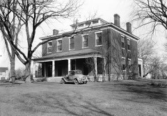
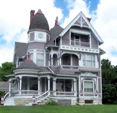
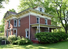
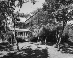
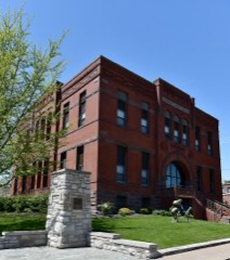
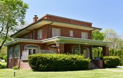
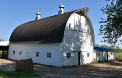
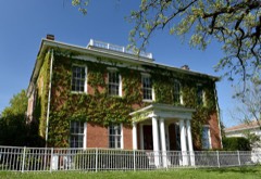
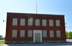
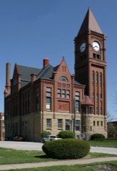
29 National Register listings published here.
Sources: the National Register database, National Park Service
42 topographic sheets cover 23 settlements here, and 29 properties are on the National Register of Historic Places.
29 National Register listings published here.
Sources: the National Register database, National Park Service
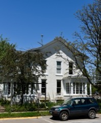
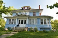
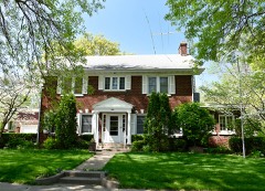
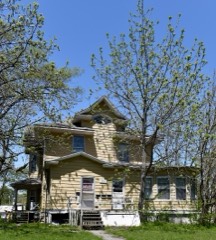
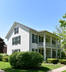
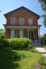
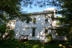
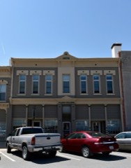
Every property in this county listed on the National Register of Historic Places, with the year it was listed and the federal nomination document.
Every wildfire the federal occurrence database records inside this county: 47 of them, burning about 556 acres. None started naturally and 1 was recorded as arson. Each settlement page carries the fires within five miles of it.
| Reported cause | Fires |
|---|---|
| Missing data/not specified/undetermined | 20 |
| Debris and open burning | 20 |
| Equipment and vehicle use | 3 |
| Smoking | 2 |
| Arson/incendiarism | 1 |
| Recreation and ceremony | 1 |
The five largest, by the area the report gives. One of them was set deliberately.
| Date | Cause | Size | Reported by | Name on the report |
|---|---|---|---|---|
| 30 April 2020 | Debris and open burning | 100 acres | Iowa Department of Natural Resources | not named |
| 20 April 2014 | Missing data/not specified/undetermined | 80 acres | Iowa Department of Natural Resources | not named |
| 12 November 2001 | Arson/incendiarism | 60 acres | Iowa State Fire Marshal's Office | not named |
| 4 October 2011 | Missing data/not specified/undetermined | 50 acres | Iowa Department of Natural Resources | 2624 136TH ST. BRIGHTON, IA 52540, IA |
| 11 March 2016 | Debris and open burning | 30 acres | Iowa Department of Natural Resources | BRIGHTON VOL. FIRE DEPARTMENT |
| 29 April 2018 | Debris and open burning | 25 acres | Iowa Department of Natural Resources | not named |
| 10 May 2018 | Debris and open burning | 25 acres | Iowa Department of Natural Resources | not named |
| 21 March 2009 | Missing data/not specified/undetermined | 22 acres | Iowa Department of Natural Resources | not named |
Every settlement page carries the fires within five miles of it - see the settlement index below.
The NOAA Storm Events Database holds 256 reports for this county, causing no deaths, 3 injuries and about $30,055,000 in recorded property damage. Each settlement page carries the reports that name it.
| Kind of event | Reports |
|---|---|
| Thunderstorm Wind | 118 |
| Hail | 93 |
| Flash Flood | 14 |
| Tornado | 13 |
| Flood | 7 |
| Heavy Rain | 5 |
| Lightning | 4 |
| Funnel Cloud | 2 |
The most serious of them, by death, then injury, then recorded damage. The accounts are quoted exactly as the forecast office filed them.
| When | Event | Place named | Harm | What the report says |
|---|---|---|---|---|
| November 1975 | Tornado (F2) | not stated | 3 hurt, $250,000 | no account filed |
| May 1988 | Tornado (F2) | not stated | $25,000,000 | no account filed |
| September 1982 | Tornado (F2) | not stated | $2,500,000 | no account filed |
| May 2003 | Hail | Packwood | $500,000 | no account filed |
| August 2010 | Flood | Pleasant Plain | $250,000 | no account filed |
| May 1959 | Tornado (F3) | not stated | $250,000 | no account filed |
| August 2010 | Thunderstorm Wind | Fairfield | $100,000 | Wind gusts estimated to be 70 mph blew a tree down onto a house on W Washington Avenue in Fairfield, IA around 340 am CDT August 3. |
| August 2010 | Flash Flood | Fairfield | $100,000 | Heavy rains resulted in some flash flooding of parts of Fairfield, IA during the late evening of August 13 and early morning of August 14. The flood water was 1 foot deep across 22nd Street and on W Grimes Avenue. |
| June 2010 | Lightning | Lockridge | $100,000 | A church steeple in Lockridge was struck by lightning, setting the building on fire. Little was rescued from the building. The time is estimated. |
| May 2003 | Tornado (F0) | Lockridge | $100,000 | no account filed |
| May 2003 | Tornado (F0) | Glasgow | $100,000 | no account filed |
| July 2003 | Thunderstorm Wind | Fairfield | $60,000 | no account filed |
| April 2008 | Thunderstorm Wind | Fairfield | $50,000 | Thunderstorm winds estimated to be 70 mph damaged some buildings in the vicinity of 8th St. and W Depot Ave. near the BNSF railroad tracks in Fairfield and ripped the roof off the Dexter-Apache Holdings Inc. building on Grimes Ave. The railroad crossing assembly was also ripped off. |
| July 2008 | Flash Flood | Fairfield | $50,000 | Heavy rains resulted in flash flooding of Fairfield, IA during the evening of July 27. Several streets in town were flooded with cars stalled out in the flood waters and people swimming in the streets. |
| July 2008 | Thunderstorm Wind | Fairfield | $50,000 | Wind gusts estimated to be 75 mph blew the roof off a house at 1103 Kodi Circle in Fairfield, IA around 637 pm July 27. |
| June 2005 | Thunderstorm Wind | Countywide | $50,000 | Initial damage began from Libertyville to about 3.7 miles northwest of Fairfield. The high winds lasted roughly 10 minutes at any one location. The Fairfield Airport measured 70 knot (81 mph) winds from 1031 to 1033 CST when power was lost. Extensive damage occurred in the city of Fairfield with trees and power poles down along with water ponding on roads from heavy rainfall. No additional damage reports were received east of Fairfield, but it is likely that sporatic damage occurred in an east northeast path to the Jefferson/Henry county line along and just north of the bow apex. Based on that assumption, the following times have been established for affected cities (all times CST); Libertyville 1027-1037, Fairfield Airport 1031-1041, Fairfield 1033-1043, Perlee 1040-1050, Salina 1045-1055, East Pleasant Plain 1048-1058, Germanville 1050-1100, and Merrimac 1053-1103. |
| April 2003 | Hail | Fairfield | $50,000 | Sheriff car damaged |
| August 2002 | Thunderstorm Wind | Libertyville | $50,000 | Barn collapsed due to high wind, while another building was completely removed from property on Indigo Boulevard. Garage destroyed, trees blown down and camper overturned on South 255th Street between Fairfield and Libertyville. Several vehicles also damaged at an auto body shop. |
| June 1997 | Thunderstorm Wind | Fairfield Muni Arpt | $50,000 | Several aircraft and aircraft hangers damaged. |
| April 2003 | Hail | Packwood | $50,000 | no account filed |
| April 2003 | Heavy Rain | Fairfield | $50,000 | no account filed |
| April 2003 | Hail | Batavia | $50,000 | no account filed |
| August 2003 | Thunderstorm Wind | Libertyville | $30,000 | Trees down with power out |
| June 2009 | Thunderstorm Wind | Fairfield | $25,000 | Wind gusts estimated to be 60 mph blew some tree limbs down onto some power lines in Fairfield, IA around 218 am June 22. A power outage was observed on the north side of town. |
| August 2003 | Thunderstorm Wind | Batavia | $20,000 | no account filed |
| July 2008 | Thunderstorm Wind | Fairfield | $15,000 | Wind gusts estimated to be 70 mph blew down several trees and power lines across all of Fairfield, IA around 637 pm July 27. |
| June 1998 | Thunderstorm Wind | Countywide | $15,000 | High winds from strong thunderstorms buffeted Jefferson County, causing damage to Fairfield and surrounding areas. The wind measuring equipment at Fairfield Flying Service, and a large sign at Fesler Auto Mall were destroyed by thunderstorm winds. Northwestern and western parts of Fairfield suffered the substantial property damage. A roof was blown off the GTE warehouse and a section of roof was ripped off Winfrey Storage. Numerous trees were blown down. One maple fell on a vacant house and another fallen tree destroyed a gas meter, broke windows and damaged eaves on another home. Streets around the area were blocked until the gas leak was repaired. A motorist driving a pickup had a brush with death when a large ash tree fell and part of the tree hit the truck's bed and dented the sidewalls. Another tree dropped on a four wheel drive Scout and boat. South of Fairfield a horse barn on Middle Glasgow Road was destroyed and a double car garage on Glasgow Road was blown down. High winds also flattened a grain storage bin near Libertyville. |
| September 2010 | Lightning | Fairfield | $10,000 | Lightning struck the waste water plant and the Grease Lightning Lift Station in Fairfield, IA during the evening of September 10. Both locations suffered mechanical and electrical malfunctions. |
| April 2006 | Tornado (F1) | Fairfield | $10,000 | Rated F1 |
| September 2005 | Hail | Packwood | $10,000 | Nickel to golfball sized hail |
| June 2004 | Thunderstorm Wind | Fairfield | $10,000 | Numerous limbs down with power out. |
| August 2003 | Thunderstorm Wind | Lockridge | $10,000 | Outbuildings and a silo damaged. |
| May 1996 | Lightning | Fairfield | $10,000 | no account filed |
| June 2004 | Thunderstorm Wind | Fairfield Muni Arpt | $8,000 | KFFL AWOS |
| September 2005 | Hail | Packwood | $6,000 | also heavy rain between Pekin and Packwood. |
| June 2012 | Thunderstorm Wind | Fairfield | $5,000 | Wind gusts estimated to be 60 mph blew down phone lines and tree branches in Fairfield, IA at 441 pm CDT June 16. |
| August 2007 | Thunderstorm Wind | Fairfield | $5,000 | Winds estimated to be 60 mph blew down power lines and tree branches in Fairfield, IA. |
| March 2006 | Hail | Libertyville | $5,000 | Hail estimated at 1 inch |
| March 2006 | Thunderstorm Wind | Countywide | $5,000 | limbs down across the southern part of the county |
| September 2005 | Thunderstorm Wind | Packwood | $5,000 | 6 inch diameter limbs down |
| September 2005 | Thunderstorm Wind | Fairfield | $5,000 | Branches down along with pea sized hail and water ponding on roads |
| May 2004 | Flash Flood | Fairfield | $5,000 | H43 and other roads closed between Cedar and Cresswood Avenues |
| June 2004 | Thunderstorm Wind | Fairfield | $5,000 | Numerous tree limbs down |
| June 2000 | Thunderstorm Wind | Libertyville | $5,000 | no account filed |
| April 1992 | Tornado (F1) | not stated | $2,500 | no account filed |
| August 1986 | Tornado (F0) | not stated | $2,500 | no account filed |
| April 2006 | Thunderstorm Wind | Fairfield | $2,000 | Tree and mailboxes down in Fairfield. |
| July 2006 | Hail | Packwood | $2,000 | quarter size hail |
| June 2006 | Hail | Salina | $2,000 | chunks the size of golfballs and possibly larger |
| June 2005 | Thunderstorm Wind | Fairfield | $2,000 | Large limbs down along Salina blacktop. |
| August 2004 | Thunderstorm Wind | Fairfield | $2,000 | Also 1.3 inches of rain |
| June 2006 | Hail | Fairfield | $2,000 | no account filed |
| June 2005 | Hail | Fairfield | $1,500 | Hail ranging from 0.70 to 1.00 inch |
| August 2010 | Thunderstorm Wind | Fairfield | $1,000 | Wind gusts estimated to be 70 mph blew a tree down near the intersection of W Hempstead Avenue and N 4th Street in Fairfield, IA around 340 am CDT August 3. The tree landed on a shed. |
| May 1998 | Thunderstorm Wind | Fairfield | $1,000 | Strong thunderstorm winds caused a major power outage across the city due to downed powerlines and tree limbs. |
| August 2006 | Thunderstorm Wind | Fairfield | $500 | Co-operative observer reported a section of a large tree down. |
| March 2026 | Hail | Fairfield Muni Arpt | - | A trained spotter reported that hail last from 640 to 650 PM CDT and covered the deck. There was no wind with this thunderstorm. |
| March 2026 | Hail | Perlee | - | A trained spotter reported hail up to the size of quarters. The time of the hail was estimated using radar. |
| April 2026 | Thunderstorm Wind | Packwood | - | Snapped power poles reported. Time estimated from radar data. |
| April 2026 | Thunderstorm Wind | Packwood | - | Power poles snapped. Time estimated from radar data. |
The Survey's mineral resources record lists 11 workings inside this county. None of them still produces: all are closed or unrecorded. Each settlement page carries the workings within five miles of it.
| Commodity | Workings |
|---|---|
| Stone, Crushed/Broken | 8 |
| Zinc | 1 |
| Sand and Gravel, Construction | 1 |
| Clay | 1 |
The least common of them first, because a county's hundredth gravel pit says nothing its first ten did not.
| Where | Site | Commodity | Status | Recorded |
|---|---|---|---|---|
| Drill Hole | Zinc | Past Producer | Sphalerite | |
| Unknown | Sand and Gravel, Construction | Past Producer | ||
| Unknown | Clay | Past Producer | ||
| Anderson Quarry | Stone, Crushed/Broken | Past Producer | ||
| Baldosier Quarry | Stone, Crushed/Broken | Past Producer | ||
| Cedar Creek Quarry | Stone, Crushed/Broken | Past Producer | ||
| Germanville Quarry | Stone, Crushed/Broken | Past Producer | ||
| Unknown | Stone, Crushed/Broken | Past Producer | ||
| Unknown | Stone, Crushed/Broken | Past Producer | ||
| Unknown | Stone, Crushed/Broken | Past Producer | ||
| Unknown | Stone, Crushed/Broken | Past Producer |
Named settlements recorded in the Geographic Names Information System, each with the topographic sheets covering it. Villages, hamlets and abandoned places alike. Each is shown with the nearest named watercourse or landform and the survey quadrangle it falls on.
Locust Grove township · 52533 · On Grubb Run · Brookville quadrangle
7 sheets, 1954 to 1982
No longer a settlement
Center township · 52533 · On Grubb Run · Libertyville quadrangle
7 sheets, 1954 to 1981
No longer a settlement
The vanished settlements of Jefferson County: the places named above that are no longer on the map.