Block
From the record
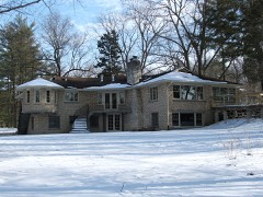
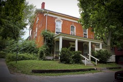
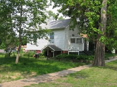
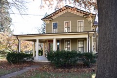
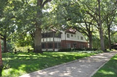
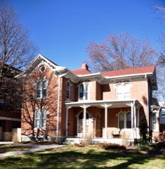
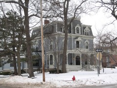
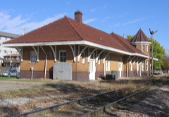
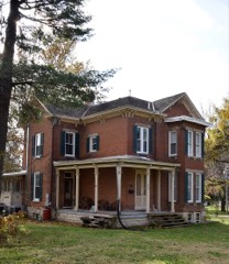
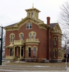
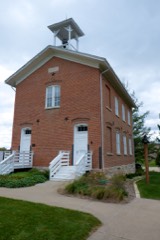
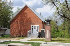
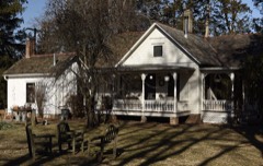
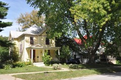
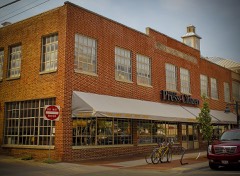
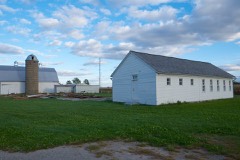
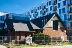
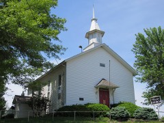
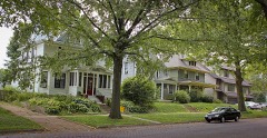
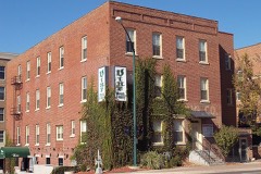
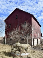
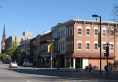
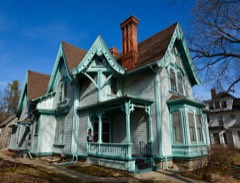
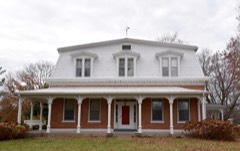
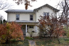
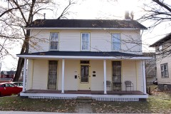
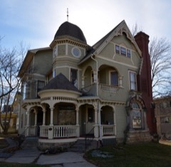
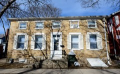
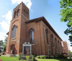
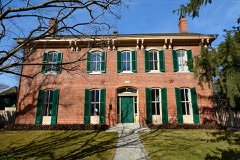
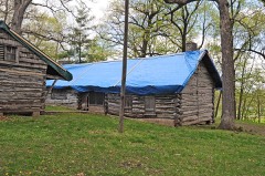
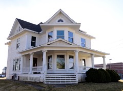
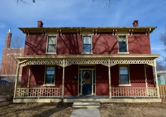
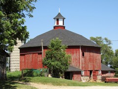
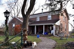
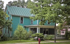
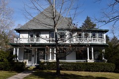
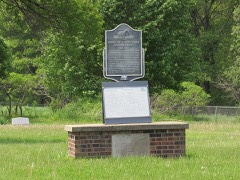
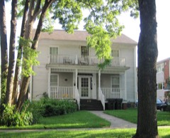
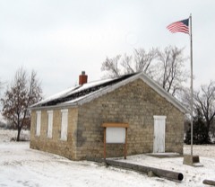
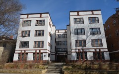
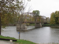
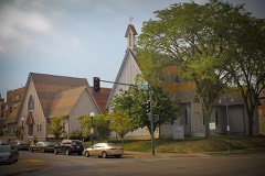
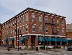
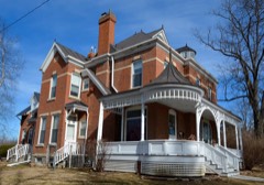
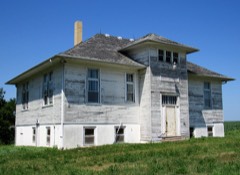
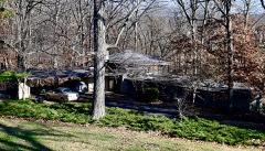
96 National Register listings published here, 1 of them a National Historic Landmark.
Sources: the National Register database, National Park Service
57 topographic sheets cover 33 settlements here, and 96 properties are on the National Register of Historic Places.
96 National Register listings published here, 1 of them a National Historic Landmark.
Sources: the National Register database, National Park Service
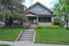
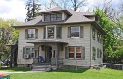
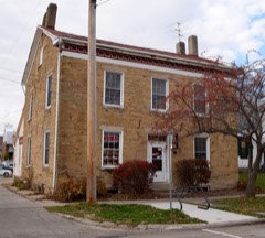
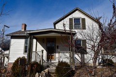
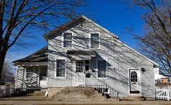
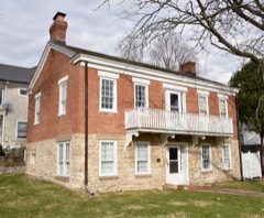
Every property in this county listed on the National Register of Historic Places, with the year it was listed and the federal nomination document.
Every wildfire the federal occurrence database records inside this county: 182 of them, burning about 1,069 acres. 1 started naturally and none was recorded as arson. Each settlement page carries the fires within five miles of it.
| Reported cause | Fires |
|---|---|
| Missing data/not specified/undetermined | 85 |
| Debris and open burning | 80 |
| Equipment and vehicle use | 9 |
| Smoking | 5 |
| Recreation and ceremony | 2 |
| Natural | 1 |
The five largest, by the area the report gives. None of them was recorded as arson.
| Date | Cause | Size | Reported by | Name on the report |
|---|---|---|---|---|
| 2 April 2011 | Missing data/not specified/undetermined | 200 acres | Iowa Department of Natural Resources | 2136 ST. BRIDGETTS RD NE, SOLON, IA |
| 11 March 2006 | Missing data/not specified/undetermined | 60 acres | Iowa Department of Natural Resources | not named |
| 23 April 2018 | Debris and open burning | 50 acres | Iowa Department of Natural Resources | not named |
| 10 March 2012 | Debris and open burning | 40 acres | Iowa Department of Natural Resources | not named |
| 30 April 2018 | Debris and open burning | 40 acres | Iowa Department of Natural Resources | not named |
| 24 April 2018 | Debris and open burning | 25 acres | Iowa Department of Natural Resources | not named |
| 16 April 2009 | Missing data/not specified/undetermined | 20 acres | Iowa Department of Natural Resources | not named |
| 11 April 2009 | Missing data/not specified/undetermined | 20 acres | Iowa Department of Natural Resources | not named |
Every settlement page carries the fires within five miles of it - see the settlement index below.
The NOAA Storm Events Database holds 652 reports for this county, causing 2 deaths, 66 injuries and about $337,328,300 in recorded property damage. Each settlement page carries the reports that name it.
| Kind of event | Reports |
|---|---|
| Thunderstorm Wind | 274 |
| Hail | 229 |
| Flash Flood | 49 |
| Tornado | 46 |
| Funnel Cloud | 19 |
| Flood | 17 |
| Lightning | 10 |
| Heavy Rain | 7 |
| Winter Weather | 1 |
The most serious of them, by death, then injury, then recorded damage. The accounts are quoted exactly as the forecast office filed them.
| When | Event | Place named | Harm | What the report says |
|---|---|---|---|---|
| May 1962 | Tornado (F2) | not stated | 1 killed, $250,000 | no account filed |
| May 2011 | Thunderstorm Wind | Lake Macbride Sp | 1 killed, $10,000 | Wind gusts estimated to be 75 mph blew down numerous trees at Lake McBride State Park about 4 miles west southwest of Solon, IA at 940 am CDT May 29. One tree fell onto a tent, killing a camper. |
| April 2006 | Tornado (F2) | Iowa City | 30 hurt, $12,000,000 | Rated very high F2 with winds estimated at 155 mph. |
| May 1998 | Tornado (F3) | Hills | 17 hurt, $6,000,000 | no account filed |
| June 1998 | Thunderstorm Wind | Countywide | 12 hurt, $30,700,000 | no account filed |
| April 1974 | Tornado (F1) | not stated | 2 hurt, $25,000 | no account filed |
| March 2023 | Tornado (EF2) | Cosgrove | 2 hurt | A tornado developed just southwest of Coralville, crossed Highway 218 and damaged the James St. Warehouse near Highway 6 in Coralville. Several trailers and a truck were flipped over in the vicinity. A retail building also had part of a roof lifted off with several vehicles rolled or flipped. The tornado then tracked into a residential area and uprooted and snapped numerous trees. At least 2 injuries were reported by emergency management. Damage then became more sporadic before the tornado reintensified across Coralville Reservoir. A more concentrated path began near Sugar Bottom campground east of North Liberty and continued northeast towards Solon. A radio tower collapsed and a roof was lifted off a home and partially removed. The tornado continued northeast into a field before eventually reaching another farmstead and destroying an outbuilding. Debris from the farmstead was lofted into a field with a 2x4 driven into the ground. The tornado continued into Solon, uprooting trees, bending street signs, and destroying another outbuilding before dissipating and lifting just north of Sutliff Rd. |
| June 1994 | Hail | Swisher | 1 hurt, $5,000 | no account filed |
| August 2010 | Lightning | Tiffin | 1 hurt, $1,000 | Lightning struck a home at 283 Woodfield Drive in Tiffin, IA around 310 pm CDT August 20. A teenage male was shocked while using a laptop computer at the time of the lightning strike. The residence sustained minor damage. |
| June 2014 | Thunderstorm Wind | North Liberty | 1 hurt | The emergency manager reported a tree fell on a person in North Liberty, and was transported to the hospital. |
| June 2008 | Flood | Kent County Park | $230,000,000 | The record crest on the Iowa River at Iowa City occurred on June 15, 2008 at 31.53 feet. Flood stage is 22 feet. The record crest on the Iowa River at Lone Tree occurred on June 15, 2008 at 23.15 feet. Flood stage is 15 feet. Preliminary damage estimates just to the University of Iowa at Iowa City was at least $230 million. This compares to $6 million in damages during the Great Flood of 1993. Water flowed over the spillway at the Corps of Engineer's Coralville Reservoir for only the third time since the reservoir began operation on September 17, 1958. (The previous two times occurred in the summer of 1993). The result was unprecedented flooding downstream of the reservoir in the cities of Iowa City and Coralville. |
| May 1997 | Hail | Iowa City | $40,000,000 | A 15 minute "rain" of baseball sized hail caused $30 to $50 million dollars of damage. One insurance agent said "this was the worst storm since 1967." He went on to say; "everyone he insures who has a skylight now has a broken skylight." This included the skylights over the swimming pool in the downtown Iowa City Holliday Inn. The average home claim was $3500 and the average car claim was $2500. The hail caused widespread damage to individuals cars and between 300 and 500 thousand dollars worth of damage to each of four car dealerships interviewed. |
| May 1988 | Tornado (F2) | not stated | $2,500,000 | no account filed |
| May 1988 | Tornado (F2) | not stated | $2,500,000 | no account filed |
| June 1984 | Tornado (F2) | not stated | $2,500,000 | no account filed |
| April 1973 | Tornado (F2) | not stated | $2,500,000 | no account filed |
| August 2016 | Flash Flood | Swisher | $1,500,000 | The Emergency Manager reported that the Cedar Rapids and Iowa City Railroad (CRANDIC) experienced washed out tracks and a bridge in the Swisher area. |
| April 2006 | Lightning | Coralville | $515,000 | Sometime between 1900 and 1930 CST lightning struck a brand new home in Coralville. The resultant fire destroyed the home and strong winds allowed the flames to spread onto a house nearing completion next door. |
| June 2008 | Flash Flood | Coralville | $500,000 | The Crandic Railroad embankment along the Iowa River in Coralville, IA failed around 9:01 pm June 12. Flash flooding resulted in sections of Coralville, IA along 1st Avenue and Highway 6. |
| June 2007 | Flash Flood | Iowa City | $500,000 | Reports of urban flash flooding were received from around Iowa City. 8 to 10 inches of water covered a parking lot at a radio station, stranding 5 employees. 4 of the 5 were evacuated by the fire department. Numerous major streets were closed, and some businesses suffered minor flooding damage. |
| June 2007 | Lightning | Swisher | $500,000 | Lightning struck a home just east of the Swisher exit off I-380, setting a fire in the rafters that destroyed the house. |
| June 2010 | Flood | Hills | $375,000 | Heavy rains during the third week of June resulted in the Iowa River at Lone Tree going above the moderate flood stage level of 16.5 feet on June 16 around 12 am. It crested around 17.0 feet around 11 am June 16. It fell below the moderate flood stage level around 930 pm June 16. |
| April 2013 | Flash Flood | Swisher | $250,000 | Several rounds of heavy rain fell across Johnson County resulting in flash flooding of much of the county from the mid morning of April 17 through the early morning of April 18. |
| June 2010 | Flash Flood | Cou Falls | $250,000 | Heavy rains resulted in flash flooding of several streets in and around the Iowa City and Coralville areas during the late morning and afternoon of June 15. Several cars were stalled out in the flood waters in Iowa City. The water was about a foot deep at the intersection of Keokuk and Laurel Streets. First Avenue in Coralville was impassable due to high water. About 3 miles south of Iowa City, a trailer park was flooded and several roads were closed due to flooding. In Morse, a large 500 gallon tank was dislodged from its footing creating a hazardous material situation. |
| June 2009 | Flood | Hills | $250,000 | Heavy rains during the middle of the month resulted in the Iowa River at Lone Tree going above the moderate flood stage level of 16.5 feet on June 22nd around 830 am. It crested around 16.6 feet around 1230 pm June 22. It fell below the moderate flood stage level around 2 pm June 22. |
| March 1991 | Tornado (F2) | not stated | $250,000 | no account filed |
| September 1991 | Tornado (F2) | not stated | $250,000 | no account filed |
| March 1990 | Tornado (F1) | not stated | $250,000 | no account filed |
| June 1983 | Tornado (F1) | not stated | $250,000 | no account filed |
| August 1977 | Tornado | not stated | $250,000 | no account filed |
| August 1977 | Tornado | not stated | $250,000 | no account filed |
| March 2002 | Thunderstorm Wind | Hills | $200,000 | A property suffered heavy damage. A large sliding door to a metal building was blown down and destroyed, a fence was damaged, a semi-trailer was tipped over and moved, the tin roof on an old shed was torn off, and an empty grain elevator was tipped over and moved. Additionally, many water tanks and other supplies that were piled around had been jumbled and thrown around. The owner credited some rail cars parked along the west side of the property with limiting the damage by providing a break from the wind. Also, a pole building on an adjacent lot northeast of the property was upended and destroyed with tractors and other equipment inside. The equipment suffered damage but was still driveable. Across the street from the pole building, a residence lost a chimney. Just east of that residence, was another residence which suffered the most damage seen in town. The home had damage on all four sides with windows broken out, siding damaged, a chimney destroyed, shingles removed and roof damage. A child was asleep in a first floor bedroom when the home was damaged. The mother reported that it was very difficult opening the door to the bedroom because of the force of the wind. The child was in bed with broken glass throughout the room and in the bed, but luckily there were no injuries. There was mud and debris plastered on the walls and in the room. Also, there was an old truck parked on a street on the east side of the home that was pushed into another vehicle parked nearby. Power lines were down, and the home was without power until 4:30 pm Saturday. Across the street from this residence was another home which suffered some roof damage, damage to a chimney and a playhouse which was tipped over and moved. There were also trees down throughout town. |
| September 2013 | Thunderstorm Wind | North Liberty | $140,000 | Three properties were damaged on the northwest side of New Liberty. Two homes had their garage doors blown in and walls subsequently blown out of the houses. There were also house windows broken and a flagpole was ripped out of the ground and thrown over a house. A weather station operated by the City of North Liberty measured a peak gust of 73 mph. |
| July 2011 | Thunderstorm Wind | Cou Falls | $125,000 | Wind gusts estimated to be 70 to 90 mph topped off some large trees and uprooted other trees on the south and west sides of Swisher, IA around 2 am. Nearby rural areas also experienced some tree damage. At 1443 Blain Cemetery Road, a tree fell onto the house and into the living room. Near exit 10 on I 380, a tree fell onto a parked truck smashing the cab. In Ely, IA a light pole was blown over behind the public library. There were several other reports of tree damage along the path. KCRG also contributed to this report. |
| June 2010 | Thunderstorm Wind | North Liberty | $100,000 | Wind gusts estimated to be 60 mph blew down some trees onto houses in North Liberty, IA around 1240 pm June 18. |
| June 2009 | Flash Flood | Lone Tree | $100,000 | Heavy rains have resulted in flash flooding in Lone Tree, IA during the evening of June 21 and early morning hours of June 22. Flooding was observed in front of spotter's residence. |
| August 2009 | Flash Flood | Solon | $100,000 | Heavy rains resulted in flash flooding in Solon, IA along Mill Creek during the evening of August 27. |
| May 2003 | Hail | Iowa City | $100,000 | Car windows broken on Interstate 380 |
| May 2003 | Hail | Iowa City | $100,000 | no account filed |
| August 2010 | Flood | Hills | $75,000 | no account filed |
| April 2006 | Tornado (F1) | Hills | $70,000 | Rated high F1 |
| May 2004 | Hail | Iowa City | $70,000 | Hail of 1.00 to 1.50 inches in diameter with some golfball sized hail occurred with thunderstorm number 3 in Iowa City, and 2 miles west, 1 mile south, and 1 mile east of Iowa City. Hail covered the ground in the southeast part of the city with numerous cars receiving dents. |
| July 2003 | Thunderstorm Wind | Oxford | $70,000 | no account filed |
| July 2011 | Thunderstorm Wind | Sharon Center | $50,000 | Wind gusts estimated to be 70 mph damaged a grain elevator, partially ripped off a garage roof, snapped some large tree limbs, and flattened some corn about 4 miles northeast of Frytown, IA which is also known as Williamstown, IA around 700 am CDT July 24. |
| May 2008 | Thunderstorm Wind | Lake Macbride Sp | $50,000 | Winds estimated to be 65 mph blew 48 boats, which were tied to a boat dock, about 3 miles from their original location at Lake MacBride State Park around 11:41 pm. Damage was sustained to the boat rental docks and rental boats. |
| July 2008 | Thunderstorm Wind | Sharon Center | $50,000 | Wind gusts estimated to be 70 mph caused widespread wind damage from Sharon Center, IA to Lone Tree, IA between 500 am and 515 am July 21. Numerous trees and utility poles were blown down. Also a sign and awning were damaged at a gas station near Hills, IA. |
| April 2006 | Hail | Iowa City | $50,000 | Spotter location is on Glendale Rd at the end of Jefferson; dime to golfball size hail |
| July 2003 | Thunderstorm Wind | Solon | $50,000 | Power lines down Solon to North Liberty |
| June 1994 | Hail | North Liberty | $50,000 | no account filed |
| April 2006 | Hail | Iowa City | $30,000 | Public report of baseball size hail at mile marker 252 on I-80 |
| July 2003 | Thunderstorm Wind | Iowa City | $30,000 | KIOW measured 49 knots @ 2301 CST |
| August 2014 | Thunderstorm Wind | Oakdale | $25,000 | Wind gusts estimated to be 75 mph overturned a semi trailer at Simpson Furniture (2300 Jones Blvd) and snapped trees and a large billboard sign along Heartland Drive around 705 am CDT August 22. A residence at 3300 Heartland Drive sustained structural damage when an evergreen tree snapped at the base and fell onto the home. A nearby flag pole at the home was also bent. |
| June 2011 | Lightning | North Liberty | $25,000 | Lightning struck a house in North Liberty, IA around 1040 pm CDT June 8 causing a fire. |
| July 2010 | Flash Flood | Lone Tree | $25,000 | Heavy rains resulted in flash flooding of Dougherty Drive in Lone Tree, IA during the late evening of July 30 and early morning of July 31. |
| June 2010 | Thunderstorm Wind | Iowa City | $25,000 | Wind gusts estimated to be 60 to 75 mph blew down numerous trees and power lines near Van Buren, Market, Church, and Fairchild streets in Iowa City around 1240 pm CDT June 18. At least 2 trees landed on homes. |
| June 2010 | Thunderstorm Wind | North Liberty | $25,000 | Wind gusts estimated to be 70 mph blew out the windows of several cars near Coralville Mall around 1225 pm June 18. In addition, trees and signs were blow down. |
| June 2008 | Flash Flood | Iowa City Muni Arpt | $25,000 | Heavy rains resulted in some flash flooding along Stevens Drive in Iowa City, IA during the evening of June 8. Some cars were stalled out in the flood waters. |
| April 2001 | Tornado (F0) | Oxford | $25,000 | An F0 tornado moved across rural areas south of Oxford, and destroyed a barn and a garage at two farms. There were no injuries. |
| September 1986 | Tornado (F1) | not stated | $25,000 | no account filed |
| November 1975 | Tornado (F1) | not stated | $25,000 | no account filed |
The Survey's mineral resources record lists 23 workings inside this county. 4 still produce and 19 are closed or unrecorded. Each settlement page carries the workings within five miles of it.
| Commodity | Workings |
|---|---|
| Stone, Crushed/Broken | 11 |
| Sand and Gravel, Construction | 9 |
| Limestone, Dimension | 2 |
| Stone, Crushed/Broken, Limestone, Dimension, Flagstone | 1 |
The least common of them first, because a county's hundredth gravel pit says nothing its first ten did not.
| Where | Site | Commodity | Status | Recorded |
|---|---|---|---|---|
| Sanders Quarry | Stone, Crushed/Broken, Limestone, Dimension, Flagstone | Past Producer | ||
| Hutchinson Quarry | Limestone, Dimension | Past Producer | ||
| Old State Quarry | Limestone, Dimension | Past Producer | ||
| Meyer Quarry | Sand and Gravel, Construction | Past Producer | ||
| Rohret Pit | Sand and Gravel, Construction | Past Producer | ||
| Showers Sandpit | Sand and Gravel, Construction | Producer | ||
| Stevens Pit | Sand and Gravel, Construction | Past Producer | ||
| Unknown | Sand and Gravel, Construction | Past Producer | ||
| Unknown | Sand and Gravel, Construction | Past Producer | ||
| Unknown | Sand and Gravel, Construction | Past Producer | ||
| Unknown | Sand and Gravel, Construction | Past Producer | ||
| Wagner Pit | Sand and Gravel, Construction | Past Producer | ||
| Conklin Quarry and Mill | Stone, Crushed/Broken | Producer | ||
| Crozier Quarry | Stone, Crushed/Broken | Producer | ||
| Dingleberry Quarry | Stone, Crushed/Broken | Past Producer | ||
| Donovan Quarry | Stone, Crushed/Broken | Past Producer | ||
| Klein Quarry | Stone, Crushed/Broken | Producer | ||
| Mc Cune Quarry | Stone, Crushed/Broken | Past Producer | ||
| Stahle Quarry | Stone, Crushed/Broken | Past Producer | ||
| Vanourney Quarry | Stone, Crushed/Broken | Past Producer | ||
| Vogel Quarry | Stone, Crushed/Broken | Past Producer | ||
| W.J. Turecek Quarry | Stone, Crushed/Broken | Past Producer | ||
| Wray Quarry | Stone, Crushed/Broken | Past Producer |
Named settlements recorded in the Geographic Names Information System, each with the topographic sheets covering it. Villages, hamlets and abandoned places alike. Each is shown with the nearest named watercourse or landform and the survey quadrangle it falls on.
West Lucas township · 52241 · On Cardinal Creek · Iowa City West quadrangle
19 sheets, 1891 to 1994
Jefferson township · 52338 · On Swisher Creek · Swisher quadrangle
14 sheets, 1887 to 1994
Madison township · 52317 · On McAllister Creek · Swisher quadrangle
14 sheets, 1887 to 1994
No longer a settlement
Scott township · 52240 · Iowa City East quadrangle
14 sheets, 1894 to 1993
No longer a settlement
Madison township · 52317 · Swisher quadrangle
14 sheets, 1887 to 1994
No longer a settlement
Iowa City city · 52240 · On Ralston Creek · Iowa City West quadrangle
19 sheets, 1891 to 1994
Scott township · 52240 · West Liberty SW quadrangle
11 sheets, 1894 to 1984
No longer a settlement
Clear Creek township · 52241 · On Deer Creek · Iowa City West quadrangle
19 sheets, 1891 to 1994
Scott township · 52240 · West Liberty SW quadrangle
11 sheets, 1894 to 1984
No longer a settlement
Fremont township · 52755 · On Pechman Creek · Lone Tree quadrangle
7 sheets, 1958 to 1984
Big Grove township · 52333 · On West Hoosier Creek · Ely quadrangle
16 sheets, 1887 to 1994
Iowa City city · 52246 · On Clear Creek · Iowa City West quadrangle
19 sheets, 1891 to 1994
Clear Creek township · 52241 · On Deer Creek · Iowa City West quadrangle
19 sheets, 1891 to 1994
Clear Creek township · 52241 · On Deer Creek · Tiffin quadrangle
17 sheets, 1891 to 1994
The vanished settlements of Johnson County: the places named above that are no longer on the map.