Block
From the record
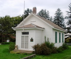
27 National Register listings published here.
Sources: the National Register database, National Park Service
57 topographic sheets cover 33 settlements here, and 27 properties are on the National Register of Historic Places.
27 National Register listings published here.
Sources: the National Register database, National Park Service
Every property in this county listed on the National Register of Historic Places, with the year it was listed and the federal nomination document.
Every wildfire the federal occurrence database records inside this county: 83 of them, burning about 460 acres. None started naturally and none was recorded as arson. Each settlement page carries the fires within five miles of it.
| Reported cause | Fires |
|---|---|
| Missing data/not specified/undetermined | 48 |
| Debris and open burning | 32 |
| Equipment and vehicle use | 2 |
| Smoking | 1 |
The five largest, by the area the report gives. None of them was recorded as arson.
| Date | Cause | Size | Reported by | Name on the report |
|---|---|---|---|---|
| 22 March 2010 | Missing data/not specified/undetermined | 60 acres | Iowa Department of Natural Resources | 6483 230TH AVE., MARTELLE, IOWA |
| 21 March 2009 | Missing data/not specified/undetermined | 50 acres | Iowa Department of Natural Resources | not named |
| 16 January 2007 | Missing data/not specified/undetermined | 30 acres | Iowa Department of Natural Resources | not named |
| 10 April 2018 | Debris and open burning | 25 acres | Iowa Department of Natural Resources | not named |
| 22 April 2018 | Debris and open burning | 25 acres | Iowa Department of Natural Resources | not named |
| 22 April 2009 | Missing data/not specified/undetermined | 20 acres | Iowa Department of Natural Resources | not named |
| 15 April 2010 | Missing data/not specified/undetermined | 20 acres | Iowa Department of Natural Resources | 16326 HWY 151, MONTICELLO, IOWA |
| 17 July 2012 | Debris and open burning | 20 acres | Iowa Department of Natural Resources | not named |
Every settlement page carries the fires within five miles of it - see the settlement index below.
The NOAA Storm Events Database holds 492 reports for this county, causing no deaths, 6 injuries and about $75,089,820 in recorded property damage. Each settlement page carries the reports that name it.
| Kind of event | Reports |
|---|---|
| Thunderstorm Wind | 251 |
| Hail | 134 |
| Tornado | 46 |
| Flash Flood | 26 |
| Flood | 21 |
| Funnel Cloud | 10 |
| Heavy Rain | 4 |
The most serious of them, by death, then injury, then recorded damage. The accounts are quoted exactly as the forecast office filed them.
| When | Event | Place named | Harm | What the report says |
|---|---|---|---|---|
| May 1953 | Tornado (F3) | not stated | 3 hurt | no account filed |
| July 1995 | Thunderstorm Wind | Monticello | 1 hurt, $240,000 | no account filed |
| April 2006 | Tornado (F1) | Anamosa | 1 hurt, $100,000 | Rated F1 |
| April 1991 | Thunderstorm Wind | not stated | 1 hurt | no account filed |
| March 1990 | Tornado (F4) | not stated | $25,000,000 | no account filed |
| July 2010 | Flood | Monticello | $15,000,000 | Along the Maquoketa River, about 50 homes and 20 businesses in Monticello were flooded due to record flooding. A printing company was flooded for the second time in 11 months, this time even worse than the last. Even with advance preparations, the company sustained losses estimated at $850,000. Similarly, a building company sustained $200,000 after 4 feet of water inundated their facilities. The local paper reported that the CEO of the company knew there was a possibility of flooding, but not 4 feet of water.||The county fairgrounds were also heavily impacted by the floods, putting a damper on the ongoing fair events that typically see more than 250,000 visitors. East of Monticello, the historic Corbett's Mill bridge washed away in the record flood and still had not been found several days after the river crested. ||Although the Lake Delhi dam failure was upstream of Monticello (and other flooded Jones County communities), the bulk of the flood damage can be attributed to the record flooding of the river itself rather than the dam failure because of the relatively slow progression of the breach and the timing of the flood crest. |
| July 2010 | Flood | Stone City | $10,000,000 | Several homes flooded in Olin. The extent of the flooding was blamed at least in part on a levee break along a creek north of town that was intended to divert the creek waters into the Wapsipinicon River. |
| June 2008 | Flood | Stone City | $5,000,000 | The record crest on the Wapsipinicon River at Anamosa occurred on June 13, 2008 at 26.18 feet. Flood stage is 14 feet. |
| July 1992 | Tornado (F3) | not stated | $2,500,000 | no account filed |
| July 1992 | Tornado (F2) | not stated | $2,500,000 | no account filed |
| March 1990 | Tornado (F1) | not stated | $2,500,000 | no account filed |
| September 1972 | Tornado (F2) | not stated | $2,500,000 | no account filed |
| July 1995 | Thunderstorm Wind | Monticello | $1,500,000 | no account filed |
| July 2016 | Flash Flood | Monticello | $1,000,000 | The emergency manager reported water up to 1.5 feet in depth on the outdoor track at the fairgrounds. |
| July 2011 | Thunderstorm Wind | Monticello | $1,000,000 | Wind gusts estimated to be 60 mph destroyed the JumboTron and sound system at the Jones County Fair in Monticello, IA at 1000 pm CDT July 22. In addition, some vendor tents were blown down and an awning on the Jones County Mobile EM Unit was destroyed. |
| May 1995 | Thunderstorm Wind | Scotch Grove | $600,000 | no account filed |
| June 2010 | Flood | Stone City | $500,000 | Heavy rains during the third week of June resulted in the Wapsipinicon River at Anamosa going above the moderate flood stage level of 15.5 feet on June 21 around 100 am. It crested around 15.6 feet around 700 am June 21. It fell below the moderate flood stage level around 715 am June 21. |
| August 2009 | Flash Flood | Monticello | $500,000 | Heavy rains resulted in flash flooding across parts of Jones County on August 27. Some areas particularly hard hit were Anamosa, Monticello, and Center Junction. Several roads were closed due to the flood waters. Highway 151 was closed between Anamosa and Monticello due to flooding of Kitty Creek. Buffalo Creek flooded out of its banks flooding low lying areas. Bear Creek flooded 140th Avenue and Madison Road near Center Junction. The flood waters were 1.5 feet deep. |
| June 2008 | Flash Flood | Anamosa | $500,000 | A levee failed along the Wapsipinicon River on the southwest side of Anamosa, IA below the County Rd E34 bridge around 9:16 pm June 12. Flash flooding resulted on the southwest side of Anamosa, IA. |
| August 2009 | Flood | Stone City | $500,000 | no account filed |
| May 1995 | Thunderstorm Wind | Center Junction | $400,000 | no account filed |
| April 2013 | Flash Flood | Monticello | $250,000 | Several rounds of heavy rains resulted in flash flooding across much of Jones County from the evening of April 17 through the early morning of April 18. |
| July 2011 | Thunderstorm Wind | Martelle | $250,000 | Wind gusts estimated to be 60 to 70 blew down numerous trees across all of Jones County Iowa between 520 am and 610 am CDT July 11. |
| July 2010 | Flood | Stone City | $250,000 | no account filed |
| July 2003 | Hail | Wyoming | $250,000 | no account filed |
| May 1988 | Tornado (F1) | not stated | $250,000 | no account filed |
| September 2016 | Flood | Stone City | $100,000 | Heavy rainfall of 4 to over 10 inches over significant areas from 21 to 23 September in extreme North Central and Northeast Iowa moved downstream causing the Wapsipinicon River to rise above major flood stage levels. ||Anamosa rose above its major flood stage level of 21.5 feet on September 27th, 2016 at approximately 11 PM CST. It crested around 22.8 feet at approximately 7 PM CST on September 27th, 2016. It fell below major flood stage on September 28th around 4 pm CST.||Flooding continued into October. |
| September 2010 | Thunderstorm Wind | Temple Hill | $100,000 | Wind gusts estimated to be 75 mph blew a semi-truck over on Highway 136 about 3 miles south of Cascade, IA around 2 pm CDT September 21. |
| May 1995 | Thunderstorm Wind | Olin | $100,000 | This path of damage was either produced by down burst type winds or possibly gustnado type winds. The Amber area was hit hardest. Damage occurred to the following: 30 trees, 15 structures, several mobile homes, five roofs and overturned campers. |
| May 1995 | Hail | Bellevue | $100,000 | no account filed |
| May 1995 | Thunderstorm Wind | Anamosa | $100,000 | no account filed |
| June 2004 | Flash Flood | Olin | $70,000 | Water over E45 and 1-2 feet of water over Highway 38; numerous basements have water in them in Olin |
| July 2011 | Thunderstorm Wind | Monticello | $50,000 | Wind gusts estimated to be 65 mph blew down a tree onto a house in Monticello, IA at 950 pm CDT July 22. Power lines and branches were also blown down across much of the town. |
| August 2010 | Thunderstorm Wind | Monticello Muni Arpt | $50,000 | Wind gusts estimated to be 70 mph ripped the roofs off of some outbuildings and blew the doors off of a shed about 4 miles east northeast of Monticello, IA around 1 am CDT August 9. Some of the debris was lofted into the tops of some trees. |
| September 2010 | Thunderstorm Wind | Monticello | $50,000 | Wind gusts estimated to be 70 mph snapped some large trees off at the base in a mobile home park about 1 mile north of Monticello, IA around 155 pm CDT September 21. Some of the trees fell onto some cars. |
| June 2010 | Thunderstorm Wind | Anamosa | $50,000 | Wind gusts estimated to be 70 mph blew down several large trees in Anamosa, IA at 1250 pm CDT June 18. One tree fell onto a house. Power outages were also observed. The local paper later reported that most of the tree damage occurred north of Main Street. |
| June 2010 | Thunderstorm Wind | Oxford Jct | $50,000 | Trees in the cemetery in Oxford Junction sustained major damage. Tree damage to trucks was reported in nearby Oxford Mills. Trees were uprooted and branches down in town and throughout the surrounding rural community. |
| July 2009 | Thunderstorm Wind | Anamosa | $50,000 | Wind gusts estimated to be 75 mph blew down some large trees on Buffalo Road just west of Anamosa, IA around 750 pm July 24. One tree fell onto a house. |
| August 2009 | Thunderstorm Wind | Martelle | $50,000 | Wind gusts estimated to be 90 to 125 mph associated with a downburst damaged a farmstead on 70th Street about 1.5 miles east of Highway 1 or about 2.75 miles east northeast of Martelle, IA around 523 pm August 19. An old barn and a corn crib were destroyed and some large limbs of an old tree were broken off. Portions of the corn crib roof were scattered to the east. |
| June 2004 | Flash Flood | Wyoming | $50,000 | Bear creek flooded out X75 on the south edge of town; numerous basements flooded in Wyoming |
| July 2003 | Thunderstorm Wind | Monticello | $50,000 | 2 to 3 inch limbs down |
| August 2003 | Thunderstorm Wind | Wyoming | $50,000 | Numerous trees down on houses & vehicles. Small Outbuilding blown over. |
| July 1994 | Thunderstorm Wind | Onslow | $50,000 | A strong thunderstorm formed over eastern Iowa during the early afternoon hours. There was not much in the way of activity around it. The storm was rather short lived and created what was an apparent downburst northwest of Onslow, in Jones County. A grain bin and 2 pole buildings were flattened by the force of the wind. |
| April 1993 | Hail | not stated | $50,000 | An intense low pressure system moved across Iowa during the afternoon of the 19th. A variety of weather occurred with this system. As the cold front, or more accurately the dry line, extending south from the low moved into southeast Iowa, strong thunderstorms erupted. They produced hail and gusty winds. Two funnel clouds were observed during the afternoon. One funnel cloud was observed south of Winfield, near Columbus Junction. The second was near Muscatine. No tornados occurred as neither of these funnel clouds touched down. One thunderstorm produced a microburst southwest of Danville. Damage occurred to one farmstead there in the amount of approximately $20,000. High winds also blew in two windows of another old farm house near Danville and also destroyed two pole buildings there. Golf ball-size hail fell in Jones County south of Martelle. The storms were scattered in nature and thus was the severe weather associated with them. |
| July 2003 | Thunderstorm Wind | Wyoming | $50,000 | no account filed |
| July 2003 | Hail | Monticello | $50,000 | no account filed |
| May 2004 | Tornado (F1) | Martelle | $40,000 | Rated F1 with winds estimated at 90 to 100 mph. |
| May 1999 | Thunderstorm Wind | Onslow | $40,000 | Severe thunderstorm winds caused extensive damage on a farm northeast of Onslow. On the property, a mobile home, shop, and several smaller buildings were destroyed. The barn was shifted one foot off its foundation and several pipe gates were mangled and destroyed. |
| May 1999 | Thunderstorm Wind | Wyoming | $40,000 | Severe thunderstorm winds destroyed a cattle shed, uprooted a large tree, overturned a feed bunk, and broke windows at a farm southeast of Wyoming. Nearby, a barn was destroyed covering the road with debris, a tree was toppled onto a house, and the roof of a shed was wrapped around a tree. Another barn was also destroyed. |
| May 1995 | Thunderstorm Wind | Martelle | $30,000 | no account filed |
| June 2010 | Thunderstorm Wind | Wyoming | $25,000 | Wind gusts estimated to be 65-70 mph blew down trees and numerous large tree limbs in Wyoming, IA around 638 pm CDT June 18. The local paper also reported that a power pole had been toppled by a tree during the same storm; at least one tree landed on a car; another tree fell onto a garage. |
| July 2009 | Thunderstorm Wind | Stone City | $25,000 | Wind gusts estimated to be 75 mph blew down or uprooted some large trees and ripped the roof off a metal barn about 8 miles west southwest of Monticello, IA around 730 pm July 24. This report was relayed by a spotter network. |
| June 2009 | Thunderstorm Wind | Monticello | $25,000 | Wind gusts estimated to be 75 mph snapped a power pole in half about 2 miles north of Monticello, IA around 800 am June 19. In addition, numerous area trees were damaged and several tree limbs were blown down. |
| July 2006 | Thunderstorm Wind | Monticello | $25,000 | Numerous trees down with one on a mobile home that temporarily trapped a woman inside. The woman was not injured. |
| April 1995 | Thunderstorm Wind | Wyoming | $25,000 | no account filed |
| May 1988 | Tornado (F0) | not stated | $25,000 | no account filed |
| April 2006 | Hail | Anamosa | $20,000 | Also reported by amateur radio; dime to golfball size hail; vehicles damaged in Anamosa. |
| August 2004 | Thunderstorm Wind | Countywide | $20,000 | Squall line left Linn County between Waubeek and Springville and entered Jones County around 1755 CST (2355 UTC). Anamosa took a direct hit with winds estimated around 61 knots (70 mph) during 1758-1808 CST from a trained spotter and co-op observer. At this point, a book end vorticy began developing across the northern part of the county. The bookend vorticy moved in an east southeast direction from Monticello to the Jones/Jackson county line, passing north of Center Junction and Onslow. A brief power interruption occurred at the KMXO AWOS with the arrival of the gust front during 1808-1813 CST with winds gusting to 35 knots (40 mph) prior to the outage. Power came back for 1 minute at 1814 CST before failing completely with the arrival of the bookend vorticy. Winds estimated of at least 61 knots (70 mph) hit Monticello during 1814-1821 CST with numerous trees and power lines down. A few homes and a car dealership on the south side of Monticello sustained roof damage and broken windows. From Monticello to the Jones/Jackson county line, a spotter reported trees down 1.6 miles southeast of KMXO on 190th Street near Pictured Rocks State Park during 1819-1825 CST. The local newspaper reported a dented grain bin on the Welter farm 9.0 miles east southeast of KMXO along highway 136 during 1836-1842 CST. |
| July 1995 | Thunderstorm Wind | Stone City | $20,000 | no account filed |
| June 1998 | Thunderstorm Wind | Anamosa | $16,000 | no account filed |
The Survey's mineral resources record lists 50 workings inside this county. 13 still produce and 37 are closed or unrecorded. Each settlement page carries the workings within five miles of it.
| Commodity | Workings |
|---|---|
| Stone, Crushed/Broken | 28 |
| Sand and Gravel, Construction | 14 |
| Limestone, Dimension | 3 |
| Lead | 2 |
| Stone, Crushed/Broken, Limestone, Dimension | 2 |
| Lead, Zinc | 1 |
The least common of them first, because a county's hundredth gravel pit says nothing its first ten did not.
| Where | Site | Commodity | Status | Recorded |
|---|---|---|---|---|
| Anamosa Mines | Lead, Zinc | Past Producer | Galena, Sphalerite | |
| James Brown Mine | Lead | Past Producer | ||
| Occurrence | Lead | Occurrence | Galena | |
| Weber Mine and Mill | Stone, Crushed/Broken, Limestone, Dimension | Producer | ||
| Weber Quarry and Mill | Stone, Crushed/Broken, Limestone, Dimension | Producer | ||
| Dearborn Quarry | Limestone, Dimension | Past Producer | ||
| John Clay Quarry | Limestone, Dimension | Past Producer | ||
| Penitentiary Quarry | Limestone, Dimension | Past Producer | ||
| Burda Pit | Sand and Gravel, Construction | Past Producer | ||
| Clement Sand Pit | Sand and Gravel, Construction | Producer | ||
| Eganhouse Pit and Plant | Sand and Gravel, Construction | Producer | ||
| Finn Pit | Sand and Gravel, Construction | Past Producer | ||
| Fleming-Jensen Pit | Sand and Gravel, Construction | Past Producer | ||
| Hintz Pit | Sand and Gravel, Construction | Past Producer | ||
| Holtz Pit | Sand and Gravel, Construction | Past Producer | ||
| Knapp Sand Pit | Sand and Gravel, Construction | Producer | ||
| Monticello Pit | Sand and Gravel, Construction | Past Producer | ||
| Unknown | Sand and Gravel, Construction | Past Producer | ||
| Unknown | Sand and Gravel, Construction | Past Producer | ||
| Unknown | Sand and Gravel, Construction | Past Producer | ||
| Vernon-Anamosa Sand Pit | Sand and Gravel, Construction | Past Producer | ||
| Weber Sand Pit | Sand and Gravel, Construction | Producer | ||
| Anamosa Quarry | Stone, Crushed/Broken | Producer | ||
| Behrends Quarry | Stone, Crushed/Broken | Producer | ||
| Canton Quarry | Stone, Crushed/Broken | Producer | ||
| Champion #2 Quarry | Stone, Crushed/Broken | Past Producer | ||
| Chas Zimmer Quarry | Stone, Crushed/Broken | Past Producer | ||
| Delay Quarry | Stone, Crushed/Broken | Past Producer | ||
| Doll Quarry | Stone, Crushed/Broken | Past Producer | ||
| Finn Quarry | Stone, Crushed/Broken | Past Producer | ||
| Freeman Quarry | Stone, Crushed/Broken | Past Producer | ||
| Gold Hill Quarry | Stone, Crushed/Broken | Past Producer | ||
| Gray Quarry | Stone, Crushed/Broken | Past Producer | ||
| Hale Quarry | Stone, Crushed/Broken | Past Producer | ||
| Hutton Quarry | Stone, Crushed/Broken | Past Producer | ||
| Jacobs Quarry | Stone, Crushed/Broken | Producer | ||
| Kula Quarry | Stone, Crushed/Broken | Past Producer | ||
| Lang Quarry | Stone, Crushed/Broken | Past Producer | ||
| Matternach Quarry | Stone, Crushed/Broken | Producer | ||
| Oeschger Quarry | Stone, Crushed/Broken | Past Producer | ||
| Olin Quarry | Stone, Crushed/Broken | Producer | ||
| Thompson Quarry | Stone, Crushed/Broken | Past Producer | ||
| Unknown | Stone, Crushed/Broken | Past Producer | ||
| Unknown | Stone, Crushed/Broken | Past Producer | ||
| Unknown | Stone, Crushed/Broken | Past Producer | ||
| Unknown | Stone, Crushed/Broken | Past Producer | ||
| Unknown | Stone, Crushed/Broken | Past Producer | ||
| Unknown | Stone, Crushed/Broken | Past Producer | ||
| Unknown | Stone, Crushed/Broken | Past Producer | ||
| Wyoming Quarry | Stone, Crushed/Broken | Producer |
Named settlements recorded in the Geographic Names Information System, each with the topographic sheets covering it. Villages, hamlets and abandoned places alike. Each is shown with the nearest named watercourse or landform and the survey quadrangle it falls on.
Castle Grove township · 52310 · Hopkinton West quadrangle
12 sheets, 1900 to 1984
No longer a settlement
Castle Grove township · 52310 · Hopkinton West quadrangle
12 sheets, 1900 to 1984
No longer a settlement
Richland township · 52033 · On Jurdan Creek · Scotch Grove quadrangle
15 sheets, 1891 to 1984
Castle Grove township · 52310 · Anamosa NE quadrangle
14 sheets, 1890 to 1984
No longer a settlement
Lovell township · 52310 · On Kitty Creek · Monticello quadrangle
15 sheets, 1891 to 1984
Scotch Grove township · 52310 · On Jurdan Creek · Scotch Grove quadrangle
15 sheets, 1891 to 1984
Scotch Grove township · 52310 · On Prairie Creek · Scotch Grove quadrangle
15 sheets, 1891 to 1984
No longer a settlement
Lovell township · 52310 · On Silver Creek · Hopkinton East quadrangle
12 sheets, 1900 to 1984
Rome township · 52312 · On North Fork Walnut Creek · Morley quadrangle
15 sheets, 1891 to 1984
Oxford township · 52323 · On Bryan Creek · Oxford Junction quadrangle
13 sheets, 1892 to 1984
Oxford township · 52323 · On Mill Creek · Oxford Junction quadrangle
13 sheets, 1892 to 1984
Richland township · 52310 · Near Chimney Rock · Scotch Grove quadrangle
15 sheets, 1891 to 1984
Wyoming township · 52362 · On Little Bear Creek · Wyoming West quadrangle
15 sheets, 1891 to 1984
The vanished settlements of Jones County: the places named above that are no longer on the map.