 Block
From the record
8 National Register listings published here.
Sources: the National Register database, National Park Service
24 topographic sheets cover 21 settlements here, and 8 properties are on the National Register of Historic Places.
8 National Register listings published here.
Sources: the National Register database, National Park Service
Every property in this county listed on the National Register of Historic Places, with the year it was listed and the federal nomination document.
| Photograph | Property | Type | Listed | Reference |
|---|---|---|---|---|
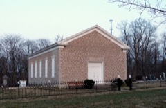 | Bethel Church | building | 1979 | 79003698 |
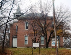 | Columbus Junction School 1882-1920 | building | 1973 | 73000735 |
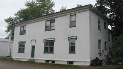 | Commercial Hotel | building | 2001 | 01000912 |
 | County Line Bridge | structure | 1998 | 98000513 |
| Fairview Church and Cemetery | building | 2023 | 100009486 | |
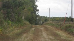 | Gipple's Quarry Bridge | structure | 1998 | 98000512 |
 | Louisa County Courthouse | building | 1981 | 81000253 |
| Mellinger Memorial Library | building | 2024 | 100010863 |
Every wildfire the federal occurrence database records inside this county: 90 of them, burning about 1,803 acres. None started naturally and 3 were recorded as arson. Each settlement page carries the fires within five miles of it.
| Reported cause | Fires |
|---|---|
| Debris and open burning | 45 |
| Missing data/not specified/undetermined | 36 |
| Recreation and ceremony | 4 |
| Arson/incendiarism | 3 |
| Equipment and vehicle use | 1 |
| Power generation/transmission/distribution | 1 |
The five largest, by the area the report gives. None of them was recorded as arson.
| Date | Cause | Size | Reported by | Name on the report |
|---|---|---|---|---|
| 20 March 1996 | Debris and open burning | 333 acres | Port Louisa National Wildlife Refuge | HORSESHOE |
| 18 March 2006 | Missing data/not specified/undetermined | 150 acres | Port Louisa National Wildlife Refuge | STRAWHACKER |
| 22 March 2015 | Debris and open burning | 140 acres | Iowa Department of Natural Resources | not named |
| 1 April 2010 | Missing data/not specified/undetermined | 103 acres | Port Louisa National Wildlife Refuge | STRAWHACKER |
| 1 April 2015 | Debris and open burning | 100 acres | Iowa Department of Natural Resources | not named |
| 11 April 2014 | Debris and open burning | 100 acres | Iowa Department of Natural Resources | not named |
| 20 March 2006 | Missing data/not specified/undetermined | 100 acres | Port Louisa National Wildlife Refuge | INDIAN SLOUGH |
| 20 March 2013 | Debris and open burning | 92 acres | Iowa Department of Natural Resources | not named |
Every settlement page carries the fires within five miles of it - see the settlement index below.
The NOAA Storm Events Database holds 247 reports for this county, causing 1 death, 6 injuries and about $62,877,480 in recorded property damage. Each settlement page carries the reports that name it.
| Kind of event | Reports |
|---|---|
| Thunderstorm Wind | 84 |
| Hail | 67 |
| Flood | 42 |
| Flash Flood | 27 |
| Tornado | 16 |
| Funnel Cloud | 7 |
| Lightning | 2 |
| Heavy Rain | 2 |
The most serious of them, by death, then injury, then recorded damage. The accounts are quoted exactly as the forecast office filed them.
| When | Event | Place named | Harm | What the report says |
|---|---|---|---|---|
| June 1998 | Thunderstorm Wind | Countywide | 1 killed, 1 hurt, $1,000,000 | no account filed |
| February 1999 | Thunderstorm Wind | Letts | 2 hurt, $20,000 | no account filed |
| June 2007 | Tornado (EF3) | Grandview | 1 hurt, $1,000,000 | The tornado touched down on the southern edge of Grandview. It moved through the center of town intensifying in rural areas as it approached the county line. In Grandview, several homes sustained severe damage. North of Grandview, about 1.5 miles, a farm house was completely destroyed. Other homes and trees along the path sustained damage. The tornado crossed the Louisa-Muscatine county line just south of Fruitland, IA.| |
| June 1998 | Tornado (F1) | Oakville | 1 hurt, $180,000 | Two homes were destroyed and trees were uprooted when a tornado touched down near Oakville. One minor injury was reported when the tornado rolled and damaged a mobile home. Twelve other residences sustained $130,000 in damages. Besides the two homes which were destroyed, two others were moved off their foundations. Roofs were torn off, and four garages were demolished. |
| January 1967 | Tornado (F2) | not stated | 1 hurt, $25,000 | no account filed |
| May 1988 | Tornado (F2) | not stated | $25,000,000 | no account filed |
| June 2008 | Flood | Gladwin | $19,000,000 | The record crest on the Iowa River at Columbus Junction occurred on June 16, 2008 at 32.49 feet. Flood stage is 19 feet. The record crest on the Iowa River at Wapello occurred on June 14, 2008 at 32.15 feet. Flood stage is 20 feet. |
| April 2003 | Hail | Morning Sun | $4,000,000 | no account filed |
| July 2016 | Thunderstorm Wind | Columbus City | $2,000,000 | A trained spotter reported several limbs and trees were down in town. A few of the trees fell on homes. |
| July 2016 | Flash Flood | Gladwin | $2,000,000 | A trained spotter reported heavy rains had produced washed out locations on gravel roads in the area. |
| April 2003 | Hail | Wapello | $1,000,000 | no account filed |
| May 2003 | Tornado (F0) | Marsh | $1,000,000 | no account filed |
| April 2003 | Hail | Wapello | $1,000,000 | no account filed |
| May 1996 | Thunderstorm Wind | Wapello | $800,000 | no account filed |
| June 2010 | Flood | Columbus City | $500,000 | Heavy rains during the third week of June resulted in the Iowa River at Wapello going above the moderate flood stage level of 22 feet on June 17 around 7 am. After briefly falling below the moderate flood stage, it crested around 23.9 feet around 7 am June 25. It fell below the moderate flood stage level around 1 pm June 27. |
| April 2003 | Flash Flood | Wapello | $500,000 | US 61 covered with water |
| August 2009 | Flood | Gladwin | $500,000 | no account filed |
| June 2009 | Flood | Columbus City | $250,000 | Heavy rains during the middle of the month resulted in the Iowa River at Wapello going above the moderate flood stage level of 22 feet on June 22nd around 3 pm. It crested around 22.4 feet around 1130 pm June 23. It fell below the moderate flood stage level around 130 pm June 23. |
| June 2009 | Flash Flood | Columbus City | $250,000 | Heavy rains have resulted in flash flooding in the vicinities of Grandview, IA and Columbus Junction, IA during the evening of June 21 and early morning hours of June 22. Significant flood waters were flowing over Highway 61 south of Grandview around 1051 pm June 21. Deep flood waters over Highway 92 near Columbus Junction, IA forced the closure of the highway around 1051 pm June 21. A water rescue was conducted on Highway 92 in Columbus Junction, IA around 1155 pm June 21 on two stalled vehicles. The flood waters were 1 to 2 feet deep and flowing fast. A trained spotter also contributed to this report. |
| April 2011 | Flood | Grandview | $250,000 | no account filed |
| July 2010 | Flood | Columbus City | $250,000 | no account filed |
| April 2003 | Hail | Cotter | $250,000 | no account filed |
| May 1987 | Tornado (F1) | not stated | $250,000 | no account filed |
| April 1981 | Tornado (F0) | not stated | $250,000 | no account filed |
| April 2003 | Tornado (F0) | Morning Sun | $200,000 | Path narrowed to 50 yards |
| April 2003 | Hail | Columbus Jct | $150,000 | Pea hail covered ground |
| July 2010 | Flood | Letts | $125,000 | no account filed |
| June 2005 | Thunderstorm Wind | Countywide | $120,000 | Bow echo entered Louisa County from Henry County and affected mainly the southern part of the county before crossing the Mississippi River into Illinois. Trees and power poles down were the primary damage but several homes and buildings were damaged by falling trees, had shingles removed, or suffered partial roof failure. A car dealership under construction at the junction of U.S. 61 and highway 78 was destroyed or 4.2 miles east of Morning Sun. Pictures indicate all the debris laying in one direction. However, the manager of a nearby convenience store reported seeing a funnel. Radar data is in conclusive but the location is on the leading edge of the squall line and is likely a gustnado. Based on radar, the following times are established (all CST); Morning Sun 1138-1148, 4.2E of Morning Sun 1143-1153, Oakville 1147-1157. |
| September 2016 | Flood | Fredonia | $100,000 | Heavy rainfall of 4 to over 10 inches over significant areas from 21 to 23 September in extreme North Central and Northeast Iowa moved downstream causing the Iowa River to rise above major flood stage levels. ||Wapello rose above its major flood stage level of 25.0 feet on September 29th, 2016 at approximately 12 AM CST. It crested around 27.2 feet at approximately 9 AM CST on September 30th, 2016. It fell below major flood stage on October 2nd around 1 PM CST.||Major flooding continued into October. |
| September 2016 | Flood | Gladwin | $100,000 | Heavy rainfall of 4 to over 10 inches over significant areas from 21 to 23 September in extreme North Central and Northeast Iowa moved downstream causing the Iowa River to rise above major flood stage levels. ||Columbus Junction rose above its major flood stage level of 23.0 feet on September 28th, 2016 at approximately 12 PM CST. It crested around 25.3 feet at approximately 2 AM CST on September 30th, 2016. It fell below major flood stage on October 2nd around 8 AM CST.||Major flooding continued into October. |
| June 2009 | Flash Flood | Wapello | $100,000 | Heavy rains have resulted in flash flooding in and near Wapello, IA during the early morning hours of June 22. Highway 99 in Wapello was covered by flood waters around 1254 am June 22. Other county roads in the vicinity of Wapello, IA were also covered by flood waters. |
| June 2008 | Flash Flood | Wapello | $100,000 | Flood waters from the Iowa River caused a levee to fail near the intersection of I Avenue and County Road G62 just east northeast of Wapello, IA around 12:46 pm June 13. This levee failure resulted in flash flooding of approximately 500 acres which included four homes located behind the levee. |
| August 2010 | Flood | Gladwin | $100,000 | no account filed |
| May 1996 | Thunderstorm Wind | Wapello | $100,000 | no account filed |
| June 2011 | Thunderstorm Wind | Wapello | $50,000 | Wind gusts estimated to be 65 mph blew a tree onto a house at 336 Jefferson Street in Wapello, IA around 330 am CDT June 20. |
| April 2003 | Thunderstorm Wind | Wapello | $50,000 | Power lines down |
| April 2003 | Hail | Grandview | $50,000 | no account filed |
| April 2003 | Hail | Columbus Jct | $50,000 | no account filed |
| March 2006 | Hail | Morning Sun | $30,000 | At the fire station |
| May 2008 | Thunderstorm Wind | Morning Sun | $25,000 | Winds estimated to be 65 mph destroyed a barn just east of Morning Sun, IA around 12:10 am. Some new corn was also blown over. |
| May 1977 | Tornado | not stated | $25,000 | no account filed |
| May 1970 | Tornado (F2) | not stated | $25,000 | no account filed |
| April 2003 | Hail | Grandview | $20,000 | no account filed |
| March 2006 | Hail | Countywide | $15,000 | The supercell entered Louisa county from northwest Des Moines and Henry counties producing hail up to 1.75 inches (golfball). Morning Sun saw 1.75 inch hail around 1833 CST. After passing over Morning Sun, the supercell appeared to fall apart with no additional hail reports being received. |
| June 2000 | Thunderstorm Wind | Wapello | $15,000 | no account filed |
| August 2015 | Lightning | Toolesboro | $10,000 | A fire department reported that a lightning strike caught a machine shed on fire about 4 miles east southeast of Wapello. The time of the event was estimated using lightning and radar data. |
| April 2001 | Heavy Rain | Letts | $5,000 | According to a newspaper report, city officials blamed heavy rain during the day for the collapse of the roof at the abandoned school building in Letts. |
| June 1997 | Thunderstorm Wind | Grandview | $5,000 | Barn damaged and trees downed. |
| March 2006 | Hail | Wapello | $5,000 | no account filed |
| April 1994 | Thunderstorm Wind | Columbus Junction | $5,000 | no account filed |
| May 1994 | Hail | Columbus Junction | $5,000 | no account filed |
| May 1994 | Thunderstorm Wind | Wapello | $5,000 | no account filed |
| April 1994 | Thunderstorm Wind | Wapello | $5,000 | no account filed |
| June 1998 | Tornado (F0) | Grandview | $2,000 | A brief tornado touchdown resulted in tree and roof damage and a missing boat at a home near Grandview. |
| August 2004 | Thunderstorm Wind | Letts | $2,000 | no account filed |
| April 2006 | Thunderstorm Wind | Cotter | $1,000 | Pine trees snapped off at the base. |
| May 2001 | Thunderstorm Wind | Wapello | $1,000 | Large tree blown down across a county road. |
| June 2000 | Thunderstorm Wind | Columbus City | $1,000 | no account filed |
| May 1983 | Tornado (F0) | not stated | $250 | no account filed |
| November 2013 | Thunderstorm Wind | Grandview | $200 | Several tree limbs were blown down. |
The Survey's mineral resources record lists 10 workings inside this county. 3 still produce and 7 are closed or unrecorded. Each settlement page carries the workings within five miles of it.
| Commodity | Workings |
|---|---|
| Stone, Crushed/Broken | 5 |
| Sand and Gravel, Construction | 3 |
| Limestone, Dimension | 1 |
| Limestone, Dimension, Flagstone | 1 |
The least common of them first, because a county's hundredth gravel pit says nothing its first ten did not.
| Where | Site | Commodity | Status | Recorded |
|---|---|---|---|---|
| Dalzell Quarry | Limestone, Dimension, Flagstone | Past Producer | ||
| Wasson Quarry | Limestone, Dimension | Past Producer | ||
| Fredonia Sand Pit and Plant | Sand and Gravel, Construction | Producer | ||
| Oakville Pit | Sand and Gravel, Construction | Past Producer | ||
| Unknown | Sand and Gravel, Construction | Past Producer | ||
| Columbus Junction Underground Mine | Stone, Crushed/Broken | Producer | ||
| Elrick Junction Quarry | Stone, Crushed/Broken | Past Producer | ||
| Mabeus Quarry | Stone, Crushed/Broken | Past Producer | ||
| Morning Sun Quarry | Stone, Crushed/Broken | Producer | ||
| Unknown | Stone, Crushed/Broken | Past Producer |
Named settlements recorded in the Geographic Names Information System, each with the topographic sheets covering it. Villages, hamlets and abandoned places alike. Each is shown with the nearest named watercourse or landform and the survey quadrangle it falls on.
Columbus City township · 52738 · On Long Creek · Cairo quadrangle
7 sheets, 1958 to 1984
No longer a settlement
Columbus City township · 52738 · On Short Creek · Columbus Junction quadrangle
7 sheets, 1958 to 1984
Eliot township · 52653 · On Smith Creek · Oakville quadrangle
11 sheets, 1946 to 1984
Concord township · 52738 · On Cedar River · Columbus Junction quadrangle
7 sheets, 1958 to 1984
Columbus City township · 52738 · On Short Creek · Columbus Junction quadrangle
7 sheets, 1958 to 1984
No longer a settlement
Columbus City township · 52738 · On Short Creek · Columbus Junction quadrangle
7 sheets, 1958 to 1984
No longer a settlement
Port Louisa township · 52653 · On Michaels Creek · Wapello quadrangle
11 sheets, 1946 to 1984
Jefferson township · 52653 · Near Camp Slough Island · Toolesboro quadrangle
13 sheets, 1946 to 1992
The vanished settlements of Louisa County: the places named above that are no longer on the map.