Block
From the record
55 National Register listings published here.
Sources: the National Register database, National Park Service
32 topographic sheets cover 20 settlements here, and 55 properties are on the National Register of Historic Places.
55 National Register listings published here.
Sources: the National Register database, National Park Service
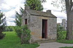
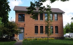
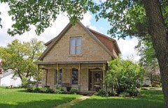
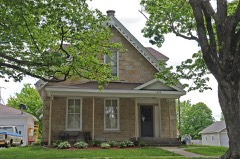
Every property in this county listed on the National Register of Historic Places, with the year it was listed and the federal nomination document.
Madison County has 5 covered bridges on the National Register. Each is a listed structure with a federal nomination on file.
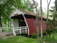 | Cutler-Donahue Covered Bridge | Listed 1976 |
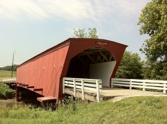 | Hogback Covered Bridge | Listed 1976 |
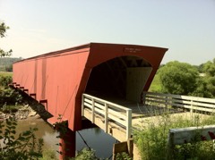 | Holliwell Covered Bridge | Listed 1976 |
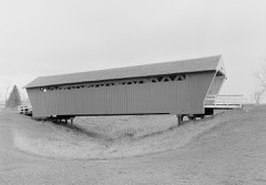 | Imes Covered Bridge | Listed 1979 |
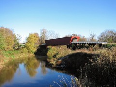 | Roseman Covered Bridge | Listed 1976 |
Every wildfire the federal occurrence database records inside this county: 20 of them, burning about 120 acres. None started naturally and none was recorded as arson. Each settlement page carries the fires within five miles of it.
| Reported cause | Fires |
|---|---|
| Missing data/not specified/undetermined | 13 |
| Debris and open burning | 6 |
| Recreation and ceremony | 1 |
The five largest, by the area the report gives. None of them was recorded as arson.
| Date | Cause | Size | Reported by | Name on the report |
|---|---|---|---|---|
| 13 March 2015 | Debris and open burning | 40 acres | Iowa Department of Natural Resources | not named |
| 9 October 2012 | Missing data/not specified/undetermined | 25 acres | Iowa Department of Natural Resources | not named |
| 24 March 2019 | Debris and open burning | 11 acres | Iowa Department of Natural Resources | not named |
| 10 March 2012 | Debris and open burning | 10 acres | Iowa Department of Natural Resources | not named |
| 6 March 2005 | Recreation and ceremony | 8.0 acres | Iowa State Fire Marshal's Office | not named |
| 1 July 2012 | Debris and open burning | 5.0 acres | Iowa Department of Natural Resources | not named |
| 3 April 2009 | Missing data/not specified/undetermined | 5.0 acres | Iowa Department of Natural Resources | not named |
| 22 March 2007 | Missing data/not specified/undetermined | 3.0 acres | Iowa Department of Natural Resources | not named |
Every settlement page carries the fires within five miles of it - see the settlement index below.
The NOAA Storm Events Database holds 402 reports for this county, causing 6 deaths, 6 injuries and about $88,133,560 in recorded property damage. Each settlement page carries the reports that name it.
| Kind of event | Reports |
|---|---|
| Hail | 152 |
| Thunderstorm Wind | 125 |
| Tornado | 38 |
| Heavy Rain | 32 |
| Flash Flood | 21 |
| Funnel Cloud | 17 |
| Flood | 16 |
| Lightning | 1 |
The most serious of them, by death, then injury, then recorded damage. The accounts are quoted exactly as the forecast office filed them.
| When | Event | Place named | Harm | What the report says |
|---|---|---|---|---|
| March 2022 | Tornado (EF4) | Macksburg | 6 killed, 5 hurt, $75,000,000 | This is the first segment of this devastating tornado which passed through four counties including Madison, Warren, Polk and Jasper. The tornado began northwest of Macksburg in western Madision county. The tornado remained in mostly rural cropland and wooded areas of western Madison county. The tornado passed through Pammel State Park southwest of Winterset producing extensive tree damage as the tornado continued to widen into a wedge tornado. Upon exiting the park, the tornado travelled along Carver Road. Several residential homes were extensively damaged or destroyed along Carver Road and six deaths occurred along this stretch of road. The tornado was at peak intensity at this time with EF4 damage occurring west of the intersection of Carver Road and Highway 169 with a house completely destoyed and removed from the foundation. After departing the Carver Road corridor, the tornado progressed just southeast of Winterset and eventually passed east of town and crossing State Highway 92. Damage in these areas was primarily to trees and outbuildings although a few homes were also impacted with mostly EF1 to EF2 damage. From Highway 92 to where the tornado exited the county, it remained mostly in rural cropland and wooded areas with numerous trees impacted. The tornado then moved into Warren county from Madison county. |
| March 1979 | Tornado (F3) | not stated | 1 hurt | no account filed |
| April 1994 | Thunderstorm Wind | Booneville | $5,000,000 | no account filed |
| March 2011 | Tornado (EF2) | Pitzer | $1,000,000 | Tornado caused property damage to several farms. A roof was torn off one of the houses and windows were broken out. |
| June 2013 | Flood | Patterson | $500,000 | Large sections of Cumming Highway underwater and a number of county bridges either washed out or underwater. |
| April 1994 | Thunderstorm Wind | Winterset | $500,000 | no account filed |
| April 1994 | Thunderstorm Wind | De Soto | $500,000 | no account filed |
| April 1999 | Tornado (F2) | Macksburg | $350,000 | no account filed |
| June 2024 | Lightning | Winterset | $250,000 | Lightning strike resulted in a house fire. Home a total loss. Time estimated. |
| July 2015 | Flood | Patterson | $250,000 | Emergency Manager reported Cumming Road/County Road G4R remained closed due to water flowing over them between 155th St and Badger Creek Rd. Additionally many secondary roads across the county remain closed with water flowing over them. |
| September 2014 | Flood | Pitzer | $250,000 | A water rescue took place at 1700 Pitzer road in Madison County. Two vehicles hit a water low spot where the road had been flooded by the North River and it inundated both vehicles at separate times. The drivers of each vehicle had to be rescued and with no injuries reported. One driver was rescued out of a tree while the other was rescued from the top of one of the vehicles. |
| June 2008 | Flood | Pitzer | $250,000 | no account filed |
| July 2025 | Flash Flood | Winterset | $200,000 | Low lying areas full of water, some streets in town impassable due to flooded intersections. Multiple reports of flood water entering homes and vehicles throughout town. Iowa highway 92 blocked in both directions due to flood waters west of town. |
| February 2000 | Thunderstorm Wind | Winterset | $200,000 | no account filed |
| July 2015 | Flash Flood | Pitzer | $150,000 | Law Enforcement in Madison County reported widespread street flooding throughout the county. |
| June 2014 | Thunderstorm Wind | Winterset Arpt | $150,000 | Narrow corridor of wind damage that extended from three miles N of Winterset to 6 miles NE of Winterset. Worst damage was to three grain bins that were tipped, otherwise damage was to trees. |
| March 2019 | Flood | Bevington | $100,000 | The county Sheriff reported that county roads are flooding and quickly becoming impassable near creeks and streams or in low-lying areas across the county. |
| June 2014 | Tornado (EF1) | Patterson | $100,000 | The tornado touched down NW of Patterson where an RFD surge was located and a curling motion noted in the damage patterns just upstream of the start point. The tornado proceeded to damage several small groves of trees over the next 1.9 miles. Here the tornado strengthened to EF1 where it snapped or uprooted several hundred trees. The path was often sporadic, owing likely to the hilly terrain of the area. The worst damage occurred to a home 2.5 miles NW of Bevington, which had the detached garage roof fail and take out part of the house roof as well. Roof and siding damage was noted to 5 homes. |
| May 2013 | Thunderstorm Wind | Earlham | $100,000 | A trailer park west to southwest of Earlham with 6 to 8 units was damaged. One unit had a missing roof. Multiple trees were down throughout town. |
| June 2008 | Flood | East Peru | $100,000 | Homes were beginning to flood. |
| May 2004 | Flash Flood | Countywide | $100,000 | no account filed |
| May 2004 | Flash Flood | Countywide | $100,000 | no account filed |
| April 2001 | Tornado (F1) | Winterset | $75,000 | Tornado moved from Clarke County into Madison County before lifting. |
| May 2004 | Thunderstorm Wind | Winterset | $75,000 | no account filed |
| May 1997 | Flood | Winterset | $75,000 | no account filed |
| May 1996 | Flood | Winterset | $75,000 | no account filed |
| May 2013 | Thunderstorm Wind | Earlham | $70,000 | Roof blown off of a house. |
| June 2018 | Thunderstorm Wind | Winterset | $60,000 | Law enforcement reported a roof blown off a house and a large tree down in town. |
| May 2015 | Tornado (EF1) | Patterson | $50,000 | This short-lived tornado tracked northwest and damaged several farmsteads. A horse trailer was thrown 40 yards into a pine tree, flipping a parked car along the way. Damage was otherwise contained to outbuilding roofs and trees. |
| November 2015 | Thunderstorm Wind | Bevington | $50,000 | A garage was destroyed by strong thunderstorm winds. |
| June 2014 | Thunderstorm Wind | Patterson | $50,000 | Very narrow but intense RFD south of the tornado path. Damage path only about a mile long and 100-150 yards wide before it wraps into the tornado. Divergent wind pattern throughout with dozens of trees snapped and uprooted. One house sustained roof and siding damage. |
| September 2014 | Flood | Barney | $50,000 | Water remained over the road in the 3100 block of 330th Street. |
| September 2014 | Flash Flood | Barney | $50,000 | Water was over the road in the 3100 block of 330th Street. |
| September 2014 | Flash Flood | Winterset | $50,000 | Water was over the road in the 2400 block of Carver Road. |
| June 2013 | Flash Flood | Patterson | $50,000 | Highway 92 between Patterson and Bevington was flooded. |
| May 2008 | Thunderstorm Wind | Winterset | $50,000 | Wind gusts of 85 MPH were reported in Winterset. |
| June 2007 | Thunderstorm Wind | Patterson | $50,000 | no account filed |
| July 2001 | Hail | Truro | $50,000 | no account filed |
| June 1998 | Flood | Winterset | $50,000 | no account filed |
| June 1997 | Thunderstorm Wind | Winterset | $50,000 | no account filed |
| April 1994 | Thunderstorm Wind | Booneville | $50,000 | no account filed |
| April 1994 | Thunderstorm Wind | Winterset | $50,000 | no account filed |
| May 2004 | Thunderstorm Wind | St Charles | $40,000 | no account filed |
| August 2012 | Thunderstorm Wind | Barney | $35,000 | A resident reported the siding was torn off of a house and outbuilding. Windows were also blown out of the house and power was out. |
| May 2013 | Thunderstorm Wind | Earlham | $30,000 | Trees and power lines were down west of Earham. Two to three poles were snapped. A shed was blown over with about 30 small pieces of wood spread across the field. |
| April 2002 | Thunderstorm Wind | Earlham | $30,000 | no account filed |
| June 1999 | Thunderstorm Wind | Winterset | $30,000 | no account filed |
| May 2015 | Tornado (EF0) | Truro | $25,000 | This tornado affected several farmsteads along its path. Damage was mostly to trees and storage silos, with damage to outbuildings caused by flying debris from these sources. The tornado path became intermittent for the latter portion of its life as it tracked northward. |
| August 2015 | Thunderstorm Wind | Winterset | $25,000 | Law Enforcement reported a few 4 to 6 inch tree limbs and a few trees downed in Winterset. Additional trees were reported snapped south and west of town. Delay report and time estimated from radar. |
| November 2015 | Tornado (EF1) | Pitzer | $25,000 | This fast moving tornado damaged at least one farmstead west of Winterset and was captured on video by a storm chaser. |
| June 2014 | Thunderstorm Wind | Bevington | $25,000 | Minor roof damage to a house and warehouse as the tornado dissipated. |
| September 2014 | Flood | Winterset | $25,000 | The 2400 block of Pammel Park Road remained flooded. |
| September 2014 | Flash Flood | Winterset | $25,000 | The 2400 block of Pammel Park Road was flooded. |
| August 2011 | Thunderstorm Wind | Macksburg | $25,000 | Roof damage was reported to the American Legion Building. |
| July 2010 | Thunderstorm Wind | Winterset | $25,000 | A roof was blown off of a camper. Tree limbs 12 to 24 inches in diameter were broken. Power lines were also downed. |
| June 2008 | Flash Flood | Patterson | $25,000 | Law enforcement reports 6 to 8 inches of water flowing over the 2800 block of Cumming Road. |
| July 2008 | Flash Flood | Truro | $25,000 | Street flooding with a foot of water flowing over Emerson Street. |
| July 1995 | Thunderstorm Wind | Earlham | $25,000 | Thunderstorms propagated south across Iowa during the early morning hours. Though in general they were below severe levels, one storm produced high winds in Earlham. The Winds took the roof off of a barn and caused damage to a few out buildings on one farmstead. |
| May 2004 | Hail | Winterset | $25,000 | no account filed |
| May 2004 | Hail | Winterset | $25,000 | no account filed |
The Survey's mineral resources record lists 25 workings inside this county. 11 still produce and 14 are closed or unrecorded. Each settlement page carries the workings within five miles of it.
| Commodity | Workings |
|---|---|
| Stone, Crushed/Broken | 21 |
| Clay | 2 |
| Clay, Stone, Crushed/Broken | 1 |
| Sand and Gravel, Construction | 1 |
The least common of them first, because a county's hundredth gravel pit says nothing its first ten did not.
| Where | Site | Commodity | Status | Recorded |
|---|---|---|---|---|
| Earlham Quarry | Clay, Stone, Crushed/Broken | Producer | ||
| Ramsey Pit | Sand and Gravel, Construction | Past Producer | ||
| Clark Brickyard | Clay | Past Producer | ||
| Unknown | Clay | Past Producer | ||
| Backbone Quarries | Stone, Crushed/Broken | Past Producer | ||
| Brown Quarry | Stone, Crushed/Broken | Past Producer | ||
| Clark Quarry | Stone, Crushed/Broken | Past Producer | ||
| Earlham Quarry | Stone, Crushed/Broken | Producer | ||
| Early Chapel Quarry & Mill | Stone, Crushed/Broken | Producer | ||
| Eyerly Quarry | Stone, Crushed/Broken | Producer | ||
| Gardner Quarry and Mill | Stone, Crushed/Broken | Producer | ||
| Grulke Quarry and Mill | Stone, Crushed/Broken | Producer | ||
| Ninety-Two Quarry | Stone, Crushed/Broken | Producer | ||
| Ninety-Two Quarry | Stone, Crushed/Broken | Past Producer | ||
| North River Quarry | Stone, Crushed/Broken | Past Producer | ||
| Pammel Quarry | Stone, Crushed/Broken | Past Producer | ||
| Penn Dixie Limestone Quarry | Stone, Crushed/Broken | Past Producer | ||
| Peru Myers Quarry | Stone, Crushed/Broken | Producer | ||
| Peru Quarry | Stone, Crushed/Broken | Past Producer | ||
| Unknown | Stone, Crushed/Broken | Past Producer | ||
| Unknown | Stone, Crushed/Broken | Past Producer | ||
| Winterset Quarry | Stone, Crushed/Broken | Producer | ||
| Winterset Quarry | Stone, Crushed/Broken | Producer | ||
| Winterset Quarry | Stone, Crushed/Broken | Past Producer | ||
| Winterset Quarry | Stone, Crushed/Broken | Producer |
Named settlements recorded in the Geographic Names Information System, each with the topographic sheets covering it. Villages, hamlets and abandoned places alike. Each is shown with the nearest named watercourse or landform and the survey quadrangle it falls on.
Scott township · 50273 · Winterset quadrangle
11 sheets, 1952 to 1993
No longer a settlement
Walnut township · 50222 · On North Fork Clanton Creek · East Peru quadrangle
9 sheets, 1951 to 1984
Jefferson township · 50261 · On North Branch North River · Saint Charles NW quadrangle
9 sheets, 1951 to 1984
Walnut township · 50222 · On South Fork Clanton Creek · East Peru quadrangle
9 sheets, 1951 to 1984
The vanished settlements of Madison County: the places named above that are no longer on the map.